
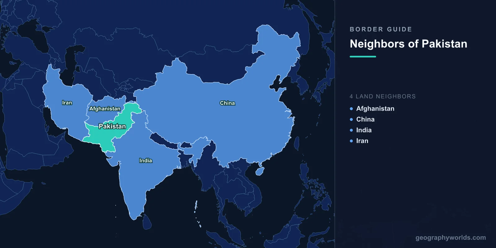
Pakistan shares land borders with four neighboring countries: Afghanistan, China, India, and Iran, and its total land boundary measures roughly 6,774 km. The country also faces Oman across the Arabian Sea to the south, giving it a maritime neighbor in addition to its four land borders. Sitting at the crossroads of South Asia, Central Asia, and the Middle East, Pakistan's frontiers stretch across some of the highest mountains and driest deserts on Earth.
Afghanistan: the Durand Line to the West
Afghanistan is Pakistan's longest land neighbor. The two countries are separated by the Durand Line, which runs about 2,670 km through the rugged mountains and tribal regions of the northwest. Drawn in 1893 during the British colonial era, this border crosses the Hindu Kush ranges and the historic Khyber Pass, one of the most strategically important mountain corridors in Asia. The frontier touches Pakistan's Khyber Pakhtunkhwa and Balochistan provinces, where Pashtun communities live on both sides and cross-border trade, family ties, and cultural exchange remain deeply intertwined. The Torkham and Chaman crossings are the busiest gateways for trucks and travelers moving between the two nations.
India: the Eastern Border and Line of Control
To the east, Pakistan shares a long and historically sensitive border with India, stretching roughly 3,190 km. This frontier runs from the Arabian Sea coast near the Rann of Kutch, up through the deserts of Sindh and Punjab, and into the mountains of the disputed Kashmir region. In Kashmir, the boundary is known as the Line of Control (LoC), a heavily fortified ceasefire line rather than a settled international border. The Wagah-Attari crossing near Lahore is famous for its daily flag-lowering ceremony, where soldiers from both countries perform a dramatic, synchronized ritual watched by cheering crowds. Despite long-standing political tensions, the two nations share a common heritage rooted in the 1947 Partition of British India.
China: the High Himalayan Frontier
To the northeast, Pakistan borders China along a relatively short but extraordinarily high boundary of about 596 km. This frontier runs through the Karakoram mountains, home to some of the tallest peaks on the planet, including K2, the world's second-highest mountain. The two countries are connected by the Karakoram Highway, often called one of the highest paved international roads in the world. It crosses the Khunjerab Pass at an altitude of over 4,700 meters, linking Pakistan's Gilgit-Baltistan region with China's Xinjiang. China is Pakistan's closest strategic partner, and the China-Pakistan Economic Corridor (CPEC) has driven major investment in roads, energy, and the deep-water port at Gwadar.
Iran: the Western Desert Border
To the southwest, Pakistan shares a border of around 909 km with Iran. This boundary runs through the arid landscapes of Balochistan, a sparsely populated region of deserts, dry mountains, and small frontier towns. The Taftan crossing is the main legal gateway between the two countries, used by traders, pilgrims, and travelers. Ethnic Baloch communities live on both sides of this border, much as Pashtuns do along the Afghan frontier. Iran and Pakistan maintain trade ties, including agreements on energy and cross-border commerce, and the region is an important corridor linking South Asia to the Middle East.
Maritime Neighbor and Coastline
Beyond its land borders, Pakistan has a coastline of roughly 1,046 km along the Arabian Sea. Across these waters lies Oman, Pakistan's maritime neighbor, with the two countries sharing a maritime boundary in the Gulf of Oman. The port cities of Karachi and Gwadar anchor Pakistan's access to international shipping lanes and the wider Indian Ocean trade network. This southern frontier connects Pakistan to global commerce and gives it strategic importance near the entrance to the Persian Gulf. For more detail on the country itself, see our pakistan country guide.
Frequently Asked Questions
How many countries border Pakistan?
Pakistan borders four countries by land: Afghanistan, China, India, and Iran. It also shares a maritime boundary with Oman across the Arabian Sea, making Oman a sea neighbor rather than a land one.
Which country shares the longest border with Pakistan?
India shares the longest border with Pakistan at roughly 3,190 km, followed by Afghanistan's Durand Line at about 2,670 km. Iran's border is around 909 km, and the border with China is the shortest at roughly 596 km.
What is the Durand Line?
The Durand Line is the approximately 2,670 km boundary between Pakistan and Afghanistan, established in 1893. It passes through mountainous tribal regions and remains a culturally and politically significant frontier dividing Pashtun communities.
Does Pakistan border any Central Asian countries directly?
No. Pakistan does not directly border any Central Asian state. However, the narrow Wakhan Corridor of Afghanistan separates Pakistan from Tajikistan by only a short distance in the far north.