
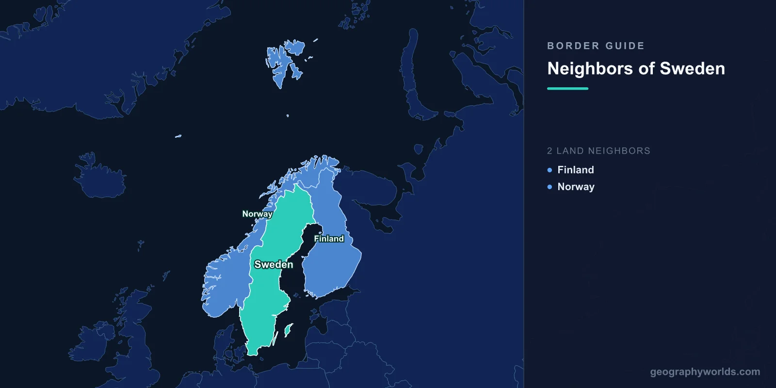
Sweden has just two land neighbours, Norway to the west and Finland to the north-east, but seven more countries face it across the sea: Denmark, Germany, Poland, Russia, Lithuania, Latvia and Estonia. By Wikipedia’s count Sweden’s land borders total 2,233 km, split between 1,619 km with Norway and 614 km with Finland (the Finnish figure includes a half-kilometre line on the skerry of Märket in the Åland area). The Norwegian border is the longest uninterrupted border in Europe, the Finnish one runs almost entirely along rivers, and Sweden’s 3,572 km coastline gives it the maritime boundaries that tie it to the rest of northern Europe, including a road and rail link to Denmark.
Norway: 1,619 km from Svinesund to Treriksröset
The Swedish–Norwegian border starts in the south at Svinesund, a narrow sound of the Iddefjord between the Swedish municipality of Strömstad and the Norwegian town of Halden, and ends, after some 1,600 km of border, at Treriksröset, the cairn where Sweden, Norway and Finland meet. The land-border list gives 1,619 km; the article on the border itself rounds it to 1,630 km. On the Swedish side six counties touch it, from Västra Götaland, Värmland and Dalarna in the south to Jämtland, Västerbotten and Norrbotten in the north.
North of Dalarna the line mostly follows the drainage divide of the Scandinavian Mountains, separating rivers that flow to the Norwegian Sea or Skagerrak from those that run east to the Baltic. Rogen and Lierne are the exceptions, lying on the “wrong” side of the watershed. Further south the border uses local divides, lakes and rivers, and where it follows a river the thalweg (the deepest channel) is the legal line, which means it can move: a change of course shifted it between Aremark in Norway and Dals-Ed in Sweden in 2023. Through forests the boundary is a cleared strip, a so-called border vista.
The northern terminus is a landmark in its own right. Treriksröset is the northernmost international tripoint in the world, and it is also Sweden’s northernmost point. Norway and Russia, which then ruled Finland, put up a stone there in 1897; Sweden added its own in 1901, and the present monument, a concrete cone on a pile of stones, dates from 1926. It sits about 10 m out in the lake, 489 m above sea level, and is easiest to reach by an 11 km trail from Kilpisjärvi in Finland; from inside Sweden it takes a hike of at least 70 km each way. At the other extreme, the border splits several tiny islands in lakes: Tannsjöröset, an islet of about 50 m² in Tannsjön (Tannsjøen in Norwegian), is divided between the two countries.
During the Second World War, when Germany occupied Norway and Sweden stayed neutral, the mountains became an escape route, and many Norwegian refugees crossed into Sweden, although entry rules were strict in 1940 and 1941 and some were turned back.
The border has moved many times through war. Jämtland, Härjedalen, Idre and Särna, and Bohuslän all belonged to Norway before 1645; the treaties of Brömsebro (1645), Roskilde (1658) and Copenhagen (1660) shifted them to Sweden. The line as it exists today was surveyed between 1738 and 1751 and fixed by a treaty signed in Strömstad in 1751, with cairns built along it in 1752–1765, many of which still stand. A companion document, the Lapp Codicil of 1751, guaranteed Sámi herders the right to cross freely with their reindeer. After the Swedish–Norwegian union dissolved in 1905, the Karlstad negotiations required Norway to dismantle several border fortresses.

The westernmost crossing is the Svinesund Bridge, opened in 2005 beside the older bridge, which carries the E6 motorway linking Oslo with Gothenburg, Malmö and Copenhagen. Both countries are in the Schengen Area, so there are no passport checks, but only Sweden is in the European Union and its customs union, which makes this one of the EU’s external frontiers. Norwegian and Swedish customs officers make sporadic checks, and automatic number-plate recognition cameras were rolled out in 2016 and 2017. Since an agreement of 1959 each country staffs some posts on behalf of both.
Finland: 614 km down the Torne and Muonio rivers
The Finnish border is younger and wetter. It was created by the Treaty of Fredrikshamn in 1809, when Sweden ceded Finland to the Russian Empire, and the two countries agreed to inspect it every 25 years; since Finnish independence, inspections have taken place in 1926–27, 1956–57, 1981 and 2006, the last of which shifted the river line in many places by 10 to 20 m. Starting at Treriksröset, in the lake Koltajärvi near Kilpisjärvi, it runs for just 230 m over land before taking to the water. It then follows a chain of rivers, the Könkämäeno, Muonionjoki and Tornionjoki (Torne in Swedish), for 555.5 km down to the Gulf of Bothnia. Amendments to the line after 1809 created so-called “sovereignty islands”, which lie in one country but are owned by people living in the other.
At the river mouth the border leaves the water for 4.03 km of straight lines between the twin towns of Haparanda in Sweden and Tornio in Finland, then runs another 25.31 km out to sea past the island of Kataja. Post-glacial rebound has lifted the seabed so much that two islands that were separate in 1809, Kataja and Inakari, have merged, so the combined island now carries a land border of about 420 m, marked by two national cairns. Kataja is also Sweden’s easternmost point.
Haparanda (9,166 people in 2024) grew up after 1809 as a Swedish replacement for Tornio, which went to Russia. At 24° 8′ E it is Sweden’s easternmost settlement, and in 2010 an estimated 70% of its residents spoke Finnish as a second language. The two towns are within walking distance of each other.

The southern end of the border is a rock. Märket, a 3.3-hectare skerry in the Sea of Åland, has been split between the two countries since the 1809 treaty. Finland’s lighthouse, built there in 1885, ended up on the Swedish half, so in 1981 the line was redrawn as a complex 470 m curve that put the lighthouse in Finland. Märket is the smallest sea island shared by two countries. For the Finnish side of these lines, see our guide to the neighbouring countries of Finland.
Denmark across the Øresund and the Kattegat
Denmark is Sweden’s closest maritime neighbour. The two countries face each other across the Kattegat and the Øresund, a strait 118 km long and only 4 km wide at its narrowest, between Helsingør and Helsingborg. Their sea boundary in the Sound was first fixed by a declaration of 30 January 1932, territorial waters by an exchange of notes on 25 June 1979, and the continental shelf and fishing zones by an agreement of 9 November 1984.
The border here was once a land line. Until the Treaty of Roskilde in February 1658, Scania, Blekinge and Halland were Danish, and Denmark levied Sound Dues on every ship passing through the Øresund from 1429. Since 1 July 2000 the two countries have been joined by the Øresund Bridge, a roughly 8 km cable-stayed bridge from Malmö to the artificial island of Peberholm, followed by a 4 km tunnel to the Danish island of Amager. It carries the E20 motorway and the Øresund railway line.
Sweden’s Baltic Sea neighbours, from Germany to Estonia
East and south of Sweden lies the Baltic Sea, and Swedish waters meet those of six more states across it. Germany lies south of Scania, Poland south of Blekinge and Öland, Lithuania and Latvia east of Gotland, Estonia across the northern Baltic, and Russia, which inherited the Soviet Union’s Baltic agreements with Sweden. Sweden’s exclusive economic zone covers about 160,885 km², more than a third of its land area.
Most of these lines were set by treaty, many of them with states that no longer exist. Sweden agreed a continental shelf boundary with East Germany on 22 June 1978, and unified Germany inherited it. With the Soviet Union it signed two agreements in 1988, on 13 January and 18 April, dividing the sea areas, shelf and fishing and economic zones between them; Russia is the successor. Poland followed on 10 February 1989, and on 30 June 1989 Sweden, Poland and the USSR fixed the common point where their three lines meet. Since independence, Estonia has signed a full maritime zones agreement with Sweden (2 November 1998), and Sweden fixed trilateral meeting points with Estonia and Latvia in 1997 and with Finland and Estonia in 2001.
Maritime lines with Norway and Finland, and the gaps between them
Sweden’s two land neighbours are also sea neighbours. In the Skagerrak, Sweden and Norway agreed fishery areas in 1967 and a continental shelf boundary in 1968. In the Gulf of Bothnia, Finnish and Swedish waters are partly separated by international waters: at the Norra Kvarken narrows the coasts are only 22.4 km apart, less than two full 12-nautical-mile territorial seas, so a narrow channel of international water threads between them along an agreed path. The territorial seas meet again in the Sea of Åland along a 15 km boundary, and the economic zones beyond were divided by agreements of 29 September 1972 and 2 June 1994.
None of these lines is currently a live dispute. Sweden’s border questions now concern security rather than location: it joined NATO on 7 March 2024, eleven months after Finland (4 April 2023), so both of its land frontiers now run between alliance members (Norway was a founding member in 1949). For how both land borders fit the geography of the peninsula, see our guide to the Scandinavian Mountains, the range that the Norwegian border follows for most of its length.