
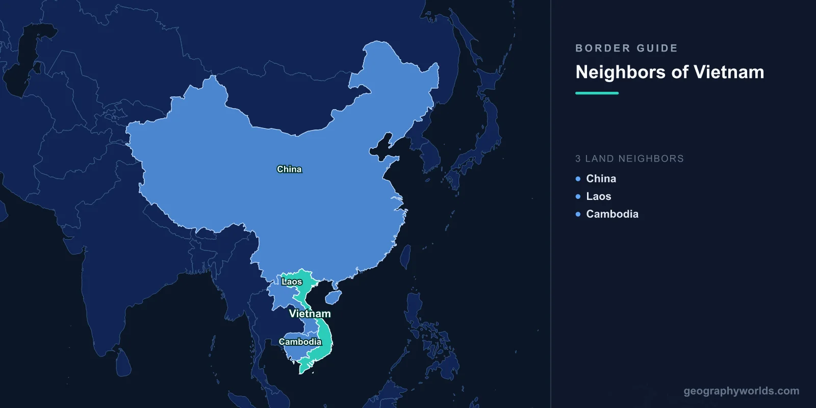
Three countries share Vietnam’s land frontier: China to the north, Laos to the west and Cambodia to the south-west. By the figures in Wikipedia’s “Geography of Vietnam”, the land borders total 4,639 km: about 2,130 km with Laos, 1,281 km with China and 1,228 km with Cambodia. At sea, Vietnam’s claims meet those of China and Taiwan in the Gulf of Tonkin and the South China Sea. They also overlap with the Philippines, Malaysia and Brunei in the Spratly Islands, and they meet the waters of Cambodia, Thailand and Malaysia in the Gulf of Thailand and adjoin Indonesia’s waters to the south. Vietnam is about 1,650 km long from north to south but only about 50 km wide at its narrowest point.
The Three Land Borders and the 4,639 km Total
Different sources measure the borders differently, because much of each line follows rivers, ridges and valleys whose length depends on the map scale. Wikipedia’s articles on the individual borders give 1,297 km for China, 2,161 km for Laos and 1,158 km for Cambodia, which add up to 4,616 km. The ranking does not change: the Laos border is the longest by a wide margin, and the China and Cambodia borders are similar in length.
All three borders were drawn in their modern form under French rule. France took Cochinchina in the south by 1862 and Annam and Tonkin in 1883–84, then joined them with Cambodia into French Indochina in 1887. Laos was added in 1893. The present lines are essentially those colonial boundaries, confirmed after independence by treaties with Laos in 1976, China in 1999 and Cambodia in 2005.
China: 1,281 km from Shiceng Dashan to the Ka Long River
The China–Vietnam border starts in the west at the tripoint with Laos on the Shiceng Dashan peak. It runs east in a highly irregular zigzag through isolated mountains, home mainly to ethnic minority peoples. On the Chinese side it touches only two provinces, Yunnan and Guangxi. In the east the line follows the Beilun, called the Ka Long in Vietnamese, between the Chinese city of Dongxing and the Vietnamese city of Móng Cái, and reaches the Gulf of Tonkin through marshland.
The frontier is old. China under the Han dynasty had taken control of northern Vietnam by the early 1st century BC, and the Vietnamese of Tonkin did not break free of Chinese rule until 939 AD, founding the kingdom of Đại Việt. A boundary close to today’s line emerged after the Lý–Song War of 1075–1077. The modern line was surveyed by a Sino-French commission after the Treaty of Tientsin of 1885. Its findings were confirmed in Beijing on 26 June 1887 and refined by a convention of 20 June 1895, and between 285 and 341 boundary markers were set up. Many of those markers were later damaged or lost, which caused problems in the 20th century.
Those problems turned violent in the 1970s, when 164 locations covering 227 km² were in dispute. Recorded border skirmishes rose from 125 in 1974 to 2,175 in 1978. In February 1979, weeks after Vietnam overthrew the Khmer Rouge in Cambodia, China invaded northern Vietnam and captured several border towns. It declared its “punitive” mission complete on 6 March and withdrew, though low-level fighting continued through the 1980s. Relations were normalised in November 1991. On 30 December 1999 the two governments signed a land border treaty based on the 1887 and 1895 lines, and demarcation was completed in 2008. Of the 227 km² once disputed, China received 114 km² and Vietnam 113 km².
Today the border is a busy trade corridor. An agreement on border trade in 1991 led to 21 border trade points opening in 1992. Two railways cross it. The narrow-gauge Hanoi–Lào Cai line meets China’s Kunming–Hekou railway on a bridge over the Nanxi River. At Đồng Đăng, standard-gauge trains on the Nanning–Hanoi line cross to Pingxiang. Just north of Đồng Đăng is the Friendship Pass (Hữu Nghị Quan), where Vietnam’s National Route 1 begins on its way to Cà Mau. The border also passes through Ban Gioc–Detian Falls, 272 km north of Hanoi, where the Quây Sơn River drops about 30 m. It is counted as the fourth-largest waterfall on an international border, after Iguazu, Victoria and Niagara. In 2022 China built a fence about 12 feet (3.7 m) high along parts of its side.

Laos: The Annamite Range and the Ho Chi Minh Trail
The Laos border is Vietnam’s longest. From the Chinese tripoint it runs south-east, briefly follows the Nam Sam River, and then follows the Annamite Range (Dãy Trường Sơn) south. A stretch follows the Sepon River before the line reaches the Cambodian tripoint. The Annamites had long divided Vietnamese kingdoms on the coast from Lao, Thai and Khmer states inland. When France annexed Laos from Siam in 1893, the colonial administration used that divide and partly demarcated it in 1916. After the communist victories of 1975, Vietnam and Laos confirmed the colonial line by a treaty signed in 1976. Demarcation on the ground took place from 1979 to 1984, with small changes in 1986.
During the Vietnam War this mountain border was crossed by the Ho Chi Minh Trail, a network of roads and paths that North Vietnam began building after July 1959. It carried troops and supplies south through Laos and Cambodia, and American bombing of the trail hit the border districts heavily. At the time it was thought to be the main supply route. Later it emerged that the Sihanouk Trail through Cambodia carried significantly more material.

Crossings now link Vietnam’s narrow coastal strip to the Mekong valley. From north to south they include Tây Trang–Sop Hun, Na Mèo–Namsoi, Nậm Cắn–Namkan, Cầu Treo–Namphao, Cha Lo–Naphao, Lao Bảo–Dansavan and Bờ Y–Phoukeua. Lao Bảo is the best known. It stands at the end of National Route 9, which the French built in 1930 from Đông Hà on the coast over the mountains into Laos. As Asian Highway AH16 the road is part of the 1,450 km East–West Economic Corridor linking Vietnam, Laos, Thailand and Myanmar.
Cambodia: From the Tonlé San to Hà Tiên
From the Lao tripoint the Cambodia border runs south over land and in places along rivers such as the Tonlé San. It then swings in a broad arc to the south-west. The Parrot’s Beak, a Cambodian salient, pushes towards Ho Chi Minh City, and the line uses the Vàm Cỏ Đông and Saigon rivers in places. It then cuts across the Mekong Delta and ends on the Gulf of Thailand just west of Hà Tiên. Crossings include Mộc Bài–Bavet, on the road between Ho Chi Minh City and Phnom Penh, Xa Mát–Trapeang Phlong, Hoa Lư–Trapeang Sre and Thường Phước–Kaoh Roka on the Mekong.
The French drew the southern section in 1868–69 and extended the line north in stages, notably in 1904, when Đắk Lắk was transferred to Annam. Khmer nationalists long claimed much of the Mekong Delta, which they call Kampuchea Krom. After the Khmer Rouge took power in April 1975, border clashes escalated until Vietnam invaded in late 1978 and captured Phnom Penh on 7 January 1979. Vietnamese troops stayed until 1989. Talks resumed in 1983, and in 1985 both sides pledged to accept the border as it stood at independence. A treaty followed in 2005, and demarcation was completed in 2012.
Gulf of Tonkin: The 2000 Sea Boundary with China
The sea is where most of Vietnam’s remaining boundary questions lie. Its coastline runs about 3,260 km, excluding islands, and it claims an exclusive economic zone of about 417,663 km². In the north, the Gulf of Tonkin is shared with China, whose Guangxi coast and Hainan Island enclose it. On 25 December 2000 the two countries signed an Agreement on the Delimitation of the Gulf of Tonkin. It came into force on 30 June 2004, and it remains the only stretch of sea boundary the two countries have agreed. Neither the land treaty nor the gulf agreement is recognised by Taiwan, which keeps its own claims on its maps.
Paracels, Spratlys and Five Rival Claimants
Beyond the gulf, the maritime border with China is undefined. The Paracel Islands, which Vietnam calls Hoàng Sa, are about 130 small coral islands and reefs roughly 350 km south-east of Hainan. Part of the group was held by South Vietnam until a naval battle with China on 19–20 January 1974. Since then the People’s Republic of China has controlled the whole archipelago, while Vietnam and Taiwan continue to claim it.
The Spratly Islands, Trường Sa in Vietnamese, lie off southern Vietnam, Malaysia and the Philippines. They have less than 200 hectares of natural land spread across hundreds of square kilometres of sea. Vietnam, China and Taiwan each claim the whole group. The Philippines and Malaysia claim parts of it, and Brunei claims an economic zone covering its south-eastern corner. On 14 March 1988 Chinese and Vietnamese forces clashed at Johnson South Reef. Vietnam occupies more Spratly features than any other claimant.
Taiwan’s single outpost, Taiping Island, is the largest natural island in the group. From 2014 to 2016 China’s land reclamation outpaced that of Vietnam and the Philippines, and by 2023 it had reclaimed around five square miles (about 13 km²). The stakes are fishing grounds, possible seabed oil and gas, and shipping lanes that carry an estimated US$3.36 trillion of trade a year.
Gulf of Thailand and the Indonesian EEZ Deal
In the south-west, Vietnam’s Mekong Delta coast faces the Gulf of Thailand, which it shares with Cambodia, Thailand and Malaysia. Vietnam holds about 13% of the gulf’s coastline, against Thailand’s 70% and Cambodia’s 16.5%. The sea boundary with Cambodia loops around Phú Quốc. At 575 km², Phú Quốc is Vietnam’s largest island, and it belongs to Vietnam although it lies closer to the Cambodian shore. Cambodian royal documents mention the island as early as 1615, and a 1939 French administrative line in the gulf, the Brévié line, was never turned into an agreed allocation of the islands. Malaysia and Vietnam share a maritime boundary in both the Gulf of Thailand and the South China Sea, and at a 1992 summit they agreed in principle on joint oil and gas exploration.
Further south, Vietnam’s waters adjoin Indonesia’s near the Natuna Islands. Disputes over Vietnamese fishing boats in Indonesian waters were frequent; Indonesia sank 96 vessels in 2016 alone. In December 2022, during President Nguyễn Xuân Phúc’s state visit to Jakarta, the two governments announced they had concluded negotiations on the boundary between their exclusive economic zones.
Vietnam’s neighbourhood looks different from each side. The view from Vientiane is in the countries that border Laos, and Phnom Penh’s is in Cambodia’s neighbouring countries. The rival island claims are set out in more detail in our guide to the South China Sea.