
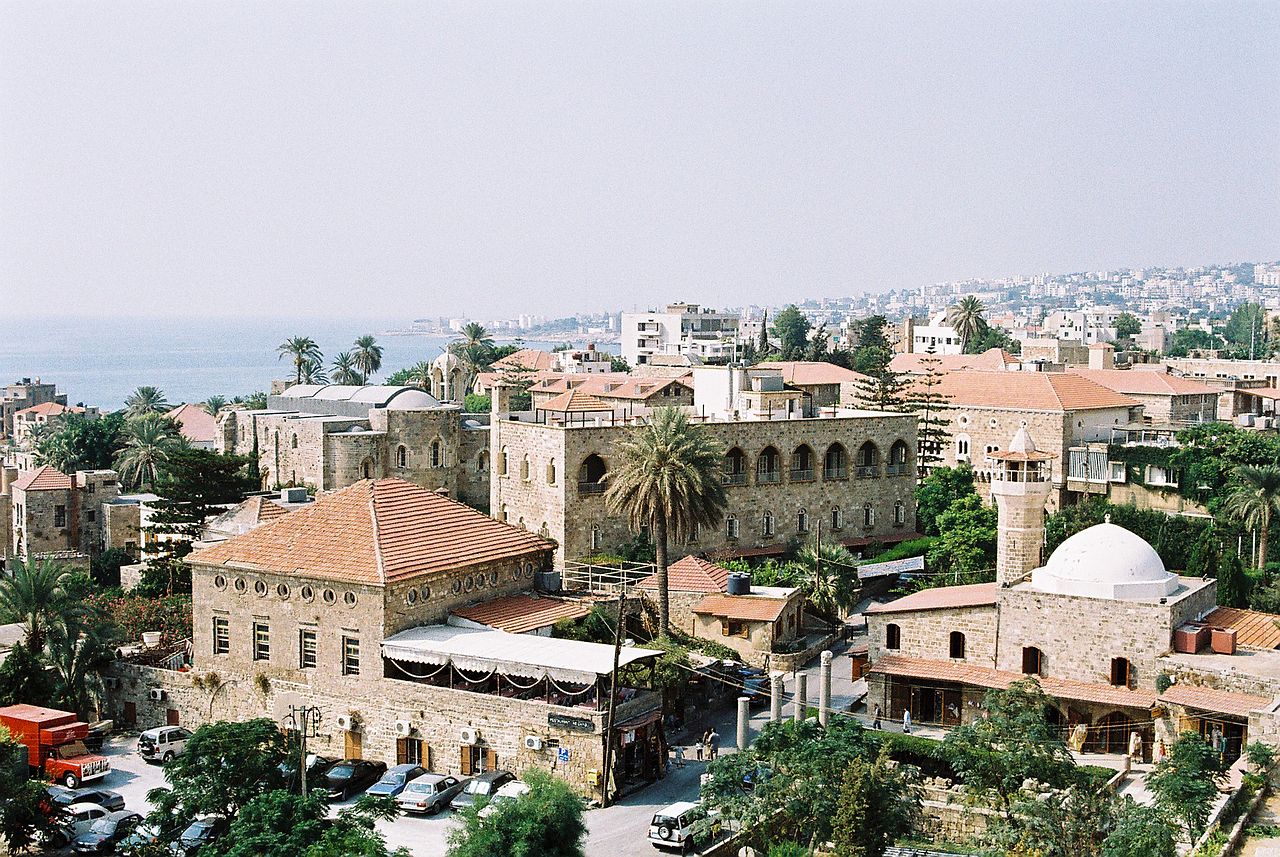
The Phoenicians were the ancient Mediterranean's greatest seafarers, traders, and colonizers, and their civilization was shaped almost entirely by the narrow coastal strip of modern Lebanon. Wedged between the Mediterranean Sea and the steep Lebanon Mountains, cities such as Tyre, Sidon, and Byblos had little farmland but superb harbors, and that geography pushed them to build a maritime trading empire stretching from the Atlantic to the Persian Gulf.
Phoenicia was never a single country with borders on a map. It was a loose collection of independent city-states sharing a language, a religion, and a coastline. To understand why they became the ancient world's master traders rather than farmers or conquerors, you have to start with the land itself: a thin ribbon of coast where the sea was always closer than the next valley.

The Geography That Made Phoenicia
The Phoenician homeland occupied roughly 200 km of coastline running from Arwad (in modern Syria) south to Acre, and it was rarely more than 30 km wide. To the east, the Lebanon Mountains rise sharply, peaking at Qornet es Saouda (3,088 m). To the west lies the Mediterranean. Between them sits only a narrow, fertile coastal plain.
This compression had two decisive effects. First, with so little arable land, the Phoenicians could never feed a large agricultural population or build a sprawling territorial state. Second, the mountains chopped the coast into isolated pockets, each centered on a natural harbor. The result was a string of self-governing city-states rather than a unified kingdom, with each city controlling its own port, hinterland, and trade routes.
The mountains were not only a barrier. They supplied the single most valuable resource the Phoenicians possessed: timber. Cedar, cypress, and pine grew on the slopes, and the famous "Cedars of Lebanon" became one of the ancient world's most prized commodities. Strong, fragrant, and rot-resistant, cedar was sought by Egypt, Mesopotamia, and later Rome for temples, palaces, and, above all, ships.
The Major City-States
Three cities dominated Phoenician history, each with a distinct geographic advantage:
- Tyre: Originally an island city about 800 m offshore, Tyre was the wealthiest and most powerful Phoenician center. Its two harbors, one facing north and one facing south, could shelter entire fleets in any weather.
- Sidon: A major port roughly 40 km north of Tyre, renowned for fine glassmaking and for producing the celebrated purple dye. It frequently rivaled Tyre for leadership of the Phoenician world.
- Byblos: One of the oldest continuously inhabited cities on Earth, settled by around 5000 BCE. It was the principal hub for the papyrus trade with Egypt.
Tyre's island setting made it almost impregnable. It withstood a thirteen-year Assyrian siege under Nebuchadnezzar II and fell only to Alexander the Great in 332 BCE, after he built a 1 km causeway connecting the island to the mainland. That causeway permanently turned Tyre into a peninsula, and silt has widened it ever since.
Byblos maintained such close ties with Egypt that the Greek word "biblos," meaning papyrus and the ultimate origin of the word "Bible," may derive from the city's name. Sidon's artisans, meanwhile, were famous for glassblowing and for extracting Tyrian purple from murex sea snails, a laborious process said to require around 12,000 snails to yield just 1.5 grams of dye, which is why purple cloth became a symbol of royalty across the ancient world.
A Trading Network That Spanned the Known World
Because farming could not sustain them, the Phoenicians turned outward. From at least 1200 BCE, their merchant ships, nicknamed "hippoi" for the horse-head prows carved on their bows, ranged across the Mediterranean and beyond. They traded cedar, glass, dye, metalwork, wine, and ivory, acting as middlemen between the civilizations of the east and the resource-rich lands of the west.
Their genius lay in building a chain of safe harbors. Trading posts and colonies were established at roughly 30-mile intervals, about a day's sail apart, along the North African coast and across the western Mediterranean. Their reach ran from Cornwall, a source of tin, to the spice routes of the east. Major colonies and outposts included:
- Carthage in modern Tunisia, founded around 814 BCE and destined to become Rome's greatest rival
- Cadiz (Gadir) on the Atlantic coast of Spain, one of the oldest cities in Western Europe
- Palermo and Motya in Sicily
- Settlements across Malta, Sardinia, and Cyprus
- Lixus and other posts along the Atlantic coast of Morocco
The Phoenicians were also superb navigators. They were the first known sailors to steer by Polaris, the North Star, which the Greeks called "the Phoenician Star." Their most audacious recorded voyage was a circumnavigation of Africa commissioned by the Egyptian pharaoh Necho II around 600 BCE, a feat not matched in Europe until the Portuguese rounded the continent in 1498. To protect their commercial edge, they kept routes secret, which only deepened their reputation as mysterious and cunning.
The Alphabet and Lasting Influence
The Phoenicians' most enduring export was not a good but an idea. Around 1050 BCE they developed a 22-letter consonantal alphabet, far simpler than the hundreds of signs in cuneiform or Egyptian hieroglyphics. Because it was easy to learn, it spread along their trade routes and became the ancestor of virtually every alphabet in use today, including Greek, Latin, Arabic, and Hebrew, and by extension Cyrillic and the scripts of South Asia.
Phoenician words also echo through Mediterranean place names. "Africa" may trace back to a Phoenician-era term, "Europe" possibly derives from "ereb" (sunset or west), and Spain may come from "i-shpan-im," sometimes interpreted as "land of rabbits." The name "Phoenician" itself comes from the Greek "phoinikes," meaning "purple people," after their dye.
Decline and the Carthaginian Successor
The homeland city-states gradually lost independence as larger empires rose around them. They came under Assyrian, then Babylonian, then Persian control before being absorbed into the empire of Alexander the Great. Yet Phoenician civilization did not simply end. In the western Mediterranean its greatest colony, Carthage, carried the culture forward for centuries, building a naval empire that fought Rome in the three Punic Wars before its destruction in 146 BCE. In this sense, the geography of a small Lebanese coast ultimately shaped the politics of the entire ancient world.
Key Facts
- Homeland: A coastal strip of modern Lebanon, about 200 km long and rarely wider than 30 km
- Main city-states: Tyre, Sidon, and Byblos, active from roughly 3000 BCE
- Highest point inland: Qornet es Saouda in the Lebanon Mountains, 3,088 m
- Signature export: Cedar timber and Tyrian purple dye (about 12,000 murex snails per 1.5 g)
- Greatest colony: Carthage, founded around 814 BCE in modern Tunisia
- Lasting legacy: The 22-letter alphabet (c. 1050 BCE), ancestor of most modern scripts
- Byblos: One of the oldest continuously inhabited cities, dating to about 5000 BCE
Fun Facts
- The word "Phoenician" comes from the Greek for "purple people," referencing their dye industry.
- Phoenician sailors may have circumnavigated Africa around 600 BCE, more than 2,000 years before Vasco da Gama.
- The English word "Bible" ultimately derives from the city of Byblos, the ancient papyrus hub.
- Phoenician glass beads have turned up as far away as China and sub-Saharan Africa.
Frequently Asked Questions
Where was Phoenicia located?
Phoenicia occupied the eastern Mediterranean coast, mostly within modern Lebanon and extending into coastal Syria and northern Israel. It was a narrow strip about 200 km long, squeezed between the Lebanon Mountains and the sea.
What were the three main Phoenician cities?
The three most important were Tyre, Sidon, and Byblos. Tyre was the wealthiest and most powerful, Sidon was famed for glass and purple dye, and Byblos was among the oldest cities in the world and central to the papyrus trade with Egypt.
Why did the Phoenicians become traders instead of farmers?
Their geography gave them little farmland but excellent harbors and abundant cedar forests for shipbuilding. With limited room to grow crops, they turned to the sea, building a network of harbors and colonies across the Mediterranean.
What is the Phoenicians' most important legacy?
Their alphabet. Developed around 1050 BCE, this simple 22-letter consonantal script spread along their trade routes and became the ancestor of the Greek, Latin, Arabic, Hebrew, and many other alphabets used today.
Test Your Knowledge!
Think you know your ancient civilizations? Try our interactive geography quiz!
Play Geography Games →