

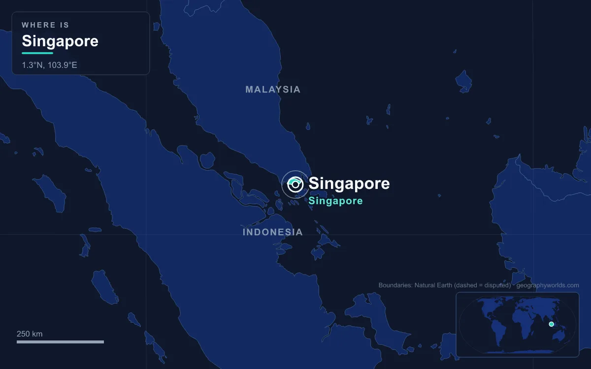
The capital of Singapore is Singapore itself. The Republic of Singapore is a city-state, an island country about one degree of latitude (137 kilometres) north of the equator, off the southern tip of the Malay Peninsula, so the city and the country are the same place. Its government sits in the Civic District and Downtown Core near the mouth of the Singapore River, where Parliament House, the Supreme Court and the old colonial City Hall stand near the Padang. In mid-2025 Singapore had 6,110,200 people. The city has been a capital for most of its modern history: of the British Straits Settlements from 1832, of a Crown colony from 1946, and of an independent republic since 9 August 1965.
6 February 1819: Raffles and the Singapore River
Singapore had been a port long before the British. The Malay Annals say the Kingdom of Singapura was founded in 1299 by Sang Nila Utama. Whatever the truth of that account, other documents show that 14th-century Temasek was a trading port under the influence of Majapahit and the Siamese kingdoms, centred on Fort Canning Hill. Its last ruler, Parameswara, was driven out at the end of the century and founded the Sultanate of Malacca. Portuguese raiders burned what remained in 1613, and the island faded for two centuries.
Stamford Raffles landed on 28 January 1819, looking for a British port to rival the Dutch, who controlled Malacca and much of the regional trade. The island belonged nominally to the Sultan of Johor, but the sultanate was split by a succession dispute. With the help of the Temenggong, the local Malay chief, Raffles brought the sultan's elder brother, Tengku Long, back from exile in the Riau Islands and recognised him as Sultan Hussein. In return for $5,000 a year for the sultan and $3,000 for the Temenggong, the Treaty of Singapore, signed on 6 February 1819, let the British set up a trading post. Island-wide sovereignty followed in a further treaty with the sultan in 1824.

The settlement was built along the banks of the river, and the city grew outward from there. That is why the modern Central Area, with its banks, courts and Parliament, still clusters around the river mouth two centuries later.
The Jackson Plan of 1822
Raffles left day-to-day rule to William Farquhar, who governed from 1819 to 1823 and let the port grow as trade dictated. When Raffles returned in October 1822 he was unhappy to find houses and warehouses built on the Padang and along the river in an area he had reserved for government. He appointed a Town Committee, and Lieutenant Philip Jackson, the colony's engineer and surveyor, drew up a layout based on Raffles's instructions. The "Plan of the Town of Singapore", published in 1828, was an idealised scheme rather than a map of what existed, but it fixed the pattern the capital still follows: a government area around the Padang north of the river, commercial quarters beside the river mouth, and separate districts for each community.
The plan is the earliest surviving plan of the town and is displayed in the Singapore History Gallery of the National Museum of Singapore. Walk from the Padang to Parliament House today and you are walking through the zone Raffles set aside for administration in 1822.
1832: Seat of the Straits Settlements
Singapore became a capital by beating a rival. In 1824 the Anglo-Dutch Treaty split the Malay Archipelago into a British zone and a Dutch zone, swapping British Bencoolen on Sumatra for Dutch Malacca and leaving Singapore undisputed. In 1826 Singapore, Penang and Malacca were grouped as the Straits Settlements under the East India Company. Their first capital was George Town, on Penang. In 1832 the seat of government moved to Singapore (some accounts date the move to 1836), and it stayed there until the colony was dissolved in 1946.
Trade explains the choice. Singapore sat at the southern end of the Strait of Malacca, the sea route between the Indian Ocean and the South China Sea, and its population rose quickly after 1819. The first census, in January 1824, counted 10,683 people. By 1836 there were 29,980, and for the first time the Chinese outnumbered the Malays. By 1860 the population had passed 80,000, many of them immigrants working on pepper and gambier plantations.
1867 and the Istana on the Nutmeg Estate
In 1867 the Straits Settlements were separated from British India and became a Crown colony ruled directly from London. The new colony needed a governor's residence to match, and the government bought land that had been part of a nutmeg plantation owned by the merchant Charles Robert Prinsep, which had collapsed. Government House was built there between 1867 and 1869, in a 106-acre estate just north of the colonial town.

The building is now called the Istana and still sits at the top of the chain of command. After self-government in 1959 the governor gave way to the Yang di-Pertuan Negara, and after independence to the President of Singapore, whose office is there along with the Prime Minister's. The estate also contains Sri Temasek, the official residence of the prime minister, although no prime minister has actually lived in it.
City Hall and the Royal Charter of 1951
The colony's civic heart was the Municipal Building on the Padang, completed in 1929. It had a turbulent war. During the Japanese occupation, which followed the British surrender on 15 February 1942, the Japanese ran civic affairs from it. On 12 September 1945 General Seishirō Itagaki surrendered the Japanese forces in the region to Lord Louis Mountbatten inside the building.
When the Straits Settlements were dissolved on 1 April 1946, Singapore became a Crown colony in its own right, with the town of Singapore as its capital. In 1951 King George VI granted the town city status by royal charter, the Municipal Commission became the City Council, and the Municipal Building was renamed City Hall. The municipal era did not last long. In 1959, after the People's Action Party won the election of 30 May, Singapore became self-governing on 3 June, and Lee Kuan Yew declared self-government at City Hall. The PAP government dissolved the City Council that year, and it was formally abolished in 1965. Since then Singapore has had no separate city government: the national government runs the city directly.
9 August 1965: A Capital That Became a Country
Singapore's time as a state capital inside a larger country was short. On 16 September 1963 it joined Malaya, North Borneo and Sarawak to form Malaysia, with Kuala Lumpur as the federal capital. The partners disagreed over trade, loans and politics, communal tension ended in the race riots of 1964, and on 7 August 1965 the two governments signed a separation agreement after secret talks. Two days later the Malaysian Parliament voted 126 to 0 to amend the constitution, and on 9 August 1965 Singapore became the independent Republic of Singapore, with Lee Kuan Yew as prime minister and Yusof bin Ishak as president.
That is why Singapore's capital is unusual. There was no choice to make and no rival city to consider, because the island had one city and the city had become a state. Singapore co-founded ASEAN in 1967, and the old colonial capital around the Padang became the seat of a sovereign government.
Parliament House and the Downtown Core Today
In planning terms, the capital's institutions sit in the Downtown Core, one of eleven planning areas in the Central Area and the country's main business district, containing Raffles Place, Tanjong Pagar, Marina Bay and the Singapore Exchange. Parliament House, completed in 1999, stands on North Bridge Road near the river, facing the Supreme Court. Its prism-shaped roof was designed by President Ong Teng Cheong, an architect by training. It replaced the Old Parliament House, used as the legislative chamber since the 1950s and now The Arts House.
Running a whole country from one city shows in the numbers. Of the 6,110,200 people counted in mid-2025, 3,660,200 (59.9 per cent) were citizens, 543,800 were permanent residents and the rest were foreign workers, students and dependants. Singapore is the largest and most populous city-state in the world and has the second-highest population density of any country. For planning, the island is divided into five regions, 55 planning areas and hundreds of subzones, yet there is no separate municipal government for any of them: since the City Council's abolition, the functions it once performed, such as water, roads and street lighting, have been run by national statutory boards, and since 1988 local estate upkeep has fallen to town councils led by each constituency's elected Member of Parliament.
The colonial buildings around the Padang have been given new uses. The former Supreme Court and the former City Hall together form National Gallery Singapore, and the former Raffles Library and Museum is the National Museum. Because the capital is also the whole country, "the city" keeps growing by reclamation: land reclamation took Singapore from roughly 580 square kilometres in the 1960s towards a planned 770 square kilometres by the 2030s. For how that area compares with other places, see how big Singapore is, and for how Parliament, the president and the cabinet share power in these buildings, read our guide to the government of Singapore.
Quick Facts About Singapore
- Country: Singapore
- Continent: Asia (Southeast Asia)
- Country population: approximately 5.9 million
- Capital city status: Singapore is the capital of Singapore, the seat of national government, and the location of foreign embassies, parliament, and the head of state's official residence.
Frequently Asked Questions
What is the capital of Singapore?
The capital of Singapore is Singapore. Singapore is the seat of national government, hosts most foreign embassies and consulates, and is typically where the head of state and parliament are located.
What continent is Singapore in?
Singapore, the capital of Singapore, is located in Asia, in the Southeast Asia region. As Singapore's capital, Singapore serves as the country's primary connection to the broader Asian political, economic, and cultural sphere.
Why is Singapore the capital of Singapore?
Singapore was chosen as the capital of Singapore for reasons that typically combine geography, history, and politics. Capital city selections often reflect a desire for centrality (being accessible from across the country), historical importance (being a longstanding seat of government or culture), or neutrality (being acceptable to multiple regions or ethnic groups within the country). The specific reasons for Singapore's designation are detailed in the city's history above.
What is Singapore known for?
As the capital of Singapore, Singapore is best known for housing the country's central government institutions — parliament, presidential or royal residences, supreme court, and key ministries. It is also typically a major cultural and economic center within Singapore, hosting national museums, embassies, and signature monuments. The introduction and history sections above provide detailed coverage of the city's specific notable institutions and landmarks.
Related Pages
- Singapore Country Guide — full geography, climate, economy, and culture overview
- Flag of Singapore — meaning, history, and design of Singapore's national flag