

Spain occupies about 85 per cent of the Iberian Peninsula in south-western Europe, plus the Balearic Islands in the Mediterranean, the Canary Islands off north-west Africa, and the cities of Ceuta and Melilla on the African coast. Its total area is about 505,370 km², making it the largest country in southern Europe, and its average altitude is roughly 650 m. The physical core is the Meseta Central, a high plateau mostly between 600 and 800 m, split by the Sistema Central and rimmed by the Cantabrian Mountains, the Sistema Ibérico and the Sierra Morena. Beyond the rim lie the Pyrenees on the French border, the Baetic ranges of the south, and two great lowlands: the Ebro Basin and the Andalusian Plain of the Guadalquivir. The highest point is Teide on Tenerife, 3,715 m; on the mainland it is Mulhacén in the Sierra Nevada, 3,479 m. The main rivers are the Tagus (1,007 km, the longest in Iberia), the Ebro (930 km, the longest entirely in Spain), the Douro, the Guadiana and the Guadalquivir. The lowest point is sea level, on the Atlantic and Mediterranean coasts.
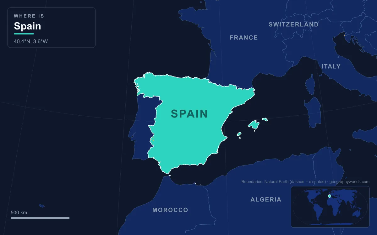
The clearest way to see how these pieces fit is to start at the top and walk down.
Teide, 3,715 m: Spain’s Summit Is an Atlantic Volcano
Spain’s highest ground is not in Europe at all. Teide rises from the island of Tenerife in the Canaries, and its 3,715 m summit is the highest point of any island in the Atlantic. Measured from its base on the ocean floor, the volcano stands about 7,500 m tall. Teide itself is young: it began to grow around 170,000 years ago inside Las Cañadas, the caldera of an older, extinct volcano whose floor sits at about 2,190 m. With Pico Viejo and Montaña Blanca it forms the Central Volcanic Complex of Tenerife, and it is still active; the last eruption, from the El Chinyero vent on its north-western rift, came in 1909.
The volcano and the caldera around it form Teide National Park, 18,900 hectares of lava fields and pumice, listed as a UNESCO World Heritage Site in 2007. In 2024 it received a record 5,242,653 visitors, more than any other national park in Spain. The Guanches, the islanders before the Spanish conquest of 1496, treated the peak as sacred and believed the demon Guayota lived inside it.
Teide is the extreme case of a pattern repeated across the Canaries, where every island is a volcano. Pico de las Nieves on Gran Canaria reaches 1,949 m. Fuerteventura, the island closest to Africa, lies about 100 km from the African coast, and geographically and geologically the archipelago is part of the African continent rather than of Iberia.
Mulhacén and the Sierra Nevada: The Mainland Roof at 3,479 m
The highest point of the Spanish mainland, and of the whole Iberian Peninsula, is Mulhacén in the Sierra Nevada, south-east of Granada. At 3,479 m it is the highest summit in southern Europe outside the Alps. Its name honours Abu’l-Hasan Ali, or Muley Hacén, the penultimate Muslim ruler of Granada in the fifteenth century, who by legend was buried on the top.
The Sierra Nevada (“snowy range”) is part of the Baetic System, or Sistema Penibético, which was pushed up during the Alpine orogeny as the African and Eurasian plates collided, in the Paleogene and Neogene periods between about 66 and 1.8 million years ago. The same collision raised the Alps and the Atlas. For a long stretch the crest of the range never drops below 3,000 m, and its soft micaceous schists slope steeply to the north and more gently south towards the Alpujarras and the Mediterranean. Above about 2,500 m the climate is subarctic, which is why one of Europe’s most southerly ski resorts operates here, in a region better known for heat and sunshine. The Genil, the main river draining the north side, starts near Mulhacén and eventually joins the Guadalquivir.
Aneto and the Pyrenees: A Shrinking Glacier Near the French Border
Only 75 m lower than Mulhacén stands Aneto, 3,404 m, the highest summit of the Pyrenees and Spain’s third-highest mountain. It lies in the Maladeta massif in the province of Huesca in Aragon, 6 km south of the French border, inside the Posets-Maladeta Natural Park above the Benasque valley. The Pyrenees run about 435 km from the Mediterranean to the Bay of Biscay by one measure, or nearly 500 km if counted from their junction with the Cantabrian Mountains, and on the Spanish side their snowmelt reaches the Ebro through rivers such as the Ésera and the Cinca.

Aneto’s north face holds the largest glacier left in the Pyrenees, and its measured retreat, driven by warmer summers and less winter snow, is a clear record of a warming climate. The ice covered more than 200 hectares in the nineteenth century and 106.7 ha in 1981; by 2022 it was down to 48.1 ha and had thinned by 8.5 m between 2011 and 2020. It may disappear around 2050.
Further west, Monte Perdido (3,355 m), the third-highest peak of the range, stands in the Ordesa y Monte Perdido National Park. A park has protected the Ordesa valley since 1918, and in 1997 its limestone canyons and karst became part of the cross-border Pyrénées – Mont Perdu World Heritage Site shared with France. There is more on the range as a whole in our guide to the Pyrenees.
Picos de Europa: The Cantabrian Wall Above the Bay of Biscay
Descending westward along the north coast, the next high ground is the Cordillera Cantábrica, a limestone barrier that runs close and parallel to the Bay of Biscay and drops about 1,500 m within some 30 km of the shore. Its highest block is the Picos de Europa, a range only about 20 km long shared by Asturias, Cantabria and Castile and León. The top is Torre de Cerredo, 2,650 m, and many other peaks pass 2,600 m. The rock is almost all limestone, carved by glaciers into alpine karst; the Cares Gorge, 1.5 km deep, separates the central and western massifs. A widely accepted explanation for the name is that these peaks were the first sight of Europe for ships returning from the Americas.
The Cantabrian wall also decides where the rain falls. North of it the climate is maritime, with mild winters and rain spread through the year; south of it, the land falls away into the drier interior. The Ebro rises on this range too, at Fontibre in Cantabria, just 42 km from the Bay of Biscay, yet it flows the opposite way, to the Mediterranean.
The Sistema Central and the Meseta: Madrid at 650 m
Inland, the next step down is the Sistema Central, described as the “dorsal spine” of the plateau, which divides the Meseta in two. Its highest peak, Pico Almanzor in the Sierra de Gredos, reaches 2,591 m; closer to Madrid, Peñalara in the Sierra de Guadarrama reaches 2,428 m and anchors the Sierra de Guadarrama National Park, nearly 34,000 hectares. Passes cross the range easily, so it divides the plateau without isolating its halves.
Below the mountains lies the Meseta Central itself. The northern half, the Submeseta Norte, mostly stands between 700 and 800 m and is drained by the Douro (897 km), which rises at the Picos de Urbión and flows west through Castile and León into Portugal. The southern half, the Submeseta Sur, is a little lower, mostly 600 to 700 m, and is drained by the Tagus and the Guadiana. The Tagus rises at 1,593 m in the Montes Universales of Teruel and runs 816 km through Spain, past Aranjuez, Toledo and Talavera de la Reina, before reaching Lisbon. Madrid, on the Manzanares in the Tagus basin, has an average altitude of about 650 m, which makes it the second-highest capital in Europe after Andorra la Vella. Most of the Meseta has a steppe climate, with about 500 mm of rain a year, hot cloudless summers and cold winters.
Down the Ebro from Zaragoza to the Delta
The Ebro Basin is the great lowland of the north-east, enclosed by the Sistema Ibérico to the south and west and the Pyrenees to the north. From Fontibre the river runs east-south-east past Logroño, Tudela and Zaragoza. Lower than the Meseta and ringed by mountains, the basin is extremely hot in summer, when temperatures can exceed 43 °C.
At its mouth in southern Catalonia, the river has built the Ebro Delta, about 320 km² of rice fields, lagoons and sandbars pushed out into the Mediterranean, one of the largest wetlands in the western Mediterranean. The town of Amposta, a seaport in the fourth century, now stands well inland from the river mouth, a measure of how fast the delta has grown. In 1993, 7,736 hectares of it were listed under the Ramsar Convention on wetlands, and the delta’s rice cooperative farms about 22,000 hectares.
The Guadalquivir to Doñana: Spain at Sea Level
The last descent runs south-west. The Guadalquivir, whose name comes from the Arabic al-wādī al-kabīr, “the great river”, rises at about 1,350 m in the Sierra de Cazorla and flows 657 km between the Sierra Morena and the Baetic ranges, through Córdoba and Seville, to the Gulf of Cádiz at Sanlúcar de Barrameda. Its valley is the Andalusian Plain, the most prominent of Spain’s lowland river valleys, and it is the only major navigable river in the country: Seville is Spain’s only inland river port for ocean-going ships.
Before the sea, the river spreads into Las Marismas, the marshes that hold Doñana National Park. The park covers 543 km² of marsh, shallow streams and sand dunes, and its land rises only from sea level to about 40 m. It was founded as a reserve in 1969, became a Ramsar wetland in 1982 and a UNESCO World Heritage Site in 1994, and in winter it hosts up to 200,000 waterfowl. Water is its constant problem: illegal wells drawing on the aquifer led the European Commission to take Spain to court in 2019, and in January 2024 the bird count was the lowest on record.

From Teide’s summit to the Doñana marsh, Spain spans 3,715 m of relief, most of it packed into mountain walls around a high central table. How those ranges steer the weather, from the rainy Cantabrian coast to the dry south-east, is set out in our guide to the climate of Spain, and the volcanic islands where the descent began have their own story in the geography of the Canary Islands.