

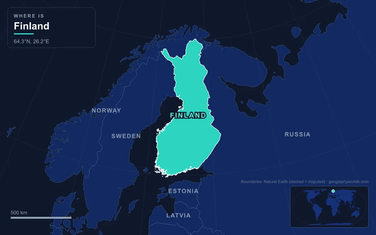
Finland lies in northern Europe between roughly 60° and 70° N, bordered by Sweden to the west, Norway to the north, Russia to the east and the Baltic Sea’s Gulf of Bothnia and Gulf of Finland to the south and west. It covers about 338,000 km², roughly a tenth of it water, and divides into three physical regions: flat coastal lowlands and archipelagos, a slightly higher central lake plateau known as the Finnish Lakeland, and uplands in the north and east that rise into the fells of Lapland. The highest point is 1,324 m, on a spur of Halti at the Norwegian border. The longest river is the Kemijoki (550 km), and the Tornionjoki (522 km) forms much of the border with Sweden. About two thirds of the country lies below 200 m, which is why the story of Finnish geography is told less by mountains than by ice: the six features below are all, in one way or another, products of the last glaciation.
Halti and the Käsivarsi Fells: Finland’s Highest Ground
Finland’s shape is often compared to a figure with one raised arm, and the “arm” (Käsivarsi in Finnish) is the narrow wedge of Enontekiö municipality squeezed between Sweden and Norway in the far north-west. This is the only corner of the country where the Scandinavian Mountains reach across the border, and the rocks here are the youngest in Finland: schists and gneisses belonging to the Caledonides, assembled in Palaeozoic times, while almost everything to the south and east is Precambrian bedrock of the Baltic Shield.
Halti itself is a fell whose true summit, Ráisduottarháldi at 1,365 m, stands about a kilometre inside Norway. The highest ground on the Finnish side, a spur called Hálditšohkka, reaches 1,324 m, and that is Finland’s highest point. The oddity dates to a Swedish–Danish border treaty of 1734, signed when Finland belonged to Sweden and Norway to Denmark. The treaty named only major landmarks, and surveyors then joined their markers with straight lines, so the line happened to cross a slope rather than a peak. The highest summit entirely inside Finland is Ridnitšohkka, 1,316 m, a few kilometres away. In 2015 a Norwegian campaign proposed moving the border about 200 m to hand Hálditšohkka’s peak to Finland for its 2017 centenary; Norway eventually declined, citing its constitution’s description of the realm as indivisible.
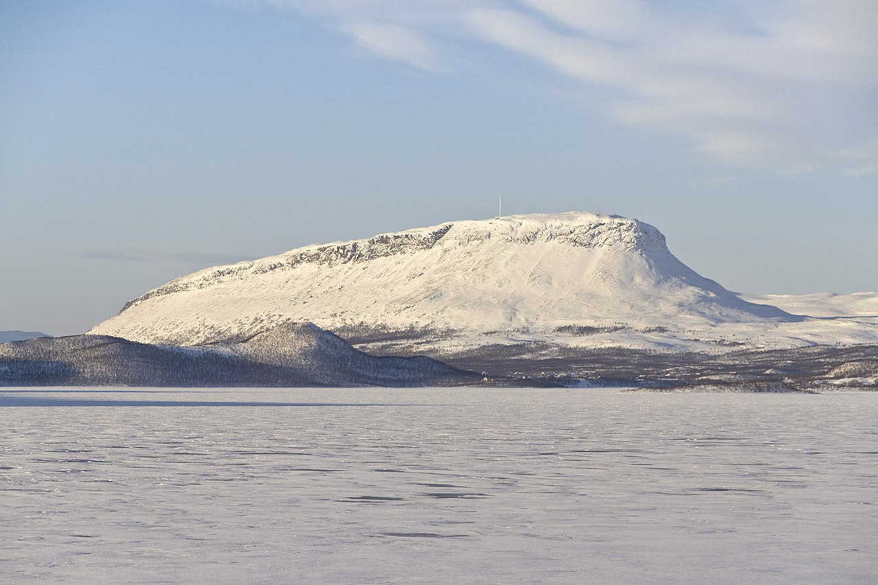
The best-known fell of the arm is Saana, 1,029 m, which rises 556 m straight above Kilpisjärvi lake beside the village of Kilpisjärvi, recorded with just 114 residents in 2000. A 55 km trail runs from Kilpisjärvi to Halti. Enontekiö as a whole has only about 1,800 inhabitants across roughly 8,400 km², and Saana itself has a tundra climate, with no month averaging above 10 °C.
The Salpausselkä Ridges: A 500-Kilometre Wall of Gravel
South of Lapland the relief collapses. Finland’s interior is a peneplain, ancient mountain ranges worn down to near-flat surfaces over hundreds of millions of years, and the ice sheets of the Quaternary scraped off what weathered rock remained. What the ice added, rather than removed, is the most important landform in southern Finland: the Salpausselkä, or “bar ridge”.
The Salpausselkä is a terminal moraine, a bank of sand and gravel dumped where the edge of the ice sheet paused in front of the Baltic Ice Lake during the Younger Dryas cold spell, roughly 12,250 to 10,400 years ago. From Hanko on the south-west coast it runs for close to 500 km towards the east, reaching 80 m in height in places. Two similar but smaller ridges, the Second and Third Salpausselkä, formed later and lie north of it.
The ridge works like a dam. It traps the lakes of the Lakeland behind it and lets water out only through a few breaches. The Kymi River drains Päijänne south to the Gulf of Finland; Saimaa’s outflow, the Vuoksi, leaves Finland at Imatra, famous for the Imatrankoski rapids, and runs into Russia to Lake Ladoga. People have used the dry, level crest for travel for centuries, and modern railways and highways follow it. Towns along it draw clean groundwater filtered through its gravels, and the land on its southern side has been inhabited for more than 10,000 years.
Saimaa: 4,279 Square Kilometres of Water and 13,710 Islands
Behind the Salpausselkä lies Saimaa, the largest lake in Finland and the fourth-largest natural freshwater lake in Europe, with a surface of about 4,279 km². It is not one open sheet of water but a maze of basins joined by glacier-carved channels, each with its own name: Orivesi, Puruvesi, Haukivesi, Pihlajavesi and Pyhäselkä among them. Counting the islands gives about 13,710, and the shoreline measures roughly 14,850 km. Yet the lake is shallow, averaging 17 m with a maximum of about 86 m, and it freezes between November and May.
Saimaa was larger once. About 6,000 years ago the ancient lake, estimated at nearly 9,000 km², drained abruptly through a new outlet, leaving thousands of square kilometres of wetland. Lappeenranta, Imatra, Savonlinna, Mikkeli, Varkaus and Joensuu all sit on its shores, and the 43 km Saimaa Canal, with eight locks, links Lappeenranta to Vyborg on the Gulf of Finland; nearly half of it runs through land leased from Russia.
The lake’s best-known resident is the Saimaa ringed seal, one of the rarest seals in the world at about 500 animals. Its ancestors were cut off when the land rose after the last ice age, and the population has lived in isolation for around 9,500 years. In 2025 genetic work reclassified it as a species in its own right, Pusa saimensis.
Saimaa is exceptional in size, not in kind. Finland has about 5,600 lakes larger than 10 hectares and, depending on the survey, between roughly 168,000 and 188,000 above 500 m². Päijänne, 119 km long, holds the deepest point of any Finnish lake at 95.3 m, and a tunnel from it supplies Greater Helsinki with drinking water. Lake Inari, north of the Arctic Circle, sits in a fault-bounded graben and drains north through the Paatsjoki to the Barents Sea.
Koli and Lake Pielinen: What Remains of the Karelides
On the western shore of Lake Pielinen in North Karelia, the land rises to Koli, a hill of white quartzite whose summits are Ukko-Koli (347 m), Akka-Koli (339 m) and Paha-Koli (334 m). By Alpine standards these are modest heights, but they are the eroded stumps of a mountain range: the Karelides, folded up in a plate collision about 1,800 million years ago and thought to have stood several kilometres high. Ice then rounded the cliffs, left boulder caves and stranded erratic blocks across the slopes.
Pielinen below is about 120 km long and covers roughly 894 km², at 93.7 m above sea level. Its basin, around 12,823 km², is split roughly equally between Finland and Russia, and like many Finnish lakes its water is dark with humic material draining from bogs. Painters discovered Koli in the 19th century, and the view east from Ukko-Koli is counted among Finland’s national landscapes. It inspired Jean Sibelius and the painter Eero Järnefelt. Koli National Park, established in 1991, protects about 30 km² of the hills and still maintains traditional slash-and-burn meadows and grazing.
The Kvarken Archipelago: Land Climbing Out of the Gulf of Bothnia
Finland is still getting bigger. When the ice sheet melted, the crust it had pressed down began to spring back, and the rebound is fastest around the Gulf of Bothnia, where the land rises close to 1 cm a year. Across the whole country the land area grows by about 7 km² annually as old seabed becomes shore. At various times roughly 62 per cent of Finland has been under water since deglaciation, and ancient shorelines now stand 150 to 220 m above sea level inland.
Nowhere is this clearer than in the Kvarken, the narrow sill between the Bothnian Bay and the Bothnian Sea. The outermost Finnish and Swedish islands are only about 25 km apart and the water is around 25 m deep. On the Finnish side, mostly in Korsholm municipality near Vaasa, lie Replot, Björkö and more than 5,600 smaller islands. Since the ice left about 9,600 years ago the region has risen by about 285 m. Its fields of De Geer moraines, low ridges laid down in regular rows parallel to the retreating ice front, emerge from the sea as strings of skerries. In 2006 parts of the Kvarken Archipelago were added to the High Coast World Heritage Site in Sweden. Estimates suggest that within about 2,000 years the sill will rise above the water, cutting the gulf into a southern sea and a northern lake.

Inland from Vaasa stretches the Ostrobothnian Plain, extending about 100 km from the coast with height differences under 50 m; it is the largest plain in the Nordic countries. Further south, between the mainland and Åland, the Archipelago Sea holds an estimated 50,000 islands in an area of about 8,300 km², only 2,000 km² of it land. Both landscapes are the same process at different stages: a tilted, glacier-scoured surface slowly emerging from the Baltic.
The Kemijoki: Finland’s Longest River and Lapland’s Power Line
Most Finnish rivers are short links between lakes, but the far north has room for long ones. The Kemijoki runs 550 km south through Kemijärvi and Rovaniemi to the Gulf of Bothnia at Kemi. At Rovaniemi, whose centre sits about 6 km south of the Arctic Circle, it is joined by the Ounasjoki. Like the Kokemäenjoki in the south-west, it drains into the Gulf of Bothnia, into which much of Finland drains.
The Kemijoki is also a major source of hydroelectric power. The first power plant, at Isohaara near its mouth, was built between 1945 and 1949, and 15 plants now stand along it. In 2003 they generated about 4.3 TWh, around 34.5 per cent of all Finnish hydroelectricity. Next door, the Tornionjoki (Torne) flows 522 km from Torneträsk in Sweden and, after meeting the Muonio, forms the Finland–Sweden border for roughly half of its length before reaching the same gulf.
The climate along these rivers is extreme by Finnish standards. Winter lasts from early October to early May in Lapland, and snow covers the north for around seven months. Finland’s coldest recorded temperature, −51.5 °C, was measured at Kittilä on 28 January 1999, while the hottest, 37.2 °C, came far to the south-east at Liperi on 29 July 2010. For the seasonal detail behind those extremes, see our guide to the climate of Finland, and for the ice-age processes that built eskers, moraines and kettle lakes worldwide, our guide to glacial landforms. The southern coast where most Finns live, from Hanko to the capital, is covered in our profile of Helsinki, Finland’s capital on the Gulf of Finland.