

Iraq covers about 438,317 km² of West Asia at the head of the Persian Gulf, and its geography falls into four main regions: the Zagros highlands of the north-east, the rolling upland of Al Jazira between the upper Tigris and Euphrates, the flat alluvial plain of Lower Mesopotamia that runs from around Tikrit to the Gulf, and the stony desert west of the Euphrates, which covers almost two-fifths of the country. The highest point is Cheekha Dar, about 3,611 m, on the Iranian border. The Tigris and Euphrates carry almost all of the country’s water, meet at Al-Qurnah to form the Shatt al-Arab, and reach the sea along a coastline only 58 km long.
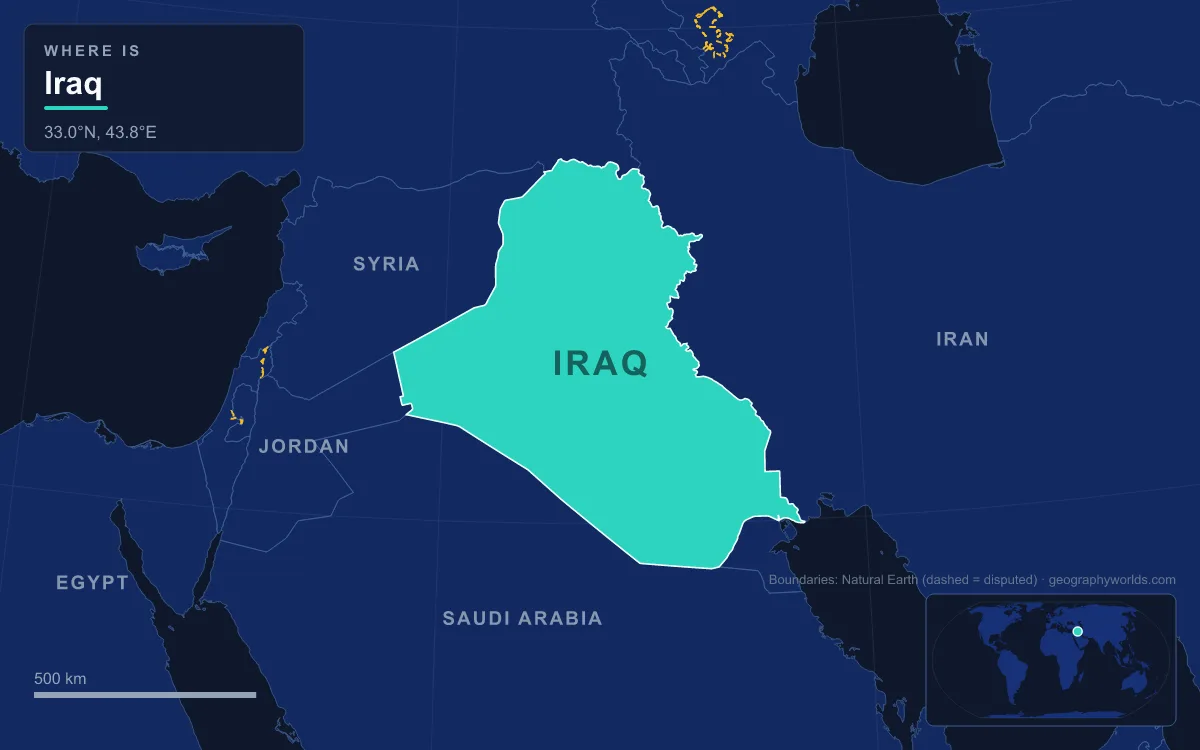
The Iraqi government uses the same four zones, and each has its own rainfall and soils. Crossing them one at a time, from the snowline in the north-east to the dunes of the south-west, explains why more than 46 million people live mostly along two river corridors and why the map is emptier the further west you look.
The Zagros Highlands of Iraqi Kurdistan: Cheekha Dar, Halgurd and the Great Zab
The highlands begin just south of a line drawn between Mosul and Kirkuk and climb north-east to the borders with Turkey and Iran. They are the north-western end of the Zagros range, part of the long alpine belt that runs from the Balkans through southern Turkey and Iran towards the Himalayas. Broad, undulating steppes give way to ridges between 1,000 and 3,611 m. The top of the country is Cheekha Dar, a Kurdish name meaning “black tent”, which stands 6 km north of the village of Gundah Zhur. The CIA World Factbook gives it 3,611 m, a figure a 2011 winter expedition confirmed by GPS. Its neighbour Halgurd, about 3,607 m, was previously thought to be Iraq’s highest mountain.

This is the only part of Iraq with a truly wet winter. Rainfall may reach about 1,000 mm a year in some places, and winter nights regularly drop below freezing. The water feeds the Tigris through a chain of left-bank tributaries: the Khabur near Zakho, the Great Zab, the Little Zab and the Adhaim all join above Baghdad, and the Diyala enters about 36 km below the city. Further up the Great Zab basin, the Rawanduz gorge cuts through the mountains beside the town of Rawandiz, 123 km from Erbil. Between 1928 and 1932 the New Zealand engineer Archibald Hamilton, who wrote that the gorge was said to be the finest in Asia, pushed a road through it, from Erbil via Rawandiz to the Iranian border near Piranshahr, and it has been fought over many times since.
The foothills hold the oil fields around Kirkuk and Mosul, and the steppes south and south-west of the mountains get roughly 320 to 570 mm of rain — enough for one rain-fed crop a year, though a dry winter can still wipe it out. North of Mosul, the Tigris is held back by Mosul Dam, a 113 m high earth embankment 3.4 km long that can store about 11.1 km³ of water. It was built in the 1980s on soluble karst rock, and its foundations have needed repeated grouting ever since.
Al Jazira and the Tharthar Depression, Between Mosul and Hit
West of the Tigris and north of the Hamrin hills lies Al Jazira, “the island”, the upland wedge between the Tigris above the Hamrin Mountains and the Euphrates above Hit. It continues into Syria and Turkey, and unlike the plain further south its rivers flow in deeply cut valleys, which makes irrigation from them hard. The northern edge, around the Nineveh Plains, Duhok, Zakho and Amedi, has Mediterranean-type vegetation that turns green in the wet winter and brown in the rainless summer. The south-western part grades into semi-desert.
The Tharthar depression, formed in the Holocene when water dissolved gypsum rock of the Fatha Formation, is about 120 km long and 48 km wide, and its floor lies around 3 m below sea level. In 1956 engineers diverted Tigris floodwater into it through the Samarra Barrage and the Tharthar Canal. The result, Lake Tharthar, covers roughly 2,050 km² about 100 km north-west of Baghdad. It is linked by canal to the Euphrates and back to the Tigris, so the reservoir soaks up spring floods and releases water in dry months.
Lower Mesopotamia: the Alluvial Plain from Tikrit to Al Amarah
Somewhere around Tikrit the ground flattens into the alluvial plain. Here the Tigris and Euphrates run on raised beds, often above the level of the fields beside them, and the whole region behaves like a delta laced with river channels and canals. The two rivers carry about 60 million m³ of silt a year, and floods and irrigation have raised the plain by nearly 20 cm a century. Villages sit on the natural levees, where the coarser soil drains well and floods reach last.
The Euphrates enters Iraq from Syria in a gorge between 2 and 16 km wide and emerges onto the plain at Ramadi. Below it, the Hindiya Barrage, built in 1914, splits the river, and the old main channel survives as the Shatt al-Hillah. The Tigris passes Samarra and Baghdad; downstream at Kut a barrage diverts much of its water into the Shatt al-Hayy, once the Tigris’s main channel, which carries it south-west to the Euphrates well above Al-Qurnah. The flood season comes in March, April and May, when the rivers can carry forty times their September flow. In 1954 the Tigris nearly overtopped the dikes protecting Baghdad, which is why dams and diversion lakes such as Tharthar followed.
Baghdad, on the Tigris in the middle of the plain, has a hot desert climate. Average summer highs reach about 44 °C, and yearly rainfall averages about 150 mm, almost all of it between November and March. Salt is the plain’s long-term problem: a high water table draws it to the surface, and salinity rises from Baghdad southward until it seriously limits farming below Al Amarah. On the plain’s western edge, surplus Euphrates water is stored in Lake Habbaniyah and spills into Lake Razzaza, also called Bahr al Milh (the “Sea of Salt”), a shallow, salty lake in a depression west of Karbala.
The Hawizeh, Central and Hammar Marshes Around Al-Qurnah
Where the plain meets the Gulf’s old shoreline, the gradient almost vanishes. Over its last 300 km the Euphrates drops only 12 m, and the Tigris 24 m, so both rivers break into distributaries and spread out as marsh. The Mesopotamian Marshes once covered about 20,000 km², the largest wetland in western Eurasia, and fell into three parts: the Central Marshes between the two rivers, the Hammar Marshes south of the Euphrates, and the Hawizeh Marshes east of the Tigris, running across the border into Iran.
The marshes are home to the Marsh Arabs, or Ahwaris, who build houses and islands from cut reed, herd water buffalo and fish from narrow boats. Drainage began in the 1950s for farming and oil exploration and was sharply expanded in the late 1980s and 1990s under Saddam Hussein, partly to drive the Marsh people out. By 2003 only about a tenth of the original area was left. Dikes were breached after 2003 and much of the water came back, though drought and dams upstream in Turkey, Syria and Iran have slowed the recovery. UNESCO inscribed the marshes, together with the Sumerian cities of Ur, Uruk and Eridu, as a World Heritage Site in 2016. For the wildlife and the reed-house culture in more detail, see our guide to the Mesopotamian Marshes.
The Shatt al-Arab and Iraq’s 58 km Gulf Coast at Al-Faw
At Al-Qurnah the Tigris and Euphrates finally join to form the Shatt al-Arab, a river about 200 km long that runs past Basra to the Gulf south of Al-Faw. Because the marshes trap most of the silt, the water leaving them is fairly clear, but the Karun joins from the Iranian side at Khorramshahr carrying heavy sediment, and the channel to Basra has to be dredged constantly. The river widens from about 232 m at Basra to about 800 m at its mouth, and along its lower course it forms the border between Iran and Iraq.

Its banks once held the largest date-palm forest in the world: in the mid-1970s the region had 17 to 18 million palms, about a fifth of the global total. By 2002 war, salt and pests had destroyed more than 14 million of them on both sides of the river. Offshore, joint Iraqi–German diving expeditions in 2012 and 2013 found a living coral reef of about 28 km² at the mouth of the Shatt al-Arab, in water that swings between 14 and 34 °C. On land the heat is extreme: Basra recorded 53.9 °C on 22 July 2016, Iraq’s all-time high and one of the highest reliable temperatures measured anywhere.
The Western Desert: Wadi Hauran, Al-Hajarah and Al-Dibdibah
West and south-west of the Euphrates lies the largest and emptiest region, about 168,000 km² of desert that belongs geographically to the Syrian and Arabian deserts beyond the borders with Syria, Jordan and Saudi Arabia. It is mostly a wide stony plain with occasional sand, crossed by wadis that are dry for most of the year and flood briefly in winter. The western desert rises above 490 m, and the land reaches 951 m at Mount ’Unayzah, where Iraq, Jordan and Saudi Arabia meet. Winters can be sharp: Ar Rutbah has fallen to −14 °C.
The longest of these dry valleys is Wadi Hauran, which runs about 350 km from the Saudi border past Rutba to the Euphrates near Haditha. Its steep banks drop 150 to 200 m, which makes it the deepest valley in Iraq, and a few oases lie in its eastern part. Further south the desert splits into two named plateaus. Al-Hajarah, in the west, is rocky ground of ridges, depressions and wadis. Al-Dibdibah, in the east, is sandier and covered in scrub. Through it runs Wadi al-Batin, 72 km long, which has marked the boundary between Iraq and western Kuwait since 1913. Apart from towns such as Ar Rutbah, which gets about 114 mm of rain a year, the region is sparsely inhabited, mostly by Bedouin herders.
Taken together, the four regions explain Iraq’s shape on a population map: a thin wet north-east, a salty but fertile river plain, a drowned southern corner and a dry west. The same river system that built the plain also ties Iraq to its upstream neighbours, which is why the course of the Tigris through Turkey and Syria matters as much to Baghdad as anything inside the country, and why Iraq’s relations with the six countries that border it so often turn on water.