

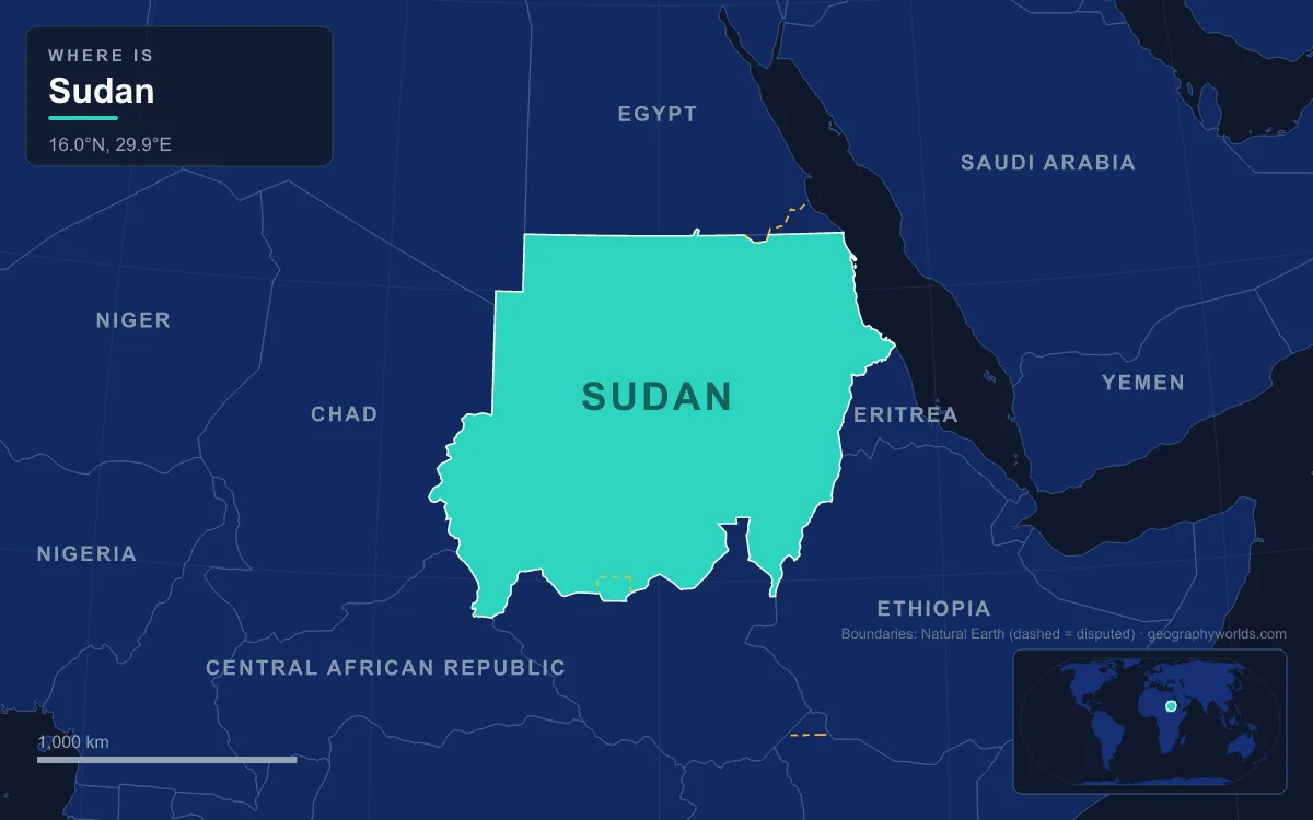
Sudan lies in north-east Africa between about 8° and 23° N, bordered by Egypt, Libya, Chad, the Central African Republic, South Sudan, Ethiopia and Eritrea, with 853 km of Red Sea coast. It covers roughly 1.86 million km² (sources range up to 1.89 million), making it the third-largest country in Africa after Algeria and the Democratic Republic of the Congo. Most of it is flat plain, and it divides into six physical regions: the Nile Valley running through the Nubian and Libyan deserts in the north, the Darfur plateau with the volcanic Marra Mountains in the west, the Nuba Mountains of South Kordofan, the central clay plains around the Gezira, the Butana and Gash country of the east, and the Red Sea Hills above a narrow coast. The highest point is the rim of the Deriba Caldera in the Marra Mountains, usually given as 3,042 m, and the lowest is sea level on the Red Sea. The Blue Nile and White Nile meet at Khartoum to form the Nile, which the Atbara joins further north as the river’s last tributary.
The Nile Valley Between the Nubian and Libyan Deserts
North of Khartoum the country is desert on both banks. East of the Nile lies the Nubian Desert, a stony plateau with drifting dunes and no oases at all; west of it lies the Libyan Desert, the eastern part of the Sahara, where water is limited to a handful of wells such as Bir an Natrun. Rainfall in this belt is close to zero. Between the two, the Nile Valley is a strip of cultivable alluvium that is often no more than two kilometres wide, and almost every town of the north, from Dongola to Karima, sits on it.
The river here does not run straight. Between Khartoum and the Egyptian border it traces a giant S-shape, the Great Bend, forced westward by an uplifted block of crust geologists call the Nubian Swell. Because the land has been rising while the river cuts down, the bed is shallow and rocky, and the river breaks into the cataracts that blocked navigation for millennia. Five of the six numbered cataracts are in Sudan. The Sixth, nearest Khartoum, is where the Nile cuts through the Sabaluka pluton, a mass of intrusive rock. The Fifth lies between Abu Hamad and Atbara. The Fourth, in the Manasir Desert, has been under the reservoir of the Merowe Dam since 2008. The Third is at Tombos and Hannek, and the Second, or Great Cataract, south of the old site of Wadi Halfa, drowned beneath Lake Nubia after Egypt built the Aswan High Dam. Lake Nubia is the Sudanese name for the southern 17% of the reservoir the Egyptians call Lake Nasser.

The Merowe Dam, about 350 km north of Khartoum, is roughly 9 km long and holds back a reservoir of 12.5 km³, about 15% of the Nile’s average annual flow of 84 km³. Inside the Great Bend lies the Bayuda Desert, where the Bayuda volcanic field packs about a hundred cinder cones into an area of 11 by 48 km; its last eruption has been dated to roughly 1,100 years ago. At the town of Atbara the Atbara River arrives from the Ethiopian Highlands after a course of about 805 km. For much of the year it is little more than a stream, but in the July-to-October rains it rises about 5 m, and it is the last water the Nile receives before the Mediterranean.
Further west, the dry bed of Wadi Howar runs more than 1,100 km from Chad to the Nile opposite Old Dongola; until about 4,500 years ago it carried a river nicknamed the Yellow Nile.
Jebel Marra and the Darfur Plateau
Darfur and Kordofan together make up the western front of Sudan, about 850,000 km² in which there are almost no permanent streams. People and herds stay within reach of wells, and the population is thin and uneven. Northern and eastern Darfur are semi-desert, watered only by seasonal wadis. The south of the region is the qoz, a belt of old sand dunes that grows a rolling cover of grass in the rainy season and has more reliable boreholes and hafirs, the dug reservoirs that store runoff.
Rising out of the western Darfur plain is the Marra Mountains, a volcanic massif on the border of South and Central Darfur that climbs as much as 2,600 m above the surrounding plain. Apart from the Aïr Mountains of Niger, it is the only major range in the flat Sahel. Its summit area is the Deriba Caldera, an oval crater about 4.8 by 6.4 km across and 500 to 1,000 m deep, formed when a large eruption about 3,500 years ago blasted out pumice and pyroclastic flows that travelled more than 30 km. Two lakes sit on the caldera floor: an 11.5 m deep salty lake in the north-east, and a smaller but much deeper freshwater lake inside a cone in the south-west. Hot springs and fumaroles are still active. Because the upper slopes catch more rain than the Sahel below, they hold permanent springs and a small temperate zone, and the drainage off the massif supports settled farming on the plain around it.

The massif has long been a refuge, for the precolonial Fur sultans and, during the War in Darfur, for rebel forces, and insecurity means the volcano is still poorly studied.
The Nuba Mountains of South Kordofan
Almost in the geographic centre of the country, the Nuba Mountains break the Sudanic plain with a cluster of dome-shaped, sugarloaf hills that rise abruptly from the flat ground. The area measures roughly 64 by 145 km, and the hills stand 450 to 900 m above the plain. Some are isolated knobs covering a few square kilometres; others are larger masses with internal valleys. Geologically they are Precambrian metamorphic rock of the Arabian-Nubian Shield poking up through much younger Cenozoic sediments.
The hills are greener than the country around them. The rainy season runs from mid-May to mid-October and brings 300 to 800 mm a year, enough for rain-fed farming and grazing, although water often runs short between February and May. Up to 1.5 million people live here, mostly the Nuba peoples, whose name comes from the mountains; they are distinct from the Nubians of the northern Nile Valley.
The Gezira and the Central Clay Plains
East of the Nuba Mountains, heavy clay plains stretch to the Ethiopian border, broken only by the Ingessana Hills and by a low ridge that slopes down from the Ethiopian Highlands between the Dinder and Rahad rivers. This is the economic heart of the country, because it is where water and soil coincide. The Blue Nile runs for about 650 km through Sudan, picking up the Dinder and the Rahad between Sennar and Khartoum.
The Gezira, Arabic for “island”, is the wedge of land between the Blue and White Niles south of their confluence at Khartoum. Its soil slopes gently away from the Blue Nile, so water flows through canals by gravity, and its high clay content keeps seepage low. British administrators first grew cotton there in 1904, and the Sennar Dam, completed in 1925 after the lowest Nile flood in two hundred years, made large-scale irrigation possible. By 2008 the Gezira Scheme, with its Manaqil Extension, irrigated about 8,800 km², around half of all irrigated land in Sudan, through 4,300 km of canals and ditches. Upstream, the Roseires Dam at Ad Damazin, completed in 1966, stores Blue Nile water; on the White Nile, the Jebel Aulia Dam south of Khartoum was the largest dam in the world when it was finished in 1937.
The longest of those borders, with South Sudan, was drawn in 2011 and is not fully settled. Under the Comprehensive Peace Agreement of 2005, the Abyei Area was given a special status, and it is now treated as belonging to both Sudan and South Sudan at once. The split of Sudan is covered in its own guide.
The Butana, the Gash Delta and the Taka Mountains
North-east of the clay plains, between Khartoum and Kassala, the land becomes semi-desert. The Butana is an undulating plain that gives good grazing for cattle, sheep and goats after the rains. East of it lies one of Sudan’s odder landforms, the Gash Delta. The Gash, known upstream in Eritrea and Ethiopia as the Mereb, is a seasonal river that never reaches the sea. Its flash floods have filled an old depression with so much sand and silt that the delta now stands above the surrounding plain. The area it waters, stretching about 100 km north of Kassala, stays moist long after the surface flow has gone, and supports grassland, food crops and cotton.
Kassala itself sits at the foot of the Taka Mountains, bare granite domes near the Eritrean border that rise steeply from the plain. The Beja and Beni Amer peoples live around them.

The Red Sea Hills and the Coast from Suakin to Halaib
North of the Gash, the Red Sea Hills run parallel to the coast and on into Egypt, a jumble of dry, bleak ranges that are noticeably cooler than the plains in summer. They are built of Neoproterozoic rock of the Arabian-Nubian Shield, 550 to 900 million years old, but they were lifted into mountains only when the Red Sea began to open in the Oligocene, 23 to 34 million years ago. Rainfall is under 200 mm a year. The Beja herd camels and goats along the wadis, and the Barka River, the most significant seasonal stream flowing to the sea, ends in the Tokar Delta.
Below the hills, the coastal plain narrows from about 56 km wide near Tokar to about 24 km near the Egyptian border. It is dry and rocky, and its seaward edge is fringed with coral. The old port of Suakin was choked by that reef, so between 1905 and 1909 the Anglo-Egyptian administration built Port Sudan to replace it; the city now handles about 90% of the country’s international trade. About 130 km north of it, Dungonab Bay and Mukkawar Island, together with the isolated Sanganeb coral reef, form a marine national park that became a World Heritage Site in 2016.
The coast ends in dispute. North of the 22nd parallel, the Halaib Triangle, about 20,580 km², was assigned to Sudan’s administration by the British in 1902 although the 1899 political boundary followed the parallel. Both countries have claimed it since Sudan’s independence in 1956, and Egypt has controlled it since 1994. Next to it, the smaller Bir Tawil is claimed by neither. The full list of neighbours and frontier details is in the countries that border Sudan, and the river that ties all six regions together has its own guide in the guide to the Blue Nile.