

The 3 main types of tsunamis are: tectonic tsunamis (caused by seafloor earthquakes), volcanic tsunamis (caused by eruptions or caldera collapses), and landslide tsunamis (caused by underwater or coastal landslides). Most destructive tsunamis are tectonic in origin.
Tsunamis are generated by different mechanisms. The three main types — tectonic, volcanic, and landslide-triggered — vary in their cause, wave characteristics, and geographic reach.
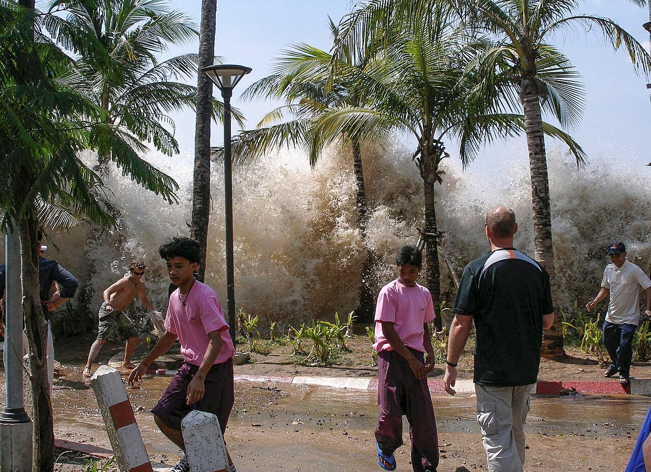
Tectonic Tsunamis
Tectonic tsunamis are caused by large undersea earthquakes (typically magnitude 7.0+) that vertically displace the seafloor along subduction zone faults. This sudden displacement pushes up a massive column of water, generating waves that can cross entire oceans at 700-900 km/h. Tectonic tsunamis account for about 80% of all tsunamis.
How it forms: A large thrust fault at a subduction zone ruptures, uplifting a section of seafloor. The displaced water forms waves that radiate outward in all directions. In deep water, waves are low but fast; near shore, they slow down and build up to devastating heights.
Examples: 2004 Indian Ocean tsunami (M9.1, 230,000+ deaths), 2011 Tōhoku tsunami (Japan, M9.1), 1960 Chile tsunami (M9.5)
Volcanic Tsunamis
Volcanic tsunamis are generated by volcanic eruptions, caldera collapses, or pyroclastic flows entering the sea. The 1883 Krakatau eruption produced tsunamis up to 40 meters high. More recently, the 2022 Hunga Tonga eruption generated a worldwide atmospheric-triggered tsunami. Volcanic tsunamis are less common but can be extremely destructive.
How it forms: Volcanic explosions, caldera collapses, or pyroclastic flows violently displace seawater. Atmospheric pressure waves from eruptions can also trigger tsunami-like waves across entire ocean basins.
Examples: 1883 Krakatau eruption (36,000+ deaths), 2018 Anak Krakatau flank collapse, 2022 Hunga Tonga-Hunga Ha'apai eruption
Landslide Tsunamis
Landslide tsunamis are caused by large volumes of rock, debris, or ice falling into water — either from coastal cliffs, submarine slopes, or volcanic flanks. These tsunamis produce extremely high local waves but dissipate quickly over distance. The tallest wave ever recorded was a landslide tsunami in Lituya Bay, Alaska in 1958 — a staggering 524 meters.
How it forms: A massive landslide or rockfall displaces a body of water. The wave height depends on the volume and speed of the landslide and the geometry of the water body. Confined bays can amplify the wave dramatically.
Examples: 1958 Lituya Bay tsunami (524 m wave, Alaska), 2018 Palu tsunami (Indonesia, submarine landslide), 1792 Mount Unzen landslide tsunami (Japan)
Meteorological Tsunamis (Meteotsunamis)
Meteotsunamis are tsunami-like waves generated by rapid changes in atmospheric pressure or strong wind events. They are smaller than seismic tsunamis but can cause damage in harbors and bays. They are increasingly recognized as a hazard, especially in enclosed bodies of water like the Mediterranean and Great Lakes.
How it forms: Rapid atmospheric pressure changes (from squall lines, gravity waves, or fast-moving fronts) transfer energy to the water surface, generating waves that can be amplified by harbor resonance.
Examples: 2014 meteotsunami in the Adriatic Sea, Great Lakes meteotsunamis, Balearic Islands events
Key Facts
- Tsunamis can travel across entire oceans — the 2004 tsunami reached East Africa from Indonesia.
- In deep ocean, tsunami waves travel at 700-900 km/h but are only 30-60 cm high.
- The Pacific Ocean has the most tsunamis because it has the most subduction zones.
- Japan's tsunami warning system can issue alerts within 3 minutes of an earthquake.
Fun Facts
- The word "tsunami" comes from Japanese: 津波 meaning "harbor wave."
- The tallest tsunami wave ever recorded was 524 meters (1,720 feet) at Lituya Bay, Alaska in 1958.
- Ancient Hawaiians built their villages on high ground because of their oral tradition of tsunami warnings.
Summary
Understanding the different types of tsunamis — tectonic, volcanic, landslide, and meteorological — is essential for early warning systems and coastal hazard planning. Each type has distinct characteristics that affect warning times and wave behavior.
Test Your Geography Knowledge!
Think you know your geographic features? Try our interactive quizzes!
Play Geography Games →