
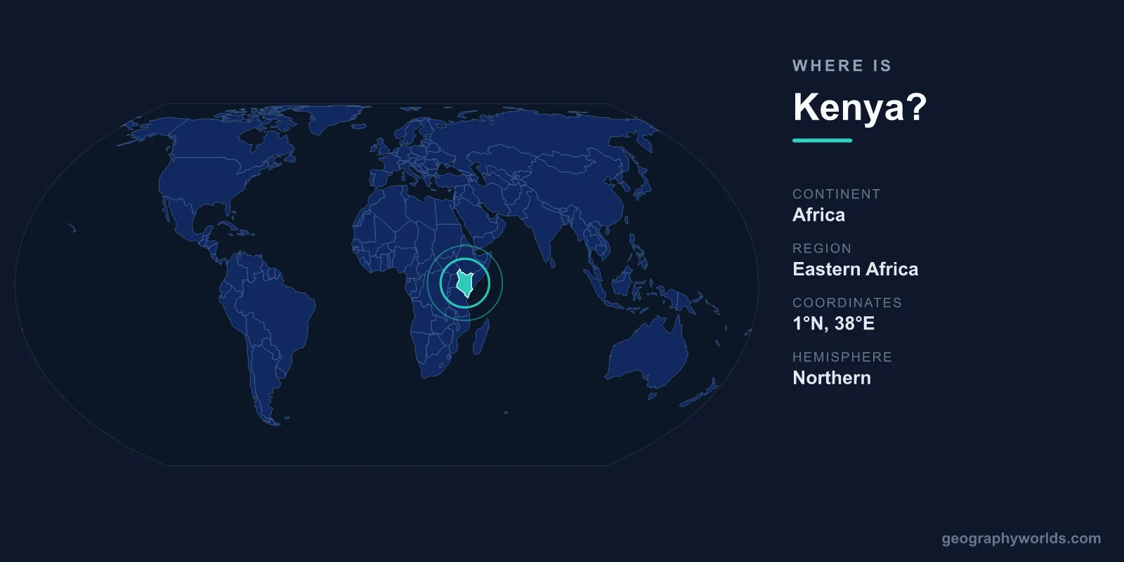
Kenya is located in East Africa, straddling the equator on the continent's Indian Ocean coast, with its capital at Nairobi and a total area of 580,367 km². It lies in both the Northern and Southern Hemispheres and the Eastern Hemisphere, with the equator cutting roughly through the middle of the country near the town of Nanyuki. Kenya borders five countries by land, shares the world's largest tropical lake, and serves as the commercial and diplomatic gateway to the entire East African region.
Where exactly is Kenya on the map?
Kenya sits on the eastern edge of Africa, between roughly 5°N and 5°S latitude and 34°E to 42°E longitude. To its southeast lies the warm Indian Ocean, giving the country about 530 kilometres of coastline anchored by the port city of Mombasa. Because the equator runs straight across Kenya, the country experiences relatively consistent day length and tropical conditions year-round, though altitude moderates the climate dramatically in the highlands.
Geographically, Kenya is often described as the gateway to East Africa. Nairobi, the capital and largest city, sits in the central highlands at around 1,795 metres above sea level, which is why it enjoys mild temperatures despite being almost on the equator. To picture Kenya's place on a globe, look for the point where the equator meets Africa's eastern coastline: the Horn of Africa juts out to the northeast, the Great Lakes region lies to the west, and the vast savannas of the Serengeti spread to the south. In time-zone terms, Kenya runs on East Africa Time (EAT, UTC+3), the same clock used across much of the region from Ethiopia down to Tanzania.
Which continent is Kenya on?
Kenya is on the continent of Africa, specifically within the sub-region known as East Africa. It is one of the founding pillars of the East African Community (EAC), an economic and political bloc that also includes Tanzania, Uganda, Rwanda, Burundi, South Sudan, the Democratic Republic of the Congo, and Somalia. Within the broader African Union, Kenya is grouped among the eastern African states and is widely regarded as the diplomatic anchor of the region, hosting the only United Nations global headquarters in the developing world at the UN Office in Nairobi (UNON).
Which countries border Kenya?
Kenya shares land borders with five neighbours and a sea border along the Indian Ocean. These borders make it a regional crossroads for trade, transport, and culture.
- Tanzania – to the south, sharing the famous Serengeti–Maasai Mara ecosystem
- Uganda – to the west, across Lake Victoria's eastern shore
- South Sudan – to the northwest
- Ethiopia – to the north
- Somalia – to the northeast, along the coast
Kenya also borders Lake Victoria, the largest lake in Africa, which it shares with Uganda and Tanzania. This central position has made Nairobi a hub for international organisations, aviation, and business across the entire region. The port of Mombasa is especially important: it serves not only Kenya but also acts as the main seaward outlet for landlocked neighbours such as Uganda, South Sudan, and parts of the Democratic Republic of the Congo, reinforcing Kenya's role as the logistical heart of East Africa. The Northern Corridor road and rail routes that radiate inland from Mombasa carry a large share of the imports for half a dozen countries.
What is Kenya's landscape like?
For a country roughly the size of France, Kenya packs in a remarkable range of landscapes. The Great Rift Valley slices through the country from north to south, lined with lakes and volcanic peaks. Mount Kenya, the country's namesake and the second-highest mountain in Africa at 5,199 metres, rises just south of the equator and is permanently snow-capped at its summit.
Moving outward from the central highlands, the terrain shifts to semi-arid plains in the north and east, fertile farmland around Lake Victoria, and a tropical coastal strip along the Indian Ocean. The Rift Valley floor holds a string of lakes — Turkana, Baringo, Nakuru, and Naivasha among them — several of them soda lakes that turn pink with flocks of flamingos. This variety supports world-renowned wildlife reserves such as the Maasai Mara, Amboseli, and Tsavo, which draw visitors for safaris each year, and it gives Kenya several distinct ecological zones within a single day's drive.
What is Kenya's climate like?
Despite sitting on the equator, Kenya's climate is defined more by altitude than by latitude. The central highlands around Nairobi and Mount Kenya are temperate and spring-like all year, with daytime temperatures often in the low 20s Celsius. The coast around Mombasa is hot and humid, the Rift Valley lakes region is warm and breezy, and the northern frontier is hot and arid. Rainfall follows a twice-yearly pattern: the "long rains" from roughly March to May and the "short rains" from October to December, with drier, sunnier spells in between that align with peak safari and travel seasons.
How big is Kenya and where does it rank?
Kenya covers 580,367 km², making it roughly the 48th-largest country in the world and comparable in size to France or the U.S. state of Texas. It is home to an estimated 55 million people. The official languages are Swahili and English, the dominant religion is Christianity, and the national currency is the Kenyan Shilling (KES). Kenya is a presidential republic.
Within East Africa, Kenya is one of the larger countries, sitting comfortably ahead of Uganda and Rwanda in land area, though smaller than Tanzania and Ethiopia. The population is heavily concentrated in the fertile, temperate highlands around Nairobi and along the shores of Lake Victoria, while the arid northern frontier remains sparsely settled. For more detail on its regions, history, and travel highlights, see our kenya country guide.
Why Kenya's location matters
Kenya's position on the equator and the Indian Ocean has shaped its story for over a thousand years. The coastal towns of Mombasa, Lamu, and Malindi grew prosperous as trading posts linking East Africa with Arabia, India, and the wider Indian Ocean world, giving rise to the distinctive Swahili language and culture that blends African and Arab influences. Today, that same connectivity makes Nairobi a continental centre for finance, diplomacy, and technology — earning the city the nickname the "Silicon Savannah" for its booming tech and mobile-money sector — and serving as a launchpad for travellers exploring the safaris, beaches, and mountains that define the country.
Key Facts
- Continent: Africa (East Africa)
- Capital: Nairobi (elevation ~1,795 m)
- Area: 580,367 km² (about the size of France or Texas)
- Population: approximately 55 million
- Bordering countries: Tanzania, Uganda, South Sudan, Ethiopia, Somalia
- Official languages: Swahili and English
- Currency: Kenyan Shilling (KES)
Frequently Asked Questions
Is Kenya in East or Central Africa?
Kenya is firmly in East Africa. It is one of the core members of the East African Community, alongside Tanzania, Uganda, Rwanda, Burundi, South Sudan, and the Democratic Republic of the Congo.
Does the equator pass through Kenya?
Yes. The equator runs across central Kenya, passing near towns such as Nanyuki and Nyahururu. Signposts marking the line are popular roadside stops for travellers heading to Mount Kenya.
What is the capital of Kenya and where is it?
The capital is Nairobi, located in the south-central highlands. Its elevation of nearly 1,800 metres gives it a temperate climate and earns it the nickname the "Green City in the Sun."
Does Kenya have a coastline?
Yes. Kenya has about 530 kilometres of Indian Ocean coastline to its southeast, anchored by the historic port city of Mombasa and dotted with beach resorts and the ancient Swahili town of Lamu, a UNESCO World Heritage Site.