
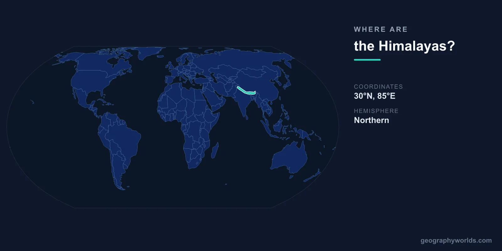
The Himalayas are located in South and Central Asia, centered at approximately 28°N latitude and 84°E longitude. They stretch roughly 2,400 kilometers in a great arc from Nanga Parbat in Pakistan to Namcha Barwa in Tibet, forming a massive natural barrier between the Indian subcontinent to the south and the Tibetan Plateau to the north.
Introduction
The range spans five countries: India, Nepal, Bhutan, China (Tibet), and Pakistan. It contains the world's highest peak, Mount Everest (8,849 meters), along with 13 other peaks above 8,000 meters. The Himalayas are the youngest major mountain range on Earth, still rising at a rate of about 5 millimeters per year.

Exact Location & Coordinates
- Center Coordinates: 28°N, 84°E
- Region: South/Central Asia
- Extent: ~2,400 km from NW to SE
- Mount Everest: 27°59'N, 86°55'E
On a world map, the Himalayas appear as the distinctive curved mountain wall along the northern edge of the Indian subcontinent. Find India on a map and look at its northern border — the Himalayas form almost the entire boundary between India and China (Tibet). Nepal and Bhutan are nestled entirely within the range.
The range runs roughly northwest to southeast, from the Indus River gorge in Pakistan to the Brahmaputra River gorge in eastern Tibet. Mount Everest sits on the Nepal-Tibet border at 27°59'N, 86°55'E, roughly in the center of the range.
Surrounding Countries & Borders
- Nepal: Central Himalayas, including Everest
- India: Western and eastern Himalayas (Himachal Pradesh, Uttarakhand, Sikkim, Arunachal Pradesh)
- Bhutan: Eastern Himalayas
- China (Tibet): Northern side of the range
- Pakistan: Western terminus (Nanga Parbat)
Nepal contains eight of the world's 14 peaks above 8,000 meters, including Everest, Kangchenjunga, Lhotse, and Makalu. The Nepalese Himalayas are the most visited section, with Everest Base Camp and the Annapurna Circuit being among the world's most famous treks.
India's Himalayan states stretch from Jammu and Kashmir in the west to Arunachal Pradesh in the east. The hill stations of Shimla, Darjeeling, and Mussoorie were established by the British in the cooler Himalayan foothills. Bhutan, the "Land of the Thunder Dragon," occupies the eastern Himalayas and has preserved its traditional Buddhist culture and forest cover.
Geographic Context
- Tectonic Origin: Indian plate colliding with Eurasian plate
- Still Rising: ~5 mm per year
- River Systems: Source of Ganges, Indus, Brahmaputra, Yangtze
The Himalayas were formed — and continue to rise — from the collision of the Indian tectonic plate with the Eurasian plate, which began roughly 50 million years ago. The Indian plate is still moving northward at about 5 centimeters per year, causing the mountains to grow taller and making the region seismically active.
The Himalayas are the source of Asia's great river systems. The Ganges and Brahmaputra flow south from the Himalayas through India and Bangladesh. The Indus flows westward through Pakistan. The Yangtze and Mekong originate on the Tibetan Plateau side. These rivers sustain over 1.5 billion people downstream.
Physical Characteristics
- Highest Peak: Mount Everest, 8,849 m
- 8,000m Peaks: 14 (all in the Himalayas and Karakoram)
- Glaciers: ~15,000 Himalayan glaciers
- Average Elevation of Range: ~6,000 m along the crest
The Himalayas contain all 14 of the world's peaks above 8,000 meters (10 in the Himalayas proper, 4 in the connected Karakoram range). The range rises from the subtropical Indo-Gangetic Plain at less than 200 meters to the summit of Everest at 8,849 meters in a horizontal distance of only about 150 kilometers — one of the steepest elevation gradients on Earth.
Roughly 15,000 glaciers exist in the Himalayas, holding the largest reserve of ice outside the polar regions. These glaciers feed the rivers that supply water to nearly 2 billion people. They are retreating due to climate change, raising concerns about future water security for South and East Asia.
Why It Matters
- Water Tower of Asia: Rivers from the Himalayas sustain 1.5+ billion people
- Climate Barrier: Blocks cold air from reaching India, blocks monsoon moisture from reaching Tibet
- Biodiversity: From tropical forests to alpine tundra in a few hundred km
The Himalayas function as Asia's primary climate barrier. They block cold Siberian air masses from reaching the Indian subcontinent in winter and force the summer monsoon to release its moisture on the Indian side, creating the extreme aridity of the Tibetan Plateau to the north. Without the Himalayas, South Asia's climate would be radically different.
The extreme elevation gradient creates extraordinary biodiversity. In the span of a few hundred kilometers, ecosystems range from subtropical jungle and bamboo forests to alpine meadows, glaciers, and permanent snow. The Himalayas harbor endangered species including the snow leopard, red panda, Bengal tiger, and Himalayan black bear.
Key Facts
- The Himalayas are centered at approximately 28°N, 84°E across South and Central Asia.
- They stretch ~2,400 km across India, Nepal, Bhutan, China (Tibet), and Pakistan.
- Mount Everest at 8,849 m is the highest peak on Earth, located at 27°59'N, 86°55'E.
- The range contains all 14 of the world's peaks above 8,000 meters.
- Approximately 15,000 glaciers supply water to over 1.5 billion people downstream.
Fun Facts
- The Himalayas are still rising at about 5 mm per year due to tectonic plate collision.
- Marine fossils have been found near the summit of Everest — the limestone was once an ancient seabed.
- The Himalayas create their own weather, with dramatically different climates on the Indian and Tibetan sides.
- Bhutan measures success by Gross National Happiness rather than GDP, partly due to its Himalayan Buddhist culture.
Final Thoughts
The Himalayas are located across South and Central Asia at approximately 28°N, 84°E, forming a 2,400-kilometer arc of the world's highest mountains across five nations. Home to Everest and all 14 eight-thousanders, they serve as Asia's water tower, climate barrier, and biodiversity hotspot. The Himalayas are arguably the most impactful mountain range on the world map, influencing the lives of billions of people across the continent.
Test Your Knowledge!
Think you know where things are on the map? Test your skills!
Play Geography Games →