
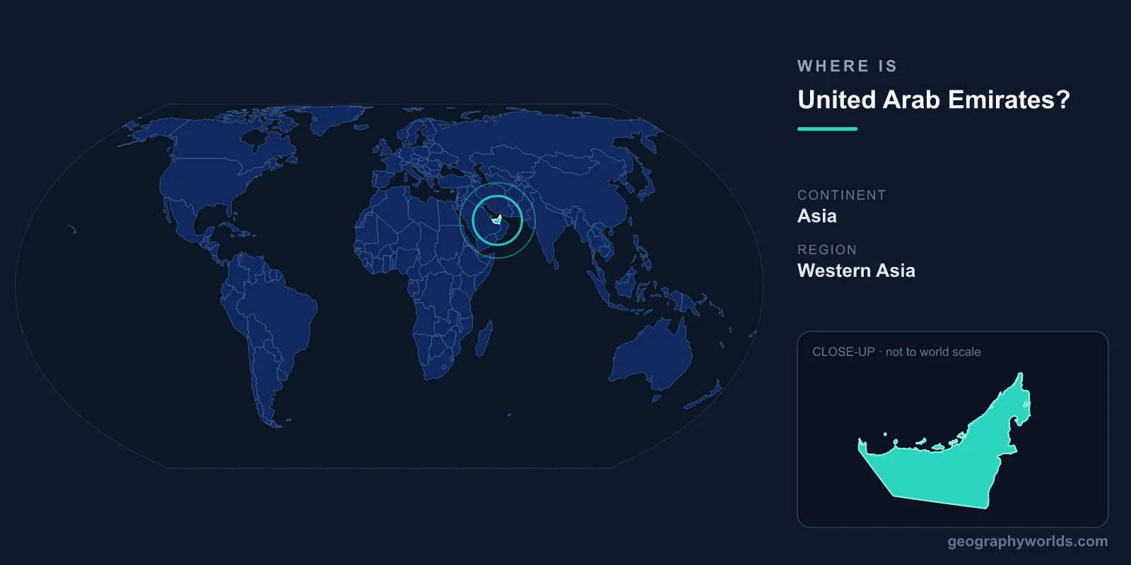
The United Arab Emirates is located in the Middle East on the southeastern Arabian Peninsula, in Western Asia, fronting the Persian Gulf and the Gulf of Oman. It is a federation of seven emirates with its capital at Abu Dhabi, covering roughly 83,600 km². The country sits in both the Northern and Eastern Hemispheres, occupying a strategic corner of Arabia where the peninsula bends toward the Strait of Hormuz.
Where Exactly Is the UAE on the Map?
The UAE lies in the southeastern part of the Arabian Peninsula, between approximately 22 and 26 degrees north latitude and 51 and 56 degrees east longitude. To the north, across the Persian Gulf, lies Iran; to the west and south stretches Saudi Arabia; and to the east is Oman. The country's coastline runs along the Persian Gulf to the northwest and reaches the Gulf of Oman in the east, near the strategically vital Strait of Hormuz, one of the world's most important oil-shipping chokepoints.
This places the UAE at a crossroads between Asia, Africa, and Europe. Dubai International Airport has become one of the busiest hubs on Earth precisely because of this central position, sitting within an eight-hour flight of roughly two-thirds of the world's population. For more detail on the nation's geography and travel basics, see our united-arab-emirates country guide.
The Seven Emirates That Make Up the Federation
The UAE is not a single unified state in the traditional sense but a federation formed in 1971, when six emirates united following Britain's withdrawal from the region; a seventh joined in 1972. The seven emirates are:
- Abu Dhabi – the largest by area and the federal capital, holding the bulk of the country's oil reserves.
- Dubai – the most populous and globally famous emirate, a commercial and tourism powerhouse.
- Sharjah – known as a cultural and educational center.
- Ajman – the smallest emirate, on the Persian Gulf coast.
- Umm Al Quwain – a quiet northern emirate with a small population.
- Ras Al Khaimah – the northernmost, home to the Hajar Mountains and Jebel Jais, the country's highest peak.
- Fujairah – the only emirate located entirely on the Gulf of Oman coast.
Abu Dhabi alone accounts for around 87 percent of the federation's total land area, while the northern emirates are far more compact and densely settled.
Borders, Coastline, and Neighbors
The UAE shares land borders with just two countries. Its longest border, running for roughly 450 km, is with Saudi Arabia to the west and south. To the east and northeast, it borders Oman, including a stretch through the Hajar Mountains. Oman also has an enclave, Madha, surrounded by UAE territory, and the UAE in turn controls small exclaves, a legacy of how tribal lands were demarcated in the twentieth century.
The coastline extends for more than 1,300 km, with the great majority facing the Persian Gulf and a smaller portion on the Gulf of Oman. Numerous low-lying islands dot the Gulf waters, including Abu Dhabi's own island, on which much of the capital is built. The Strait of Hormuz, lying off the UAE's eastern flank, gives the country an outsized importance in global energy geopolitics.
Landscape and Climate
Most of the UAE is flat, sandy desert that rises gradually toward the dunes of the Rub al Khali, the Empty Quarter, in the south. The only significant high ground is the Hajar mountain range in the east and northeast, where Jebel Jais reaches about 1,900 meters. Coastal areas are marked by sabkha, salt flats, mangrove lagoons, and offshore coral reefs.
The climate is hot and arid. Summers between June and September are intensely hot and humid along the coast, with temperatures regularly exceeding 40°C, while winters are mild and pleasant. Rainfall is sparse and irregular, concentrated in the cooler months, which is why the country relies heavily on desalinated seawater for fresh water.
People, Capital, and Everyday Facts
Abu Dhabi is the political and administrative capital, seat of the federal government and the presidency, while Dubai serves as the dominant commercial center. The official language is Arabic, and Islam, predominantly Sunni, is the state religion and a central part of daily life. The currency is the UAE dirham (AED), pegged to the US dollar. The population is around 10 million, but one of the country's most distinctive features is that the large majority are expatriates, drawn from South Asia, the wider Middle East, and beyond, making the UAE one of the most diverse societies on the planet.
Frequently Asked Questions
What continent is the United Arab Emirates on?
The UAE is on the continent of Asia, specifically in Western Asia within the Middle East region, on the southeastern edge of the Arabian Peninsula.
What is the capital of the UAE?
The capital is Abu Dhabi, which is also the name and largest of the seven emirates. Dubai is the most populous city but is not the capital.
Which countries border the United Arab Emirates?
The UAE shares land borders with two countries: Saudi Arabia to the west and south, and Oman to the east and northeast. Iran lies across the Persian Gulf to the north.
Is the UAE near the Strait of Hormuz?
Yes. The eastern part of the country, near Fujairah and the Musandam region, lies close to the Strait of Hormuz, a narrow passage between the Persian Gulf and the Gulf of Oman through which a large share of the world's seaborne oil passes.