

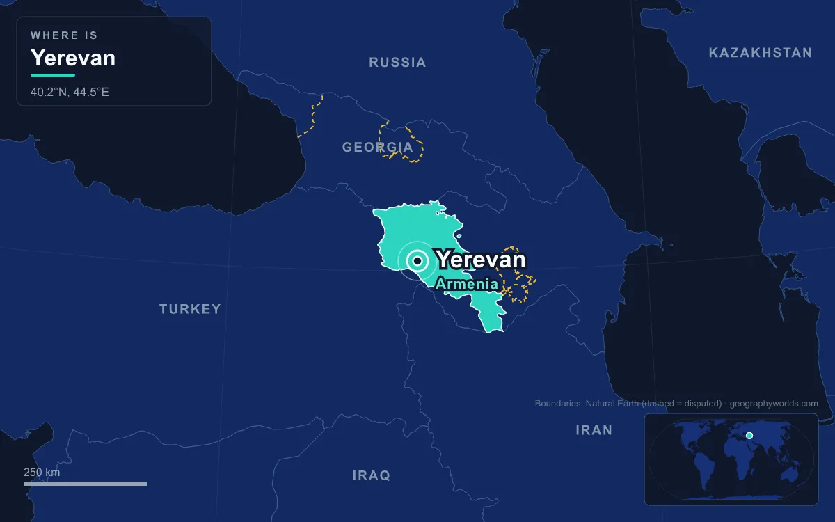
Yerevan is the capital and largest city of Armenia, home to 1,086,677 people at the 2022 census, more than a third of the country’s population. It sits on the Hrazdan River at the north-eastern edge of the Ararat Plain, at an average height of about 990 metres, with Mount Ararat visible across the border in Turkey. Capital since Armenia declared independence on 28 May 1918, Yerevan traces its founding to the Urartian fortress of Erebuni in 782 BC. Five places tell its story best: an Iron Age citadel, a Soviet-era square of pink stone, a manuscript library, a hillside staircase and a genocide memorial.
Erebuni Fortress on Arin Berd, 782 BC
Yerevan is one of the few capitals that can put a date on its birth. In the autumn of 1950 an archaeological team led by Konstantine Hovhannisyan found a cuneiform inscription on Arin Berd, a hill on the south-eastern edge of the modern city. It announced that Argishti I, king of Urartu and son of Menua, had built “this mighty stronghold” and named it Erebuni, “for the glory of Biainili” and “to instill fear among the king’s enemies.” The date was 782 BC. Argishti left a matching record at his capital Tushpa, on Lake Van, saying he brought 6,600 prisoners of war from Khate and Tsupani to populate the new town.
The fortress stands 1,017 metres above sea level on a triangular hilltop plan, behind ramparts 10 to 12 metres high. It guarded Urartu’s northern frontier and was designed as a royal administrative and religious centre. Excavations uncovered a temple of the god Khaldi with painted walls, giant clay karas jars for storing wine buried in the ground, and everyday ceramics and bronze jewellery. The name Yerevan itself is derived from Erebuni.

The Erebuni Museum at the foot of the hill opened on 19 October 1968, timed for the city’s 2,750th anniversary, and holds more than 12,000 exhibits. Between the citadel and the modern capital lie long gaps. Later Armenian kingdoms placed their capitals elsewhere and Yerevan faded. The Safavid shah Abbas I deported much of its Armenian population to Persia in the Great Surgun of 1603–05, and an earthquake in 1679 levelled most of the town. Yerevan passed to the Russian Empire in 1828, and at the start of the 20th century it was still a provincial town of about 29,000 to 30,000 people.
Republic Square and Alexander Tamanian’s 1924 Plan
That small town became a capital almost overnight. After the Armenian victories at Sardarabad, Abaran and Karakilisa in May 1918, the First Republic of Armenia declared independence and made Yerevan its seat, while thousands of genocide survivors from the Ottoman Empire poured into the area. Yerevan was the fourteenth capital in Armenia’s history and the seventh on or near the Ararat Plain.
The city you walk through today was drawn by one man. Alexander Tamanian, born in Yekaterinodar in 1878 and trained at the St Petersburg Academy of Arts, produced the General Plan of Yerevan, approved by the Soviet authorities in 1924. It was the first general plan drawn up for any Soviet city. Tamanian laid a radial-circular design over the old street pattern and paired neoclassical forms with Armenia’s volcanic tuff stone. The price was high: churches, mosques, baths and the Erivan Fortress were demolished to make room.
His centrepiece is Republic Square, designed in 1924. It has two parts: an oval roundabout with a stone pattern in the middle meant to look like a traditional Armenian rug, and a trapezoid section with a pool of musical fountains. Five major buildings of pink and yellow tuff, set on basalt bases, surround it. They include the Government House, the building shared by the History Museum and National Gallery, the Armenia Marriott Hotel and two former ministries. Most were finished by the 1950s; the National Gallery wing came last, in 1977.

In Soviet times it was Lenin Square, with a statue of Lenin and parades until 1988. The city council voted to rename it Republic Square on 1 November 1990, and the Lenin statue was removed on 13 April 1991, months before independence. It was the main stage of the 2018 Velvet Revolution. Tamanian planned the city for 150,000 residents, and it soon outgrew that figure many times over.
The Matenadaran at the Head of Mashtots Avenue
Walk north-east up Mashtots Avenue, the city’s main thoroughfare, and the street ends at a grey basalt cube raised 18 metres above the road. This is the Matenadaran, officially the Mesrop Mashtots Institute of Ancient Manuscripts, and it holds the largest collection of Armenian manuscripts in existence: about 23,000 manuscripts and scrolls, including fragments, plus more than 500,000 archival documents. The collection is on UNESCO’s Memory of the World register.
Its core came from Etchmiadzin, the seat of the Armenian Apostolic Church, where a collection was set up in 1441. That library was pillaged several times, last in 1804 during the Russo-Persian War. Thousands of manuscripts were destroyed during the Armenian genocide, although around 1,600 were rescued from Van, Mush, Erzurum and elsewhere. On 17 December 1920, weeks after Armenia was Sovietised, the Bolshevik government nationalised the Etchmiadzin repository. In 1939 the whole collection was moved to Yerevan, and on 3 March 1959 the Matenadaran was established as a research institute in its new building. It took Mashtots’s name in 1962, after the monk who created the Armenian alphabet. His statue stands at the foot of the steps.

The building was designed by Yerevan’s chief architect Mark Grigorian, commissioned in October 1939 and finished on paper in November 1944. Work ran from 1945 to 1957–58, with a pause from 1947 to 1953 for lack of skilled labour. The 22.4-metre façade, with its tall central arch between two narrow niches, is modelled on the 12th-century church of the Holy Apostles at Ani, the medieval Bagratid capital.
The Cascade, From Tamanian’s Sketch to the Cafesjian Center
Tamanian’s plan also imagined a green link from the city centre up to the northern hills of Kanaker, with terraces, waterfalls and flower beds. The idea was judged too ambitious in the 1920s and shelved. It revived in 1967, when the “Revived Armenia” obelisk was placed on the Kanaker plateau, completing the city’s north–south axis. In the early 1970s the architects Jim Torosyan, Sargis Gurzadyan and Aslan Mkhitaryan designed a stairway complex with exhibition halls, hidden escalators and courtyards. A statue of Tamanian was erected at its foot in 1974.
Construction started in 1980 but stopped in the late 1980s, after the 1988 Spitak earthquake, the collapse of the Soviet Union and the First Nagorno-Karabakh War. In 2002 the government decided to finish it with the Armenian-American philanthropist Gerard Cafesjian, who donated $128 million. His Cafesjian Museum of Art opened in 2009, and the Aznavour Centre followed on the upper tier in 2011. The complex runs about 302 metres, with 555 to 572 steps depending on the side, and in summer its steps double as seating for classical and jazz concerts. From the top terraces, on a clear day, the city spreads out towards Ararat.
Tsitsernakaberd, the Swallows’ Fortress
On a hill above the Hrazdan gorge, west of the centre, stands Armenia’s official memorial to the victims of the Armenian genocide. Its name, Tsitsernakaberd, means “swallows’ fortress”. On 15 February 1965, ahead of the 50th anniversary, the Soviet Armenian authorities resolved to build a memorial to the 1.5 million Armenians who perished. That April, mass demonstrations filled Yerevan’s streets, and the monument was completed in November 1967 to designs by the architects Arthur Tarkhanyan and Sashur Kalashyan and the artist Hovhannes Khachatryan.
Local legend gives the hill its name from the swallows that carried messages between the pagan gods Vahagn and Astghik. The memorial has three parts. Twelve inward-leaning stone slabs form a circle around an eternal flame. Many visitors take the twelve to stand for the lost provinces of Western Armenia, although Western Armenia actually spanned six Ottoman provinces, from Van to Erzurum, with Cilicia separate. Beside them rises a 44-metre column split into two parts, symbolising the rebirth of the nation. A memorial wall about 100 metres long completes the complex. It is carved with the names of the towns and villages where massacres and deportations took place, and plaques on its rear side honour people who helped the survivors, among them the German pastor Johannes Lepsius, the novelist Franz Werfel, the American ambassador Henry Morgenthau Sr. and the Norwegian explorer Fridtjof Nansen. An alley of trees planted in memory of the victims lines the approach. Every year on 24 April, Remembrance Day, thousands walk up the hill to lay flowers around the flame. The Armenian Genocide Museum-Institute, built into the hillside so as not to compete with the monument, opened in 1995 for the 80th anniversary, and visits to it are now part of state protocol for foreign delegations.
Taken together, these five places cover nearly 2,800 years, from Argishti’s citadel to a republic whose capital was named World Book Capital by UNESCO in 2012. For the church traditions behind several of them, see our guide to religion in Armenia. The question of where this highland country belongs is taken up in whether Armenia is in Europe or Asia, and the rest of the country, from Lake Sevan to Syunik, is covered in our Armenia country guide.
Quick Facts About Yerevan
- Country: Armenia
- Continent: Asia (Western Asia)
- Country population: approximately 2.9 million
- Capital city status: Yerevan is the capital of Armenia, the seat of national government, and the location of foreign embassies, parliament, and the head of state's official residence.
Frequently Asked Questions
What is the capital of Armenia?
The capital of Armenia is Yerevan. Yerevan is the seat of national government, hosts most foreign embassies and consulates, and is typically where the head of state and parliament are located.
What continent is Yerevan in?
Yerevan, the capital of Armenia, is located in Asia, in the Western Asia region. As Armenia's capital, Yerevan serves as the country's primary connection to the broader Asian political, economic, and cultural sphere.
Why is Yerevan the capital of Armenia?
Yerevan was chosen as the capital of Armenia for reasons that typically combine geography, history, and politics. Capital city selections often reflect a desire for centrality (being accessible from across the country), historical importance (being a longstanding seat of government or culture), or neutrality (being acceptable to multiple regions or ethnic groups within the country). The specific reasons for Yerevan's designation are detailed in the city's history above.
What is Yerevan known for?
As the capital of Armenia, Yerevan is best known for housing the country's central government institutions — parliament, presidential or royal residences, supreme court, and key ministries. It is also typically a major cultural and economic center within Armenia, hosting national museums, embassies, and signature monuments. The introduction and history sections above provide detailed coverage of the city's specific notable institutions and landmarks.
Related Pages
- Armenia Country Guide — full geography, climate, economy, and culture overview
- Flag of Armenia — meaning, history, and design of Armenia's national flag