

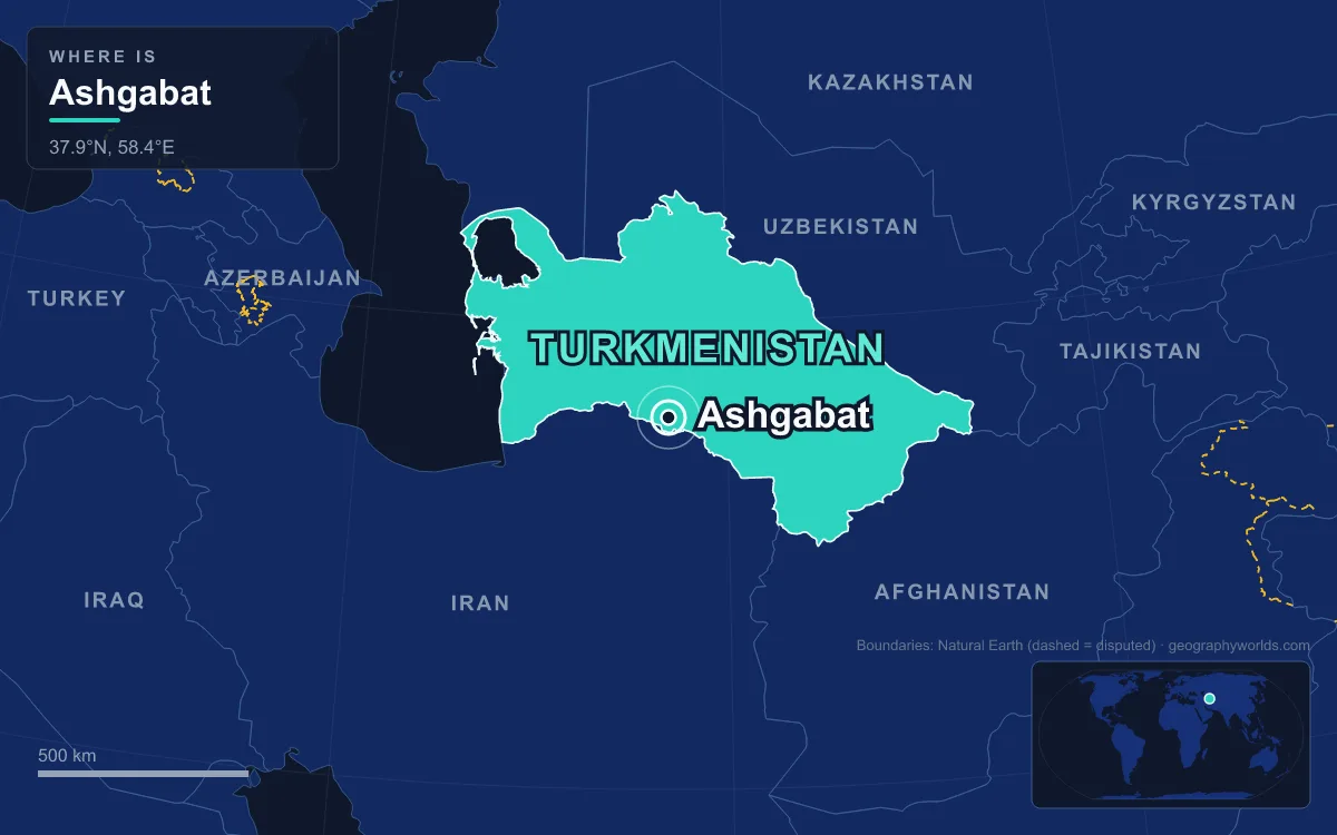
Ashgabat is the capital and largest city of Turkmenistan, an oasis city on the plain between the Karakum Desert to the north and the Köpetdag mountains to the south, about 50 kilometres from the border with Iran. The 2022 census counted 1,030,063 residents. Russian forces founded it as a garrison in 1881 beside a Turkmen village of the same name, it became the capital of the Turkmen Soviet Socialist Republic in 1924, and it was almost entirely destroyed by an earthquake in 1948, rebuilt in plain Soviet style, and then remade after independence in the white marble that now defines it. Behind the marble is a story about people: Teke tribesmen, Russian soldiers, Persian and Armenian merchants, Bahá’í believers, wartime refugees and a Turkmen population that began moving into the city in the 1920s and is now the large majority. Each group left a mark on the city, and following them in turn is the clearest way to understand how Ashgabat came to look and work the way it does.
The Ahal Teke Village Behind the Name Ashgabat
The site was settled long before the city. Ashgabat grew on the ruins of Konjikala, a Silk Road settlement first mentioned as a wine-producing village in the 1st or 2nd century BC, rebuilt after an earthquake and finally destroyed by the Mongols in the 13th century. The suburb of Köşi, absorbed in 2013, may have held a Parthian fortress guarding the nearby capital of Nisa.
The people who gave the modern city its name were the Ahal branch of the Teke, one of the Turkmen tribes. According to a British report of 1881, they arrived in the area around 1830 and founded several semi-nomadic villages, or auls, along the foot of the mountains; one was called Askhabad. A Russian document of 1850 lists “Ishkhabad” among 43 Ahal fortresses and calls it a typical Turkmen aul. In 1871 a Russian visitor counted more than 4,000 nomad tents in the area, implying 16,000 to 20,000 Ahal Teke Turkmen. The name itself means “city of love” or “city of devotion” in modern Persian, though that may be folk etymology; the Turkmen historian Ovez Gundogdiyev traces it instead to Arsaces I, founder of the Parthian Empire.
The Teke were famous horse breeders. The Akhal-Teke breed, prized for speed, endurance and a metallic sheen that earned it the nickname “Golden Horses”, takes its name from the Akhal line of oases along the north slope of the Köpetdag, where the Teke lived. Many of those Teke were killed or scattered at the Battle of Geok Tepe in January 1881, when Russian forces broke Turkmen resistance in the oasis. In September of that year Persia ceded the area to Russia under the Akhal Treaty.
Russian Officers and Persian Traders in 1880s Askhabad
The Russian town was officially founded on 18 January 1881 as a fortified garrison on the western edge of the aul, on the road to Persia. Its fortress stood on a 12-metre hill, and 67 Turkmen families were compensated for land taken to build it. The first residents were overwhelmingly soldiers and officials: the population of 2,500 in 1881 was virtually all Russian, and by 1886 about 10,000 people lived there, still mainly ethnic Russians. Streets and squares were named after the generals of the conquest, including a main square honouring Mikhail Skobelev and a central avenue named for Aleksey Kuropatkin.
Trade brought the next arrivals. A wagon road over the mountains to Quchan in Iran opened in 1882, and Persian and Armenian merchants settled in the town. The Trans-Caspian Railway reached Askhabad in 1885, pulling in workers from the Caucasus, the Volga valley and Iran. By 1897 the population was 19,426, and about a third of it was Persian. Migrants from the Caucasus, mainly Armenian, made up roughly a fifth of residents in the years that followed. One source goes further and says pre-revolutionary Askhabad had no Turkmen residents at all, because they lived in the surrounding auls.
The town these people built was divided by occupation. Officials lived around the fortress in thick-walled houses with gardens; railway workers and craftsmen lived in tighter streets near the station; and a merchants’ quarter grew up around the market between the two. By 1911 about half of the town’s 400-odd industrial workers were employed at the railway depot, and by 1915 Askhabad had branches of the Russian State Bank, the Persian Accounting Loan Bank, the Russian-Asian Bank and Société Générale.
Ashgabat’s Bahá’ís and the 1908 House of Worship
One community from Persia left an unusual legacy. Under Russian rule the number of Bahá’ís in Askhabad rose to more than 1,000, and they built their own schools, medical facilities and cemetery. In 1908 they completed the first Bahá’í House of Worship anywhere in the world, designed under the guidance of ʻAbdu’l-Bahá by Ustad ʻAli-Akbar Banna Yazdi, with a school, a hostel, a small hospital and a groundskeepers’ building at the corners of its gardens.
Soviet religious policy ended that chapter. The Bahá’ís gave up the properties in 1928, the building served as an art gallery from 1938, it was badly damaged in the 1948 earthquake, and it was demolished in 1963.
Poltoratsk, Wartime Refugees and the Night of 6 October 1948
Soviet power reached the city in December 1917, and in 1919 it was renamed Poltoratsk after Pavel Poltoratskiy, a local revolutionary. When the Turkmen SSR was created in 1924, Poltoratsk became its capital; the old name returned in 1927 in the Russian form Ashkhabad. The new state changed who lived in the city. Soviet power and forced collectivisation began to bring Turkmen into the city in the 1920s, and factories followed: a silk-spinning plant in 1928, cotton spinning and textiles in 1929, a garment factory in 1933 and a shoe factory in 1934. The 1926 count of 51,593 residents was 52.4% Russian, 13.53% Armenian and 4.3% Persian. By 1939 the population had reached 126,500, of whom 11.7% were Armenian.
The Second World War brought a different kind of newcomer. Institutions evacuated from the west, among them Moscow State University and the Kiev film studio, moved to Ashkhabad, and roughly 8,000 refugees were quartered in private homes. The physicist Andrei Sakharov and the writer Yury Olesha were among those who sat out the war here.
Then, at 1:12 a.m. on 6 October 1948, a magnitude 7.3 earthquake centred about 25 kilometres southwest of the city shook for around 10 seconds. Almost every building of adobe or fired brick collapsed. Soviet censorship kept the scale hidden; the official toll was 40,000, and estimates of the dead range from about 10,000 to over 110,000. At the upper estimates, that was around two-thirds of the city’s population, and the city was rebuilt from 1949 to a hasty new plan of drab two-storey Soviet blocks.
From 2,500 Russians to a Million Mostly Turkmen Residents
Rebuilding pulled in people from across the Soviet Union. The 1959 census recorded 169,900 residents, and by 1983 there were 338,000 belonging to 105 nationalities. After independence in 1991 the balance shifted decisively: estimates from the 2012 census put Turkmen at 78.5% of the city’s population, Russians at 10%, and Turks, Uzbeks and Azeris at about 1% each. The Armenian community shrank: the 1989 Soviet census had counted 31,829 Armenians across Turkmenistan, and after a visa regime was introduced in 1999 about 7,000 were considered to lack legal residence, many of whom later moved to Russia.
Part of the jump to a million came from moving the boundary rather than from births or migration. In 2013 Ashgabat annexed part of Ruhabat district and the industrial town of Abadan, now the Büzmeýin neighbourhood, along with the land and villages in between, adding 37,654 hectares. A further annexation in 2018 took in the Gurtly Reservoir to the north and set up the city’s four current boroughs.
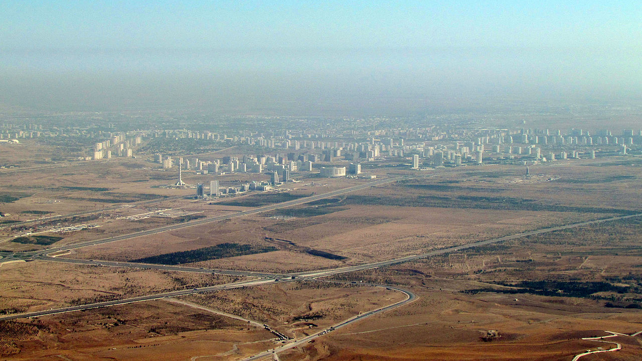
The same years remade the city physically and pushed some residents out. President Saparmyrat Nyýazow hired foreign builders, above all France’s Bouygues and the Turkish firms Polimeks and Gap Inşaat, to raise domed and columned public buildings faced in white marble; in 2013 Guinness World Records listed Ashgabat as having the world’s highest concentration of white marble buildings. Much of that construction replaced single-family houses rebuilt after 1948, often unregistered, and residents were frequently evicted without compensation, as were former dacha communities such as Ruhabat, Berzeňňi and Çoganly.
Carpet Sellers, Cotton Mills and the State Payroll
How Ashgabat’s people earn a living still echoes the city’s origins. The principal industries are cotton textiles and metalworking, and the Trans-Caspian line that brought the first wave of labour migrants remains a major railway. The largest employer, though, is the state: ministries and agencies provide a large share of the city’s jobs, alongside foreign staff at the embassies. The Büzmeýin district hosts the power station commissioned in 1957 as Turkmenistan’s first large plant, plus cement, concrete and carpet-weaving factories.
Trade in the old Turkmen goods continues at the bazaars. The Altyn Asyr Bazaar at Choganly, better known as Tolkuchka, sells traditional fabrics and hand-woven carpets alongside livestock and used cars, and residents shop at the Gülistan, Teke, Daşoguz and Jennet bazaars. The Turkmen Carpet Museum keeps the city’s best-known craft on display.

For foreigners the city is famously costly: ECA International ranked Ashgabat the world’s most expensive city for expatriates in 2019 and 2020, a result blamed on high inflation and rising import costs. Water, as for the Teke herders who first camped here, is the other constant. The city gets only about 221 millimetres of rain a year, with July highs averaging 38.3°C, and it depends on the Karakum Canal, which carries Amu Darya water through the city from east to west across the Karakum Desert. For how the capital fits into the rest of the country, from the Caspian coast to the Amu Darya, see the Turkmenistan country guide.
Quick Facts About Ashgabat
- Country: Turkmenistan
- Continent: Asia (Central Asia)
- Country population: approximately 7.7 million
- Capital city status: Ashgabat is the capital of Turkmenistan, the seat of national government, and the location of foreign embassies, parliament, and the head of state's official residence.
Frequently Asked Questions
What is the capital of Turkmenistan?
The capital of Turkmenistan is Ashgabat. Ashgabat is the seat of national government, hosts most foreign embassies and consulates, and is typically where the head of state and parliament are located.
What continent is Ashgabat in?
Ashgabat, the capital of Turkmenistan, is located in Asia, in the Central Asia region. As Turkmenistan's capital, Ashgabat serves as the country's primary connection to the broader Asian political, economic, and cultural sphere.
Why is Ashgabat the capital of Turkmenistan?
Ashgabat was chosen as the capital of Turkmenistan for reasons that typically combine geography, history, and politics. Capital city selections often reflect a desire for centrality (being accessible from across the country), historical importance (being a longstanding seat of government or culture), or neutrality (being acceptable to multiple regions or ethnic groups within the country). The specific reasons for Ashgabat's designation are detailed in the city's history above.
What is Ashgabat known for?
As the capital of Turkmenistan, Ashgabat is best known for housing the country's central government institutions — parliament, presidential or royal residences, supreme court, and key ministries. It is also typically a major cultural and economic center within Turkmenistan, hosting national museums, embassies, and signature monuments. The introduction and history sections above provide detailed coverage of the city's specific notable institutions and landmarks.
Related Pages
- Turkmenistan Country Guide — full geography, climate, economy, and culture overview
- Flag of Turkmenistan — meaning, history, and design of Turkmenistan's national flag