

Castries is the capital and largest city of Saint Lucia, set around a deep, sheltered harbour on the island’s northwest coast. The urban area had about 20,000 people and the wider Castries district just under 70,000 in 2013, which means close to 40 percent of Saint Lucians live in the capital’s district. Much of the city is built on a flood plain and on land reclaimed from the harbour, and because it has been rebuilt after major fires in 1805, 1813 and, worst of all, 1948, the buildings that tell its story are scattered: a harbour, a square, a cathedral, a market and a hill of forts above them. Seven of those places explain how Castries became what it is.
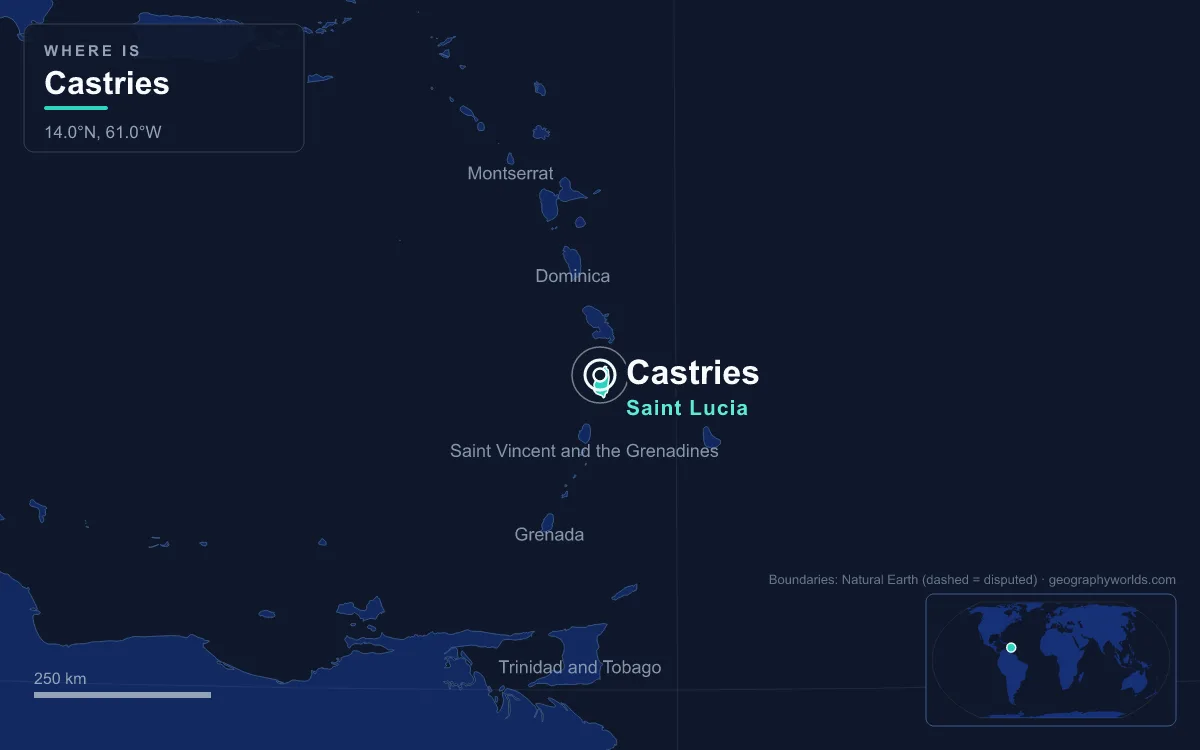
Castries Harbour: The Carénage That Named the City
The city began at the water. In 1650 a group of 40 Frenchmen led by the Sieur de Rousselan built a fort at the mouth of the Rivière du Carénage, sent by Jacques Dyel du Parquet, the governor of Martinique, who bought the island outright from the Compagnie des Îles de l’Amérique later that year. The settlement took the name Carénage from the harbour: a careenage is a place where ships can be hauled over for repairs, and this long, deep inlet gave ships a safe anchorage out of the Atlantic swell. In 1785 the town was renamed Castries after Charles Eugène Gabriel de La Croix, marquis de Castries, then France’s minister of the navy and colonies.
The harbour stayed the city’s reason for being under British rule. The first steamship, RMS Solway, arrived in 1841, and in 1888 Castries became a coaling station for steamships. That strategic value made it a target in the Second World War: on the night of 9–10 March 1942 the German submarine U-161 slipped into the harbour and sank two Allied ships. One of them, the Canadian liner Lady Nelson, sank where she lay with 18 people killed, and was later refloated and converted into a hospital ship. Today the harbour handles cargo, the ferry to Fort-de-France in Martinique and cruise ships, which dock at Pointe Seraphine on its north side, itself a duty-free shopping complex; a second duty-free centre, La Place Carenage, stands on the city waterfront.
Derek Walcott Square, the Old Place d’Armes
A few blocks inland lies the square that has served as Castries’ civic centre since French times. Bounded by Bourbon, Brazil, Laborie and Micoud streets, it began as the Place d’Armes, the parade ground, and was later called Promenade Square. In 1892 it was renamed Columbus Square, and in 1993 it took its present name to honour Derek Walcott, the poet and playwright born in Castries on 23 January 1930. Walcott won the Nobel Prize in Literature in 1992, two years after publishing Omeros, his Caribbean reworking of Homer.
Castries also produced Sir Arthur Lewis, born in the city on the same date in 1915, who won the Nobel Memorial Prize in Economic Sciences in 1979 and remains the only Black winner of that prize. Two Nobel laureates born in one small city, on the same day of the year, help give Saint Lucia what is often cited as the highest ratio of Nobel winners to population of any sovereign country. The square is also the setting for the Castries Central Library, and the city’s Catholic cathedral stands directly opposite it.
The Cathedral Basilica of the Immaculate Conception
A Catholic church has stood on this site since 1767. A second building was started in 1807 but stalled for lack of money in 1827; work resumed in 1831 and that church was finished by 1835. By the 1880s it was too small, and in 1885 Father Louis Tapon wrote to the archbishop asking for funds to expand it. The foundation stone of the present cathedral, designed by Father Scoles, was laid in 1894, and the building was completed in 1897.
It is a big church for a small city, about 61 metres long and 30 metres wide, and its interior is its most striking feature: the walls, arches and roof timbers are painted in bright colours, and the church holds a mural by the Saint Lucian artist Dunstan St. Omer. Pope John Paul II visited on 7 July 1986, and the church was made a minor basilica on 11 May 1999. It is the seat of the Archdiocese of Castries, whose church province also takes in the Diocese of Kingstown in Kingstown, capital of Saint Vincent. The church matters in a country where 50.6 percent of residents told the 2022 census they were Catholic, a legacy of the island’s long French colonial period.

The cathedral has also seen violence. During the New Year’s Eve mass of 2000, two men armed with machetes attacked the congregation and set worshippers alight; Father Charles Gaillard and Sister Theresa Egan died. Both attackers were sentenced to death, later reduced to life imprisonment on appeal.
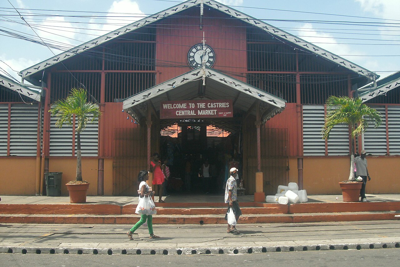
Castries Central Market, Opened in 1894
The same decade that produced the cathedral also produced the city’s best-known commercial building. The Castries Market was built in 1891 by the Liverpool engineering firm Bruce and Still, partly to tidy up the town’s appearance, and was opened by Sir Charles Bruce on 2 July 1894. Its long, gabled front, painted red and yellow with a clock over the main gate, is one of the most recognisable sights in the city.
It is the largest open-air market in Castries, with over 300 regular vendors and a hundred or more extra sellers on market days, trading fruit, vegetables, spices, herbs, crafts and dry goods. Fish is no longer sold inside, and meat is no longer slaughtered on the premises. To take pressure off crowded pavements, Castries City Council opened a Vendors’ Arcade annex in 1996, where cooks run food stalls and craftspeople make and sell goods on the spot.
Morne Fortune and Fort Charlotte
The hill that rises 258 metres (845 feet) south of the harbour is where the long fight for Saint Lucia was settled. Originally called Morne Dubuc, it was renamed Morne Fortuné in 1765, when the French moved their military headquarters there from the Vigie headland. Their fort, the Citadelle du Morne Fortuné, was completed in 1784, and during the French Revolutionary Wars it changed hands again and again. The British captured it on 1 April 1794, and three days later Prince Edward, Duke of Kent, named it Fort Charlotte after his mother, Queen Charlotte. The French retook it in June 1795; the British stormed it again on 24 May 1796, and a memorial to the 27th (Inniskilling) Regiment still marks that battle. Castries itself was burned during that campaign.
France got the island back under the Treaty of Amiens in 1802, but Lieutenant-General William Grinfield captured the fort in June 1803, and it stayed British until Saint Lucia’s independence in 1979. By then its military life was long over: troops were still posted there when the harbour became a coaling station in 1888, but the fort was abandoned in 1905. A secondary school now occupies the site, the hill is also home to Sir Arthur Lewis Community College and the Saint Lucia campus of the University of the West Indies, and the Saint Lucia National Trust looks after the listed military buildings on the summit.
Government House, Built in 1895
The governor’s residence has sat on the crest of Morne Fortune since the early 19th century, looking down over the city and the bay. The first house on the present site was destroyed by a hurricane in 1817 before it was finished, and a timber replacement completed in 1819 had fallen into disrepair and been abandoned by 1865. The current brick building was begun in 1894 and finished a year later. It housed the commissioners who ran Saint Lucia as part of the British Windward Islands until 1958, then the island’s administrators and governors, and since 1979 it has been the official residence of the Governor-General. It also holds the Le Pavillon Royal Museum, and in 2016 solar panels were installed on its roof after the government pledged to do so at the 2015 United Nations climate conference.
The government itself works down in the city below. Besides the national ministries, Castries hosts the secretariat of the Organisation of Eastern Caribbean States and the headquarters of the Eastern Caribbean Supreme Court, which gives a city of about 20,000 people a regional role out of proportion to its size.
Vigie Peninsula and George F. L. Charles Airport
The low headland on the north side of the harbour was where the French kept their government buildings by 1746, before moving across the water between 1768 and 1771. Today Vigie is home to George F. L. Charles Airport, about 2 kilometres north of the city centre, whose runway runs beside Vigie Beach. British West Indies Airways was flying Lockheed Lodestars from what was then Vigie Field as early as 1950. Long-haul flights now land at Hewanorra International Airport near Vieux Fort at the island’s southern tip, up to an hour and a half away by road, so Vigie mainly handles regional flights.
The airport’s weather station also gives the best picture of the capital’s climate. Castries has a tropical rainforest climate with highs of about 29 to 31 °C all year, but rainfall more than triples between the dry early months and the wet season from June to November.
That pattern matters for anyone planning a trip, and our guide to the best time to visit Saint Lucia covers the dry and wet seasons in more detail. For the rest of the island beyond its capital, including the volcanic Pitons near Soufrière, see our Saint Lucia country guide.
Quick Facts About Castries
- Country: Saint Lucia
- Continent: North America (Caribbean)
- Country population: approximately 180 thousand
- Capital city status: Castries is the capital of Saint Lucia, the seat of national government, and the location of foreign embassies, parliament, and the head of state's official residence.
Frequently Asked Questions
What is the capital of Saint Lucia?
The capital of Saint Lucia is Castries. Castries is the seat of national government, hosts most foreign embassies and consulates, and is typically where the head of state and parliament are located.
What continent is Castries in?
Castries, the capital of Saint Lucia, is located in North America, in the Caribbean region. As Saint Lucia's capital, Castries serves as the country's primary connection to the broader North American political, economic, and cultural sphere.
Why is Castries the capital of Saint Lucia?
Castries was chosen as the capital of Saint Lucia for reasons that typically combine geography, history, and politics. Capital city selections often reflect a desire for centrality (being accessible from across the country), historical importance (being a longstanding seat of government or culture), or neutrality (being acceptable to multiple regions or ethnic groups within the country). The specific reasons for Castries's designation are detailed in the city's history above.
What is Castries known for?
As the capital of Saint Lucia, Castries is best known for housing the country's central government institutions — parliament, presidential or royal residences, supreme court, and key ministries. It is also typically a major cultural and economic center within Saint Lucia, hosting national museums, embassies, and signature monuments. The introduction and history sections above provide detailed coverage of the city's specific notable institutions and landmarks.
Related Pages
- Saint Lucia Country Guide — full geography, climate, economy, and culture overview
- Flag of Saint Lucia — meaning, history, and design of Saint Lucia's national flag