

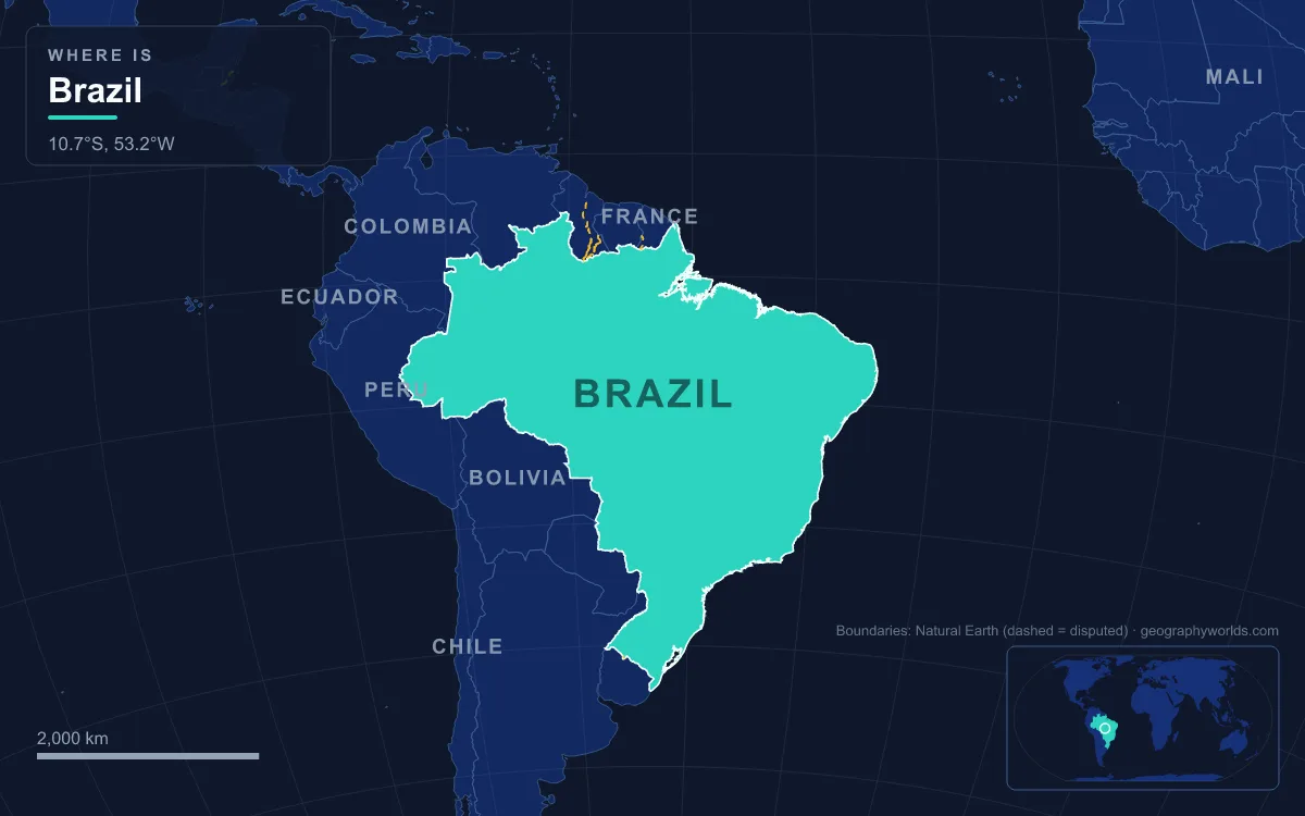
Brazil fills most of eastern South America, covering 8,514,215 km², which makes it the fifth-largest country in the world and a neighbour of every South American state except Chile and Ecuador. Its land splits into three great physical units: the ancient Brazilian Highlands, a plateau that takes up roughly half the country; the Amazon lowland of the north and west; and a narrow Atlantic coastal strip 7,367 km long, with the Pantanal wetland tucked against the western border. The highest point is Pico da Neblina, 2,995 m, on the Venezuelan frontier in Amazonas state, and the lowest is sea level on the Atlantic. The main rivers are the Amazon, whose basin covers 45.7% of Brazil, the Paraná and its tributary the Iguaçu, the Tocantins–Araguaia, and the São Francisco, the longest river that flows entirely within the country. About 41% of the country averages under 200 m, and only around 0.5% rises above 1,200 m.
Pico da Neblina and the Guiana Highlands Border Peaks
Brazil’s roof is not in the populous south-east but in the far north-west, in the Serra do Imeri on the edge of the Guiana Highlands. Pico da Neblina, “Mist Peak”, was measured at 2,995.30 m, and its summit sits only about 687 m inside Brazilian territory. Its twin, Pico 31 de Março at 2,974 m, stands directly on the Brazil–Venezuela border, 687 m away across a col that climbers cross in about an hour. The second peak’s name is a relic of politics: it honours 31 March 1964, the date of the military coup, and was never changed after democracy returned in 1985. Venezuelans call the same summit Pico Phelps.
Pico da Bandeira in the south-east was considered the national high point until 1965, when army expeditions explored and measured the Neblina massif. The Yanomami, whose Indigenous Territory overlaps the mountain, call it Yaripo, “Mountain of the Winds”, and treat it as sacred. Pico da Neblina National Park was created in 1979.
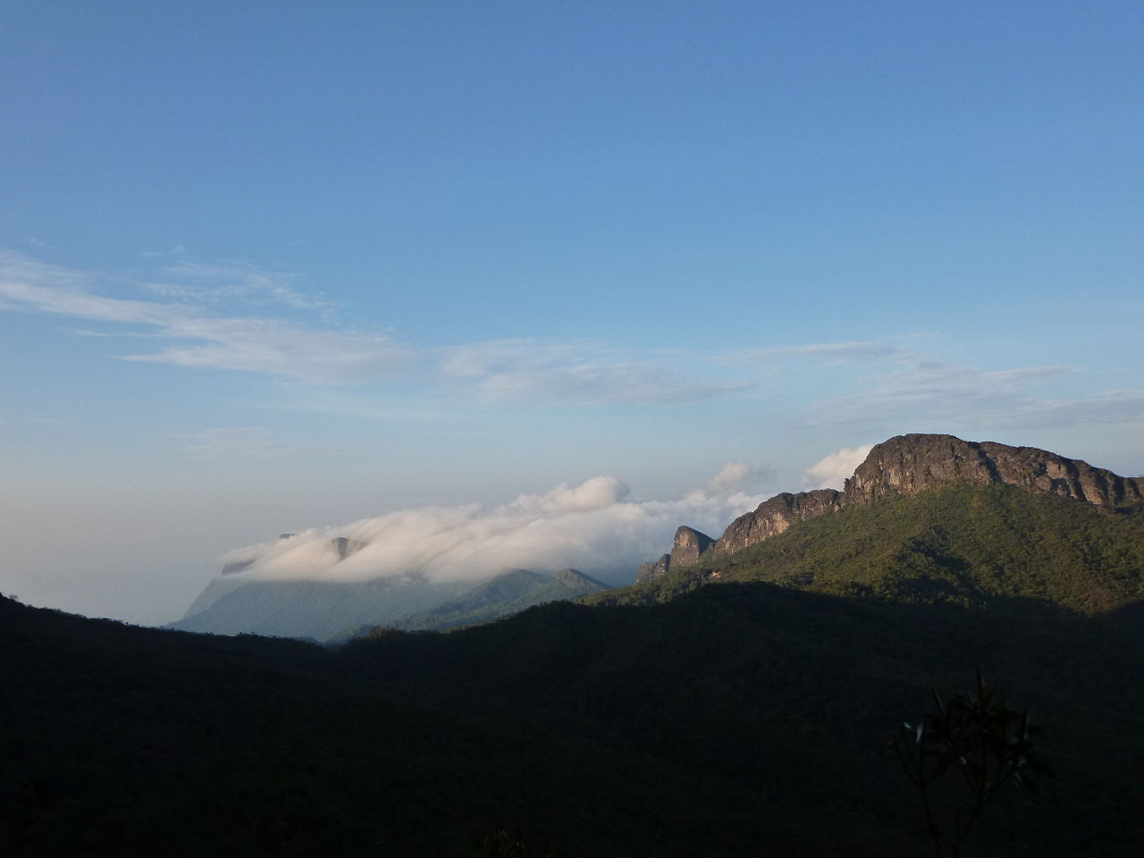
Further east the same highland belt continues through the Pacaraima and Tumucumaque ranges along the borders with Venezuela, Guyana, Suriname and French Guiana. At its eastern end rises Monte Roraima, a tepui walled by cliffs 400 to 1,000 m high; Brazil owns only about 5% of its summit plateau, and the 2,810 m top is in Venezuela.
Pico da Bandeira, the Mantiqueira and the Serra do Mar Escarpment
Descending the list of Brazil’s highest peaks means jumping more than 2,000 km south-east to the Atlantic highlands. Pico da Bandeira, 2,892 m, is the third-highest summit and the highest outside the Amazon. It sits on the border of Espírito Santo and Minas Gerais inside Caparaó National Park, created in 1961, and takes its name from the flag Emperor Pedro II is said to have ordered raised on top. Its summit rock is migmatite, and it is one of the most topographically isolated mountains on Earth: there is no higher ground within 2,344 km.
The fourth and fifth peaks belong to the Serra da Mantiqueira, which runs through São Paulo, Minas Gerais and Rio de Janeiro states. Pedra da Mina, 2,798 m, is the highest point of São Paulo state, yet its true height was barely recognised until the turn of the 21st century, and schoolbooks had to be corrected. It is made of nepheline syenite, a rock that normally erodes too quickly to form high ground. Close by, in the neighbouring Itatiaia massif, Pico das Agulhas Negras, 2,791 m, is the high point of Rio de Janeiro state and the centrepiece of Itatiaia National Park. The Mantiqueira is a water tower: its streams feed the Paraíba do Sul and the Grande River, one of the headwaters of the Paraná.
Between these mountains and the ocean lies the Serra do Mar, a 1,500 km chain of ranges and escarpments running from Espírito Santo to southern Santa Catarina. Its main scarp is part of the Great Escarpment that separates the sea-level coast from an inland plateau averaging 500 to 1,300 m, and most of its relief dates from about 60 million years ago. At the foot of the system, Rio de Janeiro’s granite domes, such as Sugarloaf Mountain at 396 m, show what tens of millions of years of erosion do to the crystalline basement.
The Planalto Central at 1,000 Metres: Brasília and the Cerrado
Behind the coastal ranges the land flattens into the Brazilian Highlands, a plateau of about 4.5 million km², roughly half the country. Precambrian crystalline shields cover 36% of Brazilian territory, and there is no volcanic or significant seismic activity; the plateau has simply been worn down. Its heart is the Planalto Central, an uneven tableland averaging about 1,000 m, where the capital Brasília was built at around that height.
Altitude tempers the tropical climate here. Brasília averages 21.4 °C, with a sharp rainy season from October to April and a dry season from May to September: November brings about 253 mm of rain, July just 1.5 mm. That rhythm suits the Cerrado, the savanna that covers the plateau and is the second-largest of Brazil’s major habitats. North of the capital, Chapada dos Veadeiros National Park, established on 11 January 1961 and a World Heritage Site since 2001, protects 2,405 km² of a plateau estimated at 1.8 billion years old. Further east, the Serra do Espinhaço runs about 1,100 km north into Bahia, where its northern section forms the Chapada Diamantina, a 38,000 km² upland of mesas and canyons mostly above 500 m.
Iguaçu Falls, Paulo Afonso and the Rivers Leaving the Plateau
Brazil’s rivers all drain to the Atlantic, but many must first fall off the plateau. The São Francisco rises in the Serra da Canastra of Minas Gerais and flows north for most of its 2,914 km, behind the coastal ranges, through Minas Gerais and Bahia, draining more than 630,000 km². It then turns east, forms the boundary between Bahia and the states of Pernambuco and Alagoas, and reaches the sea between Alagoas and Sergipe. On the way it drops over Paulo Afonso Falls, a series of cascades with a total height of 84 m whose flow, before dams tamed it, was estimated at 2,832 m³/s.
In the south the plateau is built of basalt, and here the drop is sharper. The Iguaçu River rises near Curitiba and crosses Paraná state before tumbling over the Serra Geral basalts, a sequence about 1,000 m thick, on the border with Argentina. The falls stretch along a 2.7 km edge in two steps of 35 and 40 m, splitting into 150 to 300 separate cascades between 60 and 82 m high depending on the water level. About half the flow pours into the Devil’s Throat, a chasm 70 to 80 m deep. Brazil’s Iguaçu National Park joined the World Heritage List in 1986, two years after Argentina’s. Below the falls, the Iguaçu meets the Paraná a short distance downstream of the Itaipu Dam, at the point where Brazil, Argentina and Paraguay meet.
Although the Iguaçu flows through Brazil for most of its course, most of the falls themselves lie on the Argentine side, so the Brazilian bank is where visitors see the whole curved front at once. The geology and the two national parks are covered in our guide to Iguazu Falls.
The Pantanal Floodplain at 80 to 150 Metres
West of the plateau, against the Bolivian and Paraguayan borders, the ground sinks into the Pantanal, the world’s largest tropical wetland and largest flooded grassland. Estimates of its size range from 140,000 to 195,000 km², most of it in Mato Grosso do Sul, with the rest in Mato Grosso, Bolivia and Paraguay. The whole basin lies between only 80 and 150 m above sea level. It formed as a depression in the crust linked to the rise of the Andes, and today it catches runoff from the surrounding highlands and releases it slowly through the Paraguay River, which flows about 2,621 km to join the Paraná.
The gradient is so slight that water spreads rather than flows. Rainfall of 1,000 to 1,250 mm a year, concentrated in the wet season, leaves roughly 80% of the floodplain submerged at its peak. For a closer look at the seasonal cycle and the wildlife it supports, see our article on the Pantanal wetlands.
The Amazon Lowland: 3,615 km of River Falling About 100 Metres
After rising in the Andes, the Amazon enters Brazil beside Tabatinga, where Brazil, Colombia and Peru meet, and it runs 3,615 km through Brazilian territory. Over that entire distance it descends only about 100 m, a gradient so gentle that the river is navigable by oceangoing vessels all the way to Iquitos in Peru, 3,885 km upstream. Upstream of Manaus the Brazilians call it the Solimões. Its southern tributaries, from west to east, are the Javari, Juruá, Purus, Madeira, Tapajós and Xingu; from the north come the Japurá, Branco, Negro and Jari. Geologists think the river once flowed west, and that the rise of the Andes reversed it towards the Atlantic.

At Manaus the Solimões meets the Rio Negro, and for about 6 km the two refuse to mix. The Negro is warm, around 28 °C, slow at about 2 km/h and stained dark by decayed plant matter; the Solimões is cooler at about 22 °C, runs at 4 to 6 km/h and is loaded with Andean sediment. By the time the combined stream reaches the ocean it discharges roughly 215,000 to 230,000 m³ per second, about a fifth of all the river water entering the world’s oceans.
Sea Level: Marajó, the Lençóis Dunes and 7,367 km of Coast
The Amazon ends in a maze of channels around Marajó, the second-largest island in South America. Between about 400 BC and AD 1600 it supported the Marajoara culture, which may have numbered more than 100,000 people, and today its rivers are known for the pororoca, a tidal bore that surges upstream at high tide.
East along the coast, in Maranhão, Lençóis Maranhenses National Park covers 155,000 ha of white dunes behind 70 km of beach. The area receives about 1,200 mm of rain a year, far too much for a desert, and because impermeable rock lies beneath the sand, the rain collects in clear lagoons between the dunes. The park was protected on 2 June 1981 and became a World Heritage Site in July 2024. Offshore, the Parcel de Manuel Luís protects the largest coral reef in South America, and further east, 354 km off the coast of Pernambuco, lies the volcanic archipelago of Fernando de Noronha.
From 2,995 m on the Venezuelan border to the lagoons of Maranhão, the descent crosses one plateau, one wetland and one enormous river plain. That river plain, with the tributaries and floodplain towns along it, is explored in our complete guide to the Amazon River.