
Panama is the larger of the two (about 75,417 km² against Costa Rica's 51,100 km²), but Costa Rica has more people: roughly 5.0 million at its 2022 census, against 4.06 million in Panama's 2023 census. Panama is built around its interoceanic canal and has used the US dollar since 1904. Costa Rica abolished its army in 1948, pays in colones, protects about a quarter of its land, and earns its fame from volcanoes and cloud forest.
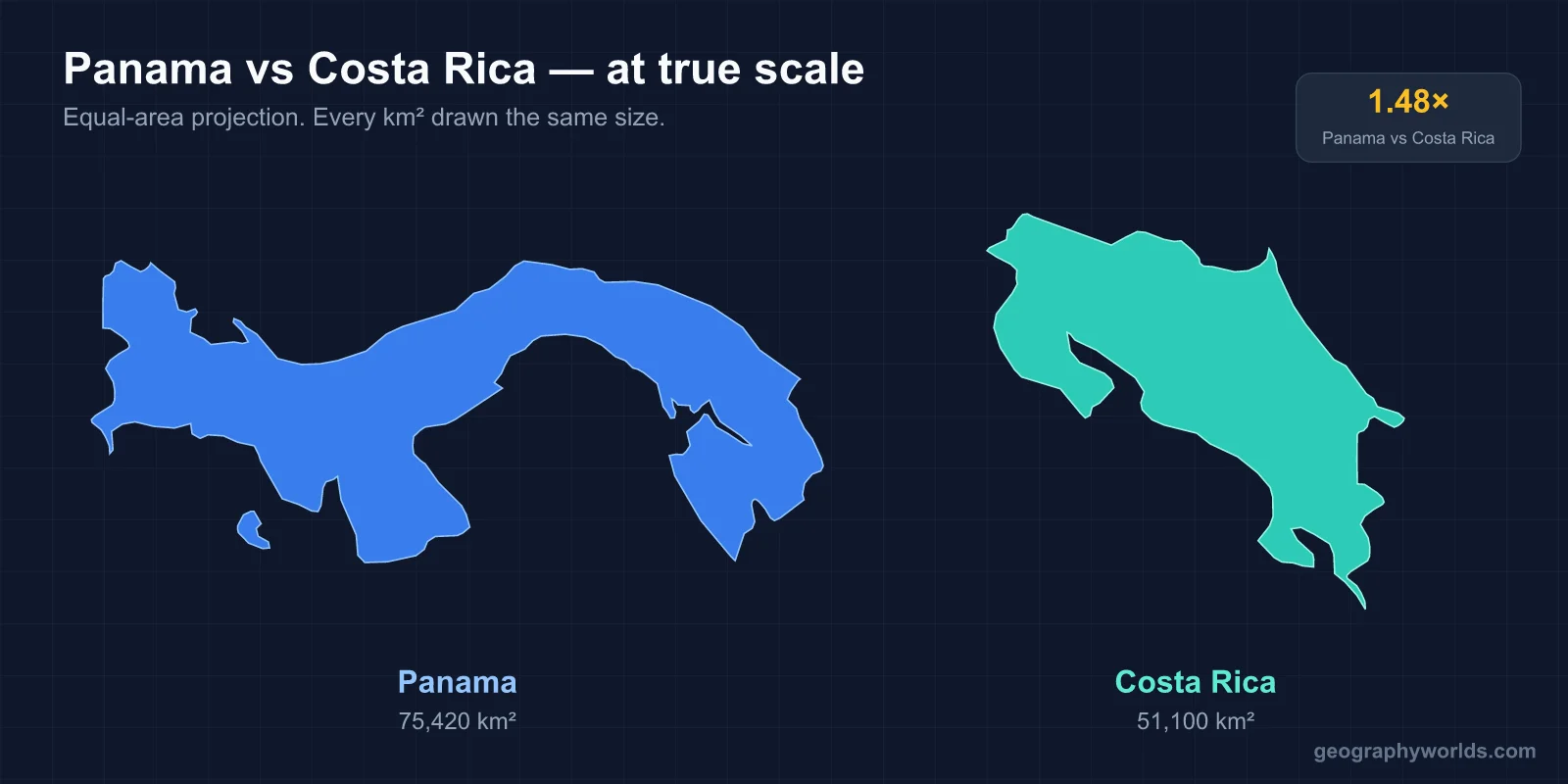
Both are narrow, mountainous, two-ocean countries at the southern end of Central America, and both speak Spanish. They took very different routes to prosperity, and those routes start at the line where they meet.
The 348-Kilometre Border from the Sixaola to Punta Burica
The Costa Rica–Panama border runs for about 348 km across the isthmus. On the Caribbean side it begins at the mouth of the Sixaola River and follows the river inland through banana country to its junction with the Yorkín. From there it climbs to the crest of the Cordillera de Talamanca and follows the watershed between Caribbean and Pacific drainage. It comes down to the Pacific at Punta Burica, the tip of a peninsula split between the two countries.

Drawing that line took four decades. Costa Rica and Colombia, which then included Panama, asked French President Émile Loubet to arbitrate, and his 1900 award was disputed on the Caribbean side. A second ruling in 1914, by US Chief Justice Edward Douglass White, favoured Costa Rica. Panama rejected it. In 1921 the two countries fought the brief Coto War over the Pacific-side Coto region, and the United States pressed Panama to withdraw. The Echandi Montero–Fernández Jaén Treaty of 1941 finally fixed the border as it stands today.
Today most travellers cross at Paso Canoas on the Pan-American Highway, or at Sixaola–Guabito on the Caribbean. The high middle of the border is wilderness. La Amistad International Park, the Costa Rican half declared in 1982 and the Panamanian half in 1988, covers about 400,000 hectares of Talamanca cloud forest and páramo. UNESCO listed the Costa Rican reserves in 1983 and extended the World Heritage site across the border in 1990. Bribri and Cabécar communities live on the Costa Rican side and Naso and Ngäbe on the Panamanian side. Each year thousands of Ngäbe-Buglé workers cross north for the Costa Rican coffee harvest.
The Caribbean ends of both countries share another history that the capitals sometimes forget. Jamaican and other West Indian labourers came to build Costa Rica's railway to Limón from the 1870s and Panama's canal from the 1880s. Their descendants still speak English-based Creoles in Limón, Puerto Viejo, Bocas del Toro and the city of Colón. Further east, the Guna people govern the autonomous comarca of Guna Yala, which includes the San Blas archipelago of more than 300 islands. Costa Rica has no self-governing indigenous region on that scale.
1914 and 1948: A Canal and an Army That Was Abolished
Panama's story starts with the canal. With US backing it broke away from Colombia on 3 November 1903. Within weeks it had signed the Hay–Bunau-Varilla Treaty, which gave Washington a strip of land across the isthmus. The canal opened on 15 August 1914: about 82 km of locks and channels lifting ships 26 m to the man-made Gatún Lake and down again. The Torrijos–Carter Treaties of 1977 set the handover, and Panama took full control on 31 December 1999. Larger Neopanamax locks opened in 2016. The canal now handles very roughly 5% of world seaborne trade. A drought in 2023 lowered Gatún Lake and forced the authority to cut daily transits for months. The lock system is explained in our guide to how the Panama Canal locks work.

Costa Rica's defining date is 1 December 1948. José Figueres had won a short civil war that spring, and that day his junta abolished the army. Article 12 of the 1949 constitution made the ban permanent, and the money went into schools, a social security system and, later, national parks. Panama reached the same place by a harder road. After the US invasion of December 1989 removed Manuel Noriega, a 1994 constitutional amendment abolished its armed forces. Today both countries rely on police forces, and Panama also has border and coastguard services.
Colón vs Balboa: Why Panama Has Used the Dollar Since 1904
Panama's official currency is the balboa. A 1904 monetary agreement with the United States pegged it one-to-one to the dollar and made the dollar legal tender. Panama mints its own balboa coins but issues almost no paper money (a brief note issue in 1941 was withdrawn within days), so the notes in every wallet are American. The dollar, a territorial tax system and the canal's shipping traffic helped make Panama City a regional banking centre. That also brought scrutiny, most famously the Panama Papers leak in 2016.
Costa Rica has had its own currency, the colón, since 1896. It is named after Columbus (Colón in Spanish), which leads to some confusion, because Colón is also the name of Panama's Caribbean port city. The colón floats, and prices in tourist areas are often quoted in dollars. In practice, a visitor to Costa Rica watches an exchange rate, and a visitor to Panama never does.
Volcanoes, Cloud Forest and More Than a Quarter Protected
Costa Rica occupies just 0.03% of the world's land surface but holds an estimated 5% of its species. The Central Volcanic Range runs from Arenal past Poás and Irazú to Turrialba, and Cerro Chirripó in the Talamanca reaches 3,819 m. After heavy clearing for cattle pasture up to the 1980s, the country began paying landowners to keep forest under its 1996 Forestry Law. More than half the country is now forested again. National parks and reserves cover about a quarter of its land, and Monteverde, Tortuguero, Corcovado and Manuel Antonio anchor an ecotourism industry. Electricity is also clean: hydro, geothermal and wind supplied about 95% of it in 2023.

Panama is no poorer in wildlife. It just gets less publicity for it. As the land bridge where North and South American species meet, it has close to 1,000 bird species, more than the United States and Canada combined. The Darién on the Colombian border is a vast roadless forest where the Pan-American Highway stops. Volcán Barú (3,474 m), near Boquerón in the west, is one of the few summits on the isthmus from which both oceans can be seen on a clear morning. The canal itself depends on forest: the watershed around Gatún Lake has to stay wooded to keep the water flowing.
Retiring in San José or Panama City
For many readers the comparison is personal: where to live. The two capitals are very different places. San José sits in the Central Valley at about 1,170 m, with spring-like temperatures all year, and the valley holds most of the country's population. Panama City is a hot, humid skyline on the Pacific at the canal's southern entrance, and its metropolitan area is home to roughly half of all Panamanians.
Both run a retiree residency, the pensionado, that asks for a lifetime pension of about US$1,000 a month. Panama's version is famous for its legally mandated discounts on flights, hotels, restaurants, utilities and medical bills. It also allows a lower threshold for buyers of property worth $100,000 or more. Costa Rica's appeal is its public health system (the Caja), its safety record and its climate, though prices there have risen steeply and many expatriates now find it the dearer of the two. Rules change often, so check the immigration authorities of each country before planning a move.
Nicaragua, the Third Corner of the Comparison
Costa Rica's other neighbour, Nicaragua, makes a useful third point. It is the largest country in Central America, at about 130,373 km², with roughly 6.8 million people. That gives it the most land of the three by far and a density between Costa Rica's (about 99 people per km²) and Panama's (about 54). Nicaragua also has a natural canal route: the San Juan River and Lake Nicaragua were surveyed for a waterway long before the United States chose Panama. In 2013 Nicaragua granted a Chinese-led company a concession for an interoceanic canal. No construction began and the concession was later revoked, so Panama's monopoly stands.
The San Juan also defines Costa Rica's northern border, and the two countries have taken their disputes there to the International Court of Justice several times. The 2009 ruling confirmed Costa Rica's navigation rights on the river, and the 2015 judgments dealt with Isla Portillos. Nicaragua kept its army and has none of Costa Rica's park-and-tourism model. Its average income is a fraction of either southern neighbour's. Seen from Managua, the Costa Rica vs Panama contrast is really between two successes of different kinds: one built on conservation and stability, the other on a piece of global infrastructure. Our geography of Nicaragua shows how the lakes and volcanoes fit together, and the guide to all seven Central American countries places each of the three on the isthmus.