

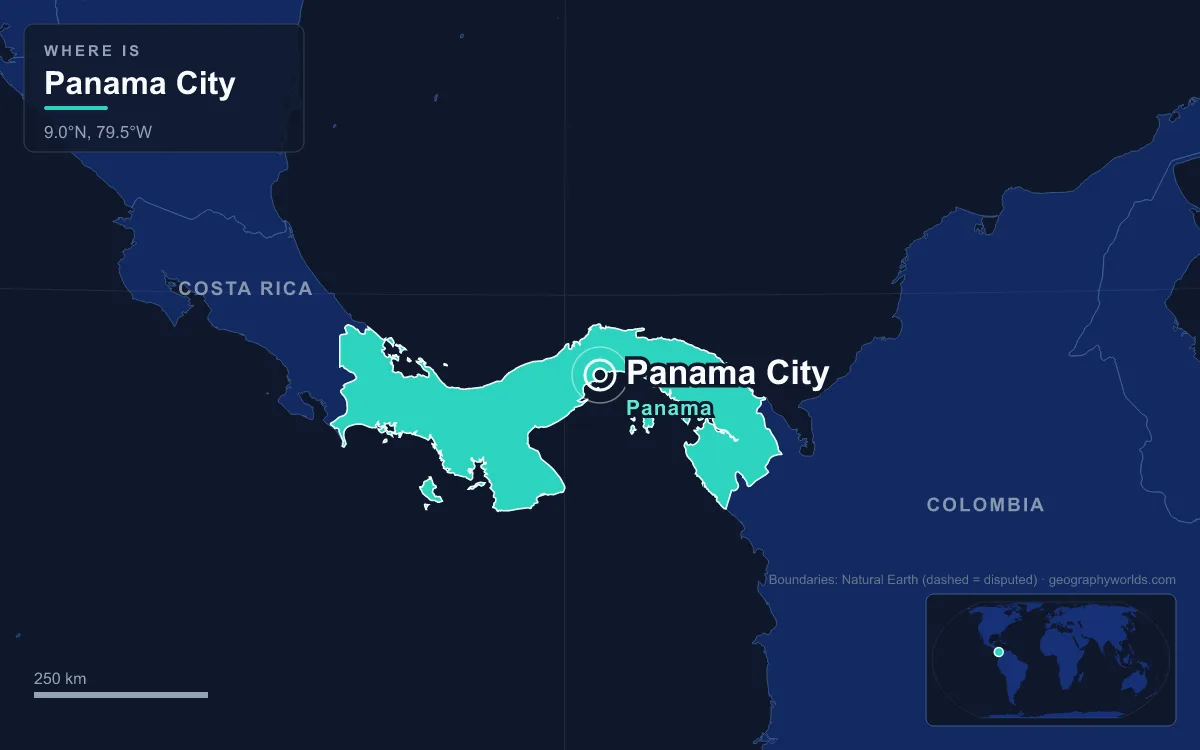
The capital of Panama is Panama City (Ciudad de Panamá), which stands on the Pacific coast at the southern entrance of the Panama Canal. The Panamá District around it counted 1,086,990 people in the 2023 census, and the wider metropolitan area holds about 2.1 million, nearly half the country. It is Panama’s seat of government and its banking and shipping centre, producing an estimated 55% of national GDP, and it is really three cities laid along one bay: the ruins of the original 1519 settlement in the east, the walled peninsula rebuilt in 1673 in the west, and a skyline of more than 120 towers in between. The easiest way to understand it is to walk that shoreline from one end to the other.
Panamá Viejo: The 1519 City Henry Morgan Left in Ruins
Start at the eastern edge of the modern city, among the stone walls of Panamá Viejo. Pedro Arias Dávila, known as Pedrarias, founded a settlement here on 15 August 1519 with about 100 inhabitants. It was the first permanent European settlement on the Pacific Ocean, and in 1521 a royal decree raised it to a city. Within a few years it was the base for the expeditions that conquered the Inca Empire, and for a century and a half the gold and silver of Peru passed through it on the way across the isthmus to the Caribbean fairs of Nombre de Dios and Portobelo, and on to Spain. For all that wealth it stayed small: a census around 1587 counted 548 inhabitants.
The end came in January 1671, when the Welsh privateer Henry Morgan attacked with a band of about 1,400 men. The city burned on 28 January; accounts differ over whether the fire was set by Morgan’s men or by the Spanish governor, Juan Pérez de Guzmán, before the attack. The stone tower of its cathedral still rises above the ruins, which are now part of a UNESCO World Heritage Site together with the later historic district.

Avenida Balboa and the Cinta Costera Waterfront
Heading west from the ruins, past the Paitilla headland, the walk follows the curve of the bay along the Cinta Costera, the “coastal belt”. This is new land: a 26-hectare reclamation completed in 2009 at a cost of $189 million, running from Paitilla to El Chorrillo with parks, cycle paths and a widened road. Behind it runs Avenida Balboa, about 3.5 km long, remodelled in 2009 and carrying about 75,000 vehicles a day. Its land is the most expensive in Panama, at around $2,000 per square metre.
The towers along it are the city’s newest layer. Panama City became an international banking centre from the late 1970s and today has around eighty banks, at least fifteen of them local, and its wealth shows in residential and office blocks that form a very dense skyline, with 127 high-rises built and more than 110 under construction by one count. The 52-storey F&F Tower of 2011, which twists through its height, earned the nickname “the Screw”. Tourism grew alongside it after the canal handover: hotel rooms in the city grew from about 1,400 in 1997 to more than 15,000 in 2013, and annual visitors rose from 457,000 in 1999 to 1.4 million in 2011.
The waterfront traffic has an underground partner now. Line 1 of the Panama Metro began service on 6 April 2014 with 15 stations over 18.1 km, and Line 2 followed in 2019, extending 24 km with a branch to Tocumen International Airport added in 2023.
Casco Viejo, the Walled Peninsula of 1673
At the western end of the bay the towers stop and the road swings out on a 2.5 km marine viaduct, opened with the third phase of the Cinta Costera in 2014, around a small peninsula. This is Casco Viejo (also Casco Antiguo or San Felipe), the city rebuilt after Morgan’s raid. Work began in 1672 under Antonio Fernández de Córdoba, and the new Panamá was formally founded on 21 January 1673, about 8 km southwest of the ruined one, on a site surrounded by the sea and a defensive wall.
Three large fires in the 18th century destroyed much of that first rebuilding, so what you see today mostly dates from the late 19th and early 20th centuries: Spanish colonial houses beside French-style and Afro-Antillean townhouses built during the canal era, a mix that sets it apart from almost purely colonial old towns such as Cartagena or Quito. Its streets hold the Palacio de las Garzas, the office and residence of Panama’s presidents, on a site first built on in 1673 and converted into a presidential palace in 1875. It is named for the herons that roam its courtyard, first brought there in 1922 by President Belisario Porras. Administratively the peninsula is the corregimiento of San Felipe, one of thirteen that make up the urban core alongside Santa Ana, El Chorrillo, Calidonia, Bella Vista and San Francisco.

It was here that the modern state began. The city’s fortunes had revived in the 19th century when the Panama Railroad, fully operational from 1855, carried the California Gold Rush across the isthmus; between 1848 and 1869 about 375,000 people crossed from the Atlantic to the Pacific and 225,000 went the other way. Panama declared independence from Colombia on 3 November 1903, and within weeks the Hay–Bunau-Varilla Treaty gave the United States a 10-mile-wide strip for a canal in return for $10 million and an annual payment of $250,000.
El Chorrillo and the 1989 Invasion
Just west of Casco Viejo, where the Cinta Costera ends, lies El Chorrillo, a poor, densely built neighbourhood made up largely of wood-framed buildings dating back to the early 1900s. It paid heavily for the city’s later history. In December 1989 the United States invaded Panama to depose General Manuel Noriega, the country’s de facto ruler, and fire destroyed a large part of El Chorrillo during the fighting. The operation ended in late January 1990 with Noriega’s surrender. Out on the Amador Causeway, a house Noriega had built for himself on one of the islands was destroyed and looted during his fall.
Ancón Hill and Balboa, the Old Canal Zone Capital
Beyond El Chorrillo the ground rises to Ancón Hill, at 199 m the highest point in Panama City. For most of the 20th century this was not Panama at all. The hill lay inside the Panama Canal Zone, the US-run strip created in 1903, and its slopes held Gorgas Hospital, the residence of the Canal Zone governor and Quarry Heights, headquarters of the US Southern Command. William Gorgas, the canal’s chief sanitary officer, had fumigated houses and cleaned the water supply until yellow fever was eradicated by November 1905, which made the canal’s completion in 1914 possible. The Zone had its own police, courts, schools and post offices, and during the Second World War Panamanians had limited or no access to large parts of it, including military bases that pressed right up against the city.
The boundary at the foot of the hill became the fault line of Panamanian politics. On 9 January 1964, a protest over flying the Panamanian flag in the Zone ended in three days of fighting in which about 22 Panamanians and four US soldiers died, remembered each year as Martyrs’ Day. The Torrijos–Carter Treaties signed on 7 September 1977 set the handover, Ancón Hill itself returned to Panama in 1977, and at noon on 31 December 1999 Panama took full control of the canal. The hill is now a nature reserve where sloths, coatis and Geoffroy’s tamarins live within sight of the towers. On its far side sits Balboa, the former Zone capital named after Vasco Núñez de Balboa, where the Panama Canal Authority keeps its headquarters on Balboa Heights. Our guide to the American role in the Panama Canal covers the Zone years in depth.
Miraflores Locks and the Amador Causeway at the Pacific Entrance
The last stretch of the walk leads to the water the city exists to serve. Up the canal from Balboa, the Miraflores Locks raise and lower ships 16.5 m in two stages between the Pacific and Miraflores Lake, and the visitor centre there lets you watch container ships being towed through the chambers; our explainer on how the Panama Canal locks work covers the engineering behind them. Downstream, the Bridge of the Americas, completed in 1962 at a cost of $20 million, spans the canal entrance on a 1,654 m structure; from 1962 until the parallel Centennial Bridge opened in 2004 it carried the Pan-American Highway.
South of the bridge, the Amador Causeway runs out to four small islands, Naos, Culebra, Perico and Flamenco, on rock dug from the canal cut. On the causeway stands the Biomuseo, designed by Frank Gehry, his first building in Latin America, which opened on 2 October 2014 to tell how the rise of the isthmus joined two continents. From the causeway the whole route is visible at once: ships queuing for the canal, the skyline of Avenida Balboa, and the old peninsula between them. The climate is tropical savanna, around 27 °C all year with about 1,900 mm of rain, most of it between May and November. Panama City’s position on the isthmus also shapes the country’s frontiers, set out in our guide to the countries that border Panama.
Quick Facts About Panama City
- Country: Panama
- Continent: North America (Central America)
- Country population: approximately 4.6 million
- Capital city status: Panama City is the capital of Panama, the seat of national government, and the location of foreign embassies, parliament, and the head of state's official residence.
Frequently Asked Questions
What is the capital of Panama?
The capital of Panama is Panama City. Panama City is the seat of national government, hosts most foreign embassies and consulates, and is typically where the head of state and parliament are located.
What continent is Panama City in?
Panama City, the capital of Panama, is located in North America, in the Central America region. As Panama's capital, Panama City serves as the country's primary connection to the broader North American political, economic, and cultural sphere.
Why is Panama City the capital of Panama?
Panama City was chosen as the capital of Panama for reasons that typically combine geography, history, and politics. Capital city selections often reflect a desire for centrality (being accessible from across the country), historical importance (being a longstanding seat of government or culture), or neutrality (being acceptable to multiple regions or ethnic groups within the country). The specific reasons for Panama City's designation are detailed in the city's history above.
What is Panama City known for?
As the capital of Panama, Panama City is best known for housing the country's central government institutions — parliament, presidential or royal residences, supreme court, and key ministries. It is also typically a major cultural and economic center within Panama, hosting national museums, embassies, and signature monuments. The introduction and history sections above provide detailed coverage of the city's specific notable institutions and landmarks.
Related Pages
- Panama Country Guide — full geography, climate, economy, and culture overview
- Flag of Panama — meaning, history, and design of Panama's national flag