
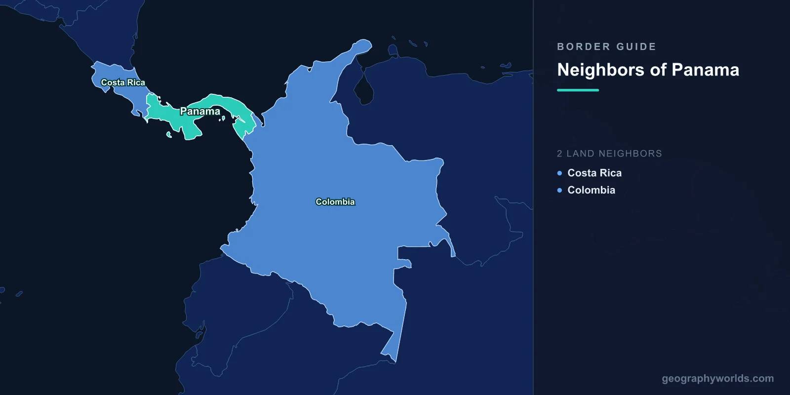
Panama borders two countries. Costa Rica lies to the west along 348 km of boundary, and Colombia lies to the east along 339 km, for a total land border of 687 km. Those two figures are almost identical, and they are the last thing the two frontiers have in common.
Cross into Costa Rica and you queue at a booth on a paved highway beside a duty-free strip. Cross into Colombia and you cannot, at least not by road, because no road exists. The 339 km facing Colombia contain the only interruption in a highway system that otherwise runs unbroken from northern Alaska to the bottom of Argentina.
Where the Longest Road in the World Simply Stops
The Pan-American Highway covers something on the order of 30,000 km. Its Panamanian section runs east out of Panama City, through the province of Darien, and ends at a small river town called Yaviza. There is no gate and no ceremony. The tarmac finishes, and ahead lies roughly 100 km of mountain rainforest and river swamp before the road network picks up again near Turbo in Colombia.
This is the Darien Gap. On the Panamanian side it is steep, drained by the Chucunaque and Tuira rivers and dominated by the Serrania del Darien, whose highest point, Cerro Tacarcuna, rises to about 1,875 m. On the Colombian side it flattens into the delta of the Atrato, a swamp so waterlogged that engineers studying road routes concluded any embankment would need continuous causeway construction through peat.
Both halves are protected. Darien National Park on the Panamanian side covers roughly 5,790 sq km and was inscribed as a UNESCO World Heritage site in 1981; Los Katios, its Colombian counterpart, was added in 1994. Much of the land is also indigenous territory, held by Embera-Wounaan communities in the interior and by the Guna along the Caribbean coast.
Why Nobody Ever Filled the Gap
It is not for want of trying. Surveys for a Darien road go back to the 1920s, and by the early 1970s the United States was funding design work with the intention of completing the highway. Four separate obstacles stopped it, and each one was enough on its own.
- Cost and terrain. Building through saturated peat and steep rainforest was expensive when it was first costed and has only become more so.
- Litigation. In 1975 a United States court halted federal funding pending a proper environmental impact statement, following a challenge brought by conservation groups. The delay killed the momentum.
- Animal disease. Colombia had foot-and-mouth disease; Panama and everything north of it did not. The gap functions as a quarantine barrier. It still does: a joint Panamanian and United States programme rears and releases sterile screwworm flies over eastern Panama specifically to keep that parasite from walking north into Central American cattle herds.
- Security. From the 1990s the Colombian side was controlled by guerrilla and paramilitary groups, and Panama, which abolished its army in 1990, had no appetite for a paved corridor into it.
The result is a genuine curiosity of world geography: two countries that share a land border and have never had a legal road, rail or bridge link between them. Travel between Panama and Colombia is by air, or by boat along either coast. The most-used pedestrian route is a concrete staircase over a ridge between the Panamanian hamlet of La Miel and the Colombian village of Sapzurro, which is, in practical terms, the border crossing.
The Year Half a Million People Walked Through It
For most of its history the Gap was crossed by a handful of adventurers, smugglers and local traders. That changed abruptly in the 2020s. Panamanian migration authorities recorded around 133,000 irregular crossings in 2021 and roughly 248,000 in 2022. In 2023 the figure reached 520,085, a record by a wide margin, with Venezuelans the largest single nationality and sizeable numbers of Ecuadorians, Haitians and Chinese nationals among them.
The route settled into a fixed shape. Travellers gathered at Necocli on the Colombian coast, took a boat to Acandi or Capurgana, walked several days over the ridge with local guides, and emerged at the Embera village of Bajo Chiquito, from where dugout canoes carried them down the Turquesa river to a reception camp at Lajas Blancas. Medical organisations working at the exit points documented severe rates of injury, robbery and sexual violence along the trail, and the death toll is certainly undercounted, because the jungle does not return most of the people it takes.
Numbers fell sharply through 2024 as Panama tightened controls, closed side trails and began deportation flights, and they collapsed further in 2025 after changes in United States policy removed the incentive to travel north, briefly reversing the flow southbound. The Gap is quieter now. What it demonstrated is that a barrier which stopped a highway for fifty years did not stop half a million people in a single year.
A Line Colombia Drew Before Panama Existed
The eastern border is old, even though the country is not. Panama was a department of Colombia until 3 November 1903, when it declared independence with the decisive assistance of United States naval power, an arrangement completed a fortnight later by the canal treaty that gave Washington its Canal Zone.
The new republic did not negotiate a border; it inherited one. The line was the internal administrative limit of the Colombian department, itself descended from mid-nineteenth-century Colombian legislation that had created a sovereign state of Panama within the union. Colombia refused to accept the separation for two decades. It finally recognised Panama and confirmed the boundary in the Victoria-Velez Treaty, signed at Bogota on 20 August 1924. The maritime limits followed in a further treaty in 1976.
As drawn, the border runs from Cabo Tiburon on the Caribbean to Punta Cocalito on the Gulf of San Miguel, on the Pacific. That is a useful reminder of how Panama sits: the isthmus bends so sharply that its eastern neighbour lies almost due south of the canal. Colombia's own frontier arrangements are far more complicated, and the full set of countries that border Colombia shows just how much of that country's perimeter is river and rainforest. It is also, at roughly fifteen times Panama's area, a neighbour of a completely different order.
The Other Border, Where Everything Works Normally
The Costa Rican line is the one Panamanians actually use, and it had a rougher legal birth than its calm present suggests. A boundary arbitration by the French president in 1900 was accepted only in part. A second award by the Chief Justice of the United States in 1914 was accepted by Costa Rica and rejected by Panama. In February 1921 the disagreement over the Coto district on the Pacific side produced a short war, ended by United States pressure rather than by either army. The matter was finally closed by the Echandi Montero-Fernandez Jaen Treaty, signed on 1 May 1941, which set the boundary that stands today.
It runs from Punta Burica on the Pacific, up over the Talamanca cordillera, and down to the mouth of the Sixaola river on the Caribbean. The mountain section is almost entirely wild, and here the two countries did the opposite of what Panama and Colombia did with the Darien: they turned it into a shared asset. La Amistad International Park straddles the border as a single UNESCO-listed protected area jointly managed by both states.
Three road crossings serve the whole border. Paso Canoas on the Inter-American Highway carries the great majority of traffic and is another of those Latin American frontier towns where the line runs through the built-up area and locals move back and forth all day without formalities. Sixaola and Guabito connect the Caribbean banana lowlands; for decades pedestrians crossed there on the sleepers of a disused banana railway bridge, until a proper road bridge finally replaced it in the early 2020s. Rio Sereno, high in the coffee country of Coto Brus, is the quiet third option.
The busiest movement across this border is seasonal and largely invisible in trade statistics. Every year several thousand Ngabe-Bugle people travel from their comarca in western Panama to pick the coffee harvest on the Costa Rican side of the Talamanca highlands, moving in extended family groups and returning when the crop is in. It is one of the oldest labour migrations in Central America, older than either country's independence, and it follows a route that predates the boundary entirely.
| Neighbour | Border length | Road link | Fixed by | Defining feature |
|---|---|---|---|---|
| Costa Rica | 348 km | Three crossings: Paso Canoas, Rio Sereno, Sixaola-Guabito | Echandi Montero-Fernandez Jaen Treaty, 1 May 1941 | La Amistad International Park on the Talamanca range |
| Colombia | 339 km | None at all | Victoria-Velez Treaty, 20 August 1924 | The Darien Gap, the only break in the Pan-American Highway |
Panama is usually described as a bridge between two continents, which is true for shipping and false for driving. Everything the world moves through Panama goes by sea through the canal or by air through Tocumen. On the ground, the country connects perfectly well to the north and not at all to the south, and the eighty-odd years of failed road schemes suggest that is unlikely to change soon.
Panama also has one of the most recognisable outlines on any map, an S-curve lying on its side with the canal cutting across the narrow part; if you think you would know it without the label, identifying countries from their silhouettes is a harder test than it looks.