
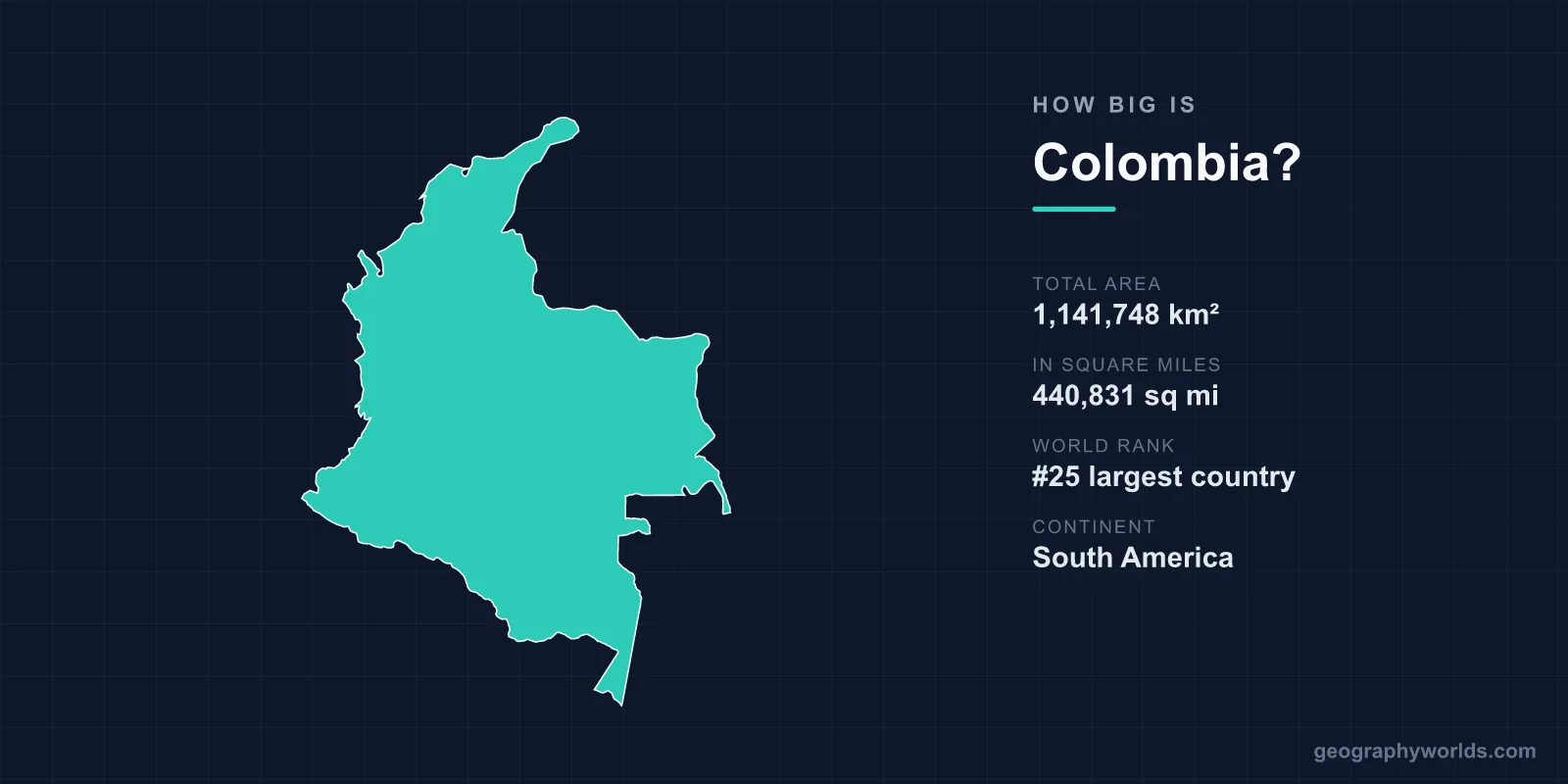
At 1,141,748 km² (440,831 sq mi), Colombia is the 25th-largest country in the world and the fourth-largest in South America, after Brazil, Argentina and Peru. It is slightly bigger than Texas and California combined, more than twice the size of Spain, and its mainland runs about 1,850 km from Punta Gallinas on the Caribbean to Leticia on the Amazon. Colombia also governs about 808,158 km² of sea in its exclusive economic zone, and is one of only two South American countries, with Chile, to have coastline on both the Atlantic, through the Caribbean, and the Pacific.
1,141,748 or 1,138,910 km²? Colombia’s Area by Source
Colombia’s size comes in two common versions. The figure of 1,141,748 km² is the one used in Wikipedia’s geography of Colombia and by Colombian sources. The CIA World Factbook, which feeds Wikipedia’s list of countries by area, gives 1,138,910 km², split into 1,038,700 km² of land and 100,210 km² of water. The difference of about 2,800 km² is smaller than the Bogotá Capital District twice over, and it does not change the rank: in both versions Colombia is 25th, just behind South Africa (1,219,090 km²) and just ahead of Ethiopia (1,104,300 km²).
- Total area: 1,141,748 km² (440,831 sq mi); CIA figure 1,138,910 km²
- World rank: 25th; 4th in South America
- Water area (CIA): 100,210 km², about 8.8% of the total
- Exclusive economic zone: 808,158 km², 35th in the world
- Highest point: Pico Cristóbal Colón, reported at 5,775 m (18,947 ft), in the Sierra Nevada de Santa Marta
- Population: 48,258,494 at the 2018 census
The water share stands out. At 8.8%, it is more than four times Italy’s 2.1% and over five times Iran’s 1.6% in the same list. Colombia’s rivers, lagoons and the reed-filled marshes of the Caribbean lowlands, known locally as ciénagas, account for a large slice of the map.
The national total also includes a distant island department. The archipelago of San Andrés, Providencia and Santa Catalina lies about 750 km north-west of the mainland, off the coast of Nicaragua. Its islands cover only about 44 to 45 km² of land, but the Seaflower Biosphere Reserve that UNESCO declared around them in 2000 takes in some 300,000 km² of the Caribbean, about 10% of that sea. Those islands give Colombia its extreme points: the Bajo Nuevo keys, at 15°53′N, are its northernmost territory, and San Andrés island, at 81°44′W, its westernmost.
Colombia was once larger. Until 3 November 1903, the isthmus of Panama was part of the country; its secession created the Republic of Panama and abolished what had been Colombia’s border with Costa Rica. Today the boundary with Panama is the only land frontier Colombia has in Central America.
Punta Gallinas to Leticia: Colombia’s Length and Breadth
On the mainland, Colombia’s northernmost point is Punta Gallinas, on the Guajira Peninsula in La Guajira department, at 12°27′N. It is also the northernmost point of mainland South America, marked since 1989 by an 18 m lighthouse. The southernmost point is on the Amazon River at Leticia, the capital of Amazonas department, at 4°13′S. Between them lie almost 17 degrees of latitude, or roughly 1,850 km, which puts Colombia on both sides of the equator.

From west to east, the mainland runs from Cabo Manglares in Nariño department, on the Pacific near the border with Ecuador at 79°00′W, to San José Island in the Río Negro, opposite the Cocuy monolith in Guainía department, at 66°51′W. That is just over 12 degrees of longitude, roughly 1,350 km close to the equator.
The two ends of that span could hardly be more different. The Guajira Peninsula in the north is semi-arid, with parts receiving less than 762 mm of rain a year. The rainy south-east of the country is often drenched by more than 5,080 mm. In between rise the Andes, which enter from Ecuador and split into three roughly parallel ranges. The Cordillera Central is the highest, a wall of crystalline rock and snow-capped volcanoes about 805 km long, topped by the Nevado del Huila at 5,365 m; its Nevado del Ruiz erupted violently on 13 November 1985. Between the ranges run the Cauca and the Magdalena, Colombia’s main river, which flows north for about 1,528 km to the Caribbean. Isolated from the Andes, the Sierra Nevada de Santa Marta rises to over 5,700 m above the Caribbean lowlands; its twin summits, Pico Cristóbal Colón and Pico Simón Bolívar, are almost equal in height, and the range is the highest coastal range in the tropics, climbing to about 5,700 m just 42 km from the sea.
The mountains stretch distances in practice as well as on the map. The Cordillera Occidental is the lowest of the three ranges, with few passes; one at about 1,519 m gives Cali its outlet to the Pacific. The Cordillera Oriental climbs to 5,493 m in the Sierra Nevada del Cocuy before turning north-west toward Venezuela, and the country around Cúcuta is so rugged that its residents historically found it easier to trade and communicate with Venezuela than with the rest of Colombia. A country 1,850 km long can feel far longer when three mountain ranges stand between its regions.
Colombia Beside Texas and California, Peru and Venezuela
For American readers the neatest comparison is a pair of states. Texas covers about 695,660 km² and California 423,970 km², a combined 1,119,630 km², so Colombia is slightly larger than both put together. It is about 1.6 times the size of Texas alone. In Europe, Colombia is more than twice the size of Spain (505,992 km²) and more than three times the size of Germany (357,022 km²).
Within South America, Colombia is mid-table among the big countries. Brazil, at 8,510,346 km², is about seven and a half times larger, and Argentina is about two and a half times larger. Peru, at 1,285,216 km², is about 13% bigger; our Colombia vs Peru comparison sets the two side by side. Bolivia is a close match, about 4% smaller at 1,098,581 km², and Venezuela, with 912,050 km², is about a fifth smaller than Colombia.
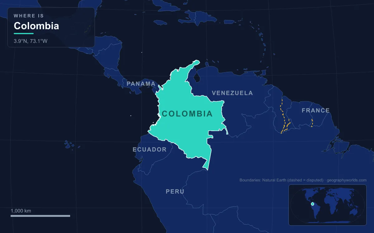
Colombia shares land borders with five of its neighbours: Panama to the north-west, Venezuela and Brazil to the east, and Peru and Ecuador to the south. At sea it also has boundaries with Costa Rica, Nicaragua, Honduras, Jamaica, the Dominican Republic and Haiti, a reminder of how far its Caribbean waters reach. The land frontiers are described one by one in our guide to the countries that border Colombia.
Amazonas, Meta and the Departments That Hold the Space
Colombia is divided into 32 departments and one Capital District, Bogotá, and their sizes follow the landscape rather than the population. Amazonas, in the far south, is the largest department at 109,665 km², most of it protected as forest reserve since 1959, yet it has the third-smallest population of any department. Meta, at the foot of the Andes on the eastern plains, covers 85,635 km². By contrast the Bogotá Capital District covers only 1,587 km², and the small Andean departments around it are a fraction of the size of those in the east. Our list of Colombia’s department capitals gives the seat of each one.
The eastern half of the country is made up of two great lowlands. The Llanos, a tropical grassland plain east of the Andes that Colombia shares with Venezuela, is cattle country with large estates and oil and gas fields. South of them lies the Amazon rainforest, shared with Brazil, Peru, Ecuador and Venezuela. About 10% of the whole Amazon forest is in Colombia, against 60% in Brazil and 13% in Peru. These eastern regions are where most of Colombia’s area lies, and where the fewest Colombians live.

Where 48 Million Colombians Live: Bogotá, the Andes and the Caribbean Coast
The 2018 census counted 48,258,494 people, which works out to about 42 per km² across the official area. That average is misleading, because Colombia’s population is very unevenly spread. Most people live in the mountainous west and along the northern coast, and the largest number in and around Bogotá, which sits on a high plateau in the Cordillera Oriental at an average of 2,640 m. In the late 1980s about 78% of Colombians lived in the Andean highlands, where the elevated basins have a mild climate and farmers can often harvest twice a year.
The Caribbean coast is the other populated strip. Its triangle of lowland carries most of the country’s commerce through the ports of Cartagena, Barranquilla and Santa Marta. Meanwhile the south and east, the Llanos and the Amazon, hold huge areas with scattered towns, small farming communities and the territories of indigenous peoples. With an estimated 50 million people in 2020, Colombia is the third-most populous country in Latin America after Brazil and Mexico, but its people are packed into well under half of its territory.
Altitude, more than area, sets how Colombians use their land. About 86% of the country lies in the hot zone, with temperatures between 24 and 38 °C, and temperatures fall by about 1.9 °C for every 305 m of climb. So a country of over a million square kilometres concentrates its people on the cooler slopes and plateaus of a much smaller Andean core. That is the clearest way to see Colombia’s size: a nation bigger than Texas and California combined, living mostly on the narrow highlands between the Caribbean and the Pacific.