
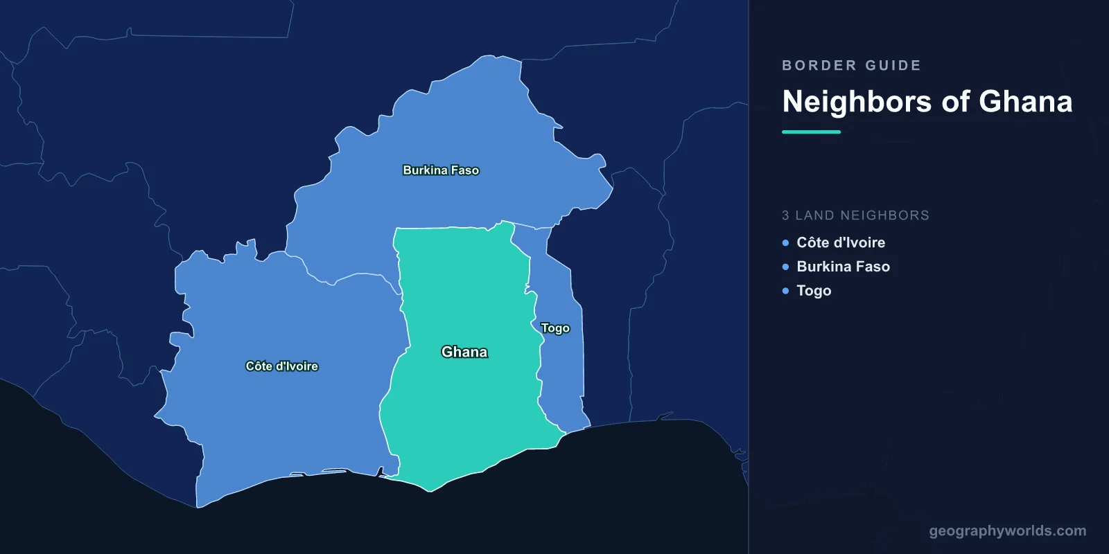
Three countries touch Ghana: Ivory Coast on the west, Burkina Faso across the north, and Togo down the east. The three lines run 2,420 km in total — 1,098 km with Togo, 720 km with Ivory Coast, 602 km with Burkina Faso — and the Gulf of Guinea supplies the fourth side, 539 km of it.
The plainest thing to say about all three is that they turn Ghana into an island. Cross any of them and the road signs switch to French, the money becomes the West African CFA franc, and the legal system changes from common law to civil code. Ghana is anglophone; every one of its neighbours is francophone. That is not an accident of geography. It is the residue of a scramble in which Britain, France and Germany each took a slice of the same coastline and pushed inland in parallel strips, indifferent to what those strips ran through.
What the Lines Cut Through
Look at where Ghana's boundaries sit relative to its peoples and the pattern is consistent. The Ewe, concentrated around the lower Volta and the coastal lagoons, are divided between Ghana's Volta Region, southern Togo and parts of Benin. The Kasena and the wider Gurunsi-speaking communities of the north straddle the Burkinabè line. The Akan world, which produced the Asante state, extends well west of the Ivorian border: the Baoulé of central Ivory Coast are Akan, tracing their arrival there to an eighteenth-century migration from Asante territory under the leader Abla Pokou. The Nzema of Ghana's south-west and the Anyi of south-eastern Ivory Coast are close kin speaking closely related languages on either side of a customs post.
None of that stopped the boundaries being drawn where they were. The Anglo-German agreements of 1886, 1890 and 1899 fixed the Gold Coast's eastern edge against Togoland; Anglo-French conventions in the 1890s handled the west and north. Britain and France finished the northern survey in 1898, running much of it along parallels and rivers of convenience.
Togo: 1,098 km, and a Capital City Standing on the Line
Ghana's longest border is also its strangest at the coastal end. Togo's capital, Lomé, sits directly against the frontier — the built-up city runs west until it stops at a fence, and on the other side is the Ghanaian town of Aflao. A resident of Kodjoviakopé, a Lomé neighbourhood, can walk to Ghana in minutes. Aflao–Lomé is among the busiest land crossings in West Africa, handling tens of thousands of movements a day when it is running normally.
The city ended up there on purpose. When Germany consolidated its Togoland protectorate, established after Gustav Nachtigal's 1884 treaty at Togoville, it moved the administrative capital to Lomé in 1897 partly because a border site was commercially useful: goods could move between the German and British zones with a minimum of friction and, when tariffs diverged, a minimum of formality. The trade that logic invited never really stopped. Fuel, textiles and produce still move across that line in whichever direction the price gradient points.
North of the coastal plain the boundary climbs into the Akwapim–Togo ranges, then picks up stretches of the Oti River, a major tributary of the Volta, before running on ruled sections to the Burkinabè tripoint.
The 1956 Vote That Moved a Border
Germany lost Togoland during the First World War, and in 1919 it was split between Britain and France — a western strip to Britain, the larger eastern portion to France. Both became League of Nations mandates in 1922 and United Nations trust territories after 1946, which meant the UN, not London, had the final say on what happened to them.
On 9 May 1956 the British-administered western strip voted in a UN-supervised plebiscite on whether to join the Gold Coast, then months away from independence, or stay under trusteeship pending Togoland's future. The result was 93,095 to 67,492 in favour of union — roughly 58 per cent. The vote split geographically: northern districts backed union heavily, while the southern Ewe districts voted against it, wanting instead to be reunited with their relatives under French administration. Integration took effect on 13 December 1956, and Ghana became independent on 6 March 1957 with British Togoland inside it.
That referendum is why Ghana has a Volta Region at all, and why an Ewe reunification movement persisted in Ghanaian politics for decades afterwards. It is one of the few African colonial boundaries actually altered by a popular vote rather than a treaty or a war.
Burkina Faso: The Shortest Border and the Busiest Corridor
The 602 km northern boundary is the shortest of the three and, for Ghana's economy, one of the most important. Landlocked Burkina Faso routes a large share of its imports through Ghanaian ports, and the highway from Tema and Accra up through Kumasi and Tamale to Paga, facing Dakola on the Burkinabè side, is the spine of that traffic. Paga is a Kasena town whose people extend across the line; the crossing sits beside sacred crocodile ponds that predate the border by a good deal longer than the border has existed.
Further west, Hamile in Ghana's Upper West faces Ouessa, and the Black Volta — the Mouhoun, in Burkina Faso — carries part of the boundary before turning south to become a stretch of the Ivorian border too. The far north edges into Sahelian country, and the security deterioration in Burkina Faso since the mid-2010s has made this the boundary Ghana watches most closely.
It is also the boundary that floods. The White Volta, the Nakambé in Burkina Faso, is dammed at Bagre before it crosses into Ghana. When the reservoir fills, usually in August or September, Burkina Faso's electricity utility opens the spillway, and the released water runs downstream into Ghana's Upper East, North East and Northern regions. Farms and villages there have been inundated in this way in most years since the dam came into service in the 1990s, with 2018 and 2023 among the worst. Ghana's disaster management agency now issues warnings on the basis of notifications from Ouagadougou, and Ghana's long-planned Pwalugu dam is intended in part to absorb the surge — an infrastructure project whose whole rationale is a decision taken in another country.
Ivory Coast: Where the Cocoa Price Decides Which Way the Beans Move
The western border begins at the sea near Elubo, facing Noé on the Ivorian side, on the highway that links Accra to Abidjan. It runs north through rainforest, then follows the Black Volta in its upper reaches.
Both countries fix a farmgate price for cocoa by administrative decision — Ghana through COCOBOD, Ivory Coast through the Conseil du Café-Cacao. Between them they grow around 60 per cent of the world's cocoa. When the two prices drift apart, usually because the Ghanaian cedi has moved against the CFA franc, beans start walking. Farmers in Ghana's Western North sell across the line when Abidjan is paying better; the flow reverses when Accra is. During the cedi's slide in 2022 and 2023 the movement ran westward at a scale that industry bodies put in the tens of thousands of tonnes, and Ghana's sharp farmgate increases in 2024 were designed in part to stop it.
The two governments have also tried acting jointly. In 2018 they signed the Abidjan Declaration, and in 2019 they introduced a Living Income Differential of 400 US dollars per tonne, charged on top of the market price on their exports — an attempt by two neighbours to behave as a single seller. It has had mixed results, but it makes this one of the few borders in the world where the boundary itself is a lever in a global commodity market.
The line has moved people as well as beans. When Ivory Coast's post-election crisis turned violent in early 2011, roughly eighteen thousand Ivorians crossed east into Ghana's Western Region, many of them through Elubo and Half Assini, and were housed at the Ampain camp. Most went home over the following years. It was a reminder that the border works as a pressure valve in both directions, and that the kinship ties running across it are what make crossing a realistic option in the first place.
Three Borders at a Glance
| Neighbour | Length | Official language | Currency | Busiest crossing |
|---|---|---|---|---|
| Togo | 1,098 km | French | West African CFA franc | Aflao – Lomé |
| Ivory Coast | 720 km | French | West African CFA franc | Elubo – Noé |
| Burkina Faso | 602 km | French | West African CFA franc | Paga – Dakola |
How Open Are They?
On paper, very. All four countries belong to ECOWAS, whose 1979 protocol on free movement allows citizens of member states to enter for up to ninety days without a visa. In practice the experience depends heavily on the day and the post: informal charges at crossings have been a persistent complaint, and the bloc's own trade monitoring has documented them repeatedly.
Ghana closed all its land borders in March 2020 as a pandemic measure and kept them shut for two years, reopening to land traffic on 28 March 2022 — a closure that hit Aflao hardest, because a great many people there cross for work rather than travel. The reopening restored a pattern that had been continuous for generations. Elsewhere in the region the picture is more strained; our look at Nigeria's boundaries covers a set of crossings that have been shut for very different reasons.
For a country of its modest area — 238,533 km², about the size of the United Kingdom — Ghana carries an outsized amount of West African traffic across those three lines. If you want to test whether you can pick out Ivory Coast, Burkina Faso and Togo on a blank map of the region without hesitating, the closest-country game is an unforgiving way to check.