
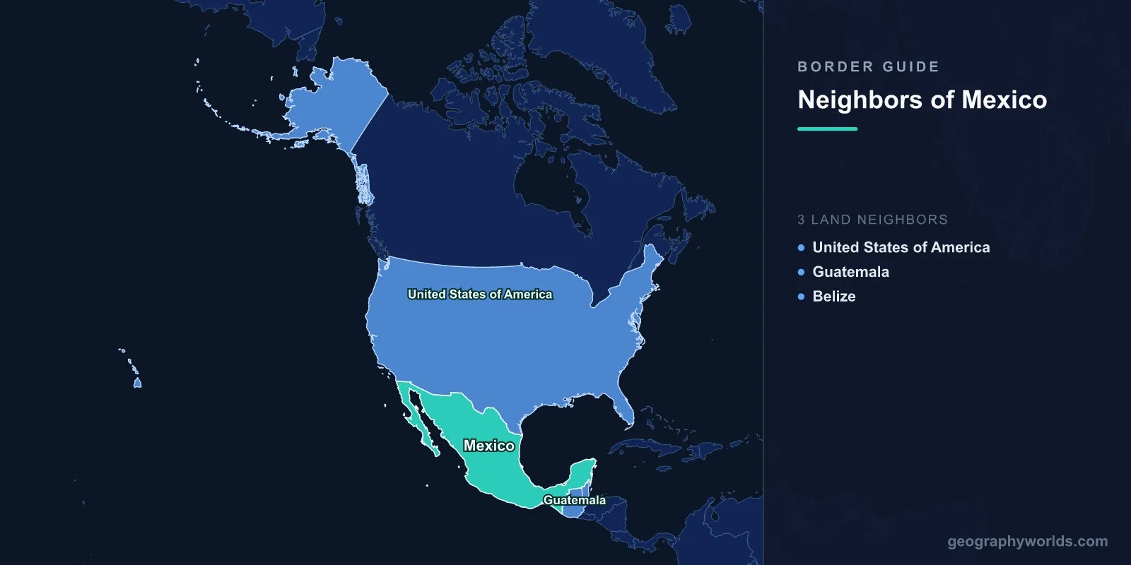
Mexico shares land borders with 3 countries: the United States (3,145 km), Guatemala (958 km), and Belize (276 km), totaling approximately 4,379 km of land boundaries.
Introduction
Mexico occupies a unique geographic position as the bridge between North America and Central America. Its northern border with the United States is one of the most crossed international boundaries in the world, while its southern borders with Guatemala and Belize connect it to the Mesoamerican cultural sphere. Mexico's borders traverse dramatically different landscapes — from the arid deserts and the Rio Grande river valley in the north to the tropical jungles of the Yucatán and Chiapas in the south. These frontiers reflect contrasting economic and political relationships that define Mexico's role in the Americas.

Complete List of Countries Bordering Mexico
- United States: 3,145 km
- Guatemala: 958 km
- Belize: 276 km
Mexico's three borders total approximately 4,379 km. The US border alone accounts for over 70% of this total. Mexico also has extensive maritime boundaries along the Pacific Ocean, the Gulf of Mexico, and the Caribbean Sea, with maritime neighbors including Cuba, Honduras, and additional Caribbean nations.
Northern Border: United States
- Border length: 3,145 km — the most frequently crossed international border in the world
- Major crossings: Tijuana-San Diego, Ciudad Juárez-El Paso, Nuevo Laredo-Laredo, Matamoros-Brownsville
- Estimated annual crossings: Over 350 million legal crossings per year
The US-Mexico border stretches 3,145 km from the Pacific Ocean at Tijuana-San Diego to the Gulf of Mexico at Matamoros-Brownsville. For approximately two-thirds of its length, the border follows the Rio Grande (known as the Río Bravo in Mexico). The remainder traverses the Sonoran and Chihuahuan deserts, with portions defined by arbitrary straight lines drawn during the 19th century.
This is the most frequently crossed international border in the world, with an estimated 350 million legal crossings annually. The border supports massive two-way trade — Mexico and the United States exchange over $700 billion in goods each year, making this one of the most economically significant frontiers on Earth. The maquiladora manufacturing zones along the Mexican side have transformed border cities like Tijuana, Ciudad Juárez, and Reynosa into major industrial centers.
The border has also been the focus of intense political debate around immigration, drug trafficking, and security. A barrier or wall covers approximately one-third of the border's length, with various US administrations expanding or modifying these structures. The twin-city pairs along the border — such as El Paso-Ciudad Juárez (combined population over 2.5 million) — demonstrate the deep economic and cultural integration that exists alongside the political tensions.
Southern Borders: Guatemala and Belize
- Guatemala border: 958 km — through mountainous Chiapas and tropical Petén jungle
- Belize border: 276 km — Mexico's shortest, through the Yucatán lowlands
Mexico's border with Guatemala extends 958 km from the Pacific coast through the highlands of Chiapas to the tropical lowlands of the Petén region. This border passes through some of the most biodiverse terrain in the Americas, including the Lacandón Jungle. The border region is predominantly indigenous, with Maya communities on both sides maintaining cultural connections that predate both modern nations by millennia.
Mexico's southern border has become increasingly significant as a transit route for migrants from Central America, South America, and even Africa and Asia heading toward the United States. The Suchiate River, which forms part of the Guatemala border, sees both formal and informal crossings daily. Mexico has faced growing pressure to manage migration along this frontier.
The Belize border (276 km) runs through the flat, forested lowlands of the Yucatán Peninsula and Quintana Roo state. This relatively quiet border connects Mexico to the English-speaking Caribbean world. The border town of Chetumal on the Mexican side serves as a commercial hub for cross-border trade, including duty-free shopping.
Historical Border Changes
Mexico's borders have undergone dramatic transformations. At independence in 1821, Mexico was one of the world's largest countries, stretching from Oregon to Costa Rica. The Texas Revolution (1836), the Mexican-American War (1846-1848), and the Gadsden Purchase (1853) cost Mexico roughly half its territory — including present-day California, Nevada, Utah, Arizona, New Mexico, Texas, and parts of Colorado, Wyoming, Kansas, and Oklahoma. The southern borders with Guatemala and Belize were established in the late 19th century: the Guatemala border was defined by an 1882 treaty, while the Belize border was fixed by an 1893 treaty between Mexico and British Honduras. These territorial losses, particularly to the United States, remain deeply significant in Mexican national identity.
Key Facts
- Mexico borders 3 countries with approximately 4,379 km of total land boundaries
- The US-Mexico border (3,145 km) is the most frequently crossed international border in the world
- Mexico and the US exchange over $700 billion in goods annually across their shared border
- Mexico lost approximately half its territory to the US in the 19th century
- Mexico's southern border has become a major transit route for intercontinental migration
Fun Facts
- El Paso, Texas and Ciudad Juárez, Mexico form one of the largest binational metropolitan areas in the world, with a combined population exceeding 2.5 million.
- Mexico once extended from Oregon to Guatemala — the Mexican-American War of 1846-1848 resulted in the loss of what is now the entire US Southwest.
- The US-Mexico border crosses the Rio Grande, which freezes in winter in its upper reaches in New Mexico but is subtropical at its Gulf outlet.
- Belize is the only English-speaking country that borders Mexico, reflecting British colonial influence in an otherwise Spanish-speaking region.
Final Thoughts
Mexico's three borders may be few in number, but they encompass some of the most significant frontiers in the Western Hemisphere. The US-Mexico border — the world's busiest international crossing — represents both the enormous economic integration and the deep political tensions between the developed and developing worlds. To the south, the Guatemalan and Belizean borders connect Mexico to its Mesoamerican roots and the complex realities of Central American migration.
Test Your Knowledge!
Think you know your borders and boundaries? Try our interactive geography quiz!
Play Geography Games →