
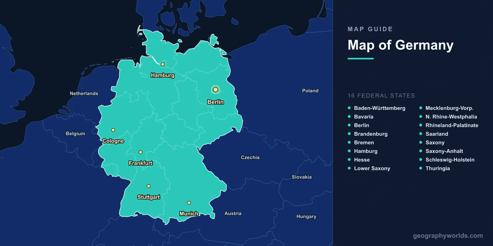
Germany is located in central Europe, covering 357,022 km2 (137,847 sq mi) with a population of approximately 84.4 million, making it the most populous country in the European Union. The capital is Berlin (52.5200°N, 13.4050°E). A map of Germany shows 16 federal states (Bundesländer), extensive river systems, and terrain ranging from the North Sea and Baltic coasts to the Alps.
Introduction
Germany is bordered by nine countries—Denmark to the north, Poland and the Czech Republic to the east, Austria and Switzerland to the south, and France, Luxembourg, Belgium, and the Netherlands to the west. This makes Germany the country with the most land borders in Europe. Its central location has made it a crossroads of European trade and culture for millennia.

Geographic Overview
- Area: 357,022 km2 (137,847 sq mi)
- Population: 84.4 million (2024)
- Capital: Berlin
- Coordinates: 51.1657°N, 10.4515°E
- Highest Point: Zugspitze, 2,962 m (Bavarian Alps)
- Coastline: 2,389 km (North Sea and Baltic)
Germany’s terrain divides into three belts running east-west: the North German Plain (flat, glacial lowlands), the Central Uplands (forested hills and plateaus like the Harz, Thuringian Forest, and Black Forest), and the Alpine Foreland and Bavarian Alps in the south. About one-third of the country is forested.
Major Regions (Federal States)
- Bavaria: Largest state; 70,550 km2; Munich; Alps and forests
- North Rhine-Westphalia: Most populous; 17.9 million; Cologne, Düsseldorf; Ruhr industrial area
- Baden-Württemberg: Stuttgart; Black Forest; automotive industry hub
- Lower Saxony: Second-largest by area; Hanover; North Sea coast; heathlands
- Hesse: Frankfurt; financial center; central highlands
- Saxony: Dresden, Leipzig; eastern Germany; Erzgebirge mountains
- Berlin: Capital city-state; 3.6 million; surrounded by Brandenburg
Germany’s 16 federal states include 13 area states and 3 city-states (Berlin, Hamburg, Bremen). Each state has its own constitution and significant legislative power. The economic divide between the formerly separate West Germany and East Germany has narrowed but remains visible in population density and per capita income.
Major Cities
- Berlin: 3.6 million; capital; northeastern Germany; Spree River
- Hamburg: 1.9 million; major port; Elbe estuary
- Munich: 1.5 million; Bavarian capital; gateway to the Alps
- Cologne: 1.1 million; Rhine River; Rhineland cultural hub
- Frankfurt: 760,000; financial capital; Main River
- Stuttgart: 635,000; automotive industry; Baden-Württemberg
Berlin, reunified since 1990, is Germany’s largest city and political center. Hamburg’s port on the Elbe is the third-largest in Europe and handles 130 million tonnes of cargo annually. Munich’s location at the foot of the Alps makes it a gateway for alpine tourism and winter sports. Frankfurt’s skyline—unusual for a European city—reflects its role as Germany’s financial capital and home to the European Central Bank.
Bodies of Water & Natural Features
- Rhine: 1,230 km total; Germany’s most important commercial waterway
- Danube: 2,850 km total; rises in the Black Forest; flows to the Black Sea
- Elbe: 1,091 km; flows through Hamburg to the North Sea
- Black Forest: Mountain range in Baden-Württemberg; up to 1,493 m
- Lake Constance (Bodensee): 536 km2; shared with Austria and Switzerland
- Bavarian Alps: Northern edge of the Alps; Zugspitze at 2,962 m
Germany’s rivers are among Europe’s most commercially important. The Rhine carries more freight than any other river in Europe. The Danube rises in the Black Forest and flows 2,850 km to the Black Sea. Germany’s canal network connects the Rhine, Elbe, and Danube basins, creating a continuous inland waterway from the North Sea to the Black Sea.
Bordering Countries
- Denmark: 140 km northern border
- Poland: 467 km eastern border
- Czech Republic: 817 km; longest border
- Austria: 801 km; Alpine border
- Switzerland: 334 km; Lake Constance region
- France: 418 km; Rhine River border
- Luxembourg: 128 km
- Belgium: 156 km
- Netherlands: 575 km
Germany shares borders with nine countries, more than any other European nation. Many of these borders follow natural features: the Rhine separates Germany from France, the Alps mark the Austrian border, and the Ore Mountains divide Germany from the Czech Republic. Germany’s central position and extensive borders have shaped European history from the Roman era to the present.
Key Facts
- Germany is the most populous EU country with 84.4 million people.
- About one-third of Germany is covered by forest.
- The Rhine is Europe’s busiest commercial waterway.
- Germany shares borders with nine countries, the most in Europe.
- The Zugspitze (2,962 m) is Germany’s highest point, on the Austrian border.
Fun Facts
- Germany has over 1,500 breweries, more than any other country in the world.
- The Autobahn network stretches over 13,000 km, and about 70% has no speed limit.
- The Ruhr Valley was once home to over 300 coal mines; today it is a cultural regeneration zone with museums and parks.
- Lake Constance is so large it is not officially part of any single country—Germany, Austria, and Switzerland all border it but have never agreed on the exact division.
Final Thoughts
Germany’s map reveals a geographically diverse and strategically positioned nation at the heart of Europe. From the sandy North Sea coast to the snow-capped Bavarian Alps, and from the Rhine’s vineyards to the forests of Thuringia, understanding Germany’s 16 federal states, major rivers, and mountain ranges is key to grasping the geography of central Europe.
Test Your Geography Knowledge!
Think you know your maps? Try our interactive geography games!
Play Geography Games →