
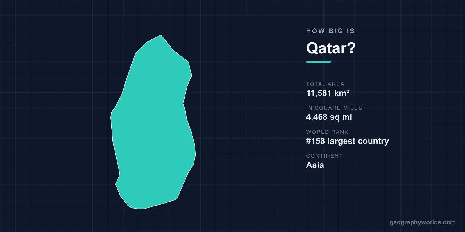
Qatar covers about 11,581 km² (4,468 sq mi), which makes it the 158th-largest country in the world, between Vanuatu and the Gambia. It is a little smaller than the US state of Connecticut (14,356 km²), slightly larger than Jamaica (10,991 km²), and Saudi Arabia, its only land neighbour, is roughly 185 times its size. The whole country is a single peninsula about 160 km long and 55 to 90 km wide, yet it holds around 3.2 million people (2025 estimate), so its population density, at roughly 278 people per km², is far higher than its size alone suggests.
Why sources disagree on Qatar’s 11,581 km²
There is no single agreed figure for Qatar’s area, and the spread is wider than you might expect for such a small place. The figure in Wikipedia’s country infobox is 11,581 km². The CIA World Factbook, which feeds the standard list of countries by area, gives 11,586 km². The Wikipedia article on the geography of Qatar uses 11,571 km², and when the eight municipalities are added together using the areas published for the 2015 census they sum to 11,621.1 km². That is a range of 50 km².
The differences have real causes. Qatar has a long, ragged coastline of sabkhas (salt flats), lagoons and low offshore islands, so where the land stops is partly a matter of definition. The country also includes islands such as Halul, about 90 km east of Doha, an offshore oil terminal. And since the 2000s Qatar has been adding land by reclamation, which nudges every new measurement upward. None of these choices moves Qatar out of the 158th spot: Vanuatu, at 12,189 km², is comfortably larger, and the Gambia, at 11,295 km², comfortably smaller.
Qatar beside Connecticut, Jamaica and Kuwait
The comparisons that work best are with places of a similar size. Among US states, Qatar falls between Connecticut (14,356 km²) and Delaware (about 6,446 km²); it is roughly 80% the size of Connecticut and almost twice the size of Delaware. Among islands and small countries, it is very close to Jamaica, the Gambia and Lebanon, all of which fall between 10,400 and 11,300 km². In Europe, Qatar is about 38% the size of Belgium (30,528 km²) and less than a third of Switzerland (41,291 km²).
Within the Gulf, Qatar is the second-smallest of the six states of the Gulf Cooperation Council. Kuwait, at 17,818 km², is about half as large again. The United Arab Emirates (83,600 km²) is more than seven times bigger, Oman (309,500 km²) about 27 times, and Saudi Arabia (2,149,690 km²) about 185 times. Only Bahrain is smaller: at roughly 778 km², the island kingdom would fit into Qatar about 15 times.
One comparison is often made because of football. Qatar hosted the 2022 FIFA World Cup, the first held in the Arab world, with the final played at Lusail, about 23 km north of central Doha. The smallest earlier host, Switzerland in 1954, has more than three times Qatar’s area.
160 km from the Saudi border to Ras Rakan
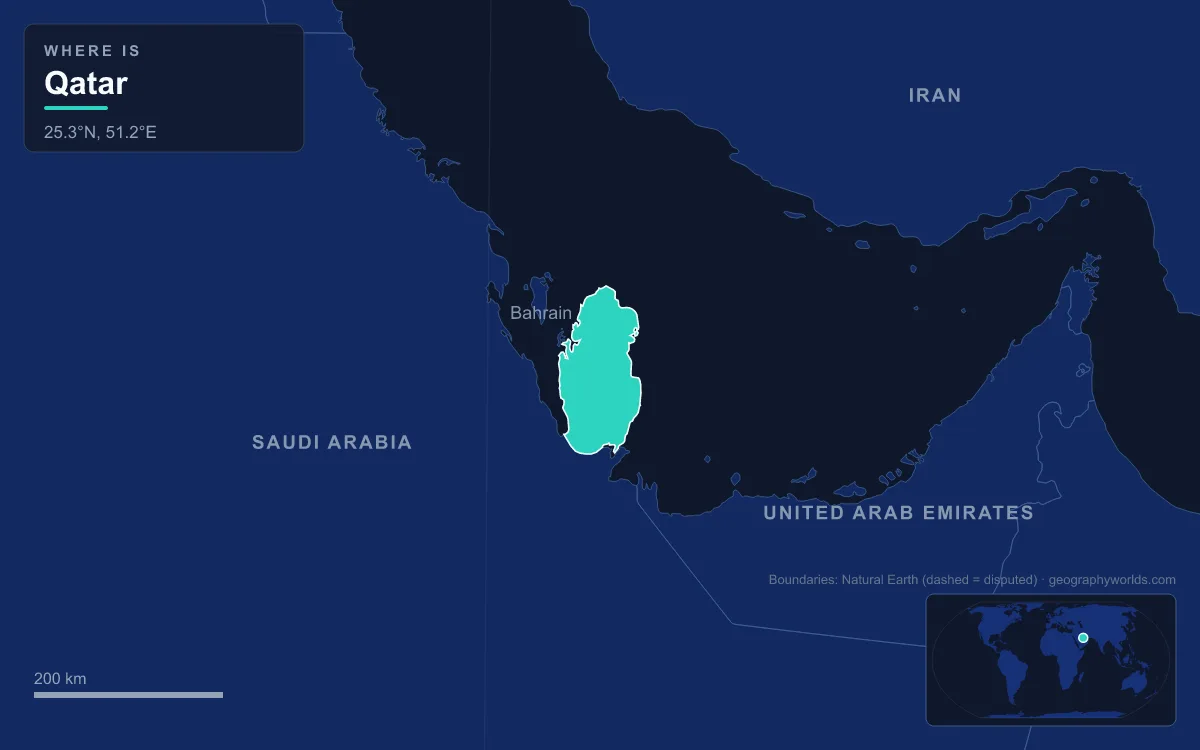
Qatar’s shape is easy to describe. The peninsula pushes about 160 km north into the Persian Gulf from the Arabian mainland, between latitudes 24° and 27° N, and its width varies between about 55 and 90 km. The northernmost point is Ras Rakan, on a small islet about 2.4 km off the northern tip that can be reached by wading at low water. To the west, the Gulf of Salwah separates Qatar from Saudi Arabia’s Al-Ahsa coast and from Bahrain, whose main islands lie less than 30 km from Qatar’s north-west shore.
The land border is short. It runs about 87 km from the head of the Gulf of Salwah at Abu Samra in the west to Khor Al Adaid in the east. By contrast, the Qatari coastline from Abu Samra round the peninsula to Khor Al Adaid measures some 650 km, so almost the entire perimeter of the country is sea.
Vertically the country is just as compact. The highest point, Qurayn Abu al Bawl, reaches only 103 m (338 ft), in the low limestone hills of Jebel Dukhan that run north to south down the west side from Zekreet through Umm Bab to the southern border. Most of the rest is a low plain of sand, gravel and limestone, with sand dunes and salt flats in the south and south-east around Mesaieed and Khor Al Adaid.

Offshore, Qatar controls far more than its land. It claims 12 nautical miles of territorial sea and an exclusive economic zone of about 31,590 km², almost three times its land area, fixed by agreements with its neighbours and ratified in Decree No. 40 of April 1992. Beneath those waters lies the North Field, Qatar’s share of the South Pars/North Dome gas field it shares with Iran, which the International Energy Agency identified in 2008 as the largest natural gas field in the world.
Three million people in 11,581 km²: Qatar’s density
Qatar ranks 158th by area but 134th by population, with an estimated 3,214,609 residents in 2025, so it is much more crowded than its size suggests. Spread evenly, that is about 278 people per km². The great majority are foreign workers: around 91% of residents in 2025 were not Qatari citizens.
The growth has been extraordinarily fast. Qatar’s first census, in 1970, counted 111,133 people, a density of fewer than 10 per km². By the 2020 census the figure was 2,846,118, or roughly 246 per km². The population tripled between 2001 and 2011 alone, as revenue from the North Field paid for building on a scale that needed hundreds of thousands of migrant labourers.
The average hides enormous contrasts, because most people live around one bay. More than 80% of residents live in Doha and its suburbs. At the 2015 census, Doha municipality held 956,457 people on just 202.7 km², under 2% of the national area, a density of roughly 4,700 per km². Al Shamal, the northern municipality around Madinat ash Shamal and Zubarah, had 8,794 people on 859.8 km², about 10 per km². Al-Shahaniya, split from Al Rayyan in 2014 and now the largest municipality at 3,309 km², covers more than a quarter of Qatar, including the oil town of Dukhan and the Jebel Dukhan hills, but held only 187,571 people.
How Qatar’s southern border was fixed, from 1913 to 2021
Qatar’s size today is the product of a long argument over its southern edge. In 1913–14 Britain and the Ottoman Empire divided their spheres of influence along the so-called Blue and Violet lines, but Ibn Saud, who proclaimed the Kingdom of Saudi Arabia in 1932, refused to recognise them and claimed much of the eastern Arabian hinterland. A conference with British officials on 25 November 1935 failed to agree a frontier, and a British note of 1936 identified the south-west, around Dohat Salwa and Jebel Naksh, as the main point of friction.
Qatar and Saudi Arabia signed a border treaty in 1965, but how to apply it stayed in dispute. In September 1992 a clash at the Al-Khufus border post killed two Qatari soldiers; Saudi Arabia said Qatar had moved the post about 14 km south during the Gulf War. An agreement followed in 1999 and the final treaty was signed in 2001.
The south-east corner had its own history. Khor Al Adaid, the tidal inlet local English speakers call the Inland Sea, was contested in the 19th century between the Al Thani rulers of Qatar and Abu Dhabi, and older maps often showed an Emirati strip reaching Qatar. The 1974 Treaty of Jeddah between Saudi Arabia and the UAE gave Saudi Arabia access to the khor, ending any possibility of a Qatar–UAE land border. A demarcation completed in November 2021 confirmed the southern shore of Khor Al Adaid as Qatari. The inlet became a nature reserve in 2007 and is on UNESCO’s Tentative List.
The border was also briefly at risk of becoming irrelevant. After Saudi Arabia and its allies cut ties with Qatar in June 2017, Saudi Arabia announced in June 2018 that it planned the Salwa Canal, a channel about 61 km long on the Saudi side of the frontier that would in effect have turned Qatar into an island. The border reopened on 4 January 2021 and the canal appears to have been abandoned.
Zubarah, the Hawar Islands and the 2001 ICJ ruling
To the west, Qatar’s territory was settled in court. The Hawar Islands lie only about 1.9 km off Qatar’s west coast but roughly 19 km from Bahrain’s main islands, and a British decision of 1939 had given them to Bahrain. Bahrain in turn claimed Zubarah, the ruined 18th-century town on Qatar’s north-west coast from which the Al Khalifa family had taken Bahrain in 1783. After Qatar took the case to the International Court of Justice in July 1991, the court ruled in March 2001.
The judgment split the difference. Bahrain kept the Hawar Islands, a land area of about 52 km², while Jinan Island just to the south, which the court treated separately, went to Qatar, which now administers it as part of Al-Shahaniya. Qatar received Zubarah, on the basis of the Anglo-Ottoman Convention of 1913, and the shoal of Fasht al-Dibal. The court also drew a single maritime boundary between the two states. Al Zubarah was inscribed as a UNESCO World Heritage Site in 2013.
The Pearl, Hamad airport and land made from the Gulf
The newest change to Qatar’s size is not political but physical. Doha has been building outward into the sea. Doha’s best-known project, The Pearl Island, is an artificial island of nearly 4 km² off the city’s coast that added about 32 km of new coastline and had around 52,000 residents by 2024.

Hamad International Airport, which replaced Doha’s old airport, covers about 36 km², and half of that sits on reclaimed land. North of the city, Lusail, which hosted the 2022 World Cup final, was planned from scratch over more than 38 km², including man-made islands. Together the reclamations are small against the national total, a few tens of km², but they are one reason published figures for Qatar’s area differ from source to source.
Put all of this together and Qatar is a small country whose shape was settled late: its southern border in 2001 and 2021, its western islands by the ICJ in 2001, and its coastline still growing at Doha. For where the land border runs and who lies across the water, see our guide to the countries that border Qatar, and for how its population has changed in more detail, the article on the population of Qatar, while the Persian Gulf guide covers the sea that surrounds it on three sides.