
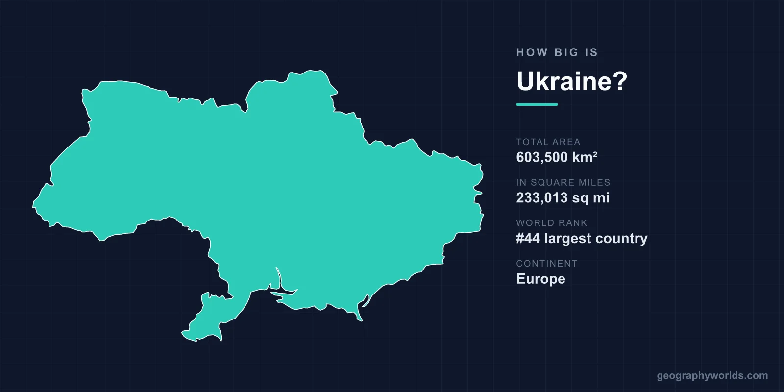
Ukraine covers about 603,550 km² (233,030 sq mi), making it the 45th-largest country in the world, the second-largest in Europe after Russia and the largest country that lies entirely within Europe. It is slightly bigger than metropolitan France (551,500 km²), almost twice the size of Poland, and about seven-eighths the size of Texas. From the Hungarian and Slovak borders near Chop in the west to the Russian border in Luhansk Oblast in the east it measures roughly 1,320 km in a straight line, and from the Russian border in Chernihiv Oblast to the southern tip of Crimea about 890 km. All of it runs on a single time zone, Kyiv Time (UTC+2).
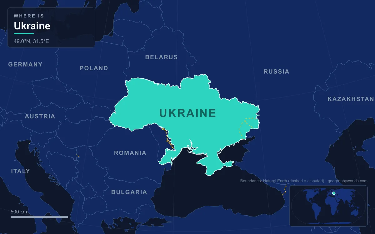
603,550 km² and the Largest Country Wholly in Europe
Wikipedia's list of countries by area, which follows United Nations figures, gives Ukraine 603,550 km² and splits that into 579,330 km² of land and 24,220 km² of water, about 4%. Other sources differ by a hundred square kilometres or so: Wikipedia's geography article gives 603,628 km² in one place and 603,700 km² in another. All of these totals are Ukraine's internationally recognised territory, including Crimea and the other areas currently occupied by Russia, which are discussed at the end of this article.
That total places Ukraine just behind the Central African Republic and just ahead of Madagascar in the world table. In European terms it is the giant of the continent's interior. Russia is much larger, but most of its territory is in Asia; France's total of 643,801 km² is bigger only because it includes overseas regions such as French Guiana. Ranked by area within Europe in Wikipedia's European table, Ukraine is second only to European Russia, ahead of European France (543,941 km²), European Spain (498,485 km²) and Sweden (438,574 km²). It is about 1.7 times the size of Germany and roughly 2.5 times the size of the United Kingdom. For a closer look at that first comparison, see our article on whether France is bigger than Ukraine.
West to East: 1,324 km from Chop to Rannya Zorya
The best way to understand Ukraine's size is to cross it. Its westernmost point lies near the town of Chop in Zakarpattia Oblast, where Ukraine meets both Slovakia and Hungary on the edge of the Pannonian Basin. Its easternmost point lies near the village of Rannya Zorya in Luhansk Oblast, on the border with Russia's Rostov Oblast. Using the coordinates in Wikipedia's list of the country's extreme points, the two lie about 1,324 km apart as the crow flies, roughly one and a half times the 874 km that separate Germany's northern and southern extremes.
Along the way, the land changes completely. Chop sits in the Zakarpattia lowland on the Hungarian side of the Carpathians, and immediately behind it the Ukrainian Carpathians rise across parts of Zakarpattia, Lviv, Ivano-Frankivsk and Chernivtsi oblasts. East of the mountains come the Volhynia-Podillia Upland, then the Dnieper Upland on the river's right bank, the Dnieper Lowland on its left bank, the south-western spurs of the Central Russian Upland around Kharkiv, and finally the Donets Ridge, whose highest point, Mohyla Mechetna, reaches only 367 m.
The big cities make useful waypoints. In straight-line terms, Kyiv is about 470 km from Lviv, about 410 km from Kharkiv and about 440 km from Odesa, which puts the capital in the north-centre of the country, on the Dnieper. Lviv to Kharkiv is about 870 km, and Uzhhorod, the westernmost regional capital, is about 1,250 km from Luhansk, the easternmost.
One Clock for 18 Degrees of Longitude: Kyiv Time
Ukraine stretches across 17°57' of longitude, which corresponds to about 1.2 hours of solar time, so sunrise in Luhansk comes more than an hour before sunrise in Uzhhorod. Even so, the whole country officially keeps one time, Eastern European Time (UTC+2), known locally as Kyiv Time. In practice, Crimea switched to Moscow Time after Russia's 2014 annexation, and the Russian-backed authorities in occupied parts of Donetsk and Luhansk followed later that year.
About 95% of Ukraine falls naturally into that zone. The exceptions are at the ends of the journey above: a small part of Zakarpattia lies geographically in the Central European zone, while Luhansk Oblast, most of Donetsk Oblast and part of Kharkiv Oblast lie geographically one zone further east. Ukraine also moves its clocks forward to UTC+3 in summer. In July 2024 the Verkhovna Rada voted to stop observing daylight saving time, but according to Wikipedia President Volodymyr Zelenskyy did not plan to sign the bill.
North to South: Polesia's Marshes to the Crimean Coast
The north–south axis is shorter but just as varied. Ukraine's northernmost point lies near the village of Hremiach in Chernihiv Oblast, on the border with Russia's Bryansk Oblast. Its southernmost point is the resort town of Foros on the Black Sea coast of Crimea. Between them lie about 890 km in a straight line and eight degrees of latitude, from 52°22' N to 44°23' N.
The journey starts in Polesia, the forest and wetland belt along the Belarus border. The Pripyat Marshes, mostly in Belarus with a share in Ukraine, are the largest wetland area in Europe. Heading south, forest gives way to the fertile black-earth belt; about two-thirds of Ukraine's land is chernozem, and 58% of the country is classed as arable. The plains average only 175 m above sea level, which is why the country can look endlessly flat from a train window between Kyiv and the coast.

In the far south the land becomes dry steppe, the Black Sea Lowland, whose few surviving patches of natural grassland are protected in reserves such as Askania-Nova in Kherson Oblast. The coast itself is shaped by estuaries and lagoons, and the Sea of Azov to the east is the shallowest sea in the world, with a maximum depth of 14 m. The trip ends in Crimea, a peninsula of about 27,000 km² joined to the mainland only by the 5 to 7 km wide Isthmus of Perekop. Its mountains rise behind the southern coast to Roman-Kosh, 1,545 m.
Hoverla to the Kuyalnik Estuary: Ukraine's Vertical Range
Ukraine is large in area but modest in height. Its highest point is Hoverla in the Carpathians, at 2,061 m, on the boundary between Ivano-Frankivsk and Zakarpattia oblasts. Its lowest point is the Kuyalnik Estuary near Odesa, about 5 m below sea level. The total vertical range is therefore just over 2,000 m, across a country more than 1,300 km wide.
That shapes how the country's size is used. Only the Carpathians in the west and the Crimean Mountains in the south are true mountain ranges. Most of the rest belongs to the Great European Plain, with uplands such as the Volhynia-Podillia and Dnieper uplands rarely rising above a few hundred metres. That flatness, combined with the black earth, is why so much of Ukraine's area is cropland rather than forest or mountain.
The Dnieper Splits Ukraine in Two
If you travel west to east, you have to cross the Dnieper. The river is about 2,200 km long in total (sources give 2,145 km or 2,201 km), and 1,095 km of that runs through Ukraine. Its basin covers 289,000 km² within Ukraine, which is nearly half the country's entire area. Kyiv sits on its banks, and in the 20th century the river was turned into a cascade of six dams and reservoirs, the first of which was the DniproHES near Zaporizhzhia, built between 1927 and 1932.
The river has divided the country politically as well as physically. The 1686 Treaty of Perpetual Peace between Russia and Poland–Lithuania confirmed Russian possession of left-bank Ukraine plus the right-bank city of Kyiv, while Poland kept right-bank Ukraine. Ukrainians still speak of Right-bank and Left-bank Ukraine, and the geography article lists the Dnieper Upland and Dnieper Lowland as separate physical regions on either side.

The Dnieper is not the only river crossing the map. The Dniester runs through the south-west toward Moldova, the Southern Bug, the longest river flowing entirely within Ukraine, runs through the centre to the Black Sea, the Siverskyi Donets drains the east, and the Danube forms part of the border with Romania, with a small part of its delta in Odesa Oblast.
Twenty-Seven Regions and the Area Under Russian Occupation
Ukraine is divided into 27 first-level regions: 24 oblasts, the Autonomous Republic of Crimea and two cities with special status, Kyiv and Sevastopol. Below them are 136 raions and 1,469 hromadas. The largest oblast is Odesa Oblast at about 33,314 km², bigger than Belgium (30,528 km²), a steppe region on the Black Sea coast divided by the Dniester estuary and bounded in the south by the Danube. For the full list, see our guide to how many regions Ukraine has.
The shape on the map was assembled in the 20th century. Eastern Galicia and Volhynia were joined to Soviet Ukraine in 1939, Northern Bukovina and parts of Bessarabia in 1940, Zakarpattia after 1945, and Crimea was transferred from the Russian SFSR in 1954, the last addition. Those borders became Ukraine's internationally recognised frontiers at independence in 1991.
Since 2014, part of that territory has been under Russian control. Russia annexed Crimea in 2014, a move most states do not recognise, and occupied further areas of Donetsk, Luhansk, Zaporizhzhia and Kherson oblasts after the full-scale invasion of February 2022. According to a figure cited in Wikipedia's area list, about 115,440 km², or 19% of Ukraine's recognised territory, was occupied as of 22 July 2025. Ukraine's official area of about 603,550 km² is unchanged, because these territories remain internationally recognised as part of Ukraine.
Population figures are similarly uncertain because of the war: the UN's 2025 estimate used in Wikipedia's density table is about 37.9 million, roughly 65 people per km² of land, while other recent estimates are lower. The land itself has not shrunk. To see which seven countries share Ukraine's 6,993 km of land borders, from Russia's 1,974 km to Slovakia's 90 km, turn to our guide to the countries that border Ukraine.