
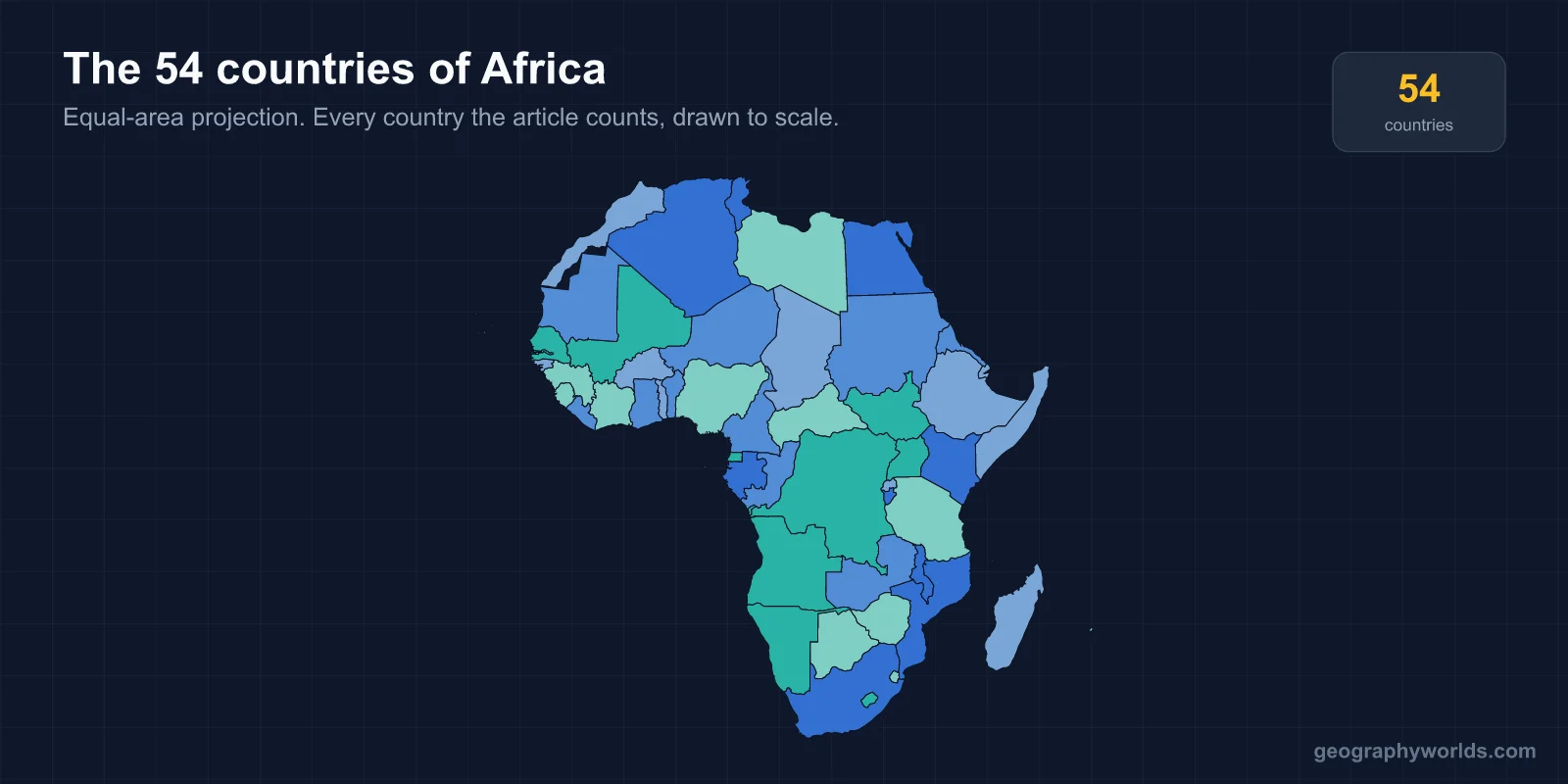
Africa has 54 countries recognised by the United Nations — more than any other continent. The African Union counts 55, because it seats Western Sahara, and that single disagreement is the whole of the argument about Africa's total. Every other continent's count is contested at several edges; Africa's is contested at exactly one.
Fifty-Four at the UN, Fifty-Five at the African Union
The 54 figure comes from UN membership, and it has held since 2011. Africa therefore supplies about 28% of the UN's 193 member states from roughly 20% of the world's land — the highest ratio of countries to territory of any continent, and a direct consequence of how its borders were made.
The African Union's own membership is 55. The extra seat belongs to the Sahrawi Arab Democratic Republic, which claims Western Sahara. Morocco controls most of that territory and left the Organisation of African Unity in 1984 in protest at the SADR's admission, staying out for 33 years before rejoining the AU in 2017 — while the SADR kept its seat. Both are now members of the same body, each disputing the other's claim to the same ground.
Western Sahara, the Fifty-Fifth
Western Sahara is the only place on the continent that turns 54 into 55. Spain withdrew in 1975 without arranging a handover; Morocco and Mauritania moved in; the Polisario Front declared the SADR in 1976. Mauritania withdrew its claim in 1979. A UN ceasefire in 1991 came with a promised referendum on independence that has never been held, more than thirty years on, because the two sides have never agreed who is eligible to vote.
The UN still lists Western Sahara as a non-self-governing territory — the last one in Africa. Around 45 states currently recognise the SADR, down from a peak in the 1980s as recognitions have been withdrawn or frozen. That is why a reference work will tell you 54 and a map published in Addis Ababa will show 55, and neither is making a mistake.
What Was Drawn in Berlin
Africa's borders are unusually straight, and the reason is documented. At the Berlin Conference of 1884–85, fourteen European powers agreed the rules for partitioning the continent among themselves; not one African was present. Roughly a third of Africa's land boundaries today run along lines of latitude or longitude, or as straight segments between two points — the highest proportion anywhere on earth.
The consequences outlived the empires. Straight borders cut through about 177 ethnic groups by one widely cited count, which is why so many African states contain communities that also live next door. When the Organisation of African Unity met in Cairo in 1964 it resolved to keep the inherited borders rather than redraw them, judging that any attempt at revision would be more destabilising than the flaws it fixed. That decision is the reason the map has stayed so nearly still since independence.
The Fifty-Four, Grouped by Region
Africa is conventionally grouped into five regions. The split is more even than Asia's, where one subregion supplies a third of the countries:
- West Africa — 16. Benin, Burkina Faso, Cabo Verde, Côte d'Ivoire, Gambia, Ghana, Guinea, Guinea-Bissau, Liberia, Mali, Mauritania, Nigeria, Niger, Senegal, Sierra Leone and Togo.
- East Africa — 14. Burundi, Comoros, Djibouti, Eritrea, Ethiopia, Kenya, Madagascar, Mauritius, Rwanda, Seychelles, Somalia, South Sudan, Tanzania and Uganda.
- Central Africa — 9. Cameroon, the Central African Republic, Chad, the Republic of the Congo, the Democratic Republic of the Congo, Equatorial Guinea, Gabon, São Tomé and Príncipe, and Angola.
- Southern Africa — 9. Botswana, Eswatini, Lesotho, Malawi, Mozambique, Namibia, South Africa, Zambia and Zimbabwe. Angola is grouped with Central Africa above; some schemes place it here instead, which is the only movement between these five lists.
- North Africa — 6. Algeria, Egypt, Libya, Morocco, Sudan and Tunisia.
Sixteen plus fourteen plus nine plus nine plus six is 54. Nigeria alone holds more people than the whole of North Africa. Egypt's Sinai Peninsula lies in Asia, making Egypt transcontinental in the same way Turkey is — but it is counted African without controversy, which shows how much these conventions depend on habit rather than rule.
1960, the Year of Africa
Almost the entire map arrived within a single generation. In 1950 there were four independent African states: Egypt, Ethiopia, Liberia and South Africa. Libya followed in 1951, Sudan, Morocco and Tunisia in 1956, and Ghana in 1957 — the first sub-Saharan colony to become independent, under Kwame Nkrumah.
Then came 1960, in which seventeen African countries became independent in twelve months, fourteen of them from France. Cameroon in January, Togo in April, Madagascar in June, Somalia in July, and through August a run of Benin, Niger, Burkina Faso, Côte d'Ivoire, Chad, the Central African Republic, the Republic of the Congo, Gabon and Senegal — most of French West and Equatorial Africa dissolved in a matter of weeks. Nigeria followed in October, Mauritania in November. The UN General Assembly grew by seventeen members in one session, and the year has been called the Year of Africa ever since.
The rest filled in over three decades: the Portuguese territories in 1974–75 after the Carnation Revolution in Lisbon, Zimbabwe in 1980, Namibia in 1990. Measured against that, the stability of the borders since is remarkable — the boundaries agreed in Berlin by people who had never seen them have outlasted every empire that drew them.
Algeria to Seychelles
Algeria is Africa's largest country at about 2.38 million km², a position it took in 2011 when Sudan split and lost the title. It is bigger than Western Europe. At the other end, Seychelles covers about 455 km² across 115 islands, and the Gambia is the smallest on the mainland — a strip averaging 30 km wide, following the river of the same name inland for 300 km, and almost entirely surrounded by Senegal.
The population spread is just as wide. Nigeria has over 220 million people; Seychelles has under 130,000. Both hold one seat at the UN and one vote in the African Union.
The Sahara Splits the Continent in Two
The single most consequential line in Africa is not a border. The Sahara covers about 9.2 million km² — roughly the area of the United States — and for most of recorded history it separated the Mediterranean world from sub-Saharan Africa more effectively than any ocean. The distinction still runs through how the continent is described, funded and studied, and it is why "North Africa" and "sub-Saharan Africa" appear as separate categories in almost every dataset.
The desert also explains the population map. The six North African countries hold about 260 million people; Nigeria alone holds more than 220 million on a twenty-fifth of the land. Between them lies the Sahel, a semi-arid belt running from Senegal to Sudan across ten countries, where the desert's southern edge has moved measurably within living memory.
Language follows the same pattern. Africa has roughly 2,000 living languages, about a third of the world's total. Nigeria alone accounts for more than 500 of them, which is more than the whole of Europe. Almost every one of the 54 has adopted a European language for government business — a direct inheritance of the partition, and the reason a Senegalese and a Malian official will often work in French while their citizens share Wolof or Bambara across the border.
South Sudan and the Only Border Added This Century
Africa's newest country is also the world's. South Sudan voted to separate in a January 2011 referendum in which 98.8% chose independence, and became a sovereign state on 9 July 2011 and the UN's 193rd member on 14 July. It remains the most recent addition to the UN anywhere on earth — its flag is the newest national flag in continuous use.
Independence did not settle everything. The status of Abyei is still unresolved, and the two Sudans have never fully demarcated their 2,000 km border. But nothing else on the continent has changed since: Eritrea's separation from Ethiopia in 1993 and Namibia's independence from South African administration in 1990 were the two before it, so Africa has added three countries in thirty-five years and none in the last fifteen.
The Landlocked Sixteen and the Island Six
Sixteen African countries have no coastline: Botswana, Burkina Faso, Burundi, the Central African Republic, Chad, Eswatini, Ethiopia, Lesotho, Malawi, Mali, Niger, Rwanda, South Sudan, Uganda, Zambia and Zimbabwe. Ethiopia is the most populous landlocked country in the world, and it has been landlocked only since 1993, when Eritrea took the Red Sea coast with it. Lesotho is one of just three countries entirely surrounded by a single other state.
Six are islands or archipelagos — Cabo Verde, Comoros, Madagascar, Mauritius, São Tomé and Príncipe, and Seychelles — and they account for six of the 54 while holding under 3% of the population. Madagascar has been separated from the mainland for around 88 million years, long enough that roughly 90% of its wildlife exists nowhere else.
Fifty-four is a lot to hold in your head, and the regional groupings are the way most people finally manage it; if you want to test whether they have stuck, our capital cities quiz covers every one of them.