
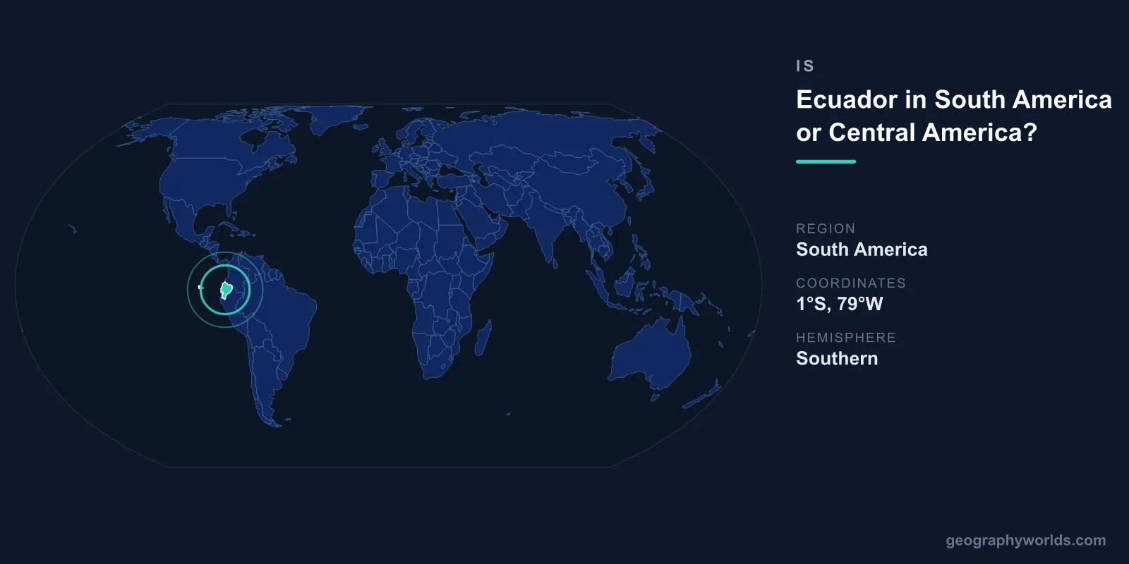
Ecuador is in South America, not Central America. It sits on the northwestern Pacific coast of the South American continent, straddling the equator between Colombia and Peru. Although it is one of the smaller countries on the continent, Ecuador is unmistakably South American by geography, history, and political affiliation. The confusion usually comes from its modest size and tropical climate, which can make it feel similar to nations farther north, but the line on the map is clear.
Where Exactly Is Ecuador?
Ecuador occupies the western edge of South America, with the Pacific Ocean to the west. It shares a long border with Colombia to the north and an even longer one with Peru to the east and south. To find the boundary between South America and Central America, you have to travel northward past Colombia to the narrow Isthmus of Panama, which is the natural land bridge connecting the two regions. Ecuador lies hundreds of kilometres south of that boundary, firmly within the South American landmass.
The country also includes the Galápagos Islands, an archipelago roughly 1,000 km off the mainland coast in the Pacific. Even these remote islands are administered as part of Ecuador and counted as South American territory. The name "Ecuador" is simply the Spanish word for "equator," reflecting the fact that the imaginary line of zero latitude runs directly through the country, just north of the capital.
Why People Confuse Ecuador With Central America
Several factors feed the mix-up. Ecuador is geographically compact, covering about 256,369 km², which is smaller than many people expect for a South American country and closer in size to nations often grouped with Central America. Its hot, humid coastal lowlands and lush rainforest also resemble the tropical character of countries like Costa Rica, Honduras, or Panama.
On top of that, Ecuador shares a border with Colombia, which is the country that directly touches the South America–Central America frontier. Because Colombia is sometimes loosely associated with both regions, neighbours like Ecuador get caught in the ambiguity. Finally, the word "equator" gives no continental clue on its own, so people who have not studied a map closely may simply guess. None of these impressions change the underlying fact: Ecuador is a South American nation.
A Country of Remarkable Geographic Diversity
Despite its small footprint, Ecuador is one of the most varied countries on Earth, divided into four distinct natural regions:
- The Costa — the tropical Pacific coastal lowlands, home to the port city of Guayaquil and much of the country's agriculture.
- The Sierra — the Andean highlands running down the spine of the country, with volcanic peaks rising above 6,000 m.
- The Oriente — the Amazon rainforest basin in the east, part of the vast tropical lowlands shared with Peru and Brazil.
- The Galápagos — the volcanic island province in the Pacific, famous for its unique wildlife.
This range of landscapes, from snow-capped Andean summits to steaming jungle, all fits within a country roughly the size of the U.S. state of Nevada, and all of it lies on the South American continent.
Key Facts About Ecuador
- Continent: South America
- Capital: Quito, at about 2,850 m elevation, one of the highest capital cities in the world
- Largest city: Guayaquil
- Area: 256,369 km²
- Population: approximately 18 million
- Official language: Spanish
- Bordering countries: Colombia and Peru
Ecuador is also a founding member of South American institutions and trade arrangements such as the Andean Community, alongside Colombia, Peru, and Bolivia, which reinforces its political identity as a South American state rather than a Central American one. For a fuller picture of its regions, history, and travel highlights, see our ecuador country guide.
What Makes Ecuador Stand Out
A few facts capture just how distinctive this equatorial nation is. The Galápagos Islands, part of Ecuadorian territory, inspired Charles Darwin's theory of evolution after his 1835 visit. Quito's historic centre was among the very first sites added to the UNESCO World Heritage List in 1978. And because of the equatorial bulge of the planet, the summit of Ecuador's Chimborazo volcano (6,263 m) is the point on Earth's surface farthest from the centre of the planet — farther even than the peak of Mount Everest measured the same way.
Frequently Asked Questions
Is Ecuador a Central American country?
No. Ecuador is a South American country. Central America refers to the narrow strip of land between Mexico and Colombia, including nations such as Panama, Costa Rica, and Guatemala. Ecuador lies well to the south of that region.
What continent is Ecuador on?
Ecuador is on the continent of South America, along its northwestern Pacific coast, between Colombia and Peru. The equator passes directly through the country, just north of the capital, Quito.
What countries border Ecuador?
Ecuador shares land borders with only two countries: Colombia to the north and Peru to the east and south. Its western edge faces the Pacific Ocean.
Why is it called Ecuador?
The name "Ecuador" is Spanish for "equator." It was chosen because the equatorial line — zero degrees latitude — crosses the country, a feature celebrated at monuments near Quito.
