

Mauritius is in Africa. It is an island country in the south-western Indian Ocean, about 2,000 km off the south-east coast of the African mainland and roughly 900 km east of Madagascar. It belongs to the African Union and the Southern African Development Community, and the United Nations counts it as part of Eastern Africa. The Asia question arises because about two-thirds of Mauritians have Indian ancestry and Hinduism is the largest religion, practised by 47.9% of people in the 2022 census. Geographically and politically, though, the country is African. It covers 2,040 km², had 1,235,260 people at the 2022 census, and its capital is Port Louis.
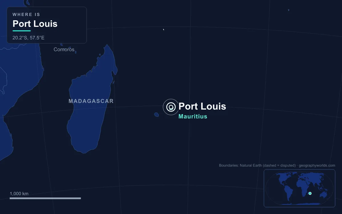
How an island 2,000 km offshore is assigned to a continent
Continents are defined by large landmasses, and an oceanic island is not part of any of them in a strict physical sense. Mauritius is volcanic. It rose from the seabed rather than breaking off a continental shelf, so it is "in" a continent only by convention. Two conventions settle the question, and both point the same way.
The first is proximity: an island is grouped with the nearest continent. The closest large land to Mauritius is Madagascar, an African island about 900 km to the west. The African mainland, along the coast of Mozambique, is about 2,000 km away. Asia is much further. Computed from coordinates (Wikipedia does not give these distances), Port Louis is about 3,830 km from Kanyakumari at the southern tip of India and about 5,900 km from Perth in Australia.
The second is political and statistical grouping: which regional bodies a country belongs to and how international agencies classify it. Here Mauritius is consistently African, as the last section shows. The UN Statistics Division adds that its geoscheme is "for statistical convenience" and implies no political judgement. Even so, the scheme, the African Union and the island's own government all place it in the same continent.
The ocean's name muddies things further: called the Indian Ocean, it gets linked in people's minds with South Asia. Yet the ocean washes the shores of Africa, Asia and Australia alike, and its south-western quarter, where Mauritius lies near the Tropic of Capricorn, is part of the African region. The island shares its weather with Madagascar and Réunion: a warm, humid summer from November to April, a cooler, drier winter from June to September, and a shared exposure to the cyclones of the south-west Indian Ocean.
The Republic of Mauritius: four island groups across the south-west Indian Ocean
The country is more than one island. The main island, also called Mauritius, covers about 1,865 km² and holds almost all of the population: 1,191,280 people in 2022. Its highest point is Piton de la Petite Rivière Noire, 828 m (2,717 ft), in the Black River range in the south-west. The better-known peaks of Pieter Both and Le Pouce, both about 820 m, rise behind Port Louis in the Moka range. That range shelters the harbour from cyclone winds, which is one reason the French made Port Louis their administrative centre in 1736. The city had 147,066 people at the 2018 census.
The outer islands are scattered over a huge area of sea:
- Rodrigues, about 108 km², lies about 560 km east of the main island. Its people, 43,650 in 2022, are mostly of African descent and part of the wider Mauritian Creole community; the island lives mainly from fishing, farming, handicrafts and a small tourism trade. It was the tenth district of Mauritius until 2002 and is now governed by its own Rodrigues Regional Assembly from Port Mathurin.
- Agaléga, two coconut-growing islands with 330 residents in 2022, lies about 1,050 km north of Mauritius Island.
- St Brandon (the Cargados Carajos Shoals), a scatter of 28 to 40 sandbanks and islets about 430 km north-east, has only about 60 resident fishermen.

Together these islands give Mauritius an exclusive economic zone of about 2.3 million km², including about 400,000 km² managed jointly with the Seychelles. That is more than a thousand times its land area. Two further territories are disputed. Mauritius and France both claim the tiny island of Tromelin. The Chagos Archipelago was separated from Mauritius by the United Kingdom in 1965, three years before independence, and administered as the British Indian Ocean Territory. In 2019 the International Court of Justice advised that the UK should end its administration, and in May 2025 the two governments signed an agreement recognising Mauritian sovereignty over the islands.
Réunion, Madagascar and the Seychelles: the island neighbours
Mauritius has no land border. Its neighbours are all across the water, and all of them are classed as African. Mauritius, Rodrigues and Réunion together form the Mascarene Islands, named after the Portuguese navigator Pedro Mascarenhas, who visited them in April 1512. Réunion, the nearest, lies about 175 km south-west and is an overseas department and region of France. Although it is legally part of the European Union and uses the euro, it is still counted in the African region. The French ruled Mauritius as Isle de France from 1715, and the two islands share a Creole, sugar-planting past.
West of Réunion is Madagascar, the fourth-largest island in the world, which also faces the same continent question (see our article on whether Madagascar is in Africa or Asia). To the north are the Seychelles, which Britain governed from Mauritius until they became a separate crown colony in 1903. Further north-west are the Comoros. In 1982 these neighbours founded the Indian Ocean Commission in Port Louis. Its members are Comoros, Madagascar, Mauritius, Réunion (through France) and the Seychelles, all of them African island states or territories. Asian powers such as India, China, Japan and South Korea take part only as observers, as of August 2025, alongside the European Union and the United Nations. The Seychelles case is very similar to this one and is covered in is Seychelles in Africa or Asia.
Why Asia comes up: Indian indenture, Hinduism and a sunken microcontinent
The Asian connection is real, but it is about people and deep geology, not location. Mauritius had no permanent inhabitants until Europeans arrived. Arab sailors may have known it as early as the 10th century: the Portuguese Cantino map of 1502 marks an island called Dina Arobi, and Portuguese crews visited in 1507. The Dutch took possession in 1598 and named the island after Prince Maurice of Orange. French settlers built a sugar economy worked by enslaved people brought from Madagascar and East Africa. Britain took the island in 1810. After 1833 slavery was abolished in stages, and the planters received two million pounds in compensation. To replace their labour, the planters turned to India. Between 1849 and 1923, about half a million Indian indentured labourers passed through the Immigration Depot in Port Louis, bound for plantations in Mauritius and across the British Empire.

That depot, now called Aapravasi Ghat, became a UNESCO World Heritage Site in 2006. The site's history notes that 68% of Mauritians today have Indian ancestry. The 2022 census recorded 47.9% Hindus, 32.3% Christians and 18.2% Muslims. That makes Mauritius the only African country where Hinduism is the most practised religion. Bhojpuri, Tamil, Telugu and Hindi-Urdu are spoken alongside Mauritian Creole, the everyday common language. French dominates the media; English and French are both used in government and the courts, and English is the language of the National Assembly and the usual medium of instruction in public schools. The census has not recorded ethnicity since 1972; the constitution instead recognises Hindu, Muslim, Sino-Mauritian and "General Population" communities for electoral purposes.
There is also a geological twist. The Mascarene Islands sit on the Mascarene Plateau, above the remains of the Mauritia microcontinent. This fragment of ancient crust lay between India and Madagascar until the two separated about 70 million years ago. The volcanic islands themselves are much younger, so this does not make Mauritius Asian. It does mean the seabed beneath it shares a story with both landmasses.
Mauritius in the African Union, SADC and the UN's Eastern Africa group
When international bodies sort countries by region, Mauritius lands in Africa every time. The UN Statistics Division's M49 geoscheme lists it under Eastern Africa, alongside Madagascar, the Seychelles, the Comoros and Réunion. Mauritius gained independence from Britain in 1968, became a republic in 1992, and belongs to the African Union. It is a member of the Southern African Development Community, the 16-country bloc headquartered in Gaborone, Botswana. It is a COMESA member too (Common Market for Eastern and Southern Africa), and in 2000 it was one of the nine states that launched that bloc's free-trade area. South Africa is by far its largest trading partner on the continent, and Mauritian investors are active in Madagascar, Mozambique and Zimbabwe.
Its ocean links reach well beyond Africa, and that also feeds the confusion. Mauritius hosts the secretariat of the Indian Ocean Rim Association at Ebene, a 23-member forum that includes India, Indonesia and Australia. It has close historical and commercial ties with India, and it belongs to both the Commonwealth and La Francophonie. None of these memberships is continental, however, and none places it in Asia. On the map, in the UN's tables and in its own treaty memberships, Mauritius is an African island nation. For its beaches, reefs and the volcanic interior around Le Morne and the Black River Gorges, see our Mauritius island guide.