

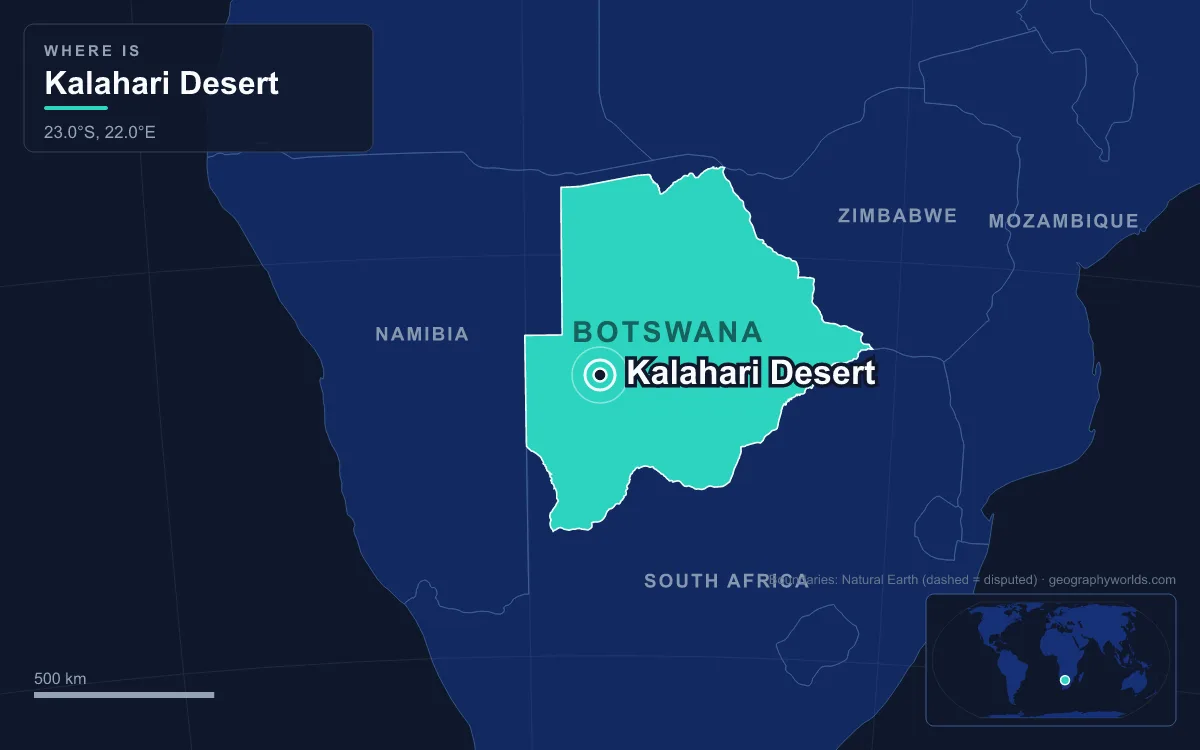
The Kalahari Desert is a semi-arid sandy savanna of about 900,000 km² (350,000 sq mi) covering most of Botswana and parts of eastern Namibia and South Africa's Northern Cape. It lies on a high interior plateau, mostly 800 to 1,200 m above sea level, and receives from about 110 mm of rain a year in the south-west to more than 500 mm in the north and east, which is why grass and trees cover most of it. Its only permanent river, the Okavango, ends in an inland delta rather than the sea. Its name comes from the Tswana Kgala, "the great thirst". Geologically it is a sand-filled basin: red Kalahari Group sands lie over Karoo rocks and a continental core more than 3.2 billion years old, and the faulting of the last two million years created the salt pans of Makgadikgadi and the Okavango Delta. This guide reads those layers from the bottom up.
The Kaapvaal and Zimbabwe Cratons, Older Than 3.2 Billion Years
The deepest layer is the Kalahari Craton, a stable block of ancient continental crust that underlies large parts of South Africa, Botswana, Namibia and Zimbabwe. It is really two cratons, the larger Kaapvaal Craton in the south and the smaller Zimbabwe Craton in the north, joined along the Limpopo Belt. Their rocks contain crust at least 3.2 billion years old and rest on a keel of buoyant mantle about 250 km thick.
The craton grew in stages. By 1.75 billion years ago new crust had been added along its north-western edge to form a proto-Kalahari Craton, and between 1.15 and 0.98 billion years ago it collided with Laurentia, the core of North America, during the assembly of the supercontinent Rodinia. Pieces that were once part of it now sit in East and West Antarctica and the Falkland Islands. In eastern Botswana these Archaean rocks reach the surface; farther west a younger cover of Karoo rocks and Kalahari sediments conceals them.
That thick, cold mantle keel matters for what came later. It is the zone where garnets and diamonds form, and it is why the Kalahari sands now cover Botswana's diamond pipes.
Karoo Sediments and the Gondwana Lavas of 183 Million Years Ago
Over the craton came the Karoo Supergroup, a pile of mostly non-marine shales and sandstones laid down over about 120 million years, from the Late Carboniferous to the Early Jurassic, in basins that formed as the supercontinent Pangaea assembled and broke apart. Karoo rocks cover almost two thirds of southern Africa's land surface, and in Botswana they form a younger cover over the western margins of the old basement.
The Karoo era ended in fire. About 183 million years ago, as Gondwana began to split, the Karoo and Ferrar large igneous provinces poured out flood basalts over some 3 million km², with an original volume of more than 2.5 million km³. Jurassic lava still frames the basin's north-eastern edge: the Zambezi at Victoria Falls flows across a basalt plateau formed around 200 million years ago.
Kimberlite Pipes at Orapa and Jwaneng
Before the sands arrived, volcanic pipes punched up through the crust from the diamond zone of the mantle. Botswana has more than 20 kimberlite pipes, most of them Cretaceous in age. The Orapa pipe, about 240 km west of Francistown, was discovered by De Beers geologists on 1 March 1967, a year after independence, and began production in July 1971. Two pipes converge near the surface there over 1.18 km², making Orapa the largest diamond mine in the world by area. Above the pipe, lake sediments about 94 to 90 million years old have been preserved, and they are an important locality for Cretaceous fossil insects.
Jwaneng, about 170 km south-west of Gaborone, began operating in 1982 and is described as the richest diamond mine in the world; it produced 13.3 million carats in 2023. The Jwaneng deposit was found in February 1973 after extensive geological surveys by De Beers, and took nine years of evaluation and construction before it opened. In 2007 diamond mining accounted for more than a quarter of Botswana's GDP.
The Kalahari Group Sands Fill the Basin
After the Cretaceous the interior bowl began to fill with the Kalahari Group, the loose sands and associated sediments that give the desert its colour and its name. They conceal not only the older basement but also whole Proterozoic mountain belts. The basin they fill is endorheic: no river drains it to the sea, so water that arrives either sinks into the sand or evaporates.
Some of that water is still underground. Large aquifers lie beneath parts of the Kalahari, which may partly be the remains of ancient lakes. In Namibia's Otjozondjupa Region, Dragon's Breath Cave, discovered by Roger Ellis in 1986 in a dolomite outcrop, holds the largest known non-subglacial underground lake, almost 2 hectares in area and 205 m deep.
Long Dunes and Lost River Routes, About Three Million Years Ago
About three million years ago strong easterly winds shaped the surface sand into long dunes running east to west across the middle of the Kalahari. In wetter periods these ridges acted as channels. They steered the northern rivers, the Okavango, the Chobe and the Upper Zambezi, south-eastwards to join the Limpopo, which carried their water to the Indian Ocean. At that stage the Kalahari had an outlet to the sea.
Fossil channels from this and later times still cross the sand. Ancient dry riverbeds known as omuramba wind across north-eastern Namibia and north-western Botswana and hold occasional standing pools of water, and in the Central Kalahari Game Reserve four fossilised rivers meander across the reserve, among them Deception Valley.
The Flexure That Made Lake Makgadikgadi, Two Million Years Ago
The outlet was closed by the crust itself. About two million years ago the Ovamboland–Kalahari–Zimbabwe axis, a line running north-east to south-west from Harare through Bulawayo to the eastern Kalahari, rose in a gentle upwarp. It cut off the route to the Limpopo, and the rivers backed up into a vast lake, Lake Makgadikgadi, about 30 m deep, whose area at its greatest is estimated at anywhere from 80,000 to 275,000 km².
Its shorelines can still be traced. The Magwikwe Sand Ridge between Savuti and North Gate probably marked one north-western shore, and relic beaches at 940 m and 920 m stand out on the Gidikwe Ridge west of the Boteti River. About 20,000 years ago the full lake overflowed through the lowest point of its rim in the north-east. That breach joined the middle and lower Zambezi and formed Victoria Falls, and as the lake drained its level fell. By about 10,000 years ago, in a drier climate, it was largely gone, filled in by river sediment and blown sand.
What remains is the Makgadikgadi Pan, a cluster of salt pans covering 16,000 km², the largest being Sua, Ntwetwe and Nxai; the biggest single pan is about 4,900 km². Sua Pan, at 890 m, is the lowest point of the basin, and it is one of only two breeding sites of the greater flamingo in southern Africa. In 2019 a team led by Vanessa Hayes proposed, from mitochondrial DNA, that the lake's former shores were the homeland of modern humans about 200,000 years ago; the scientists Chris Stringer and Sarah Tishkoff dispute that conclusion.
Rift Faults and the Okavango Delta
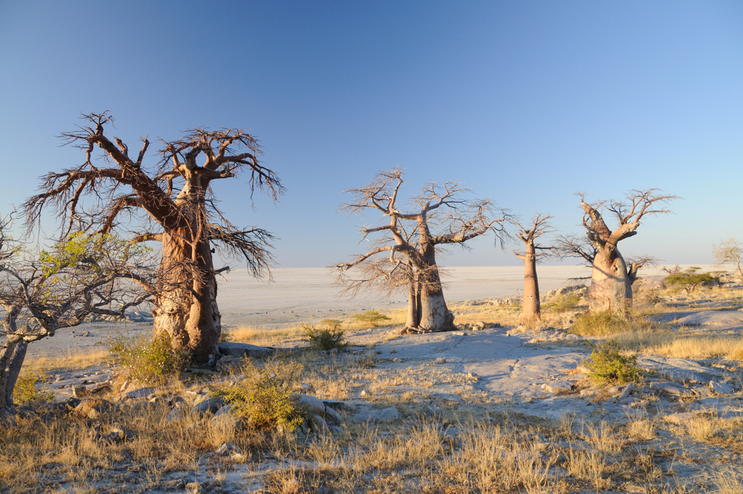
Faulting made the youngest landforms. Beneath the sand of northern Botswana run deep parallel faults thought to be the southernmost extension of the system that formed East Africa's Great Rift Valley, and stretches of the Linyanti and Chobe rivers follow them. When the Gumare fault formed and lowered the land, the Okavango River spread out over a much wider area and built the fan-shaped inland delta seen today, which sped the end of Lake Makgadikgadi by keeping its water.

The delta lies in a tectonic trough 930 to 1,000 m above sea level. Rain that falls on the Angolan highlands in January and February takes about a month to travel 1,200 km down the river, then spreads over the delta for the next four months, so the flood peaks between June and August, in Botswana's dry winter. About 11 km³ of water covers between 6,000 and 15,000 km² each year, and almost all of it evaporates or is transpired. The faults also built islands: Chief's Island, the largest, was raised along a fault over an area more than 70 km long and 15 km wide. On 22 June 2014 the delta became the 1,000th site inscribed on the UNESCO World Heritage List.
Overflow still links the old lake bed to the rivers. In high-water years the Okavango feeds Lake Ngami, which David Livingstone described in 1849 as some 80 miles long, and reaches the Makgadikgadi through the Boteti. In a good flood year some water also escapes east along the normally dry Selinda Spillway into the Linyanti Swamp and so into the Zambezi basin; the spillway and the Boteti are the only outlets of the Okavango basin.
Wet Phases, Drying and the Savanna of Today
The climate has swung repeatedly within this frame. Fossils from Gcwihaba Cave in north-western Botswana show that the area had more vegetation and permanent water between about 30,000 and 11,000 years ago, with the wettest phase after 17,500 years ago, when antelope, elephants and even hippopotamuses probably lived here. After about 11,000 years ago rainfall fell and evaporation rose, and the semi-arid Kalahari of today took shape. In drier phases of the last 250,000 years the sand extended into western Zimbabwe, Zambia and Angola.
The result is a desert in name only across most of its area. About 600,000 km² in the south and west is xeric savanna of grasses and camel thorn trees, while dry forests of Rhodesian teak and acacia cover more than 300,000 km² in the north and east. The barest ground is in the south-west, around the Kgalagadi Transfrontier Park, where the Nossob and Auob riverbeds flow perhaps once a century. Frost is common from June to August, and Twee Rivieren recorded 44.8 °C in 2012. The San have lived in this landscape for about 20,000 years.
The water that this geology traps is the subject of our Okavango Delta guide; for a desert built in a completely different way, compare the fog-fed Namib Desert on the Atlantic coast, and see how big Botswana is to put the basin's scale in context.