

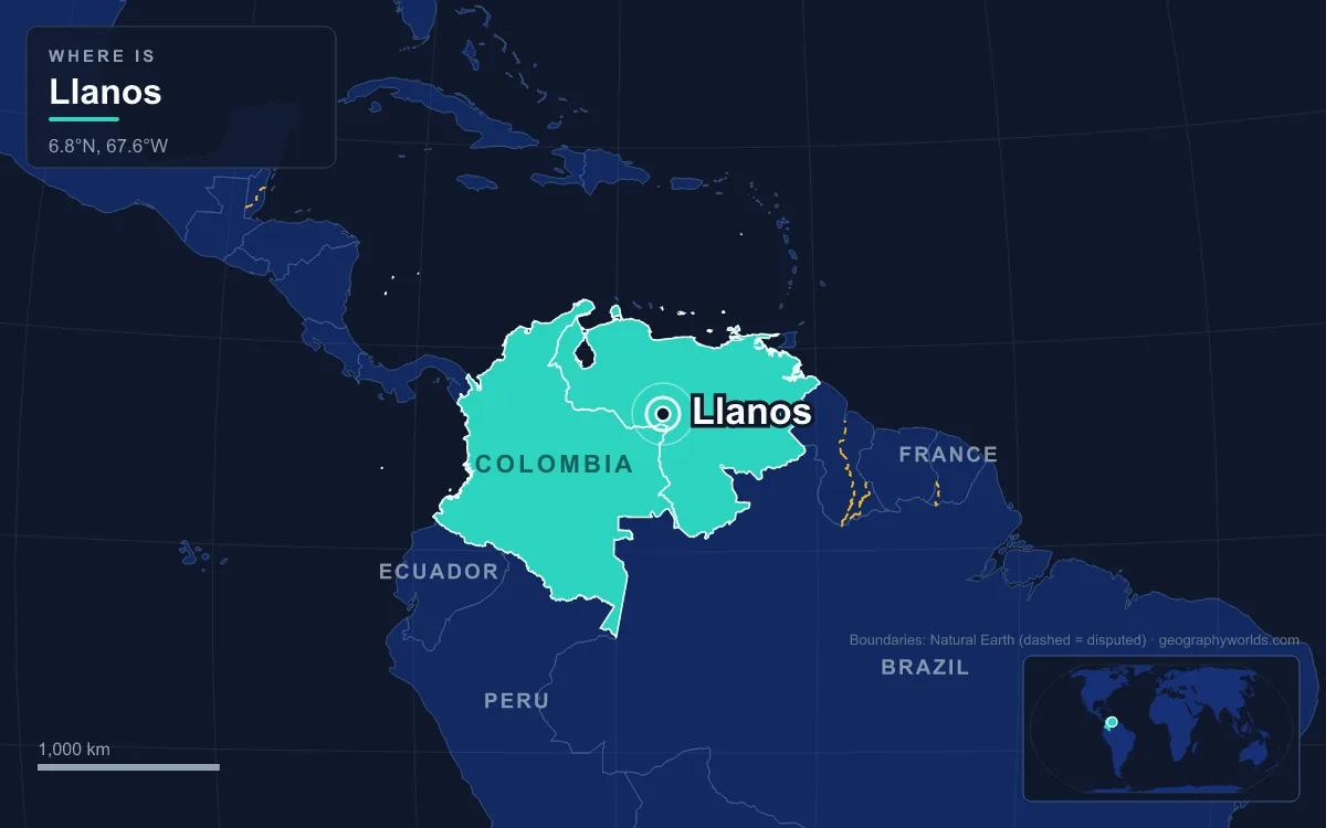
More than a quarter of the Llanos is now under some form of protection, and the reasons why explain the whole region. The Llanos are the vast tropical grassland plain east of the Andes in Venezuela and Colombia, drained by the Orinoco and its tributaries such as the Meta and Apure, and covering roughly 375,000 km² as an ecoregion. It is a flat savanna of grass, palm groves and gallery forest, parts of which flood up to a metre deep in the April-to-November rains and bakes dry from December to March. A 2017 assessment counted 105,323 km², or 28 percent, inside protected areas, led by Venezuela’s Aguaro-Guariquito National Park (1974) and Colombia’s El Tuparro National Natural Park (1970), and in 2018 the entire basin of Colombia’s Bita River became a Ramsar Wetland of International Importance. Cattle, fire, rice, dams, oil and hunting are the pressures those designations answer.
Cattle, Fire and African Grass Since the Colonial Era
The oldest pressure is also the one that defines llanero culture. Since the Spanish colonial period the main economic activity has been herding millions of cattle across open range, and the cowhands who worked them, the llaneros, shared some of the culture of the gauchos of the Pampas. Ranching changed the vegetation. Grasslands and savannas are burned regularly to freshen grazing and kill off trees and shrubs, and non-native pasture grasses have been sown for fodder, among them the African molasses grass Melinis minutiflora, which now covers large areas.

The trees that burning is meant to clear give the plain its structure: the matas, clumps of manteco, chaparro and alcornoque trees from about 12 metres across up to a hectare, and the gallery forests along rivers, which hold a more diverse set of large mammals than the open grass, from tapir and peccary to jaguar and puma. The dry, sandy, nutrient-poor llano alto covers about two-thirds of the Venezuelan Llanos, while the seasonally flooded llano bajo has richer soils.
Climate sets the rhythm of the burning. The mean annual temperature is about 27 °C and barely changes through the year, so the seasons are defined by rain: up to 3,000 mm a year in the southwest of the Colombian Llanos, 1,200 to 1,600 mm in Apure State and 800 to 1,200 mm in Monagas in the northeast. Almost all of it falls between April and November, with June and July the wettest months, which leaves December to March for the fires. The plains were not empty before the ranchers came: the Guahibo live in the western Llanos of Colombia and Venezuela and the Yaruro in the eastern Llanos of Venezuela, on the same savannas that ranching, farming and oil now share.
The Guárico Reservoir, 1954–1956: Drying the Flood for Rice
In the 20th century the plains of Guárico State swung between severe drought, which killed crops and cattle, and uncontrolled floods. Venezuela’s answer was engineering. The Ministry of Public Works began surveys of the Guárico River in January 1953, decrees that December expropriated more than 55,500 hectares for a reservoir and farm zones, and the first stone was laid on 2 February 1954. Work finished on 3 November 1956, in 33 months, at a cost of more than 408 million bolívares. The reservoir near Calabozo, now named after the engineer Generoso Campilongo, anchors the Guárico River irrigation system, built to turn low-lying savanna into rice farms and to control floods.
Irrigation and drainage on this scale helped turn savanna into cropland, and that is the conservation problem. Rice and maize now cover extensive areas of the Llanos, including rice fields laid out in former seasonal wetlands, the same llano bajo that supports around 70 species of water birds, including the scarlet ibis, when it floods.

Oil from Caño Limón to the Orinoco Belt
Both countries have built large oil and gas industries in the Llanos states and departments of Arauca, Casanare, Guárico, Anzoátegui, Apure and Monagas. In Colombia, the Caño Limón field in Arauca, on the Venezuelan border, feeds a 780 km pipeline to Coveñas on the Caribbean coast, opened in 1986 and jointly owned by Ecopetrol and Occidental Petroleum. Guerrilla groups attacked it repeatedly: in 2001 alone there were 170 attacks, the line was out of service for 266 days, and the government estimated that the bombings may have cut Colombia’s GDP by 0.5 percent. The Colombian government militarised the area in response, and the United States added $98 million in military aid in 2003 to help defend the line. The security effort also had civilian costs: in December 1998 a Colombian military cluster-bomb attack on the village of Santo Domingo killed 18 civilians, including nine children, after the village was reportedly misidentified as a guerrilla target, and the case led to legal actions against the parties involved. Attacks on the pipeline fell in the years after 2003.
Venezuela’s reserve is on a different scale. The Orinoco Belt, entirely within Venezuelan territory, holds deposits of extra-heavy crude among the largest oil sands known, behind only Canada’s Athabasca deposits, and the country’s non-conventional oil, about 1,200 billion barrels found mainly in these sands, is estimated to roughly equal the world’s conventional oil reserves. Monagas, one of the producing states, lies in the drier northeastern Llanos, where rainfall is only about 800 to 1,200 mm a year.
The Orinoco Crocodile: Thousands Killed Between the 1940s and 1960s
The plains’ top predator is also one of its most endangered species. The Orinoco crocodile, found only in the Orinoco basin of Venezuela and Colombia, was hunted for its hide on such a scale that from the 1940s to the 1960s thousands were killed in the river and the Llanos wetlands, bringing it very close to extinction. It was given protected status in the 1970s, is protected in both countries and is listed on CITES Appendix I, yet it has not recovered. Estimates of the wild population run from 250 to 1,500, and the largest Venezuelan subpopulation, in the Cojedes and Sarare rivers, has fewer than 500 adults.

Today’s threats are newer: juveniles taken for the live animal trade, pollution, competition from the far more numerous spectacled caiman, and a proposed dam on the upper Orinoco. Since the early 1990s Venezuela has released large numbers of captive-bred hatchlings into private ranches, where nature tourism matters to the local economy, and into national parks, but its six captive-breeding programmes are often short of money and staff.
Arrau Turtles and the Tortuga Arrau Reserve
The Arrau, or giant South American river turtle, is the largest freshwater turtle in Latin America and nests in large groups on river beaches of the Orinoco basin, sometimes 500 females on one beach. Each lays an average of 75 to 123 eggs in a nest 60 to 80 cm deep during the low-water season, timed so the young hatch about 50 days later as the river begins to rise. If the water rises too early or too fast, the nests drown. Hunting of adults, egg collection, pollution, habitat loss and dams all threaten it, and numbers have collapsed: in the middle Orinoco alone an estimated 330,000 females nested in 1800, but only 700 to 1,300 by the early 2000s. Since the mid-1990s Venezuela has collected many thousands of eggs for safe incubation and released the hatchlings, and its 98.56 km² Tortuga Arrau Reserve is named after the species.
Aguaro-Guariquito (1974) and Santos Luzardo (1988): Venezuela’s Llanos Parks
Venezuela’s two great Llanos parks were created fourteen years apart. Aguaro-Guariquito National Park was established on 7 March 1974 under President Rafael Caldera to keep a sample of the plains in its original condition, and covers 5,857.5 km² in the municipalities of Francisco de Miranda and José Rondón in southern Guárico. It is an Important Bird Area for species such as the yellow-knobbed curassow, and the Amazon river dolphin lives in its rivers. Santos Luzardo National Park, also called Cinaruco-Capanaparo, was created by presidential decree in 1988 under Jaime Lusinchi. It covers 5,843.68 km² in Apure State between the Capanaparo and Cinaruco rivers down to their meeting with the Orinoco, near the Colombian border, and is managed by INPARQUES. The 93 km² Caño Guaritico Wildlife Refuge adds a smaller protected wetland.
El Tuparro and the Maipures Rapids: Colombia’s 1970 Park
On the Colombian side, El Tuparro National Natural Park in Vichada Department was created in 1970 and covers about 5,500 km² between the Orinoco to the east, the Tomo River to the north and the Tuparro River to the south. It is the only protected area of the Eastern Plains within Colombia’s national park system. Savanna covers 75 percent of the park and gallery forest the rest, with flooded and non-flooded grasslands and five types of riparian forest. Rainfall averages 2,477 mm a year in the west and 2,939 mm in the east, and the park records 74 mammal species, 320 birds and five primates. Its best-known feature is the Raudal de Maipures on the Orinoco, the rapids Alexander von Humboldt called the “Eighth Wonder of the World”.
The Bita River: The World’s First Whole-Basin Ramsar Site, 2018
The newest protection is also the most ambitious. The Bita, or Vita, River rises from a spring in the middle of the Colombian Llanos near La Primavera in Vichada and meanders 520 km, forming lagoons and beaches, to join the Orinoco near Puerto Carreño. It has no dams or other artificial barriers. In 2018 its whole basin, more than 824,000 hectares, was declared a Ramsar Wetland of International Importance, then the largest of Colombia’s eleven Ramsar sites and the first in the world to cover an entire river basin. The site has recorded 1,474 plant species, 254 fish, 201 birds, 63 mammals and 30 amphibians, including tapir, jaguar, giant otter and the Amazon river dolphin.
The flooding cycle that these parks protect is described in more detail in the guide to the Llanos wetlands, while the river that drains the whole plain is covered in the Orinoco River guide, and the oil beneath it in the overview of Venezuela’s natural resources.