

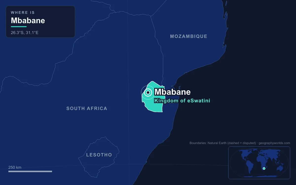
Mbabane is the capital and largest city of Eswatini, the small kingdom formerly called Swaziland. More precisely, it is the executive capital, where the government's ministries sit, while Lobamba, 16 kilometres away, is the legislative and royal capital. Mbabane lies in the Mdzimba Mountains of the Hhohho Region, on the Mbabane River and its tributary the Polinjane, at an average elevation of 1,243 metres. In 2010 its population was estimated at 94,874. It was founded in 1887 as a trading stop where a wagon road crossed the river, and it took its name from a Swazi chief, Mbabane Kunene, who lived nearby. The groups who came after him, from Swazi homesteads and British officials to miners, exiles and students, explain what the city is today.
Chief Mbabane Kunene and the Swazi of the Mdzimba Hills
Long before there was a town, the hills around Mbabane were worked by people. On Bomvu Ridge, northwest of the city near the South African border, lies the Ngwenya Mine, whose name means "crocodile" in siSwati. Radiocarbon dates put its oldest mining at 41,000 to 43,000 years ago, which would make it the oldest known mine in the world. Stone Age miners dug red and specular haematite there to make ochre for cosmetics and ritual, and the ancestors of the San used the same ochre in the rock paintings found across Eswatini. By about 400 AD, Bantu-speaking herders who knew how to smelt iron had settled at the site and were trading iron over long distances.

The Swazi kingdom itself took shape in the mid-18th century under Ngwane III. That is why Eswatini is also known as KaNgwane, and the royal house still carries the surname Nkhosi Dlamini. The country and its people take their name from Mswati II, the 19th-century fighting king who extended the kingdom to twice its present size. He also curbed the autonomy of the Emakhandzambili, "those found ahead", clans who had held the land before the Dlamini kings arrived, while later newcomers were known as the Emafikemuva, "those who came behind". The kingdom's borders were fixed in 1881, during the European Scramble for Africa. When British settlers arrived in the area, the local chief was Mbabane Kunene, and the river and then the town took his name.
The descendants of those homesteads still make up most of the city. Across the country about 84 percent of people are Swazi and about 10 percent Zulu, with small Tsonga, Indian and other communities. SiSwati, a Nguni language with about 2.5 million speakers across Eswatini and South Africa, is the language of the street and the home, and it is an official language alongside English. English is used in schools, business and the press. Many Swazi families still combine farming and herding in the countryside with wage work in the towns, and Mbabane is where much of that work is.
Mickey Wells, Bremersdorp and the British Town of 1902
The town itself began with traders. In 1887 a settler named Mickey Wells set up on the spot where the road from the Transvaal to Mozambique crossed the Mbabane River. For its first fifteen years it stayed small, because colonial business was run from somewhere else. That was Bremersdorp, a trading post opened in 1885 in the middleveld, where Arthur Bremer sold his hotel to the colonial authorities who governed Swaziland from 1894 on the condition that the settlement bear his name. Dorp is Afrikaans for village.
The Second Boer War changed that. Bremersdorp was destroyed in 1902, and in January of that year the administration moved up the hill to Mbabane, which Britain declared the capital of its new protectorate. From 1903, after the war, Swaziland was a British high commission territory. The early colonial town was a handful of shops, churches and schools built by white settlers, and it was segregated. Black Swazis were not permitted to live in the town and had to stay in the surrounding rural districts. By the 1930s Mbabane had electricity, running water, telephones and a hospital, but there was little growth. Before the Second World War most Swazis still lived in the countryside, and many worked outside the territory altogether.
Bremersdorp recovered in its own way. It kept the country's commercial, farming and transport business, earned the nickname "The Hub", and in 1960 went back to its Swazi name, Manzini, after Chief Manzini Mbokane, a trusted adviser of King Mbandzeni. The two towns have divided the country's urban life ever since. Mbabane has the government, and Manzini, about 110,000 people in 2008 and next to the Matsapha industrial estate, has much of the trade.
Miners, Railway Workers and Michael Stern's Waterford Kamhlaba
After the Second World War new people arrived, and with them the town grew. Trade schools opened in Mbabane. The Goba railway to Maputo in Mozambique arrived, and foreign investment, especially in sugar, brought jobs. The biggest single project was back at Ngwenya. In 1964 the Swaziland Iron Ore Development Company, owned by the Anglo American Corporation, began open-pit mining on Bomvu Ridge under a ten-year contract that made a Japanese company its main buyer. About 20 million tonnes of ore came out before mining stopped in 1977, leaving an estimated 32 million tonnes in the ground. The mining also gave the region electricity and a rail connection, and it wore down the crocodile-shaped hill that gave the mine its name. The land was later handed to the Swaziland National Trust Commission, whose visitor centre, opened in 2005, burned down in September 2018, and an Indian company, Salgaocar, briefly reopened the modern pit from 2011 to 2014.
The most unusual newcomers came in 1963, when Michael Stern founded Waterford Kamhlaba in Mbabane in direct opposition to apartheid in neighbouring South Africa. It was the first school in southern Africa open to children of all races. The Portuguese architect Pancho Guedes designed its campus without charge and later sent his own children there. Pupils included the children of Nelson Mandela and Desmond Tutu, as well as Lindiwe Sisulu, later a South African cabinet minister, and Ian Khama, later president of Botswana. In 1981 Waterford became the fourth member of the United World Colleges movement. Our guide to the geography of apartheid explains the system the school was set up against.
Mozambique has shaped the country too. Eswatini received Portuguese settlers and African refugees from Mozambique, and the Portuguese-speaking community is now large enough that Portuguese has been introduced as a third language in schools.
Between Lobamba and Manzini: Who Lives in Mbabane Today
Independence came on 6 September 1968. It was announced at a cattle byre in Lobamba by Prince Makhosini, the first prime minister, under King Sobhuza II, whose reign of almost 83 years is the longest recorded for any monarch. Since then the country's power has been split across a short stretch of road. Parliament, the royal village of Ludzidzini and the national stadium are at Lobamba in the Ezulwini Valley. The Lozitha Palace of King Mswati III, on the throne since 1986, is about 10 kilometres from Lobamba. The ministries and the civil servants who staff them are in Mbabane. In April 2018 the king changed the country's official name from Swaziland to Eswatini, "land of the Swazis". Eswatini remains Africa's last absolute monarchy. Sobhuza II annulled the independence constitution on 12 April 1973, and the current constitution dates from 2005. Political parties may not run in elections. In June 2021 pro-democracy protests turned violent in Msunduza township, near Mbabane, and spread across the country, and opposition leaders reported more than 250 people injured by government forces.
Today's city spreads over neighbourhoods such as Mbangweni, Sidvwashini, Kent Rock, Sandla, Westridge Park, Malunge, Msunduza and Vukutentele. Its residents include government workers, bank and insurance staff in a growing financial sector, and a large student population. The University of Eswatini has one of its three campuses here. Eswatini Medical Christian University opened in the city in 2012, and the same year Limkokwing University of Creative Technology opened a campus in Sidvwashini. The city lies on the MR3 road, and its nearest border crossing into South Africa is Ngwenya–Oshoek. Artists sell through the Indingilizi Gallery, opened in 1982, which shows sculpture, batik, mohair, jewellery and pottery. Churches are mainly Christian, from Catholic parishes to the Zion Christian Church, and there are also mosques.
The highveld climate is part of daily life. Mbabane's average temperature is about 22 °C in January and 11 °C in July. There are around four days of frost a year, and snow has fallen only three times since 1900. Most rain arrives in summer, and the wettest month, January, gets about 210 millimetres more than the driest, June.
Once a year thousands of residents walk together up Sibebe, a granite dome about 10 kilometres from the city. It rises 350 metres above the Mbuluzi valley and is described as the second-largest monolith in the world. The Mbabane-Mbuluzi Rotary Club organises the fundraising walk, called the Sibebe Survivor.

The walkers in that line are a fair sample of the city: Swazi families from the hill suburbs, teachers and students, expatriates from Mozambique and further away, and the grandchildren of people who were once not allowed to live in the town at all. For the kingdom beyond its capital, see our country guide to Eswatini.
Quick Facts About Mbabane
- Country: Eswatini
- Continent: Africa (Southern Africa)
- Country population: approximately 1.3 million
- Capital city status: Mbabane is the capital of Eswatini, the seat of national government, and the location of foreign embassies, parliament, and the head of state's official residence.
Frequently Asked Questions
What is the capital of Eswatini?
The capital of Eswatini is Mbabane. Mbabane is the seat of national government, hosts most foreign embassies and consulates, and is typically where the head of state and parliament are located.
What continent is Mbabane in?
Mbabane, the capital of Eswatini, is located in Africa, in the Southern Africa region. As Eswatini's capital, Mbabane serves as the country's primary connection to the broader African political, economic, and cultural sphere.
Why is Mbabane the capital of Eswatini?
Mbabane was chosen as the capital of Eswatini for reasons that typically combine geography, history, and politics. Capital city selections often reflect a desire for centrality (being accessible from across the country), historical importance (being a longstanding seat of government or culture), or neutrality (being acceptable to multiple regions or ethnic groups within the country). The specific reasons for Mbabane's designation are detailed in the city's history above.
What is Mbabane known for?
As the capital of Eswatini, Mbabane is best known for housing the country's central government institutions — parliament, presidential or royal residences, supreme court, and key ministries. It is also typically a major cultural and economic center within Eswatini, hosting national museums, embassies, and signature monuments. The introduction and history sections above provide detailed coverage of the city's specific notable institutions and landmarks.
Related Pages
- Eswatini Country Guide — full geography, climate, economy, and culture overview
- Flag of Eswatini — meaning, history, and design of Eswatini's national flag