

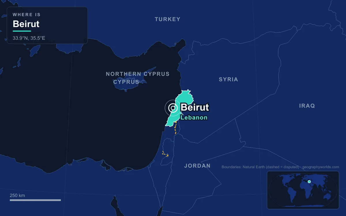
Beirut is the capital and largest city of Lebanon, set on a small peninsula halfway along the country’s Mediterranean coast. Greater Beirut had about 2.4 million people in 2025, just under half of Lebanon’s population, crowded into a strip of coast between the sea and the Lebanon Mountains. The city has been inhabited for more than 5,000 years, and nearly everything about it is best understood by comparison: a tiny municipality against a huge metropolis, a wet winter against a bone-dry summer, a Christian east against a Muslim west, a Roman law school against a rebuilt glass downtown.
18 Square Kilometres Holding Half of Lebanon
The Beirut Governorate, which is the city proper, covers only about 18 square kilometres. The metropolitan area stretches to roughly 67 square kilometres, running along the coast and up the lower slopes behind it. Lebanon as a whole measures 10,452 square kilometres, so the capital’s urban core occupies well under one percent of the national territory while housing close to half of its people. The city spills far beyond it into suburbs such as Burj Hammoud, Sin el Fil and Hazmiyeh to the east and Haret Hreik, Ghobeiry and Chiyah to the south.
Nobody knows the exact figure. Lebanon has not held a population census since 1932, because the balance between religious communities underpins the country’s confessional political system and a count would be politically explosive. Published estimates for Beirut therefore range from about 939,000 for the city as high as 2.2 million for Greater Beirut, while the 2025 figure of 2.4 million covers the wider metropolitan sprawl. Lebanon as a whole has a population of more than five million.
Density is the everyday consequence. Concrete roofs cover about 80 percent of the capital’s area, and the city has just two main public gardens, Sanayeh and Horsh Beirut, the pine forest near the hippodrome. Administratively the city is split into 12 quarters, including Achrafieh, Ras Beirut, Mazraa, Medawar, Saifi and the Port, and those are subdivided into 59 sectors.

Beirut Against Tripoli, 81 Kilometres Up the Coast
Lebanon’s second city, Tripoli, lies 81 kilometres north of Beirut and is the capital of the North Governorate. For centuries it was Beirut’s equal in trade and commerce. Tripoli holds the largest Crusader castle in Lebanon, the Citadel of Tripoli, and the second-highest concentration of Mamluk architecture anywhere after Cairo.
The balance tipped in the 19th and 20th centuries. After Ibrahim Pasha of Egypt took Acre in 1832, Beirut began to revive from a low point when it had shrunk to a town of about 10,000 people. In 1888 the Ottomans made it the capital of the Vilayet of Beirut, a province that stretched from Latakia to Acre and included Tripoli itself. French engineers built a modern harbour in 1894, and a railway reached Damascus and Aleppo in 1907. When Lebanon became independent in 1943, Beirut became its capital.
Tripoli’s decline was sealed by a border. The 1948 breakup of the customs union between Syria and Lebanon cut it off from the Syrian hinterland that had fed its trade, while Beirut, with the central bank, the stock exchange, the national airline and the only commercial airport, pulled further ahead. Tripoli regained a little of its old role after August 2020, when damage to the Port of Beirut forced cargo to be redirected to smaller harbours at Tripoli and Tyre.
730 Millimetres of Rain and a Summer Without Any
Beirut has a hot-summer Mediterranean climate, and the contrast between its seasons is sharper than the mild temperatures suggest. At Beirut International Airport the average annual rainfall is about 730 millimetres, spread over roughly 62 days, yet almost all of it falls between October and April. January averages 154 millimetres and December 141, while July receives 0.3 millimetres and August none at all.
Temperatures swing less. The January mean is about 14.0°C and the August mean about 27.8°C, with August afternoons averaging around 30.7°C. The sea keeps winters mild enough that frost has never been recorded in the city, though the airport’s record high reached 40.4°C in July. Snow is essentially unknown at sea level, but the mountainous eastern suburbs climb high enough to see it, a few kilometres from beaches where it never freezes.
East Beirut and West Beirut Across the Old Green Line
The city sits on two hills, Achrafieh in the east and Musaytibah in the west, and between them runs its deepest social contrast. Before 1975 Beirut’s neighbourhoods were fairly mixed. During the Lebanese Civil War, which lasted from 1975 to 1990, the city split into a mainly Muslim west and a mainly Christian east, and the old commercial downtown between them became a no man’s land known as the Green Line. About 60,000 people died in the first two years of the war alone.
The fighting fell unevenly on each side. In 1978 Syrian forces shelled Achrafieh, the main Christian district, for about three months in what became known as the Hundred Days’ War. In 1982 most of West Beirut was besieged by Israeli troops, and in 1983 bombings of the American and French barracks killed 241 American and 58 French servicemen. Fighting between rival factions in 1989 and 1990 destroyed parts of East Beirut.
The religious map today still reflects that division. East Beirut is mainly Christian with a small Muslim minority; West Beirut has a Sunni majority with Shia, Christian and Druze minorities; the southern suburbs are predominantly Shia. Across the city as a whole, estimates put Christians at about 40 percent and Muslims at about 59 percent. The figures a century earlier tell a very different story: the 1911 Encyclopaedia Britannica counted about 77,000 Christians, 36,000 Muslims, 2,500 Jews, 400 Druze and 4,100 foreigners in a city of roughly 120,000. For more on how these communities share power, see this guide to religion in Lebanon.
Language cuts across the old line in a way religion does not. Researchers at the American University of Beirut found that trilingualism in Lebanese Arabic, French and English is normal among residents of every sect and neighbourhood. The university itself is a marker of that mix: it opened on 3 December 1866 as the Syrian Protestant College with a class of 16 students, took its present name in 1920, and has taught in English since 1887.
Roman Berytus Under the Solidere Downtown
Beirut’s oldest and newest layers sit on the same ground. The name comes from the Phoenician word for “wells”, a reference to the site’s accessible water, and it first appears in the Amarna letters of the 14th century BC, written by a king of Biruta to the pharaoh of Egypt. The Phoenician city was destroyed in 140 BC by Diodotus Tryphon during a Seleucid succession war, and the Roman general Pompey took the rebuilt town in 64 BC.
Under Rome, Berytus became a colony in 14 BC with full Italian rights, which exempted its citizens from imperial taxation, and it was settled by veterans of two legions. It was the most Latin-speaking city in the region, and its law school became one of the most respected in the empire. The jurists Papinian and Ulpian taught there, and in AD 533 Emperor Justinian recognised it as one of three official law schools. An earthquake in 551 ruined the city, killing some 30,000 people by some estimates, and the school moved to Sidon.
That buried city resurfaced only after the civil war. When reconstruction of the wrecked centre began, salvage excavations from 1993 onwards uncovered bath complexes, colonnaded streets, a circus and a theatre, along with Phoenician, Hellenistic, Byzantine, Crusader and Ottoman layers. The reconstruction itself was handed to Solidere, a company founded in 1994 by Prime Minister Rafic Hariri. The Beirut Central District it rebuilt covers about 4.69 million square metres, with more than 60 gardens and squares and the rebuilt Beirut Souks, home to over 200 stores along the old Hellenistic street grid.

The project remains contested. Critics argue that many expropriations were made at undervalued rates, partly paid in company shares, and that demolitions in the 1980s and early 1990s destroyed some of the last Ottoman and medieval buildings in the city. Parts of the rebuilt centre, including the area around Nejmeh Square where parliament sits, are often empty because of heavy security. Its landmarks sit side by side: the Mohammad Al-Amin Mosque, whose foundation was laid in 2002 and which opened in 2008, stands beside the Maronite Cathedral of Saint George, and Hariri, assassinated in 2005, is buried next to the mosque.
The Port of Beirut Before and After 4 August 2020
The port made modern Beirut. The Ottomans granted it to a French company in 1887, and in the 19th century silk exports to Europe, much of it carried on French ships to Marseille, turned a small town into a trading city. Before 2020, about 60 percent of Lebanon’s imports came through it, according to an S&P Global estimate, and Beirut had become the region’s banking centre, receiving much of the Gulf’s oil money from the 1960s.
On 4 August 2020, ammonium nitrate that had been confiscated and stored at the port exploded. More than 200 people were killed, more than 6,500 were injured, and as many as 300,000 were left homeless. Prime Minister Hassan Diab announced his government’s resignation six days later. The port’s grain silos, which had absorbed part of the blast, were ordered demolished in April 2022, and the last of their northern block collapsed on 4 August 2022, exactly two years after the explosion.
The disaster struck a city already in crisis. A financial crisis had become fully apparent in August 2019, and in June 2021 the World Bank warned that Lebanon’s economic crisis risked becoming one of the three most severe anywhere since the mid-19th century. Yet Beirut still hosts the central bank, the headquarters of Middle East Airlines, and the UN Economic and Social Commission for Western Asia, and it remains rated a Beta-minus world city.
Sea Level to Snowline: Beirut and Mount Lebanon
The final contrast is vertical. Beirut sits almost at sea level, its coast a mix of rocky beaches, sandy shores and cliffs, with the Corniche running past the Raouché cliffs and the sea stacks of Pigeons’ Rock. Directly behind it the Lebanon Mountains rise steeply, and the metropolitan area has climbed up their lower slopes. Rafic Hariri International Airport, opened on 23 April 1954 and renamed in 2005, is the country’s only commercial airport, so almost every air traveller bound for the mountains, the Bekaa Valley or the Roman temples at Baalbek passes through the capital first. How a country so small packs in coast, peaks and valleys is laid out in this overview of Lebanon’s geography.
Quick Facts About Beirut
- Country: Lebanon
- Continent: Asia (Middle East)
- Country population: approximately 5.9 million
- Capital city status: Beirut is the capital of Lebanon, the seat of national government, and the location of foreign embassies, parliament, and the head of state's official residence.
Frequently Asked Questions
What is the capital of Lebanon?
The capital of Lebanon is Beirut. Beirut is the seat of national government, hosts most foreign embassies and consulates, and is typically where the head of state and parliament are located.
What continent is Beirut in?
Beirut, the capital of Lebanon, is located in Asia, in the Middle East region. As Lebanon's capital, Beirut serves as the country's primary connection to the broader Asian political, economic, and cultural sphere.
Why is Beirut the capital of Lebanon?
Beirut was chosen as the capital of Lebanon for reasons that typically combine geography, history, and politics. Capital city selections often reflect a desire for centrality (being accessible from across the country), historical importance (being a longstanding seat of government or culture), or neutrality (being acceptable to multiple regions or ethnic groups within the country). The specific reasons for Beirut's designation are detailed in the city's history above.
What is Beirut known for?
As the capital of Lebanon, Beirut is best known for housing the country's central government institutions — parliament, presidential or royal residences, supreme court, and key ministries. It is also typically a major cultural and economic center within Lebanon, hosting national museums, embassies, and signature monuments. The introduction and history sections above provide detailed coverage of the city's specific notable institutions and landmarks.
Related Pages
- Lebanon Country Guide — full geography, climate, economy, and culture overview
- Flag of Lebanon — meaning, history, and design of Lebanon's national flag