

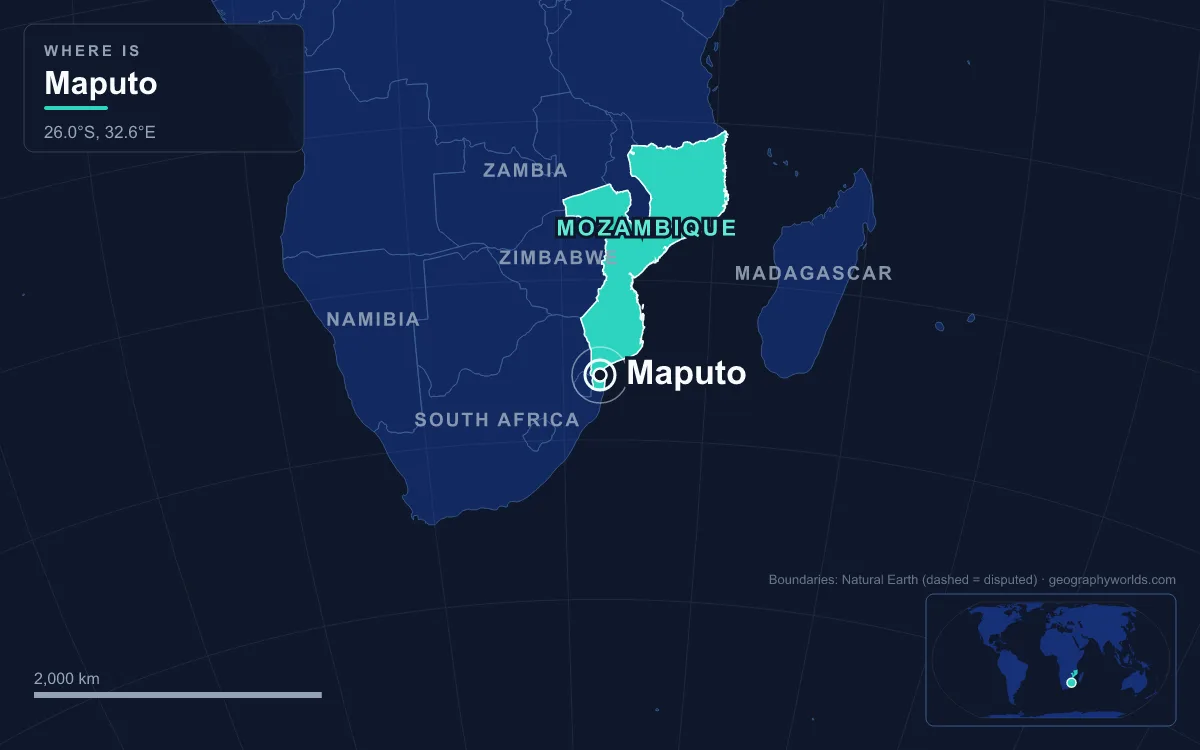
Mozambique's capital, Maputo, sits on the west shore of Maputo Bay in the far south of the country. It is about 120 kilometres from the South African border and 80 kilometres from Eswatini. The 2017 census counted 1,088,449 people in the city, and about 2.7 million in the metropolitan area that includes Matola. It is Mozambique's largest city, its main port and the seat of government. It has held the role since 1898, when it was still called Lourenço Marques and was growing fast as the nearest seaport to the Transvaal gold fields. Most things about the city look different once you set them against the rest of the country, so this guide uses numbers and comparisons: area, population, distance, weather, bridges and cargo.
346 Square Kilometres Out of 801,537
Mozambique covers about 801,537 square kilometres, which makes it the 35th-largest country in the world. The municipality of Maputo covers about 346. The capital therefore takes up less than a twentieth of one percent of the national territory, yet it is a province in its own right. Since 1998 Maputo City has been run separately from the surrounding Maputo Province, and it is both the smallest and the most densely populated of Mozambique's provinces. With just over a million people on about 347 square kilometres, it averages roughly 3,100 residents per square kilometre.
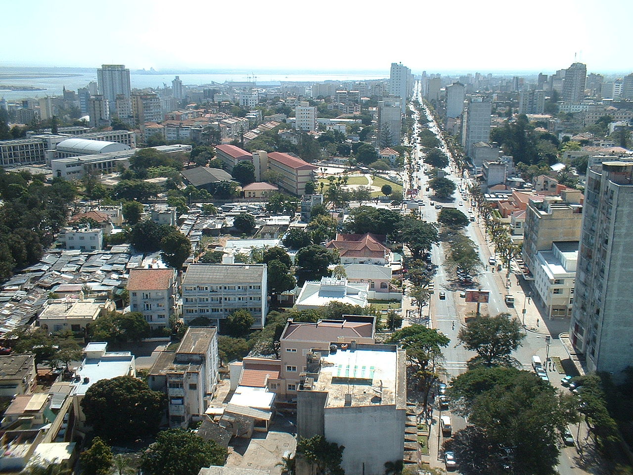
That small area contains very different kinds of city. The centre is a planned grid of square blocks and wide avenues lined with jacaranda and acacia trees. That is where the city gets its old nicknames, City of Acacias and Pearl of the Indian Ocean. Outside the grid are the bairros, the neighbourhoods that make up the city's seven administrative divisions. Many of them grew informally, with poor drainage and roads. The municipality also includes KaTembe on the far side of the bay. Until 2018 the direct link was a ferry carrying about 20 vehicles per trip; the only road route was a long detour inland through Boane.
Maputo Versus Matola: 1,088,449 Against 1,032,197
The capital's closest rival is right next door. Matola, directly to the west, is the capital of Maputo Province and has had its own elected council since 1998. At the 2017 census it had 1,032,197 residents, up from 671,556 in 2007. The capital counted 1,088,449 in the same census, a lead of only about 56,000. Growing that fast, Matola may overtake Maputo, and some sources already describe it as the most populous city in the country. Together the two form a single urban area of about 2.7 million people.
The two cities split the work. Maputo holds the ministries, the banks and the universities, including Eduardo Mondlane University, the oldest in the country. Matola is the country's biggest industrial area. It has a mineral port handling chrome and iron from Eswatini and South Africa, cement and soap factories, an aluminium smelter opened in 2002 that more than doubled Mozambique's GDP, and a Hyundai assembly plant opened in 2014. The rest of the urban system is far smaller. Nampula, the biggest northern city, had 743,125 people in 2017, and the central port of Beira had about 530,600 in 2019.
Lourenço Marques Against the Island of Mozambique
For centuries the capital was at the other end of the country. The Island of Mozambique, a small island off the northern coast in today's Nampula Province, was the seat of Portuguese East Africa until 1898. It even gave the country its name. Today it has about 14,000 permanent residents and is a UNESCO World Heritage Site. By the 1890s it was a long way from where the money was.
Maputo started out much smaller. The Portuguese named the bay area after Lourenço Marques, a navigator sent to explore it in 1544. Their early forts and trading posts there were repeatedly abandoned. The present town dates from around 1850 and grew around a fortress completed in 1787. In 1871 a visitor described narrow streets, grass huts, decayed forts and a rusty cannon. Britain also claimed the bay, and on 24 July 1875 the French President, Patrice de MacMahon, ruled in Portugal's favour. Lourenço Marques became a town in 1876 and a city in 1887.
Gold made it matter. The Witwatersrand gold rush began in 1886, and Lourenço Marques was the closest seaport for exporting South African gold. When the railway to Pretoria opened in 1895, the town's population grew fast. In 1898 the capital moved south from the island, whose fortunes had waned since the opening of the Suez Canal. After independence on 25 June 1975, the city was renamed Maputo in February 1976. The name came from the Maputo River on the South African border, which FRELIMO had used in its slogan for a united country "from the Rovuma to the Maputo".
From the Rovuma to the Maputo: A Capital at One End
That slogan also shows how awkward the capital's position is. Mozambique's coast runs for about 2,300 kilometres, from 26°52′S at the South African frontier to 10°40′S at the Rovuma River and the Tanzanian border. Maputo is in the bottom corner of that coast, close to two foreign borders. Most of the country lies far to the north, and the Zambezi splits it in two. Since October 2017 an Islamist insurgency has been fought in Cabo Delgado, the northernmost coastal province, on the Tanzanian border and about as far from the capital as the country reaches.
Maputo's closeness to South Africa also shapes its economy. Three railway lines end in the city: the Pretoria–Maputo line, the Goba line to Eswatini and the Limpopo line to Zimbabwe. Before 1975, thousands of tourists from South Africa and Rhodesia came for the beaches, hotels and casinos. The port was built largely to serve that inland traffic, and it still does. The city once had its own rails in the streets as well. An electric tramway opened in February 1904, one of the first in Africa, running from the central railway station to the municipal building. It closed in 1936, and bits of track still show through the asphalt on Avenida 24 de Julho.
January at 26.8 °C, July at 18.8 °C
Maputo has a tropical savanna climate. It is only just wet enough, at 829.6 millimetres of rain a year, to avoid being classed as semi-arid. The annual mean temperature is 22.8 °C. January is the warmest month, with a mean of 26.8 °C, and July the coolest at 18.8 °C. Most of the rain falls in the southern-hemisphere summer, and winter is dry and mild. Compared with inland capitals on the plateau, such as Harare at about 18 °C, Maputo is markedly warmer, and its low shoreline leaves it vulnerable to cyclones and flooding.
Being on the coast brings risks as well. The 2022 IPCC report named Maputo among twelve major African cities expected to be hit hardest by sea-level rise. Poverty and crowding in the bairros make them the most vulnerable parts of the city. One study estimated that by 2050 the city's climate could resemble that of Goiânia in Brazil today, with the annual average 1.8 °C higher.
A 680-Metre Span to KaTembe
The city's biggest recent structure crosses its own bay. The Maputo–Katembe bridge opened on 10 November 2018 and replaced the ferry as the main link to the southern shore. It is 3,041 metres long in total, and the deck is 60 metres above the water. Between its two 141-metre pylons is a clear span of 680 metres, with no supports standing in the shipping channel. That made it the longest suspension bridge in Africa, taking the title from the Matadi Bridge in the Democratic Republic of the Congo, built in 1983. China Road and Bridge Corporation built it, largely with Chinese Exim Bank loans.

The bridge had been discussed for decades. A World Bank-funded urban plan for Maputo included one as early as 1989, modelled loosely on Lisbon's 25 de Abril bridge over the Tagus. Portugal was expected to pay for it after a 2010 visit by Prime Minister José Sócrates, but its own debt crisis ruled that out. Financing was agreed with China after President Armando Guebuza visited Beijing in August 2011, and building began in 2014.
The project also built 129 kilometres of road from KaTembe to Ponta do Ouro on the South African border. That turned the bridge into part of a coastal route south, as well as a new way for the city to spread onto the undeveloped far shore.
17 Million Tonnes in the Early 1970s, 50 Million Planned for 2030
The port is the reason the city exists, and its figures show how far it fell and how far it plans to go. At its colonial peak in the early 1970s the port handled about 17 million tonnes of cargo a year. The civil war of 1977 to 1992 cut that to barely a million tonnes by 1988. Since 2003 it has been run by the Maputo Port Development Company, a joint venture of Grindrod and DP World, under a concession running to 2030. Dredging of the approach channel, finished in 2010, lets Panamax ships dock. The plan is for 50 million tonnes a year by 2030, with up to 25 trains and 1,500 trucks a day, and more than 500 million US dollars of investment.
The port is the terminal for the Goba, Limpopo and Ressano Garcia lines, carrying goods from South Africa, Eswatini and Zimbabwe, and in 2023 it handled record volumes, much of it from South African mines avoiding congested ports at Richards Bay and Durban. For the other cities that compete with Maputo along this coast, from Beira to Pemba, see our list of the largest cities in Mozambique, or read the wider Mozambique country guide to see how far the country stretches beyond its southern corner.
Quick Facts About Maputo
- Country: Mozambique
- Continent: Africa (Southern Africa)
- Country population: approximately 36.6 million
- Capital city status: Maputo is the capital of Mozambique, the seat of national government, and the location of foreign embassies, parliament, and the head of state's official residence.
Frequently Asked Questions
What is the capital of Mozambique?
The capital of Mozambique is Maputo. Maputo is the seat of national government, hosts most foreign embassies and consulates, and is typically where the head of state and parliament are located.
What continent is Maputo in?
Maputo, the capital of Mozambique, is located in Africa, in the Southern Africa region. As Mozambique's capital, Maputo serves as the country's primary connection to the broader African political, economic, and cultural sphere.
Why is Maputo the capital of Mozambique?
Maputo was chosen as the capital of Mozambique for reasons that typically combine geography, history, and politics. Capital city selections often reflect a desire for centrality (being accessible from across the country), historical importance (being a longstanding seat of government or culture), or neutrality (being acceptable to multiple regions or ethnic groups within the country). The specific reasons for Maputo's designation are detailed in the city's history above.
What is Maputo known for?
As the capital of Mozambique, Maputo is best known for housing the country's central government institutions — parliament, presidential or royal residences, supreme court, and key ministries. It is also typically a major cultural and economic center within Mozambique, hosting national museums, embassies, and signature monuments. The introduction and history sections above provide detailed coverage of the city's specific notable institutions and landmarks.
Related Pages
- Mozambique Country Guide — full geography, climate, economy, and culture overview
- Flag of Mozambique — meaning, history, and design of Mozambique's national flag