

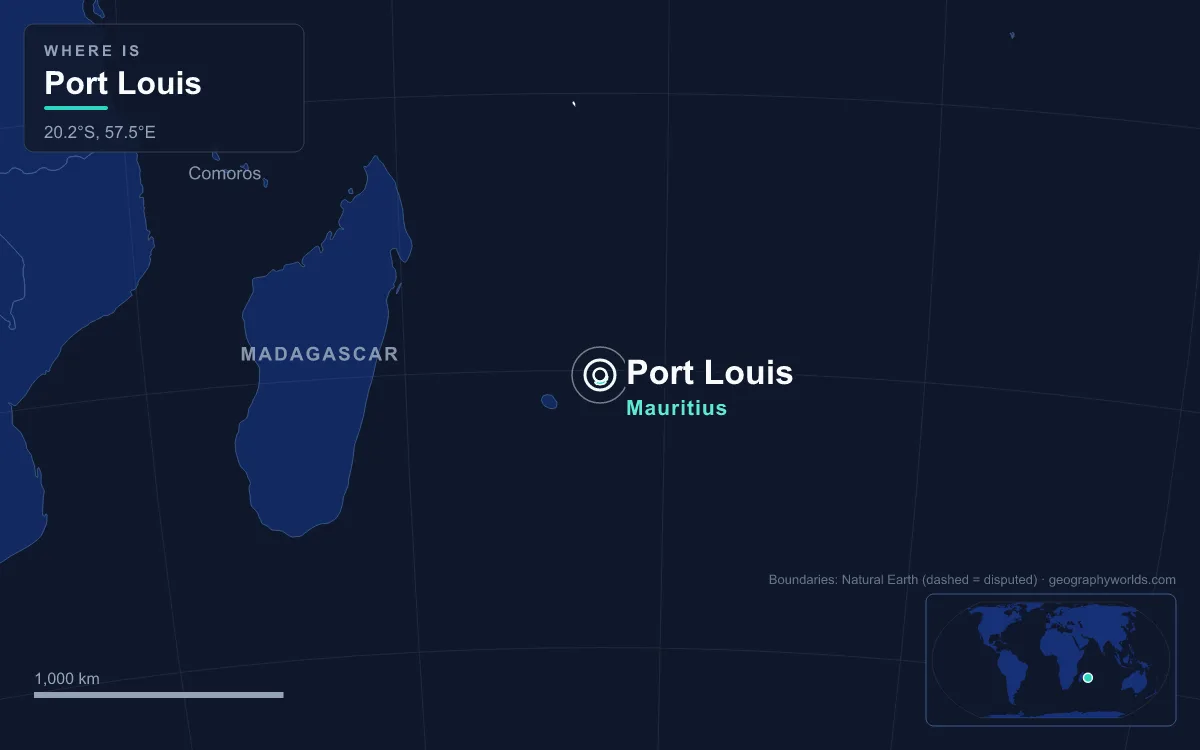
The capital of Mauritius is Port Louis, a harbour city on the north-west coast of the main island, held in a bowl of mountains that open onto the Indian Ocean. The 2018 census counted 147,066 people there, making it the country's most populous city as well as its political and financial centre. Its defining feature is the harbour itself: Port Louis grew up because the Moka Range sheltered this bay from cyclone winds, and it is still the only official port of entry for ships arriving in Mauritius. The city is compact enough to walk in a morning, and nearly every street corner carries a piece of the island's Dutch, French, British, African, Indian and Chinese past.
Le Caudan Waterfront: A Saltpan on a Coral Islet
A walk through Port Louis starts best at the water. Le Caudan Waterfront, today a strip of shops, cinemas, a marina and the Le Labourdonnais hotel, takes its name from Jean Dominique Michel de Caudan, a settler from Languedoc who started a saltpan beside a small bay here in 1726. The peninsula itself formed around a fossil coral islet, and over some 250 years it held a powder magazine, an astronomical and meteorological observatory, quays and warehouses. For about 150 years its daily rhythm followed the sugar harvest, with sacks carried by hand, train and truck onto waiting ships, until the Bulk Sugar Terminal took over the trade in 1980.
The waterfront's quietest corner is the Blue Penny Museum, opened in November 2001. It holds the 1847 Blue Penny and Red Penny, among the rarest postage stamps in the world, which a consortium of Mauritian firms led by the Mauritius Commercial Bank bought in 1993 for about US$2 million and brought home after almost 150 years abroad. The originals are lit only briefly to protect them. The museum also keeps Prosper d'Épinay's 1881 statue of Paul and Virginie, the lovers of Bernardin de Saint-Pierre's novel set on the island.
The harbour behind the museum is why any of this exists. The Dutch used the bay from 1606 and called it the Harbour of Tortoises. When the French took the island in 1715 and renamed it Isle de France, they chose this spot for both the main harbour and the island's fort because the Moka Range shielded it from storm winds. In 1736 it became the administrative centre, named in honour of King Louis XV.
Aapravasi Ghat, Where Half a Million Labourers Landed
A short walk around the harbour, on the east side of the sheltered bay of Trou Fanfaron, stand the remains of Aapravasi Ghat, the Immigration Depot. After Britain abolished slavery in the 1830s, planters turned to indentured workers, and Mauritius became the first British colony to receive them on a large scale. Between 1849 and 1923 about half a million Indian indentured labourers passed through this depot on their way to plantations in Mauritius and across the British Empire. Roughly 68 percent of Mauritians today have Indian ancestry, and this spot is where many of their family stories begin.

Unchecked building work in the mid-20th century left only partial remains of three stone buildings from the original complex. Those fragments are protected as a national monument, and UNESCO listed the site as a World Heritage Site in 2006, one of two in Mauritius alongside Le Morne Brabant. Conservators are working to return the fragile structures to their 1860s condition.
Place d'Armes and Government House
Turn inland from the harbour and the city's ceremonial axis opens up. Place d'Armes, the square that links the waterfront with the old administrative buildings, is still recognisable in the Mauritian artist Raouf Oderuth’s scene of the 1930s waterfront, although the carts have given way to traffic jams and glass office blocks. At its head stands Government House, first built in 1729 and rebuilt in 1910, and on the square itself a statue of Bertrand-François Mahé de La Bourdonnais, unveiled in 1859. He arrived as governor in 1735 and turned Port Louis into a naval base and shipbuilding centre, a halt where French ships sailing between Europe and Asia around the Cape of Good Hope could refit and take on supplies. The Line Barracks, the Casernes Centrales, was also begun under his rule, in 1740, and inaugurated in 1774.
The same streets carry the story of the transfer of power. British forces took the island in December 1810, and the port kept its value to London as a base for controlling the Indian Ocean. The city council was founded in 1830 and today has 32 members, four from each of eight wards, who elect a Lord Mayor. Close by is the Natural History Museum, the oldest museum in Mauritius, in a building erected in 1880; its best-known gallery is devoted to the dodo. A short walk away is the five-tier Port Louis Theatre, where travelling European troupes gave the island its first opera performances in the 19th century.
Central Market and the Chinatown Friendship Gate
North-east of Place d'Armes the grid tightens into narrow, mostly one-way commercial streets. The Central Market was a favourite haunt of the writer and painter Malcolm de Chazal. Just east of it, a large "friendship" gate marks the entrance to Chinatown, one of several Chinatowns in Africa. It was the traditional home of the Chinese community, dominated by descendants of Hakka migrants who first reached Mauritius in 1826. The Chinese Chamber of Commerce, founded in 1908 and said to be second only to Singapore's as the world's oldest, runs a food and cultural festival here each April or May. Old shophouses and pagodas face the towers of the business district across the street.
Those towers show how far the modern city has moved from its colonial layout. The Bank of Mauritius Tower, the headquarters of the central bank, reached its full height in May 2006 in an area where high-rises had once been banned, and it now looms over the old fortress on the hill behind it.
Up to Fort Adelaide on Citadel Hill
The steepest part of the walk climbs to Fort Adelaide, a stone fortress on the rise now called Citadel hill. Its origins lie in a political crisis. In 1832 the procureur-general moved to abolish slavery without compensating slave owners, provoking open discontent among the planters. The government ordered residents to hand in their weapons and built the stone fort in the middle of the city to quell any uprising; it was completed in 1838. Slavery was abolished gradually after 1833, and the planters eventually received £2 million in compensation.
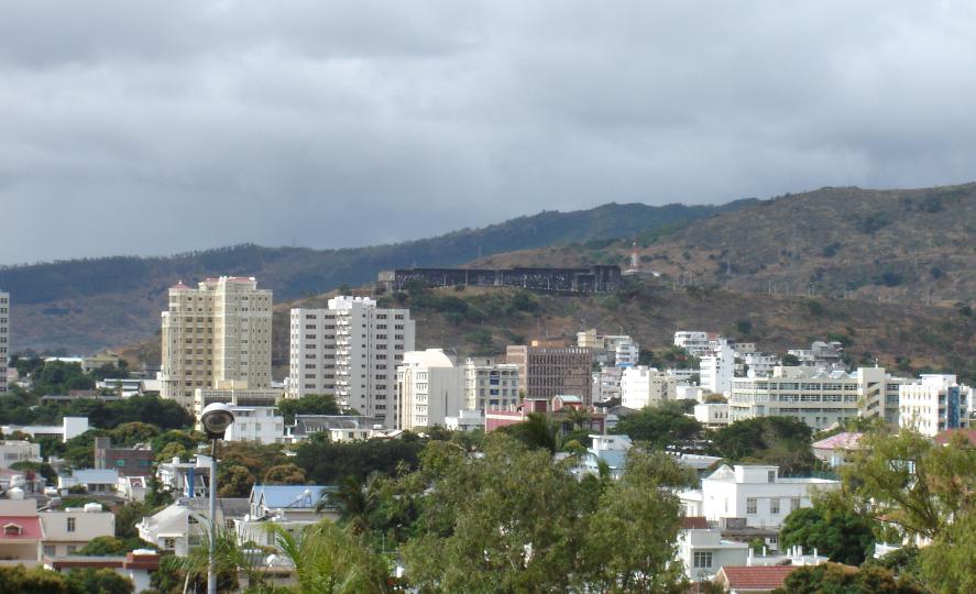
From the ramparts the whole city reads like a map. The harbour and its three terminals spread out below, the grid of the old French town runs down to the quays, and the peaks of the Moka Range rise behind the city. The thumb-shaped peak of Le Pouce, at 812 metres the third-highest mountain in Mauritius, is plainly visible; Charles Darwin climbed it on 2 May 1836 during the voyage of the Beagle.
Champ de Mars, Where Mauritius Became Independent
Inland from the business district lies the Champ de Mars, an oval racecourse that doubles as the city's great open space. The Mauritius Turf Club, founded in 1812 by the colonial official Edward Alured Draper, inaugurated the track on 25 June that year; it is the oldest horse-racing club in the Southern Hemisphere. The right-handed circuit is just 1,298 metres around, with a 225-metre home straight that runs uphill, and on race days from late March to early December it draws tens of thousands of spectators.
The ground also carries the country's political memory. On 12 March 1968 the flag of independent Mauritius was raised here, with Sir Seewoosagur Ramgoolam as the first prime minister, and for many years afterwards independence was celebrated on the same field. The run-up had been tense: in January 1968, six weeks before independence, riots in Port Louis killed 25 people.
Beyond the Old Grid: Port Terminals, Metro Express and Ébène
The walk ends back where it began, at the harbour that still drives the economy. The port's fortunes rose and fell with world shipping. Calls dropped sharply after the Suez Canal opened in 1869, recovered during the canal's closure from 1967, and were secured by modernisation in the late 1970s. Today it has three terminals, including a container terminal with 14-metre-deep berths and a bulk sugar terminal that can store 175,000 tonnes. In 2010 more than 2,200 ships called, and by 2019 container capacity had reached one million TEU. The Christian Decotter cruise terminal, opened in 2010, was the first in the Indian Ocean able to take the largest cruise ships afloat.
Getting in and out of the city is its daily struggle. Port Louis houses 24 government ministries in narrow colonial streets, and commuters pour in each morning through two bus stations, Victoria Station for the south and east and Immigration Square for the north. To ease the pressure, office work has been spreading to the Ébène tower complex to the south, and the Metro Express light rail opened from Port Louis to Rose Hill in January 2020, reaching Curepipe in October 2022. Its route climbs towards the cooler Central Plateau, where a significant part of the population had moved in the late 19th century to escape the malaria that once plagued the coast; a malaria outbreak struck Port Louis in 1867, and Mauritius was declared malaria-free only in 1973.
A morning on foot here covers most of the island's history, but the capital is only one corner of it; our guide to the island of Mauritius follows the coast and plateau beyond the city, and the story of the Indian Ocean trade routes explains why ships kept coming to this sheltered bay in the first place.
Quick Facts About Port Louis
- Country: Mauritius
- Continent: Africa (East Africa)
- Country population: approximately 1.3 million
- Capital city status: Port Louis is the capital of Mauritius, the seat of national government, and the location of foreign embassies, parliament, and the head of state's official residence.
Frequently Asked Questions
What is the capital of Mauritius?
The capital of Mauritius is Port Louis. Port Louis is the seat of national government, hosts most foreign embassies and consulates, and is typically where the head of state and parliament are located.
What continent is Port Louis in?
Port Louis, the capital of Mauritius, is located in Africa, in the East Africa region. As Mauritius's capital, Port Louis serves as the country's primary connection to the broader African political, economic, and cultural sphere.
Why is Port Louis the capital of Mauritius?
Port Louis was chosen as the capital of Mauritius for reasons that typically combine geography, history, and politics. Capital city selections often reflect a desire for centrality (being accessible from across the country), historical importance (being a longstanding seat of government or culture), or neutrality (being acceptable to multiple regions or ethnic groups within the country). The specific reasons for Port Louis's designation are detailed in the city's history above.
What is Port Louis known for?
As the capital of Mauritius, Port Louis is best known for housing the country's central government institutions — parliament, presidential or royal residences, supreme court, and key ministries. It is also typically a major cultural and economic center within Mauritius, hosting national museums, embassies, and signature monuments. The introduction and history sections above provide detailed coverage of the city's specific notable institutions and landmarks.
Related Pages
- Mauritius Country Guide — full geography, climate, economy, and culture overview
- Flag of Mauritius — meaning, history, and design of Mauritius's national flag