

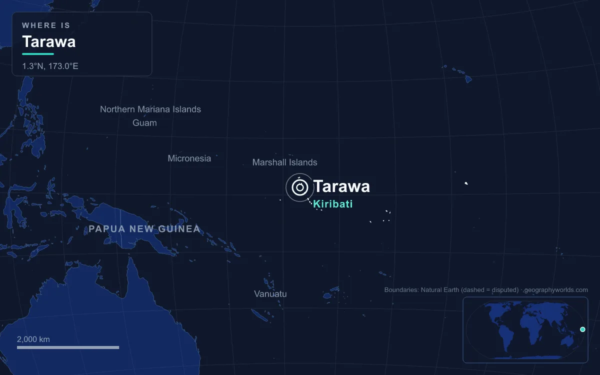
South Tarawa is the capital of Kiribati: a chain of low coral islets on the southern rim of Tarawa Atoll in the central Pacific, joined by causeways into a single strip of land running from Betio in the west to Bonriki and Tanaea in the northeast. At the 2020 census it held 63,439 people, 52.9 per cent of the national population of 119,940, on a strip averaging only 450 metres wide and mostly less than 3 metres above sea level. Its defining feature is crowding. Excluding the airport runway, the water reserve and swampy reclaimed land, South Tarawa has just over 10 square kilometres of usable ground, giving it a density close to that of London. The city was made by people arriving from elsewhere: outer-island families, colonial officials, soldiers of two empires, missionaries, copra traders and seafarers. This is the story of those groups.
Kain Tarawa: The Families Who Own the Land
Before any government arrived, Tarawa belonged to its own people, the kain Tarawa, and in large part it still does. Most land on South Tarawa is owned by the original families. The name Tarawa is an old Gilbertese form of te rawa, “the passage”, after the broad ship channel into the lagoon; in the mythology of Kiribati, the spider-god Nareau separated Karawa, the sky, from Marawa, the sea, and Tarawa, the land. The atoll is central to that mythology, though ordinary life on its southern islets differed little from life elsewhere in the Gilberts until the colonial era.
The first European description came from Thomas Gilbert, captain of the East India Company ship Charlotte, who sighted the atoll on 20 June 1788, did not land, and named it Matthew Island after the ship’s owner. More than a century later, in 1895, the British chose Tarawa as the seat of government for the Protectorate of the Gilbert and Ellice Islands. That decision set up the tension that still governs the city: an administration needing land, on an atoll where land was held by lineages. In the main centres of Betio, Bairiki and Bikenibeu the government holds large areas on long-term lease, but elsewhere newcomers without family land or government housing often become squatters, and land disputes are common.
From the Outer Islands to Betio: Migration Since 1978
The largest group in South Tarawa today is made up of I-Kiribati who came, or whose parents came, from the other islands of the Gilbert group. Until recently most of the country lived in outer-island villages of 50 to 3,000 people, in houses of coconut and pandanus, fishing and cutting copra. The pull of wage jobs, schools, the hospital and government offices changed that. At the 1978 census South Tarawa had 17,921 residents, mostly concentrated in Betio, Bairiki and Bikenibeu. By 2015 the figure was 56,388, and by 2020 it was 63,439, more than three and a half times the level of 1978.
Those newcomers fitted themselves in by living in larger households rather than taller buildings. Multi-storey buildings are rare; the average household holds 7.3 people on a small plot. Betio, the largest township, packed 17,356 people onto 1.54 square kilometres in 2015. Crowding has consequences that residents feel daily: water from the protected freshwater lenses at Bonriki and Buota, with a combined sustainable yield of about 1,300 cubic metres a day, reaches each village for around two hours every two days, and Betio in particular has high rates of respiratory infection, diarrhoea and dysentery. Anote Tong’s government tried to ease the pressure by building services on the outer islands, such as the South Kiribati Hospital, and encouraging families to stay or return.
The islets are now effectively one continuous settlement, run by two councils created in 1972 by the colonial governor John Hilary Smith: the Betio Town Council, and the Teinainano Urban Council, which covers everything from Bairiki to Tanaea. Teinainano means “down of the mast”, a reference to the sail shape of the atoll.
Gilbertese Speakers and the Legacy of Hiram Bingham II
Whatever island their families came from, almost everyone in South Tarawa speaks Gilbertese, taetae ni Kiribati, an Austronesian language of the Micronesian branch of Oceanic. The country’s name is itself a Gilbertese rendering of “Gilberts”, the name Russian admiral Adam von Krusenstern gave the islands around 1820 in honour of Thomas Gilbert. When the country became independent on 12 July 1979 it chose Kiribati over the indigenous name Tungaru, because the new state also included Banaba and the Phoenix and Line Islands.
The language became a written one through mission work. Traders, whalers and Chinese merchants frequented the islands from the 1820s, but it was Hiram Bingham II of the American Board of Commissioners for Foreign Missions, who arrived on Abaiang, the atoll immediately north of Tarawa, in 1857, who gave Gilbertese the written form used today and was the first to translate the Bible into it. English is the other language of government, and the language of the University of the South Pacific campus at Teaoraereke.
Maneaba and Church: How South Tarawa Gathers
The city’s traditional seat of public life is the maneaba, the meeting house. A traditional maneaba is a tall roof of coconut timber resting on coral supports, lashed with coconut-fibre string and thatched with pandanus, built by the whole community; every element has a symbolic as well as a practical meaning. The national parliament carries the name: the House of Assembly is the Maneaba ni Maungatabu, “maneaba of the sacred mountain”, sitting at Ambo since October 2000 after two decades at Bairiki.

Churches have become the other great organisers of city life, and they increasingly build maneabas of their own in South Tarawa for their congregations. According to 2020 government figures, Christians make up about 96 per cent of the population. Catholics are the largest group and are concentrated in the northern islands, while Protestants dominate the south, so a crowded capital drawing on both regions has become a meeting point for the two traditions. Their headquarters are spread along the road: the Roman Catholic diocese at Teaoraereke, the Kiribati Uniting Church, renamed in 2015, at Antebuka, the Bahá’í National Spiritual Assembly at Bikenibeu and the Church of Jesus Christ of Latter-day Saints at Eita.
Betio in November 1943: Garrison, Labourers and Marines
The most violent arrivals came during the Second World War. Japanese forces attacked the island in December 1941 and occupied it the following year. In October 1942, after an American air raid, the Japanese executed 17 New Zealand coastwatchers who had been captured in the Gilberts and imprisoned at Tarawa. The garrison of about 4,500 defenders fortified the islet, which then covered only 118 hectares, using some 1,200 Korean labourers brought to Tarawa to build the defences. Only 129 of those Koreans survived what followed.
On 20 November 1943 the US 2nd Marine Division landed on Betio in Operation Galvanic. In four days of fighting, to 23 November, nearly 6,400 Japanese, Koreans and Americans died, most of them on or around that one small islet. Bunkers, guns and the hulk of a ship used as a Japanese machine-gun post still lie along the shore, and the recovery of the dead continues: in March 2019 the remains of 30 US servicemen were found on Betio. The war also displaced the colony’s capital. The headquarters had been on Ocean Island, now Banaba, from 1906 to 1942, moved to Funafuti during the Japanese occupation, and returned to Tarawa only in 1946.
Copra Workers, Seafarers and the Marine Training Centre of 1967
After the war Betio became the country’s workshop. It is the main port, and the copra cut on the outer islands is shipped there and processed into coconut oil for export and other products sold locally; a fish-processing plant prepares tuna for export. Cash work is scarce, though: in 2010 only 34 per cent of urban adults were engaged in it, and most households depend on government jobs and on money sent home by relatives abroad.

Many of those relatives are at sea. In 1967 the Marine Training Centre opened on Betio, founded with the German shipping line Hamburg Süd after one of its captains reported on the skill of Gilbertese seamen; it still trains I-Kiribati crews for merchant ships, and circular labour migration, by seafarers, agricultural workers and urban service workers, has become one of the country’s main sources of income. The diaspora follows the same routes: its largest and still-growing community is probably in New Zealand, with others in Australia, and older resettled communities on Ghizo and Wagina in the Solomon Islands.
Banabans, Tuvaluans and Diplomats: Tarawa’s Other Communities
Two neighbouring peoples once shared Tarawa’s government and then left it. The Ellice Islanders asked to separate from the colony in 1974; the split took effect on 1 January 1976, and the Ellice Islands became independent Tuvalu in 1978, though the meeting-house word, maneapa, still links the two. The Banabans of Ocean Island, whose phosphate was mined from 1900 to 1979, were moved by the British after 1945 to Rabi Island in Fiji, bought with mining royalties. Their descendants keep one seat in the Maneaba ni Maungatabu, the only member who is not elected.
The newest arrivals are diplomatic. The High Commissions of Australia and New Zealand and the embassy of China sit in Bairiki. Kiribati recognised Taipei rather than Beijing between 2003 and 2019, and resumed relations with the People’s Republic on 27 September 2019. Their presence, a short walk from the State House, is a reminder of how much outside powers value a capital of 63,439 people spread along a strip of coral. For how that strip formed and why it is so vulnerable, see our guide to what an atoll is; for the rest of the country, from Banaba to the Line Islands, read the Kiribati country guide, or compare South Tarawa with its former colonial partner in our profile of Funafuti, the capital of Tuvalu.
Quick Facts About Tarawa
- Country: Kiribati
- Continent: Oceania
- Country population: approximately 138 thousand
- Capital city status: Tarawa is the capital of Kiribati, the seat of national government, and the location of foreign embassies, parliament, and the head of state's official residence.
Frequently Asked Questions
What is the capital of Kiribati?
The capital of Kiribati is Tarawa. Tarawa is the seat of national government, hosts most foreign embassies and consulates, and is typically where the head of state and parliament are located.
What continent is Tarawa in?
Tarawa, the capital of Kiribati, is located in Oceania. As Kiribati's capital, Tarawa serves as the country's primary connection to the broader Oceanian political, economic, and cultural sphere.
Why is Tarawa the capital of Kiribati?
Tarawa was chosen as the capital of Kiribati for reasons that typically combine geography, history, and politics. Capital city selections often reflect a desire for centrality (being accessible from across the country), historical importance (being a longstanding seat of government or culture), or neutrality (being acceptable to multiple regions or ethnic groups within the country). The specific reasons for Tarawa's designation are detailed in the city's history above.
What is Tarawa known for?
As the capital of Kiribati, Tarawa is best known for housing the country's central government institutions — parliament, presidential or royal residences, supreme court, and key ministries. It is also typically a major cultural and economic center within Kiribati, hosting national museums, embassies, and signature monuments. The introduction and history sections above provide detailed coverage of the city's specific notable institutions and landmarks.
Related Pages
- Kiribati Country Guide — full geography, climate, economy, and culture overview
- Flag of Kiribati — meaning, history, and design of Kiribati's national flag