
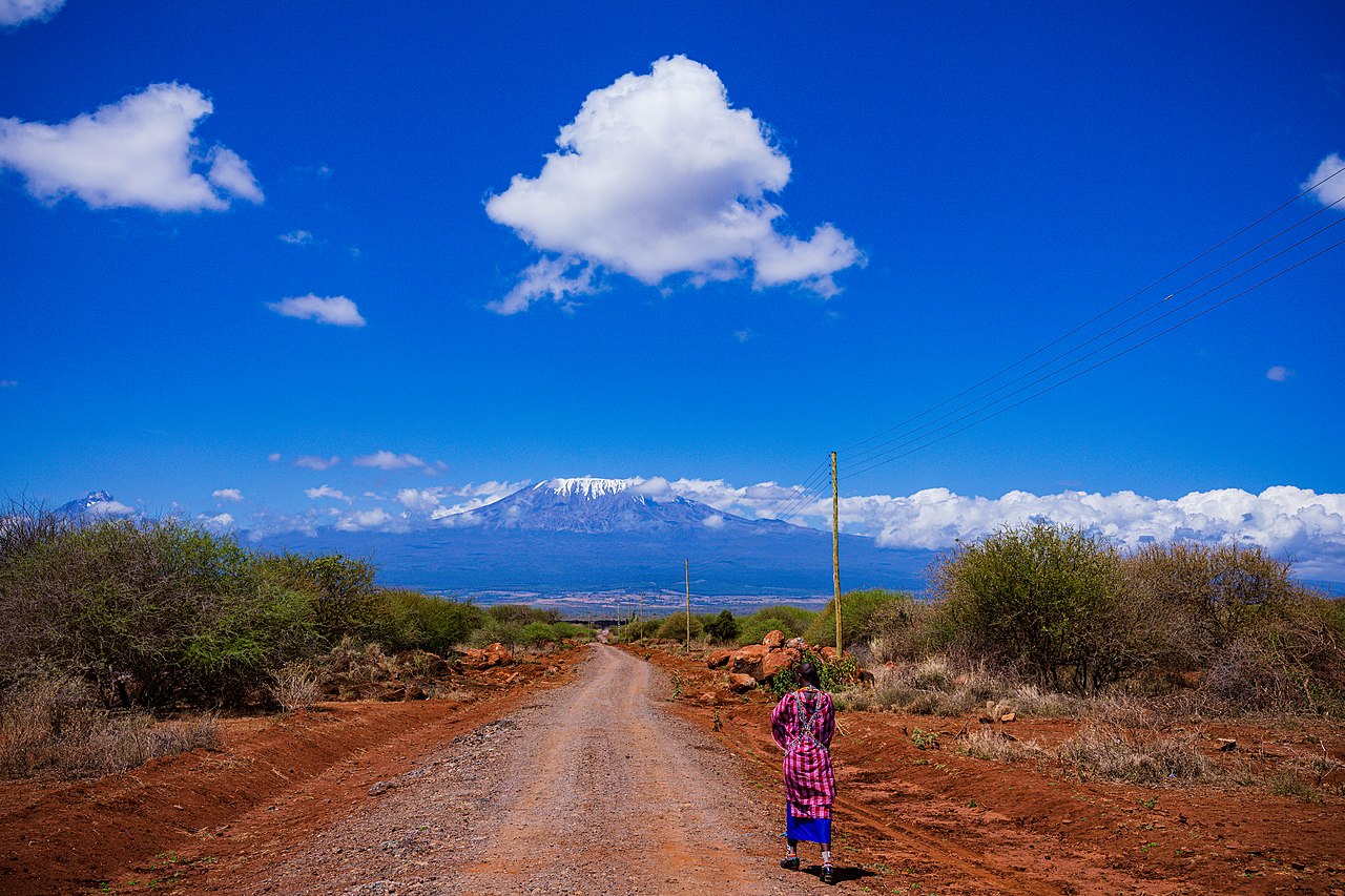
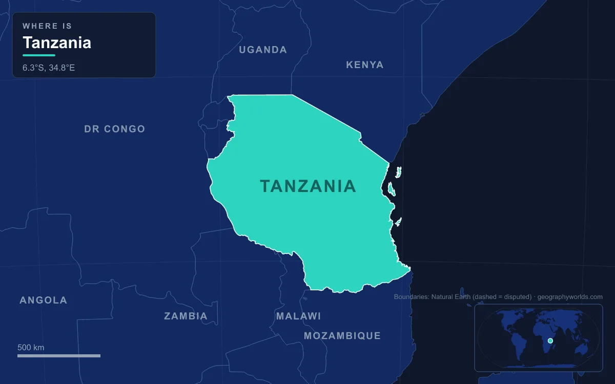
Mount Kilimanjaro, at 5,895 m the highest point in Africa, stands in Tanzania, the East African country of 947,300 km² that lies between Kenya and Mozambique on the Indian Ocean and includes the islands of Zanzibar and Mafia. Behind a coastline 1,424 km long, most of the mainland is a high central plateau, broken in the north and south by highlands and crossed by both branches of the East African Rift. Three of Africa's great lakes touch its borders: Victoria in the north, Tanganyika in the west and Nyasa (Lake Malawi) in the south. The Rufiji, about 600 km long, is the largest river wholly inside the country; others include the Pangani, Wami and Ruvu, and the Ruvuma, which forms the Mozambique border. About 67.5 million people lived there in 2024. The clearest way to read the country is region by region, from the coast inland.
The Swahili Coast, Zanzibar and the Rufiji Delta
The coastal belt is a low plain of mangroves, tidal flats and coral shores. Dar es Salaam, founded in the mid-1860s by Sultan Majid of Zanzibar near a fishing village called Mzizima, grew into the country's largest city and main port; with more than 7 million people it is the largest city in East Africa. Offshore lies the Zanzibar archipelago, a semi-autonomous part of Tanzania. Its main island, Unguja, is a low, hilly island about 85 km long and 30 km wide, covering roughly 1,666 km², with Pemba about 59 km to its north. Said bin Sultan, Sultan of Muscat and Oman, moved his capital from Muscat to Stone Town in 1832 or 1840 (sources differ), and the old quarter grew from that trading role.
About 200 km south of Dar es Salaam, the Rufiji reaches the sea opposite Mafia Island through a delta that holds the largest mangrove forest in eastern Africa. The river forms where the Kilombero and Luwegu meet, gains the Great Ruaha as its main tributary, and drains a basin of 177,429 km². In 2025 Tanzania completed the Julius Nyerere Hydropower Station at Stiegler's Gorge on the Rufiji, a 134 m concrete arch dam with 2,115 MW of capacity and a reservoir of about 1,200 km², the largest power station in East Africa. The gorge is named after a German engineer who surveyed it in 1901 and was killed there by an elephant in 1907.
The Eastern Arc Chain from the Pare to the Udzungwa Mountains
Inland from the coast rises a broken crescent of ancient ranges called the Eastern Arc. From northeast to southwest they include the North and South Pare, the East and West Usambara, the Nguru, Ukaguru and Uluguru mountains, and the Rubeho, Udzungwa and Mahenge ranges. They are the oldest mountains in East Africa, raised at least 100 million years ago along a fault east of the much younger rift. Around 10 million years ago a cooler, drier climate turned the surrounding lowland forest into savanna, leaving each range as a forest island watered by moist winds from the Indian Ocean. Isolation produced high endemism: 75 vertebrate species live nowhere else, and the Eastern Arc is counted among the world's top 20 biodiversity hotspots.

Kilimanjaro and Mount Meru in the Northern Volcanic Highlands
At the northern end of the Eastern Arc the ancient rock gives way to young volcanoes. Kilimanjaro is a dormant stratovolcano formed over two million years ago, rising about 4,900 m above its plateau base to Uhuru Peak on the Kibo summit, which makes it the highest free-standing mountain in the world. The German missionary Johannes Rebmann was the first European to report it, in 1848, and Hans Meyer reached the highest summit in 1889. Its southern and eastern slopes were home to the Chagga kingdoms, and the mountain became a national park in 1973. Kilimanjaro holds the largest glaciers in Africa, but more than 80 percent of its ice cap was lost during the 20th century.
Seventy kilometres to the west stands Mount Meru, at 4,562 m the second-highest mountain in Tanzania, rising directly above the city of Arusha. Meru lost much of its height in a summit collapse about 7,800 years ago, which left a caldera 3.5 km wide, and it last had a minor eruption in 1910. Its forested slopes form the centre of Arusha National Park.
Lake Natron, Ol Doinyo Lengai and the Ngorongoro Crater in the Gregory Rift
West of Kilimanjaro, the land drops into the Gregory Rift, the eastern arm of the East African Rift. Its floor holds a string of salt lakes with no outlet to the sea: Natron in the north, Manyara to the south and Eyasi to the southwest. Lake Natron, which crosses into Kenya at its northern tip, is less than 3 m deep and up to 57 km long. Mineral-rich hot springs feed it, evaporation has left deposits of natron and trona, and the water's alkalinity can exceed pH 12, and air temperatures often exceed 40 °C.
Sixteen kilometres south of the lake rises Ol Doinyo Lengai, the Maasai "Mountain of God", a steep cone standing more than 1,800 m above the rift floor. It is the only volcano on Earth known to erupt natrocarbonatite, an unusually cool and fluid lava, and its eruptions in 2007 and 2008 affected the surrounding area.

On the western shoulder of the rift lie the Crater Highlands, whose Ngorongoro volcanic group is made up of eight extinct volcanoes. Its best-known caldera, Ngorongoro, formed when a volcano estimated at 4,500 to 5,800 m high erupted and collapsed on itself two to three million years ago. The result is described as the world's largest inactive, intact and unfilled volcanic caldera: 610 m deep, with a floor of 260 km² at about 1,800 m above sea level and a seasonal soda lake, Magadi, at its centre. In the plains to its west, inside the same conservation area, lies Olduvai Gorge, where fossils show that hominins occupied the area at least 1.75 million years ago.
The Serengeti Plains and the Lake Victoria Basin
Beyond the Crater Highlands the ground flattens into the Serengeti, a region of grassland, woodland and rocky outcrops called kopjes that spans the Mara and Arusha regions and continues into Kenya. Its protected areas cover about 30,000 km², and every year millions of wildebeest, zebras and gazelles move in a great circuit between Serengeti National Park, the Ngorongoro area and Kenya's Maasai Mara. Serengeti National Park was established in 1940, and in 1959 its eastern part was split off as the Ngorongoro Conservation Area.
North-westward, the plains slope down to Lake Victoria, which Tanzania shares with Uganda and Kenya. At 59,947 km² it is Africa's largest lake and the world's largest tropical lake, but it is shallow, averaging 40 m and reaching only about 81 m, and geologically young at roughly 400,000 years old. Tanzania holds 49 percent of its surface, about 33,700 km². Most of northern Tanzania drains into it, and so into the Nile. The explorer John Hanning Speke named it after Queen Victoria in 1858, and the introduced Nile perch has since driven many of its native cichlid species to extinction.
Dodoma and the Miombo Woodlands of the Central Plateau
The heart of Tanzania is a broad plateau, part of the larger East African Plateau. The northern part is farmland and holds Dodoma, the national capital, 453 km west of Dar es Salaam. The government decided in 1974 to move the capital there to place it at the centre of the country; the move became official in 1996, and Dodoma had 765,179 people at the 2022 census. Parts of the interior have a hot semi-arid climate, and rainfall here comes in a single long wet season from about October to April or May, unlike the north and east of the country, which get two rainy seasons, the short vuli rains of October to December and the long masika rains of March to May. Flooding in the rainy season and periodic drought are its main hazards.
The southern half of the plateau is miombo woodland, much of it inside the huge Selous protected area, through which the Rufiji flows toward the sea.
Lake Tanganyika and the Western Rift around Kigoma
Tanzania's western border runs down the Albertine Rift, the western branch of the East African Rift, and along Lake Tanganyika. The lake is a true rift trough: 676 km long, the longest freshwater lake in the world, averaging 50 km wide, with a maximum depth of 1,471 m, second only to Lake Baikal. Its central basin began to form 9 to 12 million years ago, and it holds about 18,750 km³ of water, some 16 percent of the world's available fresh water. Tanzania holds 46 percent of the surface, the Democratic Republic of the Congo 40 percent, with Burundi and Zambia sharing the rest. It drains west through the Lukuga River into the Congo, so western Tanzania belongs to the Atlantic drainage. The Malagarasi, Tanzania's second-largest river, enters from the east, and the port of Kigoma stands on its eastern shore.

Lake Rukwa, to the southeast in west-central Tanzania, is another basin with no outlet, and the flat country between the lakes is miombo woodland.
The Southern Highlands, the Kitulo Plateau and Lake Nyasa
In the southwest the plateau rises again into the Southern Highlands around the northern end of Lake Nyasa, with Mbeya as the largest city. Here, at about 2,600 m between the Kipengere and Poroto ranges, the Kitulo Plateau carries montane grassland with some 350 plant species, including many ground orchids, that flower from November to April. Kitulo National Park, announced in 2002 and gazetted in 2005 across 412.9 km², was the first national park in tropical Africa created mainly to protect plants; locals call the plateau the "Garden of God".
Below the highlands lies Lake Nyasa, the Tanzanian name for Lake Malawi. It covers about 29,600 km², reaches 706 m deep and holds at least 700 species of cichlid, more fish species than any other lake. It drains south through the Shire River to the Zambezi. The boundary on the lake is disputed. Tanzania holds that the border runs through the middle of the lake; Malawi claims the whole surface outside Mozambique's portion, including the water along Tanzania's shore, and currently administers it. Both countries cite the Heligoland Treaty of 1890 between Britain and Germany, and the question has resurfaced at intervals since 1967, most recently over oil exploration in 2012.
Taken region by region, Tanzania is a set of highland islands and rift troughs set into a vast plateau. For more on the country's summit, see our complete guide to Mount Kilimanjaro; the geography of Lake Tanganyika explores the western rift lake in detail, and the plateau capital is covered in Dodoma, Tanzania's capital.