

Geographers group the world’s natural vegetation into a handful of broad types, each set mainly by temperature and rainfall: tropical rainforest (evergreen, multi-layered forest where every month is wet, as in the Amazon), tropical savanna (grassland with scattered trees and a long dry season, as on the Serengeti), desert and xeric scrub (cacti, succulents and drought-proof shrubs, as in the Sonoran Desert), temperate broadleaf and mixed forest (trees that drop their leaves in winter, as at Białowieża in Poland and Belarus), temperate grassland (prairie and steppe), Mediterranean scrub, boreal coniferous forest or taiga (pine, spruce and larch across Siberia and Canada) and tundra (mosses, lichens and dwarf shrubs on frozen ground, as on Russia’s Yamal Peninsula). Mountains add montane belts that repeat these types with altitude.
The idea that climate sorts plants this way was formalised by the American botanist Leslie Holdridge in 1947, who classified “life zones” by the effects of temperature and rainfall on vegetation, and simplified by the ecologist Robert Whittaker into a diagram of biomes plotted against just those two variables. Soil, fire and grazing animals then fine-tune the picture, as the six places below show, travelling from the equator to the Arctic.
The Amazon Basin: Evergreen Rainforest Where Every Month Is Wet
The Amazon basin covers about 7 million km² of South America, and about 6 million km² of it is rainforest: over half of all the rainforest left on Earth, spread across nine countries, with 60% in Brazil, 13% in Peru and 10% in Colombia. An estimated 390 billion trees of about 16,000 species grow there.
A true tropical rainforest needs two conditions. Mean monthly temperatures stay above 18 °C all year, and every month has at least 60 mm of rain, so there is no dry season to make trees shed their leaves. Annual rainfall is no less than 1,680 mm and usually 1,750 to 3,000 mm; Manaus, in the heart of the Brazilian Amazon, receives around 2,300 mm. With water and warmth never limiting, the competition is for light, and the forest stacks itself into layers. A few emergent trees rise to 45–55 m. Below them the main canopy, usually 30–45 m high, forms a closed roof hung with orchids, bromeliads and mosses. Only about 5% of sunlight reaches the understory, and only 2% the forest floor, which is why the ground under mature rainforest is surprisingly open.
The richness above ground hides poor soil. Rainforest soils are typically acidic and nutrient-poor, because so much rain leaches soluble nutrients out of them. The forest is also changing: Amazon sediment records show that during the last glacial maximum, around 21,000 years ago, rainfall in the basin was lower and moist tropical vegetation covered less of it than today, and in 2019 Brazil recorded 72,843 fires, more than half of them in the Amazon region.
The Serengeti Plains: Savanna Held Open by Grazing and Fire
Move away from the equator into a climate with a long dry season, and forest gives way to savanna. The Serengeti of northern Tanzania and south-western Kenya, with about 30,000 km² under protection, lies between 920 and 1,850 m above sea level with mean temperatures of 15–25 °C. Rain comes in two seasons, March to May and a shorter one in October and November, and amounts vary from about 508 mm a year in the rain shadow of the Ngorongoro highlands to 1,200 mm on the shores of Lake Victoria.

That rainfall gradient shows up in the plants. The driest south-east is short-grass plain, where wildebeest give birth to around 500,000 calves in two or three weeks each February. Further north and west come acacia woodlands, and in the far north-west, the wettest part, broadleaved Terminalia–Combretum woodland takes over, a change caused by different underlying geology.
Climate alone does not keep the Serengeti open, though. Its recent history is an experiment in what holds savanna in place. After the Maasai, who had moved onto the plains in the early 1800s, were resettled around the Ngorongoro Crater in the twentieth century, poaching and the absence of the fires people had set let dense woodland and thicket spread over the next 30 to 50 years. By the mid-1970s wildebeest and buffalo had recovered and were cropping the grass so hard that fires had less fuel, and acacia began to re-establish. Savanna, in other words, is a balance between grass, trees, grazing and fire, and it shifts whenever one of them changes.
Arizona’s Sonoran Desert: Saguaro and Creosote on 300 mm of Rain or Less
The Sonoran Desert covers about 260,000 km² of Arizona, California and the Mexican states of Sonora, Baja California and Baja California Sur. In its lowest parts, rain is irregular and often under 90 mm a year; the Arizona uplands around Tucson receive 100–300 mm. Unlike the neighbouring Mojave, the Sonoran gets rain in two seasons, winter storms and summer monsoon downpours, and that double supply gives it more plant species than any other desert in the world.
Desert vegetation is defined by how it handles drought. Creosote bush and bur sage dominate the valley floors. Up the gravel slopes come velvet mesquite, palo verde, desert ironwood and spindly ocotillo. And on the uplands stands the saguaro, a cactus found wild only in the Sonoran Desert, which can grow to over 12 m tall and routinely lives 150 to 200 years.

The saguaro shows almost every desert adaptation in one plant. A root network spreading up to 30 m catches rain quickly, and the stem visibly expands as it stores the water. Like other cacti it uses crassulacean acid metabolism, opening its pores only at night to cut water loss. Growth is painfully slow: a saguaro may take 20 to 50 years to reach 1 m and 75 to 100 years to grow its first arm. Seedlings depend on “nurse plants” such as palo verde, which can cut summer highs beneath them by as much as 18 °C and, more importantly, soften winter frosts.
Białowieża Forest: One of Europe’s Last Primeval Lowland Woods
An immense primeval forest once stretched across the European Plain. Białowieża Forest, straddling the border between Poland and Belarus, is one of the last and largest surviving parts of it. Its World Heritage site covers about 1,419 km². Its core was declared a national reserve in 1921, and most of the forest became a national park in 1932 to protect a reintroduced herd of European bison.
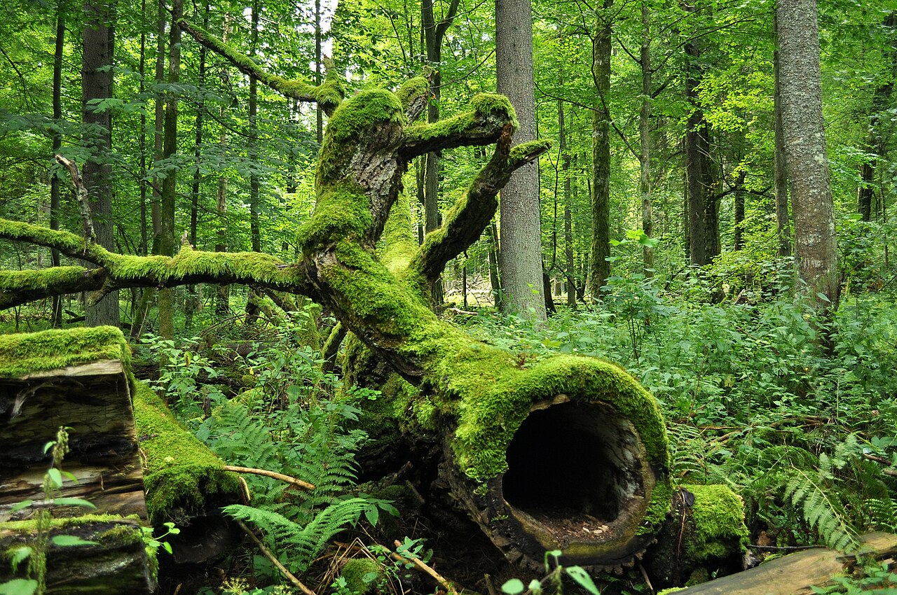
Temperate forests grow where there is enough rain for trees all year but a cold winter that halts growth. Broadleaf trees respond by being deciduous: they lose all their leaves for part of the year, with leaf fall in autumn and leaf-out in spring triggered by a combination of daylight and air temperature. The forest is layered like a rainforest but more simply: a canopy of mature trees 30 to 61 m tall, a sub-canopy of younger trees waiting for a gap, a shrub layer and, usually the most diverse, a ground layer of herbs. Białowieża is a mixed forest: an inventory in the 1840s found pine on two-thirds of its area, spruce on a fifth and oak on about a thirteenth. Its giant pedunculate oaks have names; the Great Mamamuszi measured 690 cm round and 34 m tall in 2005. The forest is also home to more than 800 European bison, Europe’s heaviest land animal.
Eastern Siberia: Larch Taiga on Permafrost
North of the temperate forests lies the taiga, or boreal forest, which covers about 17 million km², 11.5% of Earth’s land, with its largest areas in Russia and Canada. It exists in its current form only since the end of the last ice age about 12,000 years ago. The tree mix changes with the climate: North America’s taiga is mostly spruce, Scandinavia’s a mix of spruce, pine and birch, and eastern Siberia’s a vast forest of larch.
Taiga winters are long and dominant, with typical winter days around −20 °C; in Siberia the coldest month averages anywhere from −6 °C to −50 °C. Summers with daily means of 10 °C or more last only one to three months. Boreal plants have a lower temperature threshold for growth than most, and some sources give about 130 days as a typical growing season. In the coldest parts of eastern Siberia, permafrost is continuous and restricts growth to very shallow-rooted trees such as larch. Larch is unusual: a deciduous conifer that sheds its needles every year. Larches are among the dominant trees in the boreal forests of both Siberia and Canada, making Larix the most abundant genus of trees on Earth. Our guide to the taiga and boreal forest follows the belt right around the Northern Hemisphere.
The Yamal Peninsula: Tundra Where Trees Stop
Where the growing season falls to about 50 to 70 days and the warmest month averages 10 °C or less, the taiga thins out and gives way to tundra. On the Yamal Peninsula of north-west Siberia, which extends about 700 km between the Kara Sea and the Gulf of Ob and whose name means “End of the Land” in the language of the Nenets reindeer herders who live there, the land is permafrost tundra. Arctic tundra is a polar desert, receiving only about 150–250 mm of precipitation a year, and winter averages around −28 °C.
Trees cannot root in soil frozen from 25 to 90 cm down, so tundra vegetation hugs the ground: dwarf shrubs, sedges, grasses, mosses and lichens such as reindeer lichen, with berries like crowberry, lingonberry and blueberry. Winds often blow at 50–100 km/h, so there is little reward for growing tall. Because meltwater cannot drain through the frozen ground, summer turns the flat tundra into a patchwork of lakes and marshes that attract millions of migrating birds. The biodiversity is low, about 1,700 species of vascular plants across the Arctic tundra, but the soil holds vast stores of carbon in the permafrost.
Set side by side, the six places line up almost exactly along the two axes Holdridge and Whittaker used, warmth and water, and the same logic explains the zones in between, from the grasslands and scrub of the mid-latitudes to the treeless tops of mountains, where the tundra’s climate returns at altitude.