
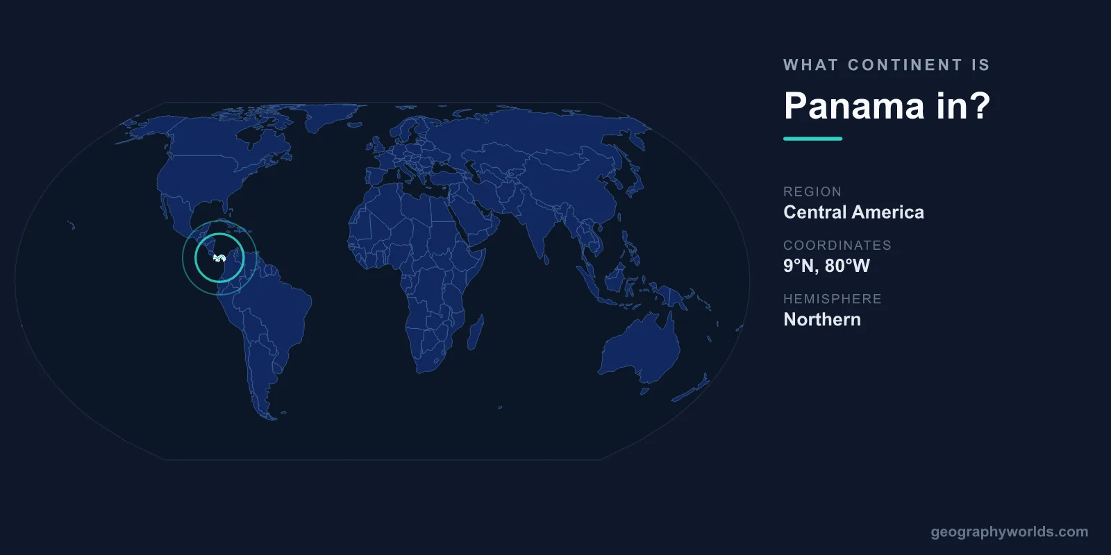
Panama is located in North America, specifically at the southern end of the Central American isthmus. In the seven-continent model used across most English-speaking countries, Central America is treated as a region of North America rather than a continent in its own right. That places Panama firmly on the North American side of the line, even though it sits closer to the equator and shares a border with South America's Colombia.
North America, Not South America
Panama occupies the narrow strip of land that joins the two American continents. Its territory covers roughly 75,417 km², making it one of the smaller nations in the region. To the west it borders Costa Rica, and to the east it meets Colombia, the only South American country it touches by land.
The boundary between North and South America is conventionally drawn along the Panama-Colombia border. Everything from that border northward, including the whole of Panama, belongs to North America. So while Panama is the southernmost country in Central America, it remains North American by continental classification. Its capital, Panama City, sits on the Pacific coast and is one of Latin America's most important commercial hubs.
What Central America Actually Is
Central America is the tapering land bridge running from Mexico's southern edge down to Colombia. It includes seven countries: Guatemala, Belize, Honduras, El Salvador, Nicaragua, Costa Rica, and Panama. Geographers describe it as a subregion of North America rather than a separate landmass, because it sits on or near the North American tectonic plate and was historically connected to the northern continent.
The formation of this isthmus around three million years ago was one of the most consequential geological events in Earth's history. By closing the gap between the oceans, it allowed animals to migrate between North and South America in an event known as the Great American Biotic Interchange, and it reshaped global ocean currents and climate.
Why People Get Confused
Several things make Panama's continent a surprisingly common question. First, it borders Colombia, a South American country, which leads many people to assume Panama must also be South American. Second, Panama lies far south on the map, sharing latitudes with northern South America, so it does not "feel" like North America the way Canada or the United States does.
Continental models differ around the world, too. In many Latin American, Spanish-speaking, and European countries, students learn a model where all of "America" is a single continent, so the North-versus-South question never comes up the way it does in English-language education. A few systems even split the Americas at the Panama Canal rather than the Colombian border. These competing conventions are the real source of the confusion, not any genuine ambiguity about where Panama physically sits.
A Country Defined by the Canal
Panama's geography is dominated by the Panama Canal, the artificial waterway completed in 1914 that links the Atlantic and Pacific Oceans. At the country's narrowest point the land is only about 80 km wide, which is exactly why engineers chose it for the crossing. The canal stretches roughly 82 km and uses a system of locks to lift ships about 26 meters above sea level before lowering them on the far side.
Because of its hourglass shape, Panama has coastlines on both the Caribbean Sea, part of the Atlantic, and the Pacific Ocean, totaling around 2,490 km. The country's S-shaped orientation produces a famous curiosity: in places you can watch the sun rise over the Pacific and set over the Atlantic. Inland, the terrain rises to Volcán Barú at 3,475 meters, Panama's highest point and an active volcano in the west near Costa Rica.
Climate and Position
Sitting between roughly 7 and 9 degrees north of the equator, Panama has a tropical maritime climate with consistently warm temperatures and a pronounced wet and dry season rather than the four temperate seasons of higher latitudes. Dense rainforest covers much of the country, and Panama City is often cited as the only national capital with a protected tropical rainforest, Metropolitan Natural Park, within its limits. This equatorial position reinforces why Panama can feel more like northern South America even though it is, by every standard classification, a North American nation. For more on the country, see our panama country guide.
Frequently Asked Questions
Is Panama in North America or Central America?
Both descriptions are correct and not contradictory. Panama is in Central America, which is itself a subregion of the North American continent. So Panama is a Central American country located on the North American continent.
Does Panama border South America?
Yes. Panama shares its eastern land border with Colombia, a South American country. This border is generally treated as the dividing line between North and South America, with Panama on the northern side.
Why isn't Panama considered part of South America?
The conventional continental boundary runs along the Panama-Colombia border, placing Panama in North America. Geologically, Central America is associated with the North American region, even though it physically connects the two continents.
What continent is the Panama Canal on?
The Panama Canal lies entirely within Panama, so it is on the North American continent. It cuts across the Central American isthmus to connect the Atlantic and Pacific Oceans.