
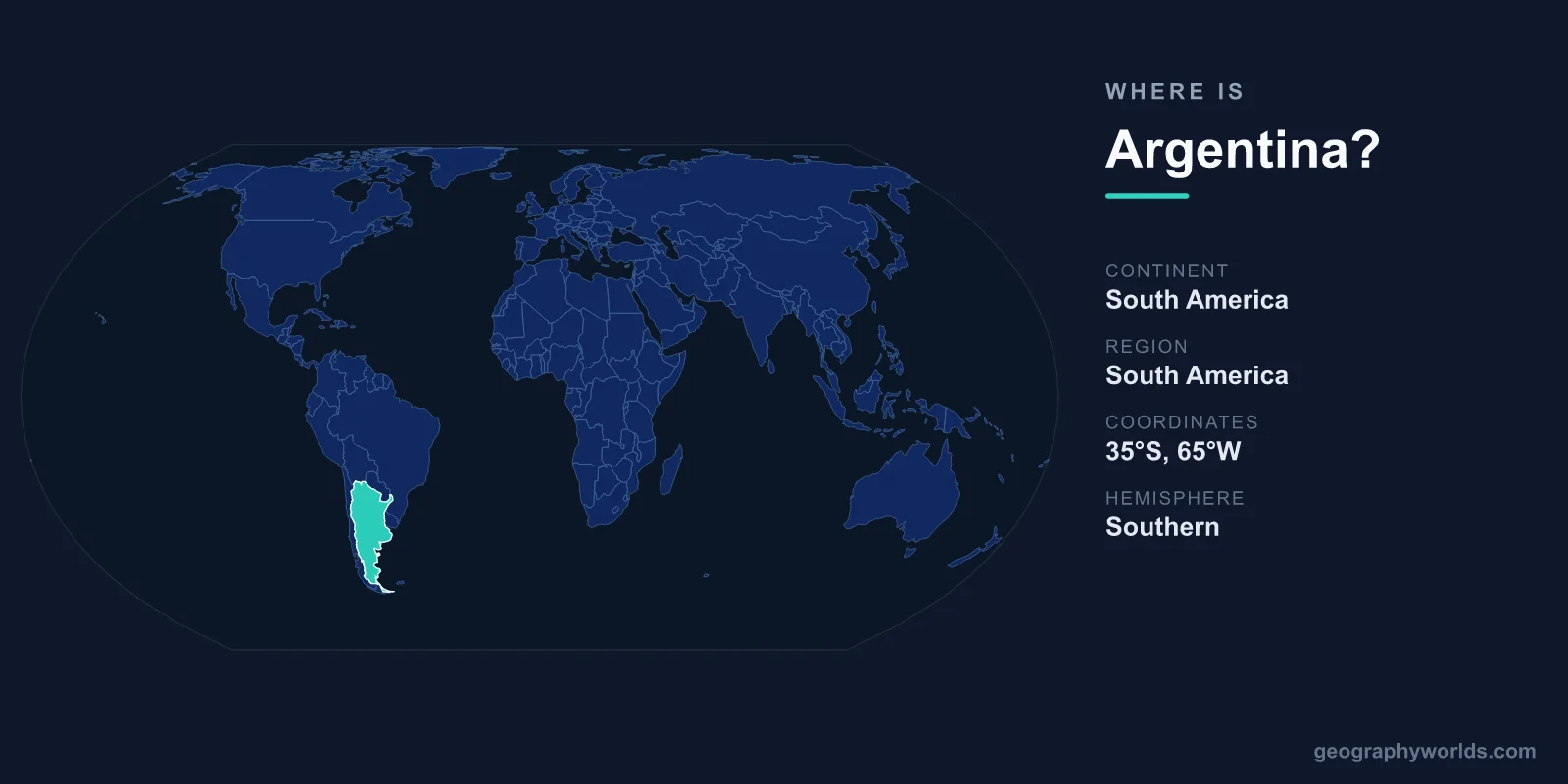
Argentina is located in the southern part of South America, occupying most of the continent's southern cone between the Andes Mountains in the west and the Atlantic Ocean in the east. Its capital, Buenos Aires, sits on the eastern coast along the Río de la Plata, and the country spans roughly 2,780,400 km² from the subtropical north to the subantarctic tip near Antarctica, making it the second-largest nation in South America and the eighth-largest in the world.
Where Exactly Is Argentina on the Map?
Argentina lies entirely within the Southern and Western Hemispheres. The country stretches more than 3,600 km from north to south, reaching from around 22°S near the Tropic of Capricorn down to roughly 55°S at Tierra del Fuego, one of the most southerly inhabited regions on Earth. Because of this elongated north–south shape, Argentina is often described as a country of extremes, packing subtropical jungle, fertile plains, high desert, and glacial wilderness into a single territory.
Its western edge is defined almost entirely by the Andes, the natural wall that separates Argentina from Chile. The eastern and southeastern coasts open onto the South Atlantic Ocean, giving the country a coastline of several thousand kilometres. At the heart of the nation, the famous Pampas grasslands fan out across the centre around Buenos Aires, where the bulk of the population of roughly 46 million people lives.
Which Countries Border Argentina?
Argentina shares land borders with five neighbouring countries, making it one of the most geographically connected nations in South America. Clockwise from the north, its neighbours are:
- Bolivia and Paraguay to the north, across subtropical lowlands and the Gran Chaco.
- Brazil to the northeast, in the forested region near the Iguazú Falls.
- Uruguay to the east, separated by the Río de la Plata estuary and the Uruguay River.
- Chile to the west and south, along the long Andean frontier.
The border with Chile is among the longest international land boundaries in the world, running the full length of the Andes for more than 5,000 km. To the southeast, Argentina faces the open South Atlantic rather than any land neighbour. This central position has long made the country a hub for trade, migration, and cultural exchange across the southern cone of the continent.
What Are Argentina's Main Geographic Regions?
Given its size — larger than all of Western Europe combined — Argentina is best understood through its distinct regions:
- The Pampas: vast, flat grasslands at the country's heart, home to its richest farmland and most of its population, and the engine of its famous beef and grain exports.
- The Andes and Cuyo: the mountainous west, including Aconcagua (about 6,961 m), the highest peak in the Americas and the entire Southern Hemisphere, plus the wine country around Mendoza.
- The North: subtropical lowlands, colourful high-altitude canyons, and dense forests, where the spectacular Iguazú Falls sit on the border with Brazil.
- Patagonia: the windswept, sparsely populated south, known for arid steppe, glacial lakes, and immense ice fields such as the Perito Moreno Glacier.
This range of landscapes means Argentina contains nearly every major climate zone, from humid subtropical in the north to cold subpolar near the southern tip. Few countries on Earth pack so much environmental variety into one set of borders.
How Far Is Argentina From Other Places?
Argentina's southern position places it far from the Northern Hemisphere's major capitals. Buenos Aires is roughly 11,000 km from London and around 8,500 km from New York, typically a flight of 11 to 14 hours. Within South America, however, Argentina is a natural crossroads: it is closely linked to neighbouring Uruguay, Brazil, and Chile by road, river, and frequent flights. Its proximity to Antarctica is also notable — the southern city of Ushuaia, often called "the end of the world," is a primary gateway for polar expeditions and one of the southernmost permanently inhabited towns on the planet.
Spanish is the official language, Christianity (largely Roman Catholic) is the dominant religion, and the national currency is the Argentine Peso (ARS). For more detail on the country's people, history, and travel highlights, see our argentina country guide.
Frequently Asked Questions
What continent is Argentina on?
Argentina is on the continent of South America, occupying the southern portion of the continent known as the Southern Cone, alongside Chile and Uruguay. It is the second-largest country in South America after Brazil.
Is Argentina in the Northern or Southern Hemisphere?
Argentina lies entirely in the Southern Hemisphere, which means its seasons are the reverse of those in Europe and North America — summer runs from December to February, and winter from June to August.
What is the capital of Argentina and where is it?
The capital is Buenos Aires, located on the eastern edge of the country along the Río de la Plata estuary, near the Atlantic coast. It is Argentina's largest city and its political, financial, and cultural centre.
Which oceans border Argentina?
Argentina's eastern and southern coastline faces the South Atlantic Ocean, extending toward the southern tip of the continent at Tierra del Fuego, near the waters leading to the Southern Ocean and Antarctica.