
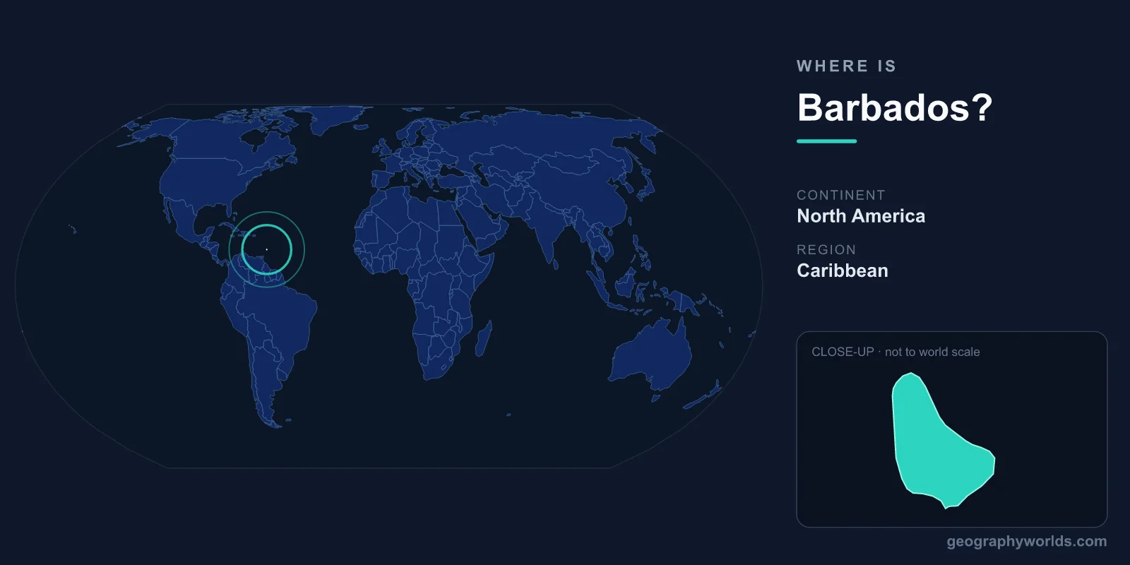
Barbados is the easternmost island in the Caribbean chain, situated so far east that it technically sits in the Atlantic Ocean rather than the Caribbean Sea. This flat coral limestone island at 13°N, 59°W defies the volcanic origins of most Caribbean neighbors.
Location
Barbados is located in the eastern Caribbean, though technically it sits in the Atlantic Ocean rather than the Caribbean Sea. It lies at approximately 13°10'N latitude, 59°32'W longitude, about 170 km east of Saint Vincent and the Windward Islands chain. It is the easternmost island in the Caribbean, sitting entirely in the Atlantic, separated from the main Lesser Antilles volcanic arc.
The island covers 431 km² (about 34 km long and 23 km wide), making it one of the smaller Caribbean nations. Despite its tiny size, Barbados has a population of roughly 280,000 people, making it one of the most densely populated countries in the world. The capital and largest city is Bridgetown, located on the southwestern coast and designated a UNESCO World Heritage Site.
Region & Neighbors
Barbados is the most isolated of the Caribbean islands, lying about 170 km east of Saint Vincent, the nearest island in the Windward chain. To its northwest lies Saint Lucia (about 190 km), and Trinidad and Tobago lies roughly 400 km to the southwest. The South American mainland (Venezuela) is approximately 430 km to the south.
Unlike most Caribbean islands, which form an arc from the Greater Antilles to Trinidad, Barbados sits on the Caribbean Plate's eastern edge, well east of the volcanic arc. This geographic isolation meant that Barbados was often the first landfall for ships arriving from Europe or Africa, which profoundly shaped its colonial history. The island was a British colony from 1627 to 1966 and became a republic in 2021, removing the British monarch as head of state.
Key Geographic Facts
Barbados is geologically unique among Caribbean islands because it is composed almost entirely of coral limestone, not volcanic rock. The island formed as coral accumulated on top of an oceanic ridge pushed upward by the subduction of the Atlantic Plate. This gives Barbados a relatively flat terrain compared to its volcanic neighbors, with gently rolling hills rather than dramatic peaks.
The highest point is Mount Hillaby at 336 meters — modest compared to the 1,000+ meter volcanic peaks on nearby islands like Dominica or Martinique. The limestone geology has created extensive cave systems, including Harrison's Cave, a crystallized limestone cavern with flowing streams, waterfalls, and dramatic stalactite and stalagmite formations.
The west coast (Caribbean-facing, called the "Platinum Coast") has calm, clear waters ideal for swimming, while the east coast (Atlantic-facing) has powerful surf, rugged cliffs, and the famous Bathsheba rock formations. The coral reef system surrounding the island supports rich marine life, though it faces threats from bleaching and pollution.
Travel & Access
Grantley Adams International Airport (BGI) is the main gateway, located in the southeast parish of Christ Church. It receives direct flights from the United States (Miami, New York, Atlanta), Canada (Toronto), the United Kingdom (London), and numerous Caribbean islands. Flight time from Miami is approximately 3.5 hours; from London, about 8.5 hours.
Barbados also serves as a regional transportation hub, with ferry and small aircraft connections to neighboring islands like Saint Vincent, Saint Lucia, and Dominica. Bridgetown is a major cruise ship port, receiving hundreds of ships annually. The island is small enough that no point is more than about 30 minutes' drive from any other, and the bus system is extensive.
Key Facts
- Location: Eastern Caribbean, technically in the Atlantic Ocean, not the Caribbean Sea.
- Area: 431 km² (34 km long, 23 km wide).
- Capital: Bridgetown (UNESCO World Heritage Site).
- Coordinates: 13°10'N, 59°32'W.
- Nearest neighbor: Saint Vincent, approximately 170 km to the west.
- Highest point: Mount Hillaby, 336 m.
- Geology: Coral limestone (not volcanic, unlike most Caribbean islands).
- Became a republic in 2021, removing the British monarch as head of state.
Fun Facts
- Barbados is the birthplace of rum — Mount Gay Rum, founded in 1703, claims to be the oldest commercial rum distillery in the world.
- The island is so densely populated (~650 people per km²) that it ranks among the top 20 most densely populated countries on Earth.
- Barbados is the only Caribbean island made entirely of coral limestone, with no volcanic rock at all.
- Flying fish are so important to Barbadian culture that the island is nicknamed "The Land of the Flying Fish," and the fish appears on currency, passports, and coats of arms.
- Rihanna, one of the world's best-selling music artists, was born in Barbados, and the government named a street after her in Bridgetown.
Test Your Knowledge!
Think you know your world geography? Try our interactive quiz!
Play Country Quiz →