
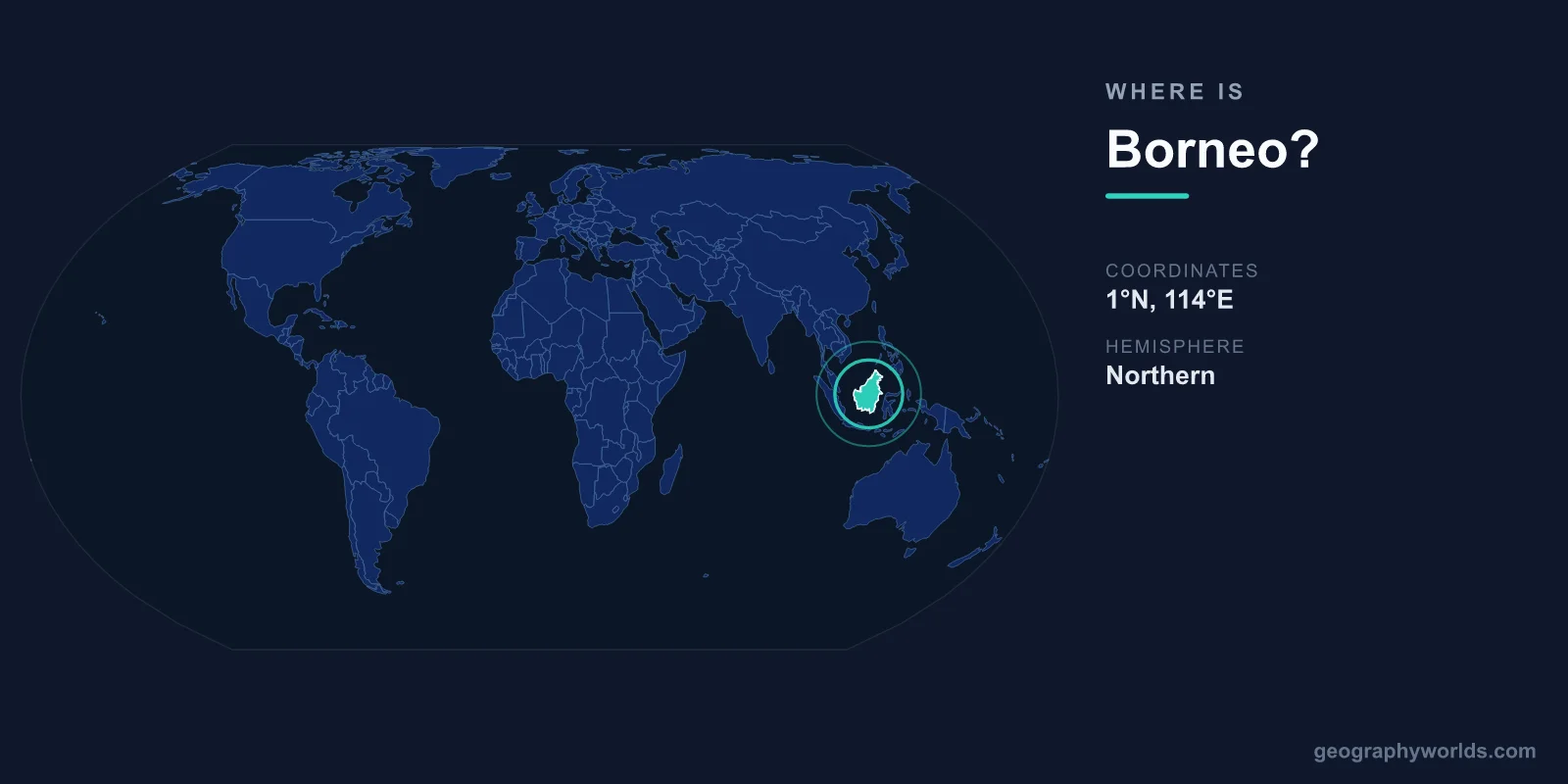
Borneo is located in Southeast Asia, centered at approximately 1°N latitude and 114°E longitude. It is the world's third-largest island, covering approximately 743,330 square kilometers. The island is divided among three countries: Indonesia (Kalimantan, ~73%), Malaysia (Sabah and Sarawak, ~26%), and Brunei (~1%).
Introduction
Borneo is situated in the heart of the Malay Archipelago, surrounded by the South China Sea to the north and northwest, the Sulu Sea to the northeast, the Celebes Sea to the east, the Java Sea to the south, and the Karimata Strait to the west. It is home to some of the oldest tropical rainforest on Earth, estimated at 130-140 million years old.

Exact Location & Coordinates
- Center Coordinates: 1°N, 114°E
- Region: Southeast Asia, Malay Archipelago
- Area: 743,330 km² (world's 3rd-largest island)
- Highest Point: Mount Kinabalu, 4,095 m (Malaysia)
On a world map, Borneo is the large island in Southeast Asia, south of the Philippines and east of the Malay Peninsula. It sits roughly on the equator, with the line crossing through its southern (Indonesian) portion. The island is broadly oval-shaped, roughly 1,100 kilometers from north to south.
To locate Borneo, find the Philippines on a map and look southwest, or find Singapore and look northeast. Borneo is the largest island in the dense cluster of Southeast Asian islands, significantly bigger than Sumatra to its west or Sulawesi to its east.
Surrounding Countries & Borders
- Indonesia: Southern ~73% (Kalimantan provinces)
- Malaysia: Northern ~26% (Sabah and Sarawak)
- Brunei: Small enclave on northern coast (~1%)
Indonesia's portion, called Kalimantan, comprises five provinces and is by far the largest part of the island. Malaysia's states of Sabah and Sarawak occupy the northern coast, separated from Peninsular Malaysia by the South China Sea. Brunei, one of the world's smallest and wealthiest nations due to oil reserves, is a small sultanate on the northern coast surrounded by Sarawak.
The division of Borneo among three nations creates complex border arrangements. Malaysia's two Bornean states are separated from each other by a tongue of Brunei territory. The Indonesia-Malaysia border across the island's interior is one of the longest land borders in Southeast Asia.
Geographic Context
- Surrounded By: South China Sea, Java Sea, Celebes Sea, Sulu Sea
- Nearby Islands: Sumatra (west), Java (south), Sulawesi (east), Philippines (north)
- Equator: Crosses through southern Borneo
Borneo sits at the geographic heart of the Malay Archipelago, the world's largest island group. The island's interior is dominated by mountain ranges, with Mount Kinabalu in Sabah rising to 4,095 meters — the highest peak in Southeast Asia between the Himalayas and New Guinea. Dense tropical rainforest covers much of the interior.
The island is surrounded by shallow seas that were dry land during ice ages, when Borneo was connected to mainland Asia via a land bridge. This connection, called Sundaland, allowed species to migrate between the mainland and islands, contributing to Borneo's extraordinary biodiversity.
Physical Characteristics
- Area: 743,330 km²
- Highest Peak: Mount Kinabalu, 4,095 m
- Coastline: ~4,971 km
- Forest Coverage: ~50% (down from ~75% in 1980s)
Borneo's terrain ranges from coastal mangrove swamps and lowland rainforest to montane forest and alpine meadows on Mount Kinabalu. The interior is mountainous, with the Crocker Range in Sabah and the Muller and Schwaner ranges in Kalimantan forming the island's backbone.
The island's rainforest, estimated to be 130-140 million years old, is among the most biodiverse ecosystems on Earth. However, massive deforestation for palm oil plantations, logging, and mining has reduced forest coverage from roughly 75 percent in the 1980s to about 50 percent today.
Why It Matters
- Biodiversity: One of the most biodiverse places on Earth
- Orangutans: One of only two islands where wild orangutans live
- Palm Oil: World's largest palm oil producing region
Borneo is one of only two places on Earth where orangutans live in the wild (the other is Sumatra). The island is also home to pygmy elephants, proboscis monkeys, clouded leopards, and the world's largest flower (Rafflesia) and tallest tropical tree. New species are discovered regularly — over 360 new species were found between 2010 and 2015 alone.
Palm oil production is Borneo's most controversial economic activity. The island is the world's largest palm oil producing region, with vast plantations covering former rainforest. The industry provides livelihoods for millions but has caused enormous environmental damage, including habitat destruction, air pollution from forest fires, and carbon emissions from drained peatlands.
Key Facts
- Borneo is centered at approximately 1°N, 114°E in Southeast Asia.
- It is the world's 3rd-largest island at 743,330 km².
- Three countries share it: Indonesia (~73%), Malaysia (~26%), and Brunei (~1%).
- Mount Kinabalu at 4,095 m is the highest peak between the Himalayas and New Guinea.
- Its rainforest is among the oldest on Earth at 130-140 million years.
Fun Facts
- Borneo is one of only two islands where wild orangutans still live.
- The island was connected to mainland Asia by a land bridge during ice ages.
- Borneo's Rafflesia flower, the world's largest, can reach 1 meter in diameter.
- Over 360 new species were discovered on Borneo between 2010 and 2015.
Final Thoughts
Borneo sits in the heart of Southeast Asia at approximately 1°N, 114°E, the world's third-largest island shared by three nations. Its ancient rainforests harbor extraordinary biodiversity including orangutans and thousands of unique species. The tension between economic development and ecological preservation makes Borneo one of the most consequential islands on the world map.
Test Your Knowledge!
Think you know where things are on the map? Test your skills!
Play Geography Games →