
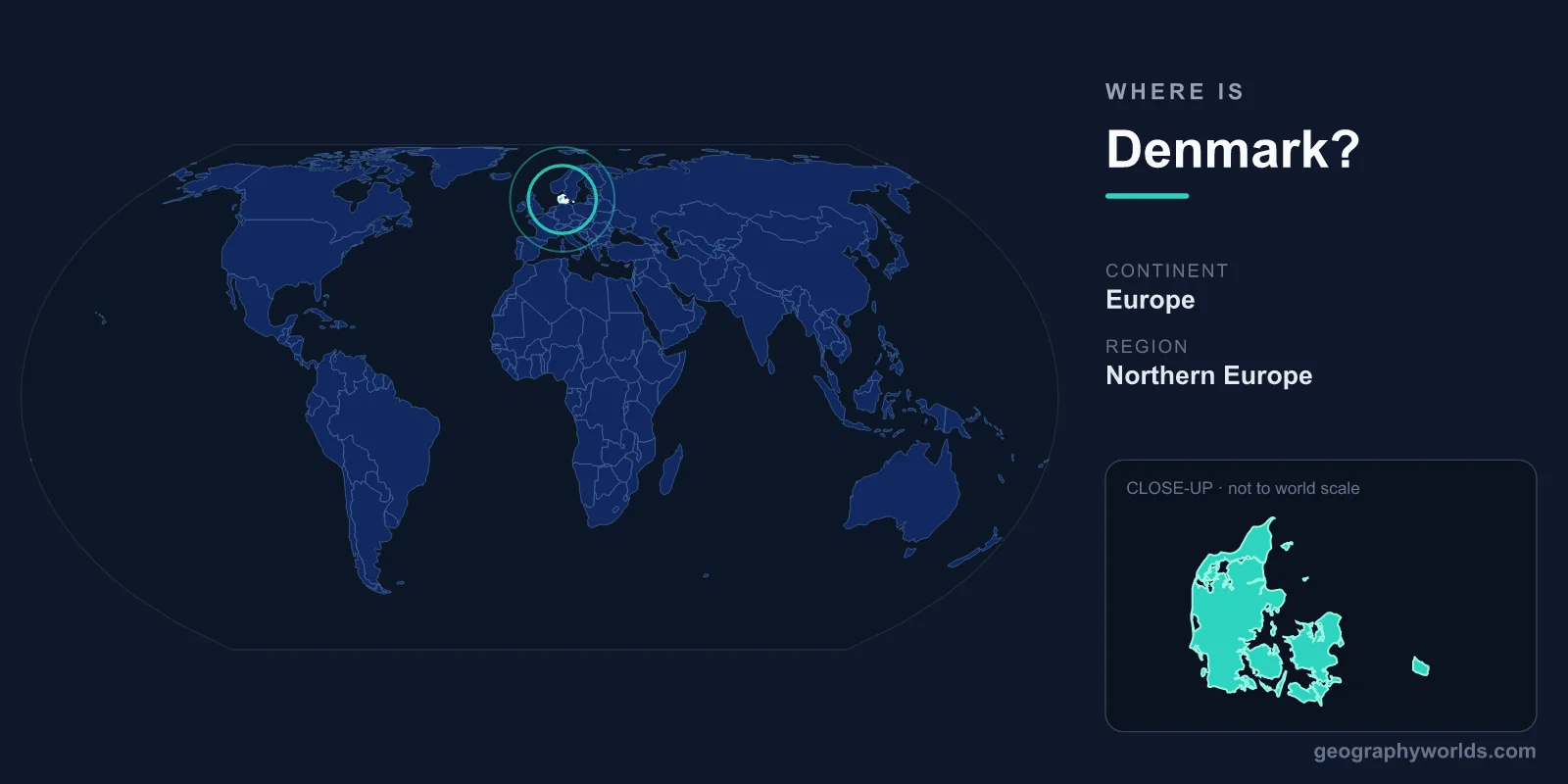
Denmark is a Scandinavian country in Northern Europe, made up of the Jutland Peninsula and more than 400 islands that bridge mainland Europe and the rest of Scandinavia. It sits in the Northern and Eastern Hemispheres, between the North Sea to the west and the Baltic Sea to the east, sharing its only land border with Germany to the south. The capital and largest city is Copenhagen, and the country covers roughly 43,094 km².
Where Exactly Is Denmark on the Map?
Denmark occupies the northernmost edge of continental Europe, positioned at approximately 56 degrees north latitude and 10 degrees east longitude. It acts as a natural gateway between the European mainland and the larger Scandinavian Peninsula that holds Norway and Sweden. To the north, across the narrow Skagerrak and Kattegat straits, lies Norway; to the east, across the Oresund strait, sits Sweden. The Swedish city of Malmo is so close to Copenhagen that the two are joined by the Oresund Bridge, a combined road-and-rail crossing.
Although it is grouped with Scandinavia, Denmark is far flatter and lower-lying than its mountainous neighbours. No part of the country rises far above sea level, and its landscape has more in common with northern Germany than with the fjords of Norway.
The Land: Peninsula and Islands
Denmark's territory has two main components. The first is the Jutland Peninsula (Jylland), a stretch of mainland that extends northward from Germany and makes up most of the country's land area. The second is an archipelago of more than 400 islands, of which around 70 are inhabited. The two largest and most important are:
- Zealand (Sjaelland) – the most populous island, home to the capital, Copenhagen
- Funen (Fyn) – the "Garden Island," birthplace of the writer Hans Christian Andersen
This island geography gives Denmark an exceptionally long coastline relative to its size, stretching some 7,300 kilometres. No point in the country is more than about 52 kilometres from the sea, which has shaped Danish fishing, shipping, and trade for centuries. Bridges and tunnels, such as the Great Belt Fixed Link connecting Zealand and Funen, tie the scattered landmasses into a single, well-connected nation.
Borders, Climate, and Terrain
Denmark shares just one land border, with Germany along the southern edge of Jutland, a frontier of roughly 68 kilometres. Every other connection to its neighbours is across water. Contrary to what its northern latitude might suggest, Denmark has a temperate maritime climate rather than an extreme one. The surrounding seas and the influence of the warm Gulf Stream keep winters relatively mild and summers cool, with frequent wind and changeable weather. There are no tropical zones, deserts, or high mountains anywhere in the country.
The terrain is famously gentle: rolling lowlands, glacial moraine hills left by the last Ice Age, fertile farmland, lakes, and sandy coasts. The highest natural point, Mollehoj in eastern Jutland, reaches only about 171 metres. This flat, arable land has made Denmark one of Europe's most productive agricultural nations, and its steady coastal winds have turned it into a world leader in wind-energy generation.
Greenland and the Faroe Islands
Denmark's geography extends far beyond Europe. The Kingdom of Denmark also includes two autonomous territories in the North Atlantic: the Faroe Islands, lying between Norway and Iceland, and Greenland, the world's largest island. Although Greenland is geographically part of North America, it remains constitutionally tied to Denmark with extensive self-rule. These overseas connections give the kingdom an Arctic and Atlantic reach far greater than its modest European footprint suggests. To explore more about the nation's regions, culture, and travel highlights, see our denmark country guide.
People, Capital, and Why the Location Matters
Around 6 million people live in Denmark, with roughly a third concentrated in the greater Copenhagen area on Zealand. Danish is the official language, the Evangelical Lutheran Church is the historically dominant faith, and the country is a parliamentary constitutional monarchy, one of the oldest in the world. It uses the Danish krone (DKK) rather than the euro, even though it is a member of the European Union. Sitting at the mouth of the Baltic Sea, Denmark controls the maritime gateway between the Baltic and the North Sea, a position that made it a strategic crossroads for trade and shipping for centuries and keeps Copenhagen a major Scandinavian hub today.
Frequently Asked Questions
What continent is Denmark in?
Denmark is located in Europe, specifically in the Northern Europe region known as Scandinavia. Its mainland is physically attached to the continent through its border with Germany, while its territory of Greenland lies geographically in North America.
What countries border Denmark?
Denmark shares only one land border, with Germany to the south. By sea it is close neighbours with Sweden across the Oresund strait and Norway across the Skagerrak and Kattegat.
Is Denmark part of Scandinavia?
Yes. Denmark is one of the three core Scandinavian countries, alongside Norway and Sweden, and is the southernmost of them. It is also counted among the five Nordic countries, together with Finland and Iceland.
What is the capital of Denmark?
The capital is Copenhagen, located on the island of Zealand in the eastern part of the country, directly across the water from Malmo, Sweden.