

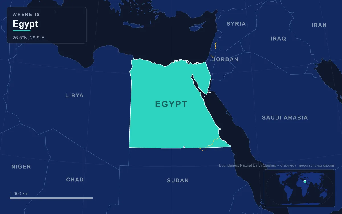
Egypt is an African country, with one corner in Asia. Roughly 94% of its territory, including Cairo, Alexandria, the Nile Valley and the Western Desert, lies in north-eastern Africa, while the Sinai Peninsula, about 60,000 km² east of the Suez Canal, is counted as part of Western Asia. That makes Egypt a transcontinental country, but a very unevenly divided one: the Asian part holds only around 600,000 of Egypt's more than 107 million people. The UN statistics office places Egypt in Northern Africa, it belongs to the African Union, and it is also a founding member of the Arab League, whose headquarters are in Cairo.
The Sinai Peninsula: Egypt's 60,000 km² in Asia
The Asian part of Egypt is a single, clearly bounded triangle. Sinai has the Mediterranean on its northern shore, the Gulf of Suez on its south-western side and the Gulf of Aqaba on its south-eastern side, with its tip at Ras Muhammad National Park. Its land area is usually given as about 60,000 km², roughly 6% of Egypt's total of 1,010,408 km², which makes Sinai a little smaller than Latvia. Its largest city is Arish, the capital of North Sinai, with around 160,000 residents.
Most of the peninsula is divided between two governorates, North Sinai and South Sinai, which together had about 597,000 residents in January 2013. Three more governorates, Port Said, Ismailia and Suez, straddle the canal, so a small slice of each sits on the Asian bank while their cities lie on the African side.
Sinai's south is mountainous. Mount Catherine, near the town of Saint Catherine in South Sinai, is Egypt's highest point at 2,642 m, the figure given in Wikipedia's Egypt and Geography of Egypt articles, so the country's summit is technically in Asia. Its lowest point, by contrast, is firmly African: the Qattara Depression in the Western Desert falls to 133 m below sea level. Sinai has been part of Egypt since the First Dynasty around 3100 BC; ancient Egyptians called it Biau, the "mining country", for its turquoise. In the modern era it was occupied by Israel in 1967 and handed back in stages, with the final withdrawal in 1982 under the 1979 peace treaty and the resort of Taba returned in 1989 after international arbitration.

From Ptolemy's Isthmus to the 1869 Suez Canal
Where Africa ends has been argued over since antiquity. The Romans used "Africa" for the lands west of Egypt, and treated "Asia" as Anatolia and what lay east of it, so for them Egypt sat awkwardly between the two names. It was the second-century geographer Ptolemy who drew the line that stuck: in his Geographia he made the Isthmus of Suez and the Red Sea the boundary between Asia and Africa. Most modern atlases still follow him.
For most of history that line ran across open desert. The isthmus, usually measured at between about 125 and 163 km wide, was a land bridge used by armies, traders and early humans leaving Africa. That changed when the Compagnie de Suez, set up by the French diplomat Ferdinand de Lesseps in 1858, dug a sea-level channel from Port Said on the Mediterranean to Port Tewfik at Suez between 1859 and 1869. The canal opened on 17 November 1869 and is about 193 km long. It has no locks, and it turned an invisible convention into a visible strip of water, so the boundary now follows the canal and its lakes, including the Great Bitter Lake.
The canal is also why the line matters in Egyptian politics. President Gamal Abdel Nasser nationalised it in July 1956, setting off the Suez Crisis. Egypt closed it on 5 June 1967 at the start of the Six-Day War and it stayed shut for exactly eight years, reopening on 5 June 1975. A parallel channel dug in 2014 and 2015 lets ships move in both directions at once along much of the route, and more than 20,600 vessels passed through in 2021, an average of 56 a day.
Crossing from African to Asian Egypt
Because the canal cuts the country in two, Egyptians cross between continents on a handful of fixed links. The Suez Canal Bridge at El Qantara, whose name means "the bridge" in Egyptian Arabic, opened in October 2001. It is 3.9 km long with a 400 m cable-stayed main span, and its two 154 m pylons were designed in the shape of Pharaonic obelisks; Japan paid about 60% of the cost. Its 70 m clearance caps the height of ships that can use the canal. Further south, the 1.63 km Ahmed Hamdi Tunnel at Shallufa connects the town of Suez on the African mainland with Sinai, and the El Ferdan Railway Bridge near Ismailia, with a 340 m span, is the longest swing bridge in the world. The 2015 expansion cut that rail line by adding a new shipping lane just east of the bridge, and a second swing bridge over the new lane began operating in 2024. The same project added new road tunnels between Sinai and the canal cities of Ismailia and Port Said.

Why Geologists See Sinai Differently
The continental line on the map is cultural; the one underneath is tectonic, and it does not quite match. Sinai sits on the African Plate, with the boundary of the Arabian Plate running along its eastern edge, down the Gulf of Aqaba. In other words, the rock under Sinai moves with Africa, and the real seam between the plates lies east of the peninsula, not along the canal.
This is why some reference works treat the whole of Egypt as African. The Wikipedia article on Africa, for example, notes that Sinai is often considered part of Africa geopolitically as well. The conventional answer, Sinai in Asia, comes from Ptolemy's isthmus line and from the canal that now marks it; the geological answer would push Egypt entirely into Africa. Either way, Egypt ends up mostly or wholly African, never mostly Asian. Our guide to the Sinai Peninsula covers its mountains, wadis and coral coast in more detail.
Libya, Sudan, Israel and Gaza: Egypt's Land Frontiers
Egypt's land borders split between the two continents exactly as its territory does. Its two longest frontiers are African:
- Sudan, about 1,276 km, from the tripoint with Libya to the Red Sea. The eastern end is disputed. Britain drew a political line along the 22nd parallel in 1899 and an administrative line in 1902; Egypt claims the first and Sudan the second. As a result both claim the Halaib Triangle, about 20,580 km² on the Red Sea coast, which Egypt has administered since 1994, while neither claims Bir Tawil, about 2,060 km², to its west.
- Libya, about 1,115 km, running south from the Mediterranean through the Western Desert, past the Siwa Oasis region, to the Sudanese tripoint.
The Asian frontiers are short and lie entirely along Sinai's eastern edge:
- Israel, a line first demarcated between Britain and the Ottoman Empire in 1906 and confirmed by the 1979 peace treaty, running from near Rafah to Taba on the Gulf of Aqaba, where the Taba crossing links to Eilat.
- The Gaza Strip, about 12 km, with the Rafah crossing as the only passage, open to people rather than goods.
Across the narrow Gulf of Aqaba lie Jordan and Saudi Arabia, so Egypt also has Asian neighbours at sea. For the full list with crossings, see the countries that border Egypt.
Northern Africa in the UN Scheme, Founding Member of the Arab League
International groupings mostly settle on Africa. The UN Statistics Division places Egypt in Northern Africa alongside Libya, Sudan, Tunisia, Algeria and Morocco, without splitting off Sinai. Egypt is a member of the African Union and in 1961 was part of the Casablanca bloc, a group of seven states whose leaders, among them Nasser, Ghana's Kwame Nkrumah and Guinea's Sékou Touré, pushed for African political unification or federation. In football, the Confederation of African Football has its headquarters near Cairo, and the national team, the Pharaohs, plays in the Africa Cup of Nations rather than the Asian Cup.
The pull towards Asia is cultural and political rather than geographical. The Arab League was founded in Cairo on 22 March 1945 by seven states, Egypt, Iraq, Transjordan, Lebanon, Saudi Arabia, Syria and North Yemen, and its secretariat is still based there. Egypt is the most populous Arab country, Arabic is its language, and much of its modern history, from the brief union with Syria as the United Arab Republic in 1958 to the wars of 1948, 1956, 1967 and 1973, has played out in the Middle East. That is why Egypt often appears in "Middle East" lists, a regional label that crosses the Africa–Asia line rather than replacing it.
The answer, then, has two layers. On a continent quiz, Egypt is Africa: its capital, about 99% of its people, its farmland and its great river are all African. If a fuller answer is wanted, Egypt is a transcontinental state whose Sinai Peninsula lies across the canal in Asia, a status it shares with only a few countries, such as Turkey and Russia between Europe and Asia. The waterway that draws the line has its own story of concessions, crises and expansions, told in our guide to the Suez Canal.