

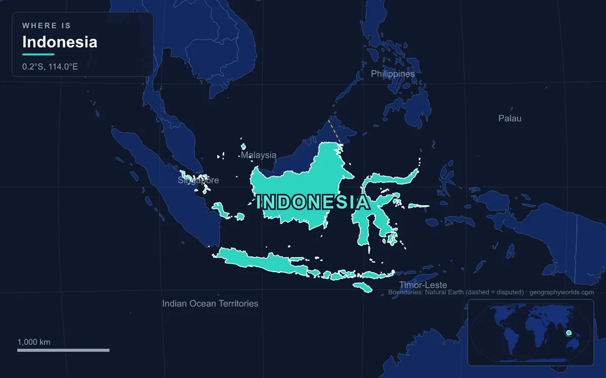
Indonesia is an Asian country: the United Nations counts it in South-eastern Asia, it was a founding member of ASEAN in 1967, and its capital, Jakarta, and most of its more than 280 million people are on islands that sit on the Asian continental shelf. The complication is its eastern edge. Indonesia’s six provinces on the western half of New Guinea, about 412,000 km² or 22 percent of the country’s land, stand on the Sahul Shelf with Australia, and New Guinea as a whole is usually counted as part of Melanesia, a subregion of Oceania. So the short answer is “Asia”, with the qualification that a fifth of Indonesia is geographically Oceanian. The lines that scientists have drawn through the archipelago explain why the question exists at all.
The Wallace Line Between Bali and Lombok
In 1859 the British naturalist Alfred Russel Wallace, who spent years collecting specimens across what was then the Dutch East Indies, described a sharp break in the animals of the archipelago. West of it were Asian mammals: tigers, rhinoceroses, apes. East of it, marsupials and birds with Australian relatives began to appear. The biologist Thomas Henry Huxley later named the boundary Wallace’s Line.
The line runs north through the Makassar Strait, between Borneo and Sulawesi, and south through the Lombok Strait, between Bali and Lombok. The Lombok Strait is about 60 km long and only about 20 km wide at its narrowest point, between Lombok and Nusa Penida, but it is at least 250 m deep. That depth matters. During the ice ages, when the sea fell far enough to join Bali, Java, Sumatra and Borneo to mainland Asia, the Lombok Strait stayed open water, so land animals from Asia could walk to Bali but not to Lombok.

The same gap has a modern use. Because the strait is much deeper than the Strait of Malacca, ships too large for Malacca often pass through Lombok instead, and it is one of the main channels of the Indonesian Throughflow, the current that carries Pacific water into the Indian Ocean.
Weber’s Line and the Wallacea Transition Zone
Wallace’s Line is not the only boundary. Later naturalists found that it marks where Asian land mammals stop, not where Australian ones take over. Between the two lies Wallacea, a belt of islands separated from both continental shelves by deep straits: Sulawesi, the largest, plus Lombok, Sumbawa, Flores, Sumba, Timor and most of Maluku. Its total land area is about 347,000 km², almost all of it Indonesian, with Timor-Leste occupying part of Timor.
The German-Dutch zoologist Max Weber, who led the Siboga Expedition of 1899–1900 through the archipelago, concluded that Wallace had placed his line too far west. The line later named after him, Weber’s Line, marks the point where Asian and Australian animals are roughly equally represented; it follows the deepest straits through eastern Indonesia, and for mammals the Tanimbar Islands appear to be the main meeting point of the Asian and Australian faunas. Further east still is Lydekker’s Line, named after the British naturalist Richard Lydekker, which traces the edge of the Sahul Shelf and the start of fully Australian fauna. Sulawesi, between the lines, shows signs of both worlds, while Wallacea’s plants are mostly of Asian origin even where its animals are mixed.
For the continent question, these lines are useful because they show that there is no single obvious place to cut. A biologist can defend a boundary at Bali, at Sulawesi or at the Aru Islands, and each would put a different share of Indonesia in Oceania.
The Sahul Shelf: Australia’s Continent Inside Indonesia
The geology is clearer than the biology. The western islands, Sumatra, Java, Madura and Kalimantan (Indonesian Borneo), lie on the Sunda Shelf, a shallow extension of mainland Southeast Asia covering about 1.85 million km², where the sea is rarely more than 50 m deep. In the far east, New Guinea and the Aru Islands lie on the Sahul Shelf, which joins them to Australia. When sea levels were up to about 120 m lower during the Pleistocene, Australia, New Guinea and Tasmania formed a single landmass called Sahul, which also took in the Aru Islands. New Guinea was cut off from Australia only about 8,000 years ago, when rising seas flooded what is now the Torres Strait.
Indonesia straddles a junction of plates: western New Guinea rides on the Australian plate, while the Sunda Shelf islands belong to a separate plate on the Eurasian side. The collision between the Australian and Pacific plates raised the Maoke Mountains, which run 600 km through the centre of western New Guinea and include Puncak Jaya, at 4,884 m Indonesia’s highest peak and the highest mountain on any island in the world. Its highest slopes still carry small glaciers, almost on the equator. Puncak Jaya is often listed as the highest peak in Oceania, and the reasons it gets counted that way are covered in our post on the highest mountain in Oceania.
Six Provinces on New Guinea
The part of Indonesia that sits on Sahul is Western New Guinea, an area of about 412,215 km² stretching 1,200 km from east to west. It was Netherlands New Guinea until 1962, when the Dutch handed it to a United Nations Temporary Executive Authority, which passed it to Indonesia. Its incorporation was confirmed by the 1969 Act of Free Choice, a consultation that remains disputed by Papuan independence supporters. The region was renamed Irian Jaya in 1973 and Papua in 2002, and received special autonomy in 2001.
It was split into two provinces, Papua and West Papua, in 2003. In 2022 four more were created: Central Papua, Highland Papua, South Papua and Southwest Papua, making six in all. The 2020 census counted 5,437,775 people there, most of them indigenous Papuans. Estimates of the number of local languages run from 200 to more than 700, with Dani, Yali, Ekari and Biak among the most widely spoken, and Papuan Malay is the everyday common language. Christianity is the majority faith, unlike the Muslim-majority west of the country.
The territory also reaches offshore. Raja Ampat, the “Four Kings” archipelago of more than 1,500 small islands, cays and shoals around Misool, Salawati, Batanta and Waigeo, lies off the north-western tip of New Guinea’s Bird’s Head Peninsula in Southwest Papua province. Its reefs form part of the Coral Triangle, the stretch of sea with the richest marine biodiversity on Earth, so even Indonesia’s Oceanian edge is tied by its waters to the Southeast Asian seas around the Philippines and Borneo.

Even the name is political. The ISO uses “Papua” for the region, Indonesian officials have used “West Papua” for one province since 2007, and independence activists use “West Papua” for the whole territory. Whatever name is used, the land is part of the same island as Papua New Guinea, which is why the question of PNG’s continent, discussed in our post on whether Papua New Guinea is in Asia or Oceania, comes up in almost the same terms.
How the UN Geoscheme and Regional Bodies Count Indonesia
Statistical schemes assign whole countries, not islands. The United Nations geoscheme used by the UN Statistics Division places all of Indonesia in South-eastern Asia, alongside its ASEAN neighbours, and puts Melanesia, its Oceania subregion, as Fiji, New Caledonia, Papua New Guinea, Solomon Islands and Vanuatu. In sport Indonesia competes as an Asian nation, as a member of the Olympic Council of Asia and of the Asian Football Confederation. Some reference works hedge and describe Indonesia as a country “in Southeast Asia and Oceania”, which reflects the same split described above.
Politically Indonesia faces west and north. It was one of the five founders of ASEAN in Bangkok on 8 August 1967, and the bloc’s secretariat is in Jakarta. Timor-Leste’s admission on 26 October 2025 as the 11th member brought every Southeast Asian state into the group. Indonesia does keep a foot in the Pacific: since June 2015 it has been an associate member of the Melanesian Spearhead Group, whose full members are Fiji, Papua New Guinea, Solomon Islands, Vanuatu and New Caledonia’s Kanak independence front (FLNKS). The group treats Indonesia as the official representative of the West Papua region, while the United Liberation Movement for West Papua, which campaigns for independence, holds observer status.
Indonesia’s Neighbours: Malaysia, Timor-Leste and Papua New Guinea
Indonesia shares land borders with three countries, and they fall neatly on either side of the continental divide. On Borneo, a 1,881 km border separates Indonesia’s North, East and West Kalimantan from the Malaysian states of Sabah and Sarawak, firmly in Asia. On Timor, in the Wallacea transition zone, two separate sections totalling 253 km divide Indonesia from Timor-Leste, a country that itself is asked the same question in our post on whether Timor-Leste is in Asia or Oceania. On New Guinea, an 824 km border, mostly a straight line along the 141st meridian east with a short stretch following the Fly River, separates the provinces of Papua, Highland Papua and South Papua from Papua New Guinea, a country counted in Oceania.
At sea the list of neighbours is longer: India and Thailand to the north-west, Malaysia, Singapore, Vietnam, the Philippines and Palau to the north, Papua New Guinea to the east, and Timor-Leste and Australia across the Timor and Arafura seas to the south. That spread from India to Australia is the best summary of the answer. Indonesia is an Asian state by politics, population and convention, which reaches across the Wallace, Weber and Lydekker lines onto the Australian continent at its eastern end.