
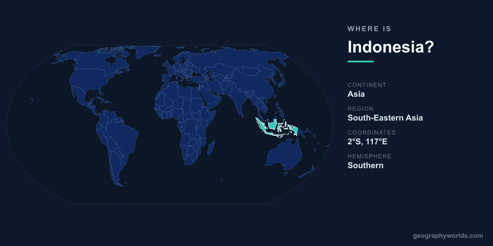
Indonesia is located in Southeast Asia, straddling the equator between the Indian and Pacific Oceans, and is the world's largest archipelago with more than 17,000 islands. It sits to the south of mainland Asia and to the northwest of Australia, with its capital, Jakarta, on the island of Java. In total the country covers about 1,904,569 km².
Where Is Indonesia on the Map?
Indonesia lies in the equatorial belt of Southeast Asia, spanning both the Northern and Southern Hemispheres but with most of its territory south of the equator. Its islands stretch across roughly 5,000 kilometers from west to east — a span comparable to the distance from London to the Middle East — making it one of the most geographically spread-out nations on Earth.
The country acts as a maritime bridge between two continents and two oceans. To the west lies the Indian Ocean; to the east and north, the Pacific. This central position along historic spice-trade and shipping routes, including the vital Strait of Malacca, has made Indonesia a strategic crossroads for thousands of years.
Which Continent Is Indonesia In?
Indonesia is part of the continent of Asia, within the Southeast Asia region. However, its easternmost territories — particularly the western half of the island of New Guinea — sit on the Australian continental shelf, placing Indonesia geographically across two tectonic regions. Because of this, the country is sometimes described as a transcontinental nation bridging Asia and Oceania.
The Major Islands
While Indonesia has over 17,000 islands, just five account for the vast majority of its land area and population:
- Java — the political and economic heart, home to Jakarta and more than half the national population, making it one of the most densely populated islands in the world.
- Sumatra — the large western island known for rainforests, volcanoes, and Lake Toba.
- Borneo (Kalimantan) — the Indonesian portion of the world's third-largest island, shared with Malaysia and Brunei.
- Sulawesi — recognizable by its distinctive multi-armed shape in the central archipelago.
- New Guinea (Papua) — the eastern frontier, where Indonesia borders Papua New Guinea.
Popular destinations such as Bali and the Lesser Sunda Islands lie east of Java, scattered toward Timor-Leste.
Neighboring Countries
Indonesia shares land borders with three countries, all on shared islands:
- Malaysia — on the island of Borneo.
- Papua New Guinea — on the island of New Guinea.
- Timor-Leste — on the island of Timor.
By sea, Indonesia has close maritime neighbors including Singapore, the Philippines, and Australia, which lies just south across the Timor and Arafura Seas.
A Land Shaped by the Ring of Fire
Indonesia sits squarely on the Pacific Ring of Fire, the planet's most seismically active zone. This explains its hundreds of volcanoes — more active volcanoes than any other country — as well as frequent earthquakes. Its equatorial location gives almost the entire nation a hot, humid tropical climate with abundant rainfall and remarkable biodiversity, from the orangutans of Borneo and Sumatra to the Komodo dragons of the Lesser Sunda Islands. For more on its regions, cities, and culture, see our indonesia country guide.
Frequently Asked Questions
Is Indonesia in Asia or Oceania?
Indonesia is officially part of Asia, specifically Southeast Asia. Its far-eastern province of Papua sits on the Australian continental shelf, so the country technically spans the boundary between Asia and Oceania, but it is grouped with Asia in most contexts.
What is the capital of Indonesia and where is it?
The capital is Jakarta, located on the northwest coast of the island of Java. Indonesia is also developing a new planned capital, Nusantara, on the island of Borneo (Kalimantan).
How many islands does Indonesia have?
Indonesia is made up of more than 17,000 islands, of which several thousand are inhabited. This makes it the largest archipelagic state in the world, stretching across three time zones.