
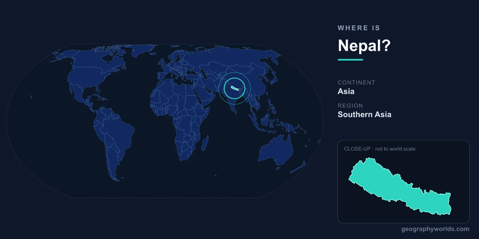
Nepal is a landlocked country in South Asia, wedged along the southern slopes of the Himalayas between China to the north and India to the east, south, and west. Covering 147,516 km², it sits squarely in the Northern and Eastern Hemispheres, with its capital, Kathmandu, located in the central hill region. Despite its modest size, Nepal contains the greatest concentration of high mountains on Earth, including eight of the world's ten tallest peaks.
Where Exactly Is Nepal on the Map?
Nepal lies between roughly 26°N and 30°N latitude and 80°E and 88°E longitude. It is shaped like a long rectangle, stretching about 800 kilometres from east to west but only 150 to 250 kilometres from north to south. This narrow band of territory rises dramatically from the flat plains of the Indian subcontinent to the crest of the Himalayas in just a short horizontal distance, making Nepal one of the most vertically dramatic countries on the planet.
Because it is landlocked, Nepal has no coastline. Its nearest access to the sea is through the Bay of Bengal in India, more than 1,000 kilometres to the south, which has historically tied Nepal's trade closely to its southern neighbour. The country is comfortably within the Asian landmass, in the region commonly described as the Himalayas or the Indian subcontinent. Sitting between the Tibetan Plateau and the Gangetic Plain, Nepal occupies one of the most geologically active and tectonically dramatic stretches on Earth, where the Indian Plate continues to push beneath the Eurasian Plate and lift the mountains higher each year.
Which Countries Border Nepal?
Nepal shares land borders with just two countries, but both are geographic giants:
- China – to the north, the border runs along the high Himalayan ridgeline. This frontier crosses the summit of Mount Everest itself, which Nepal and China's Tibet Autonomous Region share. The crest divides the two nations across some of the most rugged terrain on Earth.
- India – to the south, east, and west, India wraps around Nepal on three sides. This open and historically porous border allows free movement of citizens between the two countries and underpins deep cultural, economic, and family ties.
This sandwiched position between two of the world's most populous nations has profoundly shaped Nepal's history, its diplomacy, and its role as a buffer state in the region. Indian states such as Uttarakhand, Uttar Pradesh, Bihar, West Bengal, and Sikkim line Nepal's southern arc, while the Chinese frontier touches the Tibetan highlands to the north. Nepal has never been colonised, a distinction it owes partly to this strategic position between rival powers.
The Three Geographic Zones
Nepal's terrain is usually divided into three parallel belts that run east to west, each at a different elevation:
- The Terai – a flat, fertile lowland strip in the south, part of the Gangetic Plain. It sits as low as 60 metres above sea level and contains much of Nepal's farmland and a large share of its population.
- The Hill Region – the central midlands of rolling hills and valleys, including the Kathmandu Valley where the capital sits at about 1,400 metres. This zone is the cultural and historical heartland of the country.
- The Mountain Region – the northern high Himalaya, home to towering peaks, glaciers, and sparse high-altitude settlements.
This staircase of landscapes means Nepal's elevation ranges from less than 100 metres to 8,849 metres at the top of Everest, an astonishing span packed into a country only a couple of hundred kilometres wide. Major rivers such as the Koshi, Gandaki, and Karnali cut deep gorges as they descend from the mountains toward the plains, carving some of the deepest valleys in the world and feeding the river systems of northern India.
Mountains That Define the Country
Nepal is most famous for being the home of the Himalayas at their grandest. Mount Everest (Sagarmatha), the highest point on Earth at 8,849 metres, stands on the Nepal–China border. In total, eight of the world's ten highest mountains lie wholly or partly within Nepal, including Kanchenjunga, Lhotse, Makalu, Cho Oyu, Dhaulagiri, Manaslu, and Annapurna. These peaks draw mountaineers, trekkers, and researchers from around the globe and form the backbone of Nepal's tourism economy. Iconic routes such as the Everest Base Camp trek and the Annapurna Circuit funnel hundreds of thousands of visitors each year through hill towns and high passes. For comparison, Nepal's total land area is similar to that of Bangladesh, Greece, or the U.S. state of Arkansas. You can learn more in our nepal country guide.
People, Capital, and Climate
Around 30 million people live in Nepal, most of them in the Terai lowlands and the central hills. The capital and largest city, Kathmandu, is the political, cultural, and economic centre of the nation. Nepali is the official language, and Hinduism is the most widely practised religion, followed by Buddhism, with which it shares a long and intertwined history. Nepal is also the birthplace of the Buddha, who was born at Lumbini in the southern Terai around the 6th century BCE. The country uses the Nepalese Rupee (NPR) as its currency and is governed as a federal democratic republic divided into seven provinces.
Nepal's climate varies as dramatically as its altitude, from subtropical heat in the Terai to alpine cold and permanent snow in the high mountains. The summer monsoon, arriving from the Bay of Bengal between June and September, delivers most of the annual rainfall and shapes the farming calendar. This range of climates within a single small country supports remarkable biodiversity, from tigers and rhinoceroses in lowland national parks such as Chitwan to snow leopards and red pandas in the high ranges.
Key Facts
- Continent: Asia (South Asia / Himalayan region)
- Capital: Kathmandu (central hill region, ~1,400 m elevation)
- Area: 147,516 km²
- Bordering countries: China (north) and India (east, south, west)
- Highest point: Mount Everest / Sagarmatha, 8,849 m
- Population: roughly 30 million
- Currency: Nepalese Rupee (NPR)
Frequently Asked Questions
Is Nepal in India or China?
Neither. Nepal is an independent, sovereign country located between India and China. It borders China to the north and India to the south, east, and west, but it is not part of either nation and has never been colonised.
Does Nepal have a coastline?
No. Nepal is landlocked, meaning it has no direct access to the sea. Its closest sea access is through India to the Bay of Bengal, over 1,000 kilometres away.
What continent is Nepal in?
Nepal is located in Asia, in the region of South Asia known as the Himalayas or the Indian subcontinent.
What is the capital of Nepal?
The capital of Nepal is Kathmandu, situated in the Kathmandu Valley in the central hill region at roughly 1,400 metres above sea level.