
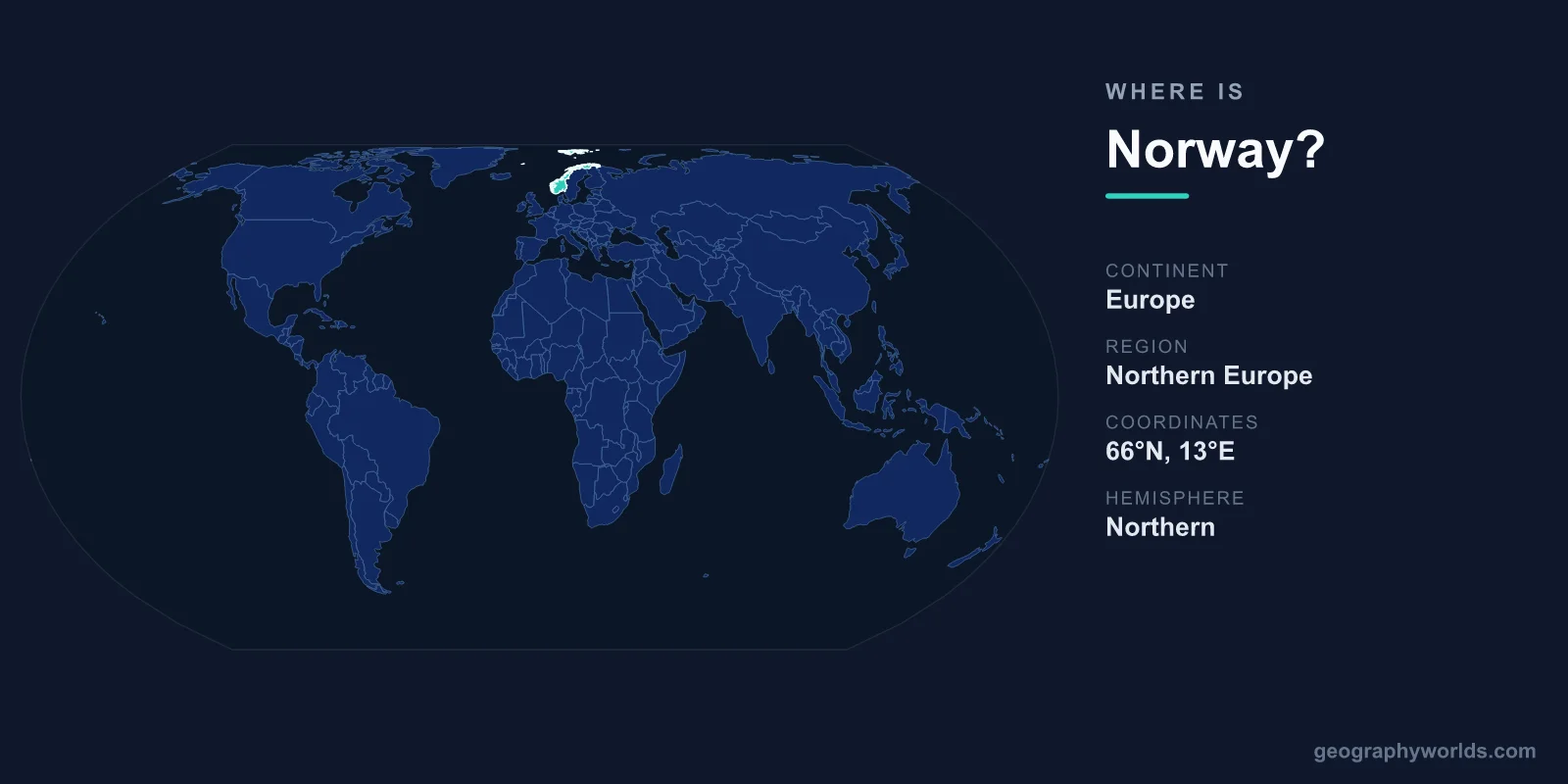
Norway is located in Northern Europe, occupying the western and northern portions of the Scandinavian Peninsula, with a long Atlantic coastline that stretches above the Arctic Circle. Its capital is Oslo, it covers roughly 385,207 km², and it sits firmly in both the Northern and Eastern Hemispheres on the continent of Europe.
Where Exactly Is Norway on the Map?
Norway forms the western flank of the Scandinavian Peninsula, the large landmass it shares with Sweden and a slice of northern Finland. The country runs in a long, narrow ribbon from the North Sea in the south to the Barents Sea in the far north, with the Norwegian Sea bordering most of its western edge. In rough terms, the mainland lies between about 58 and 71 degrees north latitude, and between roughly 5 and 31 degrees east longitude.
That high-latitude position is the single most important fact about Norway's geography. Much of the country sits above the Arctic Circle, which means the northern regions experience the midnight sun in summer and long polar nights in winter. Despite being so far north, the coast stays surprisingly mild for its latitude thanks to the warm North Atlantic Current, a continuation of the Gulf Stream, which keeps most harbours ice-free year-round.
Which Countries Border Norway?
Norway shares land borders with three countries, all to its east:
- Sweden – by far the longest border, running the length of the peninsula and forming Norway's main land connection to the rest of Scandinavia.
- Finland – a shorter border in the north, where the two countries meet across Arctic terrain.
- Russia – the shortest border, a small stretch in the far northeast near the town of Kirkenes, giving Norway a frontier with a non-EU, non-Nordic neighbour.
To the west and south, Norway has no land neighbours at all. Instead it faces the open ocean, with Denmark and the United Kingdom lying across the North Sea, and Iceland and the Faroe Islands further out across the North Atlantic. This combination of a long sea frontier and only three land borders has shaped Norway as a maritime, seafaring nation throughout its history.
The Coastline and the Fjords
Norway is famous worldwide for its fjords: deep, narrow inlets carved by glaciers and flanked by steep mountain walls. The Geirangerfjord and the Nærøyfjord are among the most celebrated and are UNESCO World Heritage sites, while the Sognefjord ranks among the longest and deepest fjords on Earth. They are only a handful of the hundreds that indent the coast. When every fjord, bay, and offshore island is measured, Norway's coastline becomes one of the longest in the world, stretching for tens of thousands of kilometres even though the country itself is geographically compact.
Beyond the mainland, Norwegian territory reaches well into the Arctic. The Svalbard archipelago lies far to the north, roughly halfway between the mainland and the North Pole, while the remote island of Jan Mayen sits in the Norwegian Sea. These holdings extend Norway's geographic footprint deep into the high Arctic and underline its role as a polar nation.
Terrain, Cities and Hemisphere
Inland, Norway is dominated by mountains, high plateaus, and glaciers. The Scandinavian Mountains run like a spine down the country, and the Jostedalsbreen is the largest glacier on the European mainland. Flat, farmable land is scarce and concentrated around the southern lowlands and the inner reaches of the fjords, which is one reason most Norwegians live in the south and along the coast in cities such as Oslo, Bergen, Trondheim, and Stavanger.
Because Norway lies north of the Equator and east of the Prime Meridian, it falls in the Northern and Eastern Hemispheres. Its climate varies sharply with latitude and altitude: the southern coast is temperate and rainy, the interior has cold, snowy winters, and the far north is genuinely Arctic. With a land area of about 385,207 km², Norway is comparable in size to Germany or Japan, yet it is home to only around 5 million people, making it one of the most sparsely populated countries in Europe. To explore its regions, history, and travel highlights in more depth, see the full norway country guide.
Frequently Asked Questions
What continent is Norway on?
Norway is on the continent of Europe, in the region known as Northern Europe or Scandinavia. It occupies the western part of the Scandinavian Peninsula.
Is Norway in the Arctic?
Part of it is. A large section of northern Norway lies above the Arctic Circle, and its Svalbard archipelago reaches deep into the high Arctic. These areas experience the midnight sun in summer and the polar night in winter.
What is the capital of Norway and where is it?
The capital is Oslo, located in the south of the country at the head of the Oslofjord. Its sheltered southern position makes it the political, economic, and cultural centre of Norway.
Does Norway border the ocean?
Yes. Norway has an extensive Atlantic coastline facing the North Sea, the Norwegian Sea, and the Barents Sea. Only its eastern side, bordering Sweden, Finland, and Russia, is landlocked.