
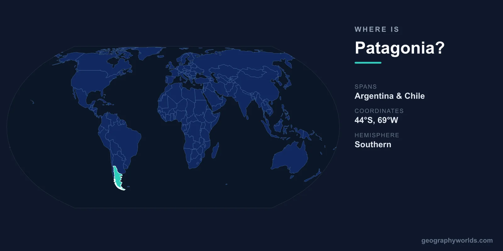
Patagonia sits at the far southern end of South America, spanning roughly 40°S to 55°S latitude and 63°W to 75°W longitude, and it is shared between two countries — Argentina to the east and Chile to the west. It is not a nation of its own but a vast geographic region covering approximately 1,043,076 square kilometers, an area larger than France and Germany combined. Patagonia reaches from the Río Colorado and Río Bío Bío in the north all the way to the Strait of Magellan and the islands of Tierra del Fuego at the continent's tip.
Where Patagonia Sits on the Map
Picture the southern cone of South America narrowing toward Antarctica — that tapering wedge is Patagonia. It lies entirely within the Southern and Western Hemispheres, bounded by the Andes mountains running down its spine, the Atlantic Ocean to the east, the Pacific Ocean and its fjords to the west, and the Southern Ocean to the south. Because the region straddles the high southern latitudes, daylight swings dramatically with the seasons, and the sun never climbs very high in the winter sky.
Despite its enormous size, Patagonia is one of the emptiest inhabited places on the planet. Fewer than two million people live across this expanse, giving it a population density of under two people per square kilometer. Towns are scattered and far apart, separated by hundreds of kilometers of open steppe, glacier-fed lakes, and uninhabited mountain wilderness.
How Patagonia Is Split Between Argentina and Chile
The Andes act as a natural wall dividing Patagonia into two distinct halves, each belonging to a different country:
- Argentine Patagonia covers the provinces of Neuquén, Río Negro, Chubut, Santa Cruz, and Tierra del Fuego. This eastern portion makes up roughly three-quarters of the region and is dominated by dry, windswept steppe plateaus that slope gently toward the Atlantic.
- Chilean Patagonia includes the regions of Aysén and Magallanes y la Antártica Chilena. The western side is a maze of fjords, glaciers, temperate rainforest, and thousands of islands fringing the Pacific.
At the southern end, the Strait of Magellan — about 560 km long — separates the South American mainland from Tierra del Fuego. Beyond that, the Drake Passage stretches roughly 800 km toward the Antarctic Peninsula. The Argentine city of Ushuaia, perched on Tierra del Fuego, is widely described as the southernmost city in the world.
The Landscapes That Define the Region
Few regions pack so much contrast into one place. The Patagonian Andes are crowned by jagged granite spires such as the Torres del Paine in Chile and Mount Fitz Roy in Argentina, both magnets for climbers and trekkers. The Southern Patagonian Ice Field — the world's third-largest mass of ice after Antarctica and Greenland — blankets some 13,000 square kilometers, and parts of it have still never been crossed on foot.
From that ice field flow some of the planet's most famous glaciers. The Perito Moreno Glacier, 30 km long and 5 km wide, calves great slabs of ice into Lago Argentino and is one of the rare glaciers that periodically advances rather than retreats. Along the Atlantic coast, eastern Patagonia hosts extraordinary wildlife: the huge Magellanic penguin colony at Punta Tombo and the southern right whales that gather at Península Valdés, a UNESCO World Heritage Site. The highest point in the region is Monte San Valentín, rising to 4,058 meters in Chilean Patagonia.
Climate and Why It Feels So Wild
Patagonia's weather is governed by its southern latitude, the rain shadow of the Andes, and the relentless westerly winds that sweep across the Southern Ocean. The Chilean west is soaked, receiving between 3,000 and 7,000 mm of rain a year, which sustains lush Valdivian temperate rainforest. Just over the mountains, the Argentine east is semi-arid to arid, getting only 150–300 mm annually, producing the scrubby grasslands of the steppe.
Temperatures stay cool to cold throughout the year. Summer, from December to February, brings lowland averages of 10–20°C, while winter from June to August hovers near or below freezing, dropping much lower in the far south. The wind is the region's signature: sustained gusts of 100 km/h are common in spring and summer, making Patagonia one of the windiest inhabited places on Earth and shaping everything from the bent trees to the way locals build their homes.
Getting to Patagonia
Most travelers reach Patagonia by air from Buenos Aires in Argentina or Santiago in Chile. On the Argentine side, El Calafate (FTE) serves the Perito Moreno Glacier and Los Glaciares National Park, Bariloche (BRC) opens up the Lake District, and Ushuaia (USH) is the gateway to Tierra del Fuego. In Chile, Punta Arenas (PUQ) is the main hub for Torres del Paine and the Strait of Magellan. For the adventurous, driving Argentina's legendary Ruta 40 or Chile's Carretera Austral is a bucket-list road trip that runs the length of the region. If you'd like to test your map skills before you go, try our geography games.
Frequently Asked Questions
Is Patagonia a country?
No. Patagonia is a geographic region, not an independent country. It is divided between Argentina, which holds the larger eastern portion, and Chile, which holds the mountainous and fjord-laced western portion.
Which countries does Patagonia belong to?
Patagonia is shared by Argentina and Chile, with the crest of the Andes forming the natural border between the two halves. Roughly 75% of the region lies on the Argentine side.
How big is Patagonia?
Patagonia covers approximately 1,043,076 square kilometers — larger than France and Germany combined — yet it is home to fewer than two million people.
Where did the name Patagonia come from?
The name likely comes from "patagones," a term used by Ferdinand Magellan's 1520 expedition to describe the tall Tehuelche people they encountered, often interpreted as meaning "big feet."