
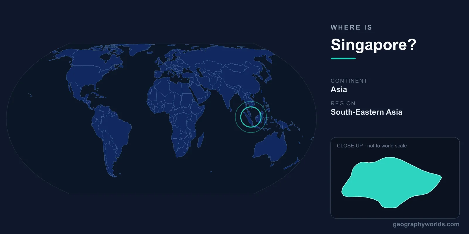
Singapore is a city-state in Southeast Asia, sitting at the southern tip of the Malay Peninsula just north of the Equator at roughly 1.35°N latitude and 103.8°E longitude. On the continent of Asia, this small island nation lies at the crossroads of the world's busiest shipping lanes, where the Indian Ocean meets the South China Sea, occupying one of the most strategically valuable maritime positions on the planet.
Where Exactly Is Singapore on the Map?
Singapore lies in both the Northern and Eastern Hemispheres, on the continent of Asia. It is separated from the Malaysian state of Johor to the north by the narrow Johor Strait, and from Indonesia's Riau Islands to the south by the Singapore Strait. Because the country sits almost exactly on the Equator, it has a hot and humid tropical climate year-round, with little variation in temperature from month to month and only wetter and drier monsoon periods rather than true seasons.
Singapore consists of one main island plus around 60 smaller islets, together covering a compact land area of approximately 733 km², making it one of the smallest sovereign nations on Earth. The main island measures roughly 50 kilometres from east to west and about 27 kilometres from north to south. Despite this tiny footprint, it is home to a population of around 6 million people, ranking it among the most densely populated countries in the world.
Singapore's Coordinates and Position in the World
At about 1.35° north of the Equator, Singapore is one of the closest national capitals to the line of zero latitude anywhere on the globe. Its longitude of roughly 103.8° east places it within the same broad meridian band as much of mainland Southeast Asia. The country observes Singapore Standard Time (SST), eight hours ahead of Coordinated Universal Time (UTC+8), the same offset used across much of East Asia despite Singapore being geographically further west than countries like China.
This near-equatorial position has practical consequences beyond climate. Daylight hours barely change throughout the year, with sunrise and sunset staying close to 7 a.m. and 7 p.m. in every season. The sun passes nearly overhead at noon, and the country never experiences the long summer evenings or short winter days familiar to people in temperate latitudes.
Does Singapore Share Any Borders?
As an island nation, Singapore shares no land borders with any other country. Instead, its closest neighbours are reached across water. Two land links connect Singapore to Malaysia: the Johor–Singapore Causeway and the Tuas Second Link, both crossing the Johor Strait and counting among the busiest border crossings in the world. To the south, a short ferry ride brings travellers to the Indonesian islands of Batam and Bintan.
This position makes Singapore an island that is anything but isolated. It functions as a vital gateway between mainland Asia and the wider Indo-Pacific, with Brunei, Thailand, and the rest of the ASEAN bloc within easy reach by sea and air. The Strait of Malacca, running to Singapore's west, is one of the busiest shipping corridors on Earth, carrying a significant share of global maritime trade past the city-state's shores every day.
The Physical Landscape
Singapore's terrain is largely low-lying and gently rolling. Its highest natural point, Bukit Timah Hill, rises just 164 metres above sea level. Much of the island was originally tropical rainforest and mangrove swamp, and pockets of this natural heritage survive today in the Bukit Timah Nature Reserve and the Sungei Buloh Wetland Reserve, where visitors can still see primary rainforest and migratory birds within sight of the city skyline.
One of the most remarkable features of Singapore's geography is how much of it has been engineered by people. Through decades of land reclamation, the country has expanded its territory by roughly a quarter since the 1960s, pushing its coastline outward into the surrounding seas. Marina Bay, the iconic waterfront district crowned by the Marina Bay Sands resort, sits on land that was once open water. With no major rivers and limited natural catchment, Singapore relies on a careful mix of reservoirs, imported water, recycled NEWater, and desalination to meet its freshwater needs.
Climate Near the Equator
Singapore's equatorial location gives it a tropical rainforest climate, classified as Af under the Köppen system. Daytime temperatures hover around 31°C and rarely fall below 23°C at night, regardless of the month. Humidity is consistently high, often exceeding 80 percent, and afternoon thunderstorms are common.
Rather than four seasons, the year is shaped by two monsoons: the Northeast Monsoon from roughly December to March brings the wettest, windiest weather, while the Southwest Monsoon from June to September is drier but punctuated by sudden squalls. Brief inter-monsoon periods sit between them. This stability of climate, combined with the country's location, has made Singapore one of the greenest tropical cities in the world, earning it the nickname "City in a Garden."
Why Singapore's Location Matters
Few places owe so much to their geography. Singapore sits astride the shortest sea route between the Indian Ocean and the Pacific, which is why it became a natural stopping point for traders sailing between China, India, the Middle East, and Europe. The British established a trading post here in 1819 precisely because of this strategic value, and the settlement grew into one of the busiest ports in the world.
Today, the Port of Singapore remains one of the largest and busiest container ports globally, while Changi Airport is a leading aviation hub linking Southeast Asia to the rest of the world. The country's location also shaped its rich multicultural society, where English, Malay, Mandarin Chinese, and Tamil are all official languages. To explore more about the nation itself, see our Singapore country guide.
Key Facts
- Region: Southeast Asia, on the continent of Asia
- Coordinates: approximately 1.35°N, 103.8°E (just north of the Equator)
- Area: around 733 km² (one of the world's smallest nations)
- Capital: Singapore (a city-state, so the city and country share one name)
- Population: approximately 6 million
- Time zone: Singapore Standard Time (UTC+8)
- Currency: Singapore Dollar (SGD)
- Nearest neighbours: Malaysia (north) and Indonesia (south)
Frequently Asked Questions
What continent is Singapore in?
Singapore is located on the continent of Asia, specifically within the Southeast Asia region. It lies at the southern end of the Malay Peninsula, near the Equator, between Malaysia and Indonesia.
Is Singapore part of Malaysia or China?
Singapore is an independent sovereign country and is not part of either Malaysia or China. It briefly merged with Malaysia in 1963 but separated to become a fully independent republic in 1965.
How far is Singapore from the Equator?
Singapore sits only about 137 kilometres north of the Equator, which is why it experiences a consistently hot, humid tropical climate with high rainfall and near-constant daylight hours throughout the year.
Is Singapore a city or a country?
Singapore is both. It is a city-state, meaning the entire country consists of a single city and its surrounding islands. The capital city and the nation share the same name.
What countries border Singapore?
Singapore shares no land borders. Its closest neighbours are Malaysia to the north, reached across the Johor Strait by the Causeway and the Tuas Second Link, and Indonesia to the south, reached by ferry across the Singapore Strait.